Braes of Minnonie

Downs, Moorland in Aberdeenshire

Scotland

Braes of Minnonie

Minor road heading to Fyvie Minor road heading south-west towards Fyvie from Monkshill, with the Mother Tap of Bennachie just visible on the horizon.
Minor road heading to Fyvie Credit: Scott Cormie

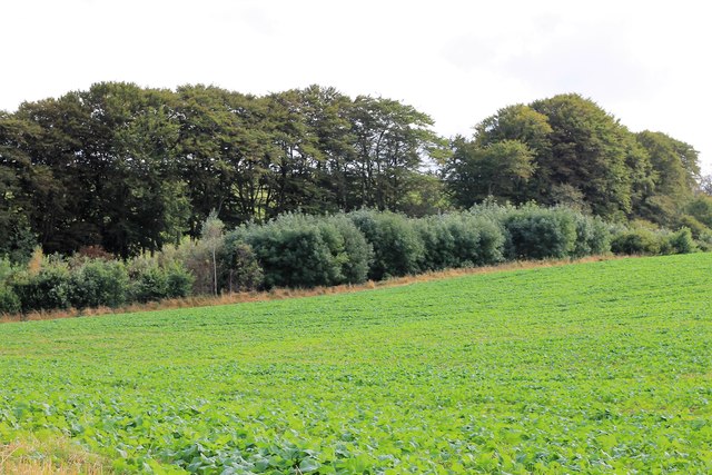
The Braes of Minnonie is a scenic area located in Aberdeenshire, Scotland. Situated amidst the picturesque Downs and Moorland, it is an exquisite destination for nature enthusiasts and those seeking tranquility. The region is known for its diverse landscapes, offering a combination of rolling hills, vast open spaces, and patches of heather-covered moors.

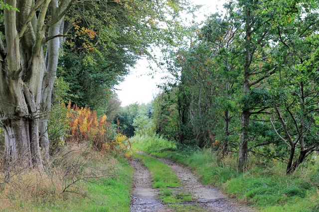
The Braes of Minnonie boasts an extensive network of walking trails, allowing visitors to explore the area's natural wonders at their own pace. These trails provide breathtaking views of the surrounding countryside, with panoramic vistas stretching as far as the eye can see. The Downs, with their gentle slopes and lush greenery, are a haven for hikers, offering a peaceful retreat from the hustle and bustle of everyday life.

Moorland areas within the Braes of Minnonie are characterized by their wild and rugged beauty. The heather-clad expanses, interspersed with rocky outcrops and peat bogs, create a unique and enchanting atmosphere. This habitat supports a variety of flora and fauna, including numerous bird species, making it a popular spot for birdwatching enthusiasts.

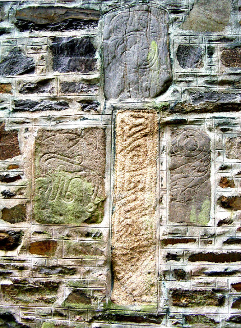
In addition to its natural charms, the Braes of Minnonie also holds historical significance. The area is dotted with remnants of ancient settlements, such as prehistoric stone circles and burial cairns, offering a glimpse into the region's past.

Overall, the Braes of Minnonie in Aberdeenshire is a captivating destination for those seeking to immerse themselves in Scotland's natural beauty. With its diverse landscapes, extensive walking trails, and rich history, it is a place where visitors can truly connect with nature and experience a sense of tranquility.

If you have any feedback on the listing, please let us know in the comments section below.

Braes of Minnonie Images

Images are sourced within 2km of 57.42805/-2.3454282 or Grid Reference NJ7937. Thanks to Geograph Open Source API. All images are credited.

Minor road heading to Fyvie Minor road heading south-west towards Fyvie from Monkshill, with the Mother Tap of Bennachie just visible on the horizon.
Minor road heading to Fyvie
Minor road heading south-west towards Fyvie from Monkshill, with the Mother Tap of Bennachie just visible on the horizon.
Copse at Denhill Copse obscuring Denhill Farm, viewed from the roadside to the south-east.
Copse at Denhill
Copse obscuring Denhill Farm, viewed from the roadside to the south-east.
Tyre marks in stubble field Evidence of vehicles in a stubble field near Denhill.
Tyre marks in stubble field
Evidence of vehicles in a stubble field near Denhill.
Rows of bales Bales arranged in rows west of Banks Farm.
Rows of bales
Bales arranged in rows west of Banks Farm.
Give Way to the A947 Approaching the A957 at Newbigging at the end of the unclassified St Johns Wells road.
Give Way to the A947
Approaching the A957 at Newbigging at the end of the unclassified St Johns Wells road.
Winding Road The slightly twisting unclassified road between Newbiggin and Slateheugh shaded by trees.
Winding Road
The slightly twisting unclassified road between Newbiggin and Slateheugh shaded by trees.
Slateheugh through Trees Slateheugh or Slatehaugh in some records was a farm of some 120acres although it was only one storey high. Nearby are other indications of slate working, quarries, Slate Pot in the Ythan and the Den of Slateheugh. Whether the waterwheel came with the farm or not is not recorded.
Slateheugh through Trees
Slateheugh or Slatehaugh in some records was a farm of some 120acres although it was only one storey high. Nearby are other indications of slate working, quarries, Slate Pot in the Ythan and the Den of Slateheugh. Whether the waterwheel came with the farm or not is not recorded.
Den of Slateheugh Running from the farm of Slateheugh to Andewsford the Den has the Burn of Slateheugh as its base.
Den of Slateheugh
Running from the farm of Slateheugh to Andewsford the Den has the Burn of Slateheugh as its base.
Path to the Den A tree lined path leading to the Den of Easter Crichie.
Path to the Den
A tree lined path leading to the Den of Easter Crichie.
Crops by the Den A field by the Den of Easter Crichie.
Crops by the Den
A field by the Den of Easter Crichie.
Ardlogie Farmland Farmland across the Ythan valley near Craigie Dot and East Ardlogie.
Ardlogie Farmland
Farmland across the Ythan valley near Craigie Dot and East Ardlogie.
Den of Crichie The Den with its burn and a windturbine in the region of Denhill farm behind.
Den of Crichie
The Den with its burn and a windturbine in the region of Denhill farm behind.
Crichie Burn The relatively small burn of Crichie as it flows out of the Den to the bridge soon to join the Ythan.
Crichie Burn
The relatively small burn of Crichie as it flows out of the Den to the bridge soon to join the Ythan.
Ythan passes Mill Water The Ythan flowing downstream; the Mill Water joins it just by the second bend of the meander.
Ythan passes Mill Water
The Ythan flowing downstream; the Mill Water joins it just by the second bend of the meander.
River Ythan The Ythan flowing downstream to make a turn north by St. John's well.
River Ythan
The Ythan flowing downstream to make a turn north by St. John's well.
St. John's Ponies Ponies by the farm of St.John's Well.
St. John's Ponies
Ponies by the farm of St.John's Well.
Denhill Farm Denhill with its shelterbelt of trees.
Denhill Farm
Denhill with its shelterbelt of trees.
Denhill Turbine A wind turbine by Denhill Farm, judging by the previous photos in this area this is a fairly recent addition.
Denhill Turbine
A wind turbine by Denhill Farm, judging by the previous photos in this area this is a fairly recent addition.
Show me another place!

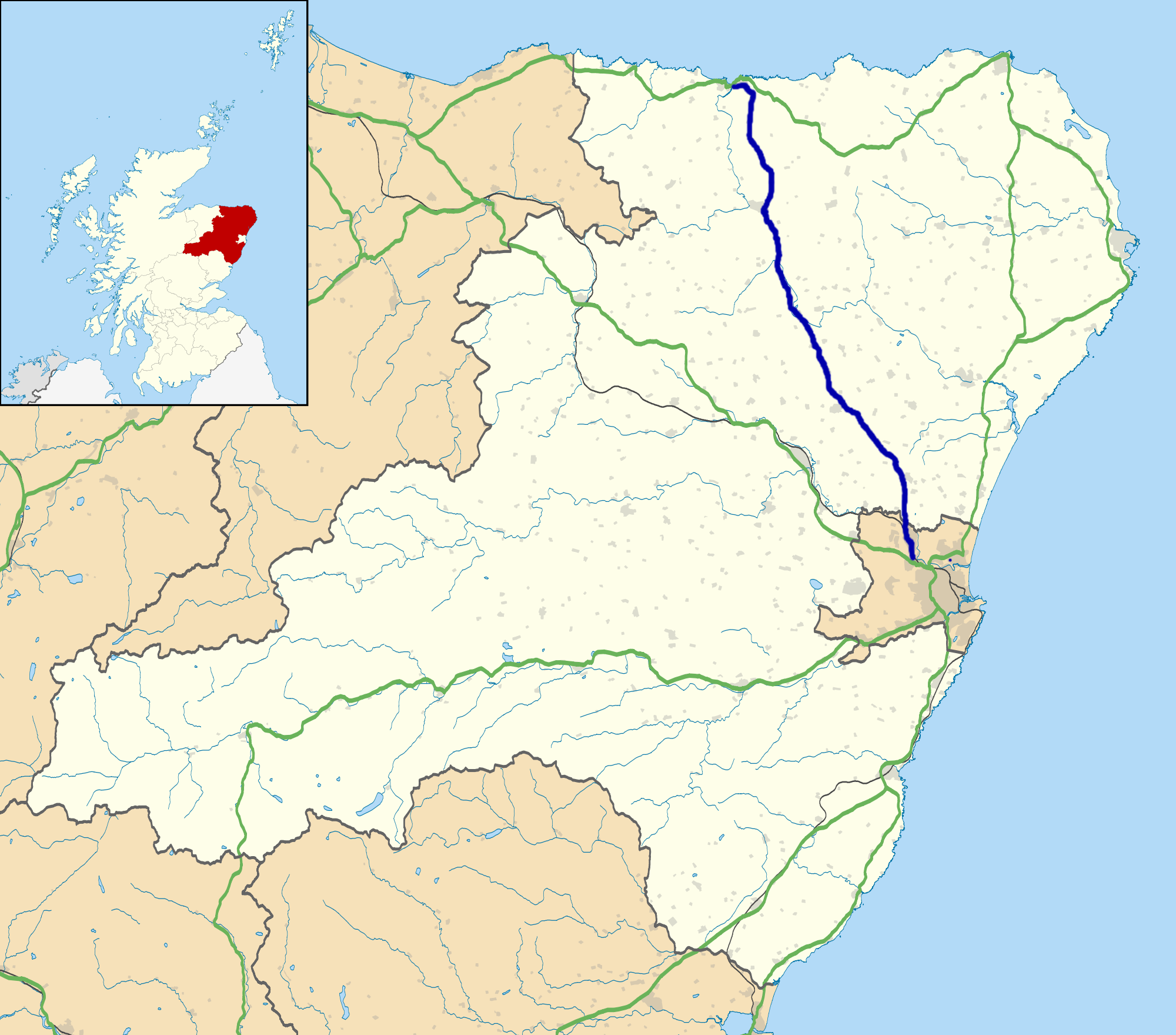
Braes of Minnonie is located at Grid Ref: NJ7937 (Lat: 57.42805, Lng: -2.3454282)

Unitary Authority: Aberdeenshire

Police Authority: North East

What 3 Words

///ruling.sorters.protests. Near Rothienorman, Aberdeenshire

Related Wikis

Woodhead, Aberdeenshire

Woodhead of Fyvie, often simply called "Woodhead", is an inland hamlet in Formartine, Aberdeenshire, Scotland, that lies to the east of Fyvie near the...

Backhill

Backhill is a rural area near Woodhead of Fyvie in Aberdeenshire, Scotland. == References ==

A947 road

The A947 is a single-carriageway road in Scotland that links Aberdeen to Banff via several towns in Aberdeenshire, including Newmachar, Oldmeldrum, Fyvie...

Fyvie

Fyvie is a village in the Formartine area of Aberdeenshire, Scotland. == Geography == Fyvie lies alongside the River Ythan and is on the A947 road. �...

Fyvie Castle

Fyvie Castle is a castle in the village of Fyvie, near Turriff in Aberdeenshire, Scotland. == History == The earliest parts of Fyvie Castle date from the...

Tifty, Aberdeenshire

Tifty is near Turriff, Aberdeenshire, Scotland. == References ==

Fyvie railway station

Fyvie railway station was a railway station near Fyvie, Aberdeenshire. It served the rural area and Fyvie Castle, but lay about 1 mile (1.6 km) from the...

Barthol Chapel

Barthol Chapel is a small village in the Formartine area of Aberdeenshire, Scotland, named after the Catholic saint, St Bartholomew. Barthol Chapel has...

Nearby Amenities

Located within 500m of 57.42805,-2.3454282
Generator Method: wind_turbine
Generator Output Electricity: 0.8 MW
Generator Source: wind
Generator Type: horizontal_axis
Power: generator
Lat/Long: 57.4257485/-2.3392305
The data included in this document is from www.openstreetmap.org. The data is made available under ODbL.

Have you been to Braes of Minnonie?

Leave your review of Braes of Minnonie below (or comments, questions and feedback).