Great Bell

Hill, Mountain in Westmorland Eden

England

Great Bell

Summit area of Tailbridge Hill, with summit cairn A few minor limestone rocks protrude from the grassy covering of Tailbridge Hill and there are exposures of limestone pavement elsewhere on it. The distant hills are those of the west side of the Mallerstang valley.
Summit area of Tailbridge Hill, with summit cairn Credit: Trevor Littlewood

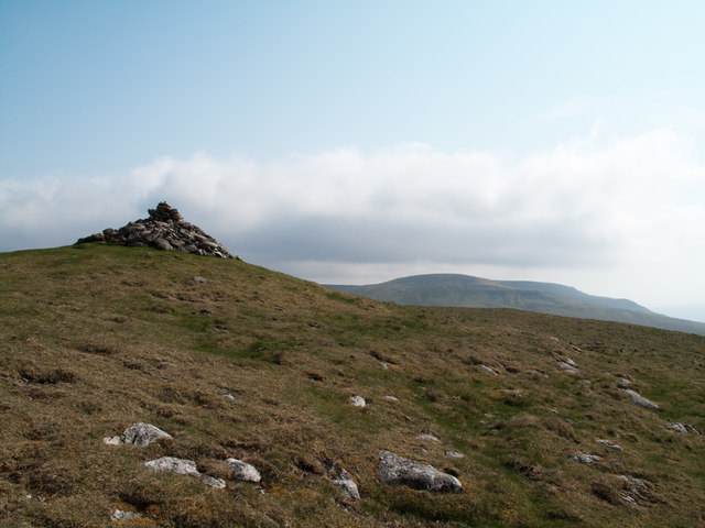
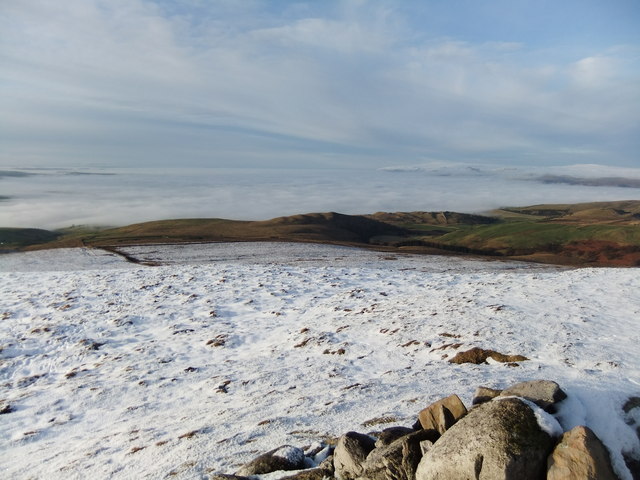
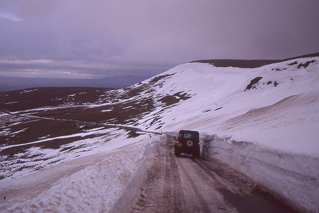
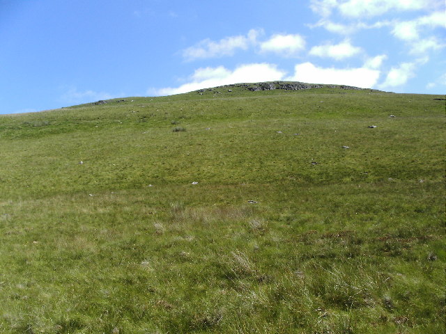
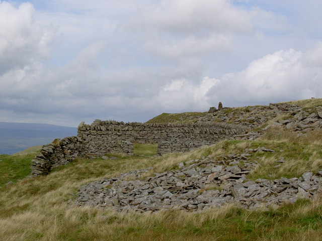
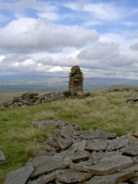
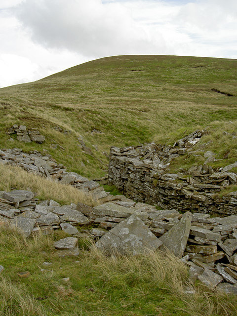
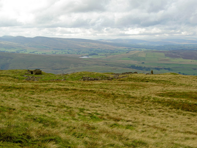
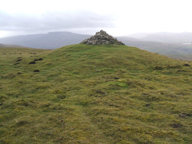
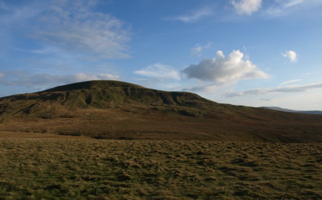
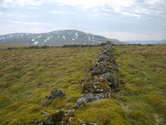
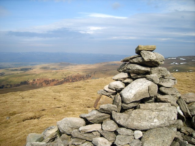
Great Bell is a prominent hill located in the county of Westmorland, in the northwestern region of England. It is part of the Lake District National Park, which is renowned for its stunning natural landscapes and picturesque surroundings. Great Bell stands at an elevation of 2,284 feet (696 meters) and is classified as a hill rather than a mountain.

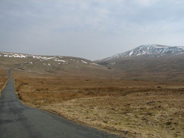
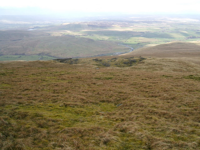
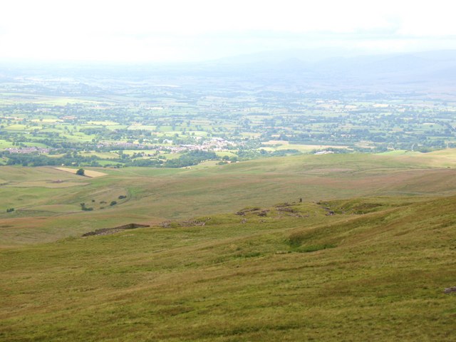
The hill is situated in close proximity to the village of Mardale, offering visitors easy access to its summit. Great Bell boasts breathtaking panoramic views of the surrounding valleys, lakes, and peaks, including Haweswater Reservoir and the nearby High Street ridge. On a clear day, one can even catch glimpses of the Scottish mountains to the north.

Great Bell is a popular destination for hikers and outdoor enthusiasts, attracting both novice and experienced climbers. There are various routes to the summit, ranging in difficulty, allowing visitors to choose a path that suits their level of fitness and expertise. The ascent is often described as moderate, with well-marked trails and paths leading to the top.

The hill's name, Great Bell, is believed to have originated from the Old English word "belle," meaning "hill" or "summit." It is a prominent feature in the local landscape and adds to the charm and allure of the Lake District region. Whether one is seeking a challenging hike or simply wishes to enjoy the stunning natural beauty, Great Bell offers a memorable experience for all who visit.

If you have any feedback on the listing, please let us know in the comments section below.

Great Bell Images

Images are sourced within 2km of 54.43672/-2.3313555 or Grid Reference NY7804. Thanks to Geograph Open Source API. All images are credited.

Summit area of Tailbridge Hill, with summit cairn A few minor limestone rocks protrude from the grassy covering of Tailbridge Hill and there are exposures of limestone pavement elsewhere on it. The distant hills are those of the west side of the Mallerstang valley.
Summit area of Tailbridge Hill, with summit cairn
A few minor limestone rocks protrude from the grassy covering of Tailbridge Hill and there are exposures of limestone pavement elsewhere on it. The distant hills are those of the west side of the Mallerstang valley.
From Tailbridge Hill Eden Valley under the mist
From Tailbridge Hill
Eden Valley under the mist
B6270 A snowed up pass between upper Swaledale and Kirkby Stephen past Nine Standards Rigg.
B6270
A snowed up pass between upper Swaledale and Kirkby Stephen past Nine Standards Rigg.
Nateby Common
Nateby Common
Tailbridge Hill Looking up it from the west
Tailbridge Hill
Looking up it from the west
The B6270 running SE up over the edge of Lamp Moss On the right is High Pike Hill with Lamp Moss leading left to Tail Bridge Hill. The valley is Kitchen Gill which runs into the river Eden South of Nateby.
The B6270 running SE up over the edge of Lamp Moss
On the right is High Pike Hill with Lamp Moss leading left to Tail Bridge Hill. The valley is Kitchen Gill which runs into the river Eden South of Nateby.
Not a standing stone or pillar but a nicely built cairn The OS shows a "pile of stones" 
<a href="https://www.geograph.org.uk/photo/563442">NY7903 : ...but there is a pillar or standing stone on the skyline that bears investigation</a>
Not a standing stone or pillar but a nicely built cairn
The cairn is about 12 feet tall and even has a spiral staircase built around it. "Pile of stones" indeed!
The cairn is about 12 feet tall and even has a spiral staircase built around it.
"Pile of stones" indeed!
A tidily built sheepfold Not the one shown on the map - or not in that position
A tidily built sheepfold
Not the one shown on the map - or not in that position
Another neatly built cairn but not as big as the one to the south Once again, ignored by the OS
Another neatly built cairn but not as big as the one to the south
Once again, ignored by the OS
There is plenty of evidence of the old mineworkings
Looking back at the mine workings and the cairn
Cairn on Tailbridge Hill A fine limestone cairn at a viewpoint
Cairn on Tailbridge Hill
A fine limestone cairn at a viewpoint
Quarry and sheepfold from Fells End
High Pike Hill Viewed from the B6270.
High Pike Hill
Viewed from the B6270.
Looking down on old quarry workings, High Pike Hill The view north westwards from the summit of High Pike Hill. Some 100m down are old quarry workings - presumably for sandstone flags. In the distance is Kirkby Stephen.
Looking down on old quarry workings, High Pike Hill
The view north westwards from the summit of High Pike Hill. Some 100m down are old quarry workings - presumably for sandstone flags. In the distance is Kirkby Stephen.
Bield on Tailbridge Hill Cross shaped bield set in a hummocky limestone hill. Looking towards Fells End.
Bield on Tailbridge Hill
Cross shaped bield set in a hummocky limestone hill. Looking towards Fells End.
On Tailbridge Hill By the cairn on the top.
On Tailbridge Hill
By the cairn on the top.
Show me another place!

Great Bell is located at Grid Ref: NY7804 (Lat: 54.43672, Lng: -2.3313555)

Administrative County: Cumbria

District: Eden

Police Authority: Cumbria

What 3 Words

///matter.donation.situation. Near Kirkby Stephen, Cumbria

Nearby Locations

Birkett Bottom Great Bell

Related Wikis

Wharton Hall

Wharton Hall in Wharton, Cumbria, England, is a medieval fortified manor house. == History == At the heart of Wharton Hall is a 15th-century hall, built...

Pendragon Castle

Pendragon Castle is a ruin located in Mallerstang Dale, Cumbria, south of Kirkby Stephen, and close to the hamlet of Outhgill (at grid reference NY781025...

Nateby, Cumbria

Nateby is a village and civil parish in the Eden district of Cumbria, England. The parish had a population of 110 in 2001, increasing to 120 at the 2011...

Wharton, Cumbria

Wharton is a civil parish near Kirkby Stephen in the Eden District of Cumbria, England, which, historically, was part of Westmorland. It has a population...

Outhgill

Outhgill is a hamlet in Mallerstang, Cumbria, England. It lies about 5 miles (8 km) south of Kirkby Stephen. It is the main hamlet in the dale of Mallerstang...

Devil's Grinding Mill

The Devil's Grinding Mill, sometimes known as the Devil's Hole, is part of The Angel's Drainpipe, a partially collapsed cave system on the River Eden in...

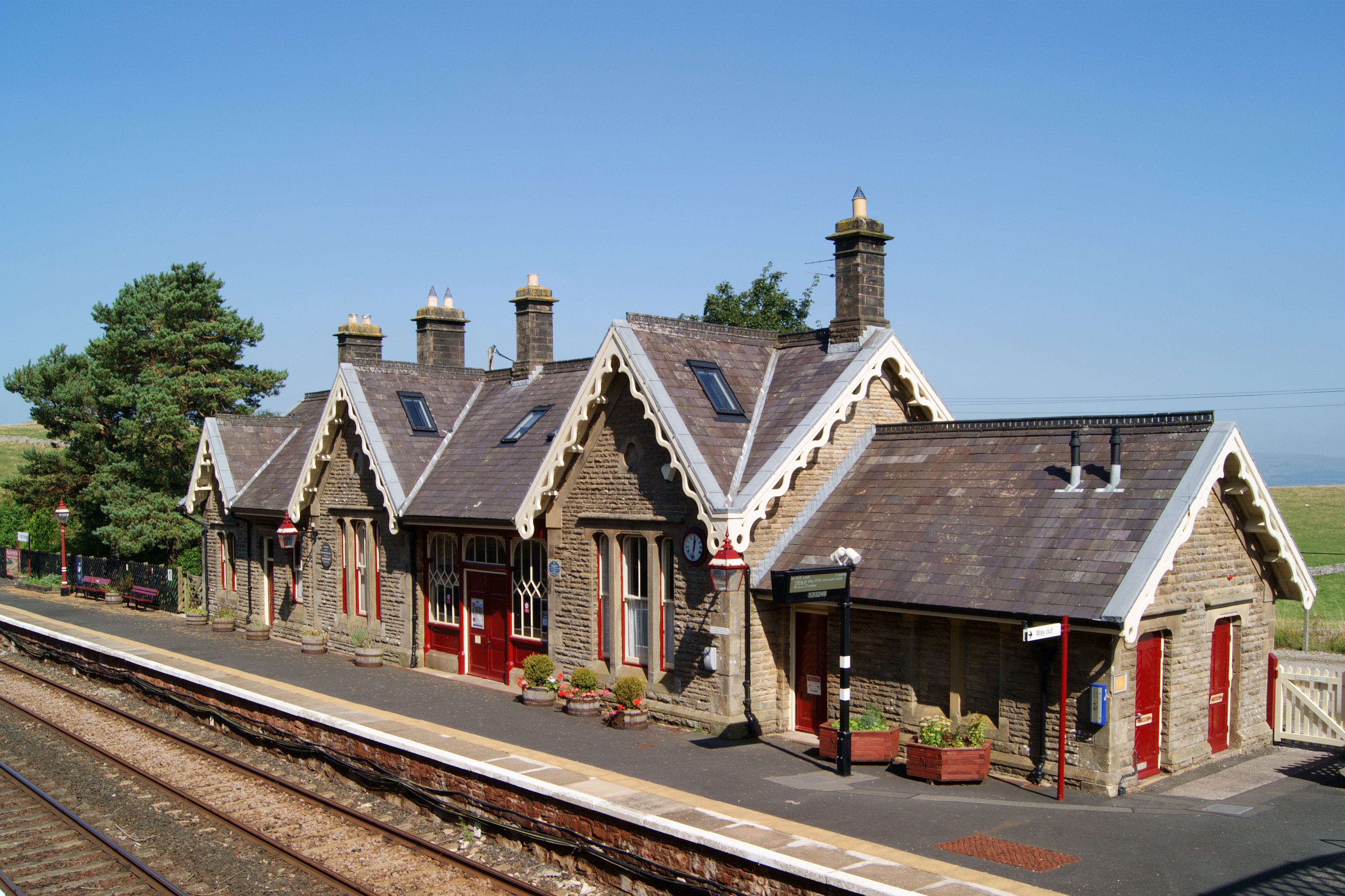
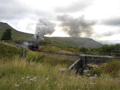
Kirkby Stephen railway station

Kirkby Stephen is a railway station in Eden in Cumbria, England, on the Settle and Carlisle Line, which runs between Carlisle and Leeds via Settle. The...

Mallerstang

Mallerstang is a civil parish in the extreme east of Cumbria, and, geographically, a dale at the head of the upper Eden Valley. Originally part of Westmorland...

Nearby Amenities

Located within 500m of 54.43672,-2.3313555
Great Bell
Ele: 377
Natural: peak
Lat/Long: 54.4364824/-2.3307652
Natural: sinkhole
Lat/Long: 54.4381156/-2.3286673
Natural: sinkhole
Lat/Long: 54.4378474/-2.328806
Natural: sinkhole
Lat/Long: 54.4379768/-2.3287403
Natural: sinkhole
Lat/Long: 54.4376599/-2.328495
Natural: sinkhole
Lat/Long: 54.4383185/-2.3286662
Natural: sinkhole
Lat/Long: 54.4386404/-2.329656
Natural: sinkhole
Lat/Long: 54.4387001/-2.3297045
Natural: sinkhole
Lat/Long: 54.4388411/-2.3297901
Natural: sinkhole
Lat/Long: 54.4390989/-2.330035
Natural: sinkhole
Lat/Long: 54.4385343/-2.330444
Natural: sinkhole
Lat/Long: 54.4384102/-2.3308672
Natural: sinkhole
Lat/Long: 54.4377669/-2.3292555
Natural: sinkhole
Lat/Long: 54.4378668/-2.3299043
Natural: sinkhole
Lat/Long: 54.4368944/-2.3273059
Natural: sinkhole
Lat/Long: 54.4370439/-2.3274517
Abandoned: yes
Historic: mine
Lat/Long: 54.4357762/-2.3304598
The data included in this document is from www.openstreetmap.org. The data is made available under ODbL.

Have you been to Great Bell?

Leave your review of Great Bell below (or comments, questions and feedback).