Badger Wells Hill

Hill, Mountain in Lancashire Ribble Valley

England

Badger Wells Hill

View over Pendleton Moor Looking north along the Clitheroe Road. A public right of way starts at this point and heads north west to Pendleton. Pendle Hill is away to the east, just out of shot.
View over Pendleton Moor Credit: Marika Reinholds

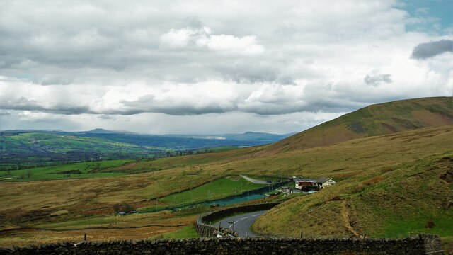
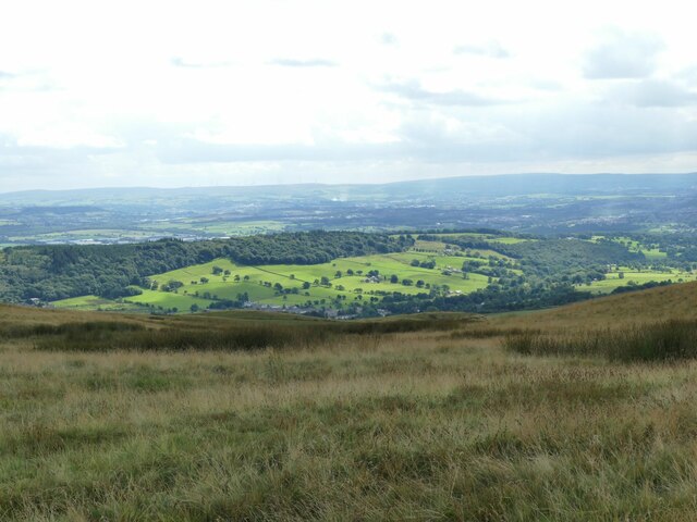
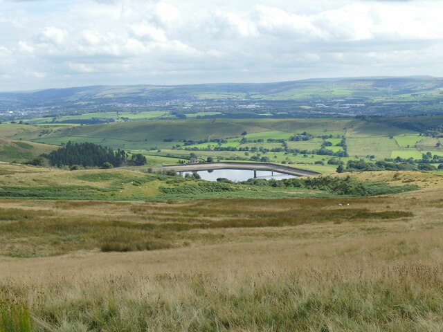
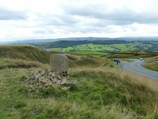
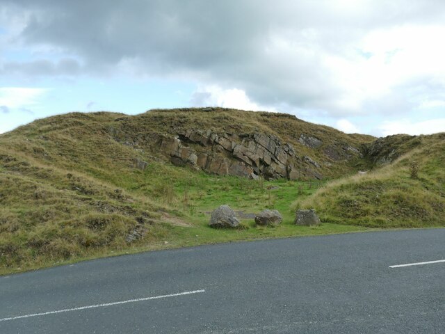
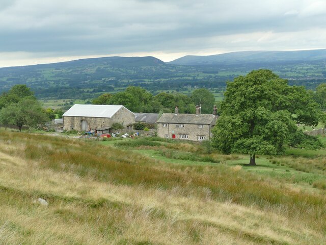
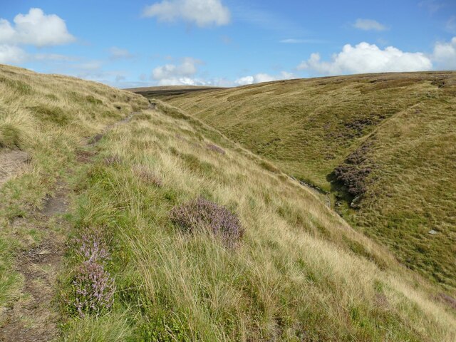
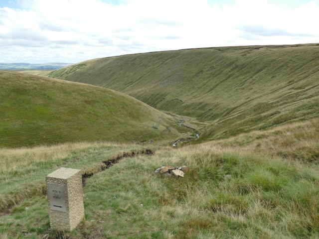
Badger Wells Hill is a prominent hill located in the county of Lancashire, England. Situated in the northern part of the county, this hill is part of the Pennine range, which is renowned for its scenic beauty and rugged landscapes. Rising to an elevation of approximately 380 meters (1,250 feet), Badger Wells Hill offers stunning panoramic views of the surrounding countryside.

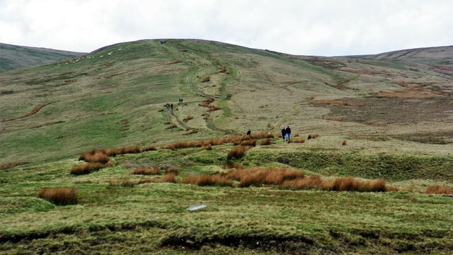
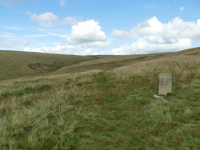
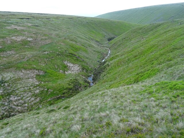
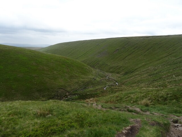
The hill is characterized by its steep slopes, covered in a mix of grasses, heather, and scattered trees. The vegetation here is typical of upland areas, with hardy plants adapted to the harsh conditions. Wildlife enthusiasts will appreciate the diverse range of species that call this hill home, including red grouse, mountain hares, and various bird species.

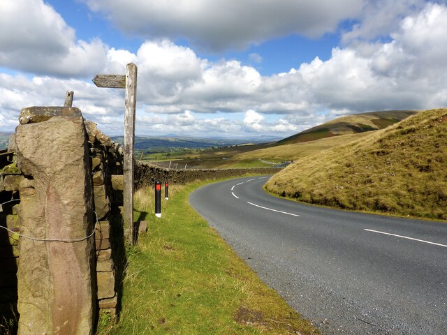
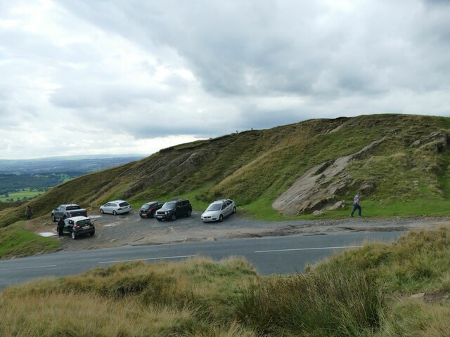
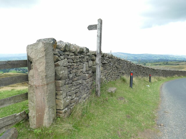
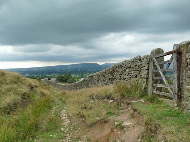
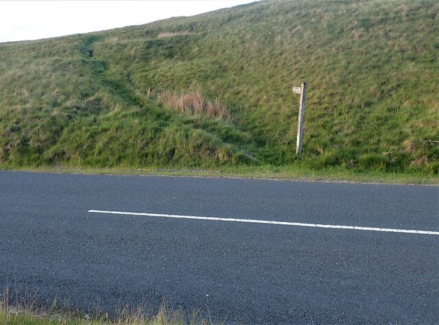
Badger Wells Hill is a popular destination for hikers and nature lovers, who are drawn to its natural beauty and peaceful ambiance. Several walking trails wind their way up the hill, providing visitors with the opportunity to explore its rugged terrain and enjoy the breathtaking vistas from the summit. The hill is also a favorite spot for photographers, as it offers ample opportunities to capture stunning landscape shots.

Due to its location in the Pennines, Badger Wells Hill experiences a relatively cool and wet climate, with rainfall occurring throughout the year. As a result, visitors are advised to come prepared with appropriate clothing and footwear suitable for varying weather conditions.

Overall, Badger Wells Hill stands as a picturesque and accessible natural landmark in Lancashire, offering visitors a chance to immerse themselves in the beauty of the English countryside.

If you have any feedback on the listing, please let us know in the comments section below.

Badger Wells Hill Images

Images are sourced within 2km of 53.851913/-2.3314431 or Grid Reference SD7839. Thanks to Geograph Open Source API. All images are credited.

View over Pendleton Moor Looking north along the Clitheroe Road. A public right of way starts at this point and heads north west to Pendleton. Pendle Hill is away to the east, just out of shot.
View over Pendleton Moor
Looking north along the Clitheroe Road. A public right of way starts at this point and heads north west to Pendleton. Pendle Hill is away to the east, just out of shot.
Nick o' Pendle Dry Ski Slope View from the hill top car park
Nick o' Pendle Dry Ski Slope
View from the hill top car park
Path to Pendleton Moor Summit Start of the path from Nick of Pendle car parks on the flanks of Pendle Hill
Path to Pendleton Moor Summit
Start of the path from Nick of Pendle car parks on the flanks of Pendle Hill
View south-west from Spence Moor A bit of sunlight on a generally dull day lit up fields on the hillside above Sabden.
View south-west from Spence Moor
A bit of sunlight on a generally dull day lit up fields on the hillside above Sabden.
Direction stone on Badger Wells Hill The stone points to Mearley Moor (left) and Summit (right, i.e. the summit of Pendle).
Direction stone on Badger Wells Hill
The stone points to Mearley Moor (left) and Summit (right, i.e. the summit of Pendle).
Church Clough Reservoir from Apronfull Hill Reservoir levels were low in a very dry summer.
Church Clough Reservoir from Apronfull Hill
Reservoir levels were low in a very dry summer.
The airmen's memorial at Nick of Pendle The memorial is to Australian and American aircrew whose planes crashed in the area in World War II. It does not mark the exact site of either incident, but is conveniently located close to a public road. <a href="https://www.geograph.org.uk/photo/4470275">SD7738 : Memorial at Nick of Pendle</a> gives the full text.
The airmen's memorial at Nick of Pendle
The memorial is to Australian and American aircrew whose planes crashed in the area in World War II. It does not mark the exact site of either incident, but is conveniently located close to a public road. SD7738 : Memorial at Nick of Pendle gives the full text.
Car park at Nick of Pendle An old quarry offers limited parking at the summit of the road from Padiham to Clitheroe (295 metres).
Car park at Nick of Pendle
An old quarry offers limited parking at the summit of the road from Padiham to Clitheroe (295 metres).
Quarry at Nick of Pendle An old stone quarry, one of several around the summit of the road from Padiham to Clitheroe. The borough boundary is immediately to the right of the quarry - Ribble Valley this side, Pendle District beyond.
Quarry at Nick of Pendle
An old stone quarry, one of several around the summit of the road from Padiham to Clitheroe. The borough boundary is immediately to the right of the quarry - Ribble Valley this side, Pendle District beyond.
Gate and stile at Nick of Pendle The path beyond the stile leads down to Pendleton village. On the stone gatepost is a benchmark, shown on the 1912 map as 974.5 feet.
Gate and stile at Nick of Pendle
The path beyond the stile leads down to Pendleton village. On the stone gatepost is a benchmark, shown on the 1912 map as 974.5 feet.
Pendle Hill Ski Slope The slope is on the western flank of the hill on the road over to Padiham. <a href="https://www.geograph.org.uk/photo/774073">SD7739 : The ski run at Pendle Ski Club on the slopes of Pendle Hill</a> shows the artificial slope more clearly; it is just over the gridline into the next square, but the buildings are in this one.
Pendle Hill Ski Slope
The slope is on the western flank of the hill on the road over to Padiham. SD7739 : The ski run at Pendle Ski Club on the slopes of Pendle Hill shows the artificial slope more clearly; it is just over the gridline into the next square, but the buildings are in this one.
Gate on the track to Wymondhouses There is no signage to show it on the present gate (and I went past the gate at first) but the public footpath turns right through the gate at this point and heads north of the farm buildings. There used to be a different gate with signage <a href="https://www.geograph.org.uk/photo/2154722">SD7638 : Path junction above Wymondhouses</a>.
Gate on the track to Wymondhouses
There is no signage to show it on the present gate (and I went past the gate at first) but the public footpath turns right through the gate at this point and heads north of the farm buildings. There used to be a different gate with signage SD7638 : Path junction above Wymondhouses.
Wymondhouses Farm The main house (left of the tree) dates from 1788 and is grade II listed (list entry 1072086) as is an even older house behind the tree in this view (list entry 1165082) <a href="https://www.geograph.org.uk/photo/761719">SD7638 : Farm building at Wymondhouses</a>.
Wymondhouses Farm
The main house (left of the tree) dates from 1788 and is grade II listed (list entry 1072086) as is an even older house behind the tree in this view (list entry 1165082) SD7638 : Farm building at Wymondhouses.
Footpath on Pendle The footpath and sign for Pendleton Moor going towards Howcroft Barn. The path is located just past the Wellsprings heading towards Clitheroe. Another view can be seen here - <a title="https://www.geograph.org.uk/photo/4470227" href="https://www.geograph.org.uk/photo/4470227">Link</a>
Footpath on Pendle
The footpath and sign for Pendleton Moor going towards Howcroft Barn. The path is located just past the Wellsprings heading towards Clitheroe. Another view can be seen here - Link
Looking up Ogden Clough
Looking down Ogden Clough
Ogden Clough A footpath follows the western side of the clough at this point.
Ogden Clough
A footpath follows the western side of the clough at this point.
Direction stone in Ogden Clough One path heads on down the clough, another turns right towards Nick of Pendle.
Direction stone in Ogden Clough
One path heads on down the clough, another turns right towards Nick of Pendle.
Show me another place!

Badger Wells Hill is located at Grid Ref: SD7839 (Lat: 53.851913, Lng: -2.3314431)

Administrative County: Lancashire

District: Ribble Valley

Police Authority: Lancashire

What 3 Words

///epic.recorders.fastening. Near Sabden, Lancashire

Related Wikis

Mearley

Mearley is a civil parish in Lancashire, England. The parish is north-west of Pendle Hill, east of Clitheroe, and is in the Ribble Valley district. It...

Pendle Water

Pendle Water is a minor river in Lancashire, England. Rising on Pendle Hill, Pendle Water cuts a deep valley between Barley Moor and Spence Hill, where...

Sabden

Sabden is a village and civil parish in the Ribble Valley, Lancashire, England. Sabden is located south of Pendle Hill, in a valley about three miles north...

Pendleton, Lancashire

Pendleton is a small village and civil parish in Ribble Valley, within the county of Lancashire, England. It is close to the towns of Whalley and Clitheroe...

Nearby Amenities

Located within 500m of 53.851913,-2.3314431
Ford: yes
Lat/Long: 53.8507542/-2.3283267
Barrier: kissing_gate
Material: wood
Lat/Long: 53.8507103/-2.3282887
The data included in this document is from www.openstreetmap.org. The data is made available under ODbL.

Have you been to Badger Wells Hill?

Leave your review of Badger Wells Hill below (or comments, questions and feedback).