Hill of Tifty

Hill, Mountain in Aberdeenshire

Scotland

Hill of Tifty

Bales near Lethenty Looking south-westwards over a field of scattered bales near Lethenty, with Bennachie on the horizon.
Bales near Lethenty Credit: Scott Cormie

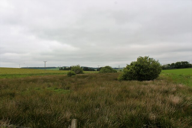
Hill of Tifty is a prominent landmark located in Aberdeenshire, Scotland. Rising to an elevation of 180 meters (590 feet), it is considered a hill rather than a mountain due to its relatively modest height. Despite this, it offers breathtaking views of the surrounding countryside and is a popular destination for hikers and nature enthusiasts.

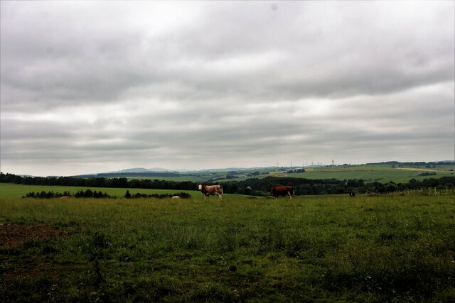
Situated near the village of Tifty, the hill is characterized by its distinctive conical shape and lush greenery. It is primarily composed of granite, a common geological feature in this region of Scotland. The hill is also home to a variety of wildlife, including deer, rabbits, and a diverse array of bird species.

Hill of Tifty is accessible via a well-marked trail that winds its way up the slope. The path is relatively steep in some sections, but the effort is rewarded with stunning panoramic vistas at the summit. On a clear day, visitors can see the rolling hills and scenic farmland stretching out in all directions.

Aside from its natural beauty, Hill of Tifty also has historical significance. It is believed to have been a site of human activity dating back thousands of years, with evidence of prehistoric settlements found in the area. Today, it serves as a peaceful retreat for locals and visitors alike, offering a chance to immerse oneself in the tranquility of the Scottish countryside.

If you have any feedback on the listing, please let us know in the comments section below.

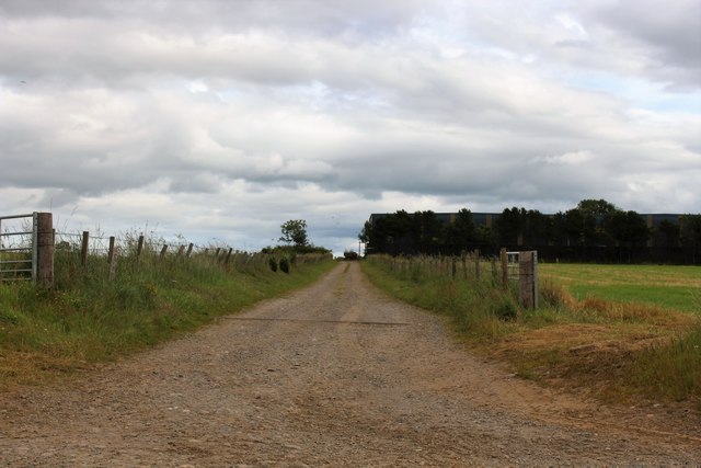
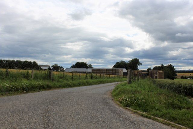
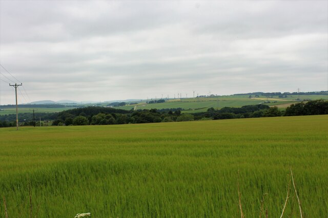
Hill of Tifty Images

Images are sourced within 2km of 57.454364/-2.3632744 or Grid Reference NJ7840. Thanks to Geograph Open Source API. All images are credited.

Bales near Lethenty Looking south-westwards over a field of scattered bales near Lethenty, with Bennachie on the horizon.
Bales near Lethenty
Looking south-westwards over a field of scattered bales near Lethenty, with Bennachie on the horizon.
Chalmers' of Monkshill Memorial Roadside memorial to Charles Chalmers of Monkshill.
Chalmers' of Monkshill Memorial
Roadside memorial to Charles Chalmers of Monkshill.
Field north of Monkshill Looking south-west over a field to the north of Monkshill, with the Aberdeenshire countryside beyond.
Field north of Monkshill
Looking south-west over a field to the north of Monkshill, with the Aberdeenshire countryside beyond.
Burnside of Gourdas Looking east from the roadside to a house at Burnside of Gourdas.
Burnside of Gourdas
Looking east from the roadside to a house at Burnside of Gourdas.
Fields north of Tifty Looking westwards over fields to the north of Tifty.
Fields north of Tifty
Looking westwards over fields to the north of Tifty.
Fields east of Tifty Looking south over fields to the east of Tifty.
Fields east of Tifty
Looking south over fields to the east of Tifty.
C26S (Aberdeenshire) Road The C26S road heading south down the Hill of Tifty.
C26S (Aberdeenshire) Road
The C26S road heading south down the Hill of Tifty.
Parkburn Belt A fine strip wood above Fyvie.
Parkburn Belt
A fine strip wood above Fyvie.
Farmland north of Monkshill
The lane over Monks' Hill
The lane to Darnabo
The lane to Darnabo
Tillyfar Farm Road The access road to Tillyfar.
Tillyfar Farm Road
The access road to Tillyfar.
Darnabo Farm The large farm of Darnabo with its access road.
Darnabo Farm
The large farm of Darnabo with its access road.
Road Ahead by Darnabo Farmland on either side of this minor road by Darnabo.
Road Ahead by Darnabo
Farmland on either side of this minor road by Darnabo.
Hill of Tifty Crop A grain crop growing on the south easterly slopes of the Hill of Tifty.
Hill of Tifty Crop
A grain crop growing on the south easterly slopes of the Hill of Tifty.
East by Tifty The minor road by Tifty leading east.
East by Tifty
The minor road by Tifty leading east.
Tifty Cattle Cattle grazing on the Hill of Tifty.
Tifty Cattle
Cattle grazing on the Hill of Tifty.
Tifty Wetland Low lying wetland by the roadside, this is to the south of the Moss of Tifty proper.
Tifty Wetland
Low lying wetland by the roadside, this is to the south of the Moss of Tifty proper.
Show me another place!

Hill of Tifty is located at Grid Ref: NJ7840 (Lat: 57.454364, Lng: -2.3632744)

Unitary Authority: Aberdeenshire

Police Authority: North East

What 3 Words

///whirlwind.cake.shop. Near Rothienorman, Aberdeenshire

Nearby Locations

Hill of Tifty

Related Wikis

Tifty, Aberdeenshire

Tifty is near Turriff, Aberdeenshire, Scotland. == References ==

Backhill

Backhill is a rural area near Woodhead of Fyvie in Aberdeenshire, Scotland. == References ==

Woodhead, Aberdeenshire

Woodhead of Fyvie, often simply called "Woodhead", is an inland hamlet in Formartine, Aberdeenshire, Scotland, that lies to the east of Fyvie near the...

Fyvie Castle

Fyvie Castle is a castle in the village of Fyvie, near Turriff in Aberdeenshire, Scotland. == History == The earliest parts of Fyvie Castle date from the...

Nearby Amenities

Located within 500m of 57.454364,-2.3632744
Power: pole
Lat/Long: 57.4505861/-2.3670455
Power: pole
Lat/Long: 57.4508953/-2.3670622
Power: pole
Lat/Long: 57.451296/-2.367219
Power: pole
Lat/Long: 57.4516886/-2.367379
Power: pole
Lat/Long: 57.450569/-2.3668146
Power: pole
Lat/Long: 57.4503077/-2.3662403
Power: pole
Lat/Long: 57.4500605/-2.3656995
Power: pole
Lat/Long: 57.4535938/-2.3585988
Power: pole
Lat/Long: 57.4542657/-2.3588634
Power: pole
Lat/Long: 57.4548795/-2.3590835
Power: pole
Lat/Long: 57.45545/-2.3593587
Power: pole
Lat/Long: 57.4559706/-2.3596063
Power: pole
Lat/Long: 57.4566251/-2.3596445
Power: pole
Lat/Long: 57.4577809/-2.3595831
Power: pole
Lat/Long: 57.4560308/-2.3586613
Power: pole
Lat/Long: 57.4561028/-2.3576004
Power: pole
Lat/Long: 57.4561683/-2.356594
Power: pole
Lat/Long: 57.4576852/-2.3608891
Power: pole
Lat/Long: 57.4576123/-2.361992
Power: pole
Lat/Long: 57.4575349/-2.3631858
Power: pole
Lat/Long: 57.4574518/-2.3643077
Power: pole
Lat/Long: 57.4573664/-2.3654698
Power: pole
Lat/Long: 57.4572787/-2.3666192
Power: pole
Lat/Long: 57.4569815/-2.3678003
Power: pole
Lat/Long: 57.4567014/-2.3689497
Power: pole
Lat/Long: 57.4564076/-2.3701203
The data included in this document is from www.openstreetmap.org. The data is made available under ODbL.

Have you been to Hill of Tifty?

Leave your review of Hill of Tifty below (or comments, questions and feedback).