Hunter Hill

Hill, Mountain in Yorkshire Craven

England

Hunter Hill

At Far Gearstones Fields near the farm buildings, marked out by traditional dry-stone walls.
At Far Gearstones Credit: Mary and Angus Hogg

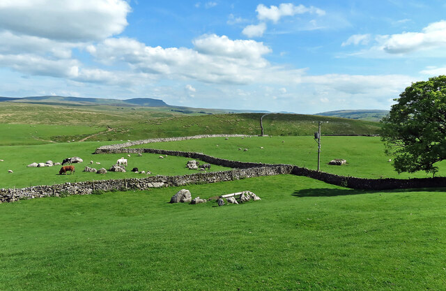
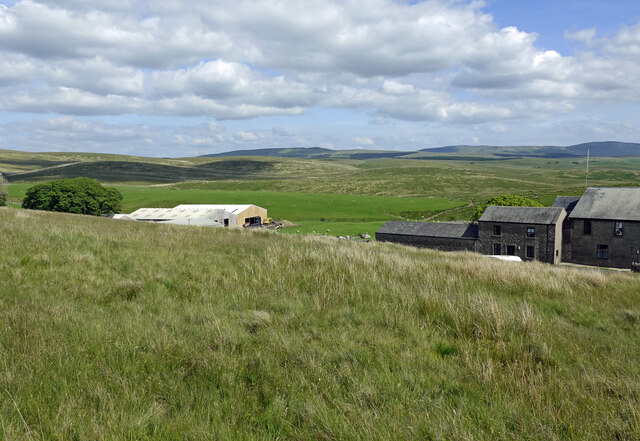
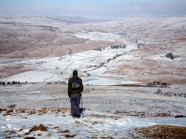
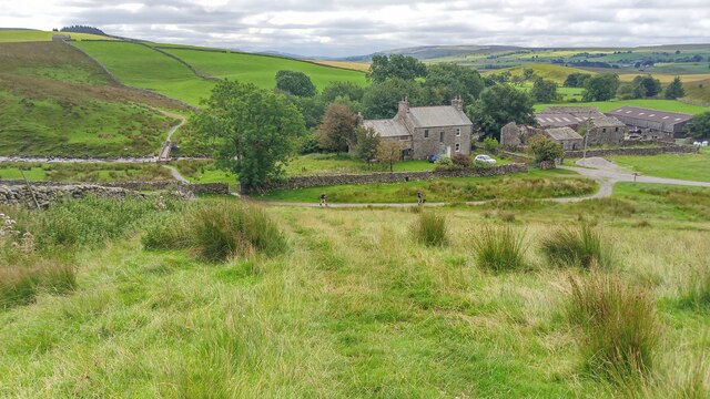
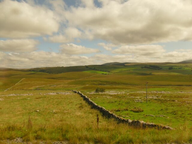
Hunter Hill is a prominent geographical feature located in the county of Yorkshire, England. Situated in the stunning North York Moors National Park, the hill is part of the expansive and picturesque landscape of the area. Rising to an elevation of approximately 454 meters (1,490 feet), Hunter Hill offers breathtaking panoramic views of the surrounding countryside.

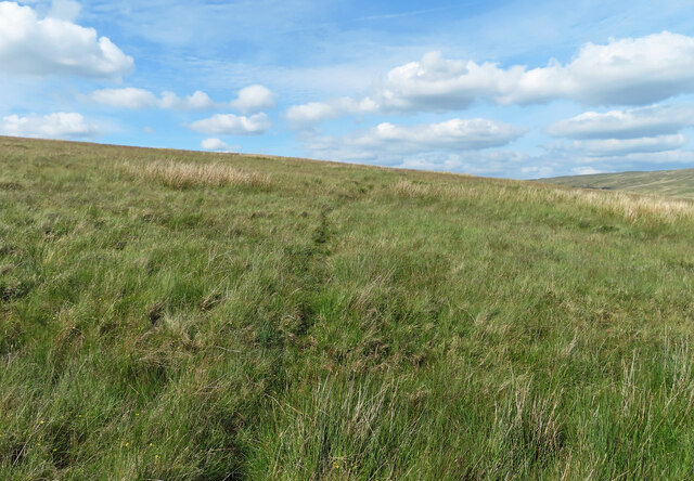
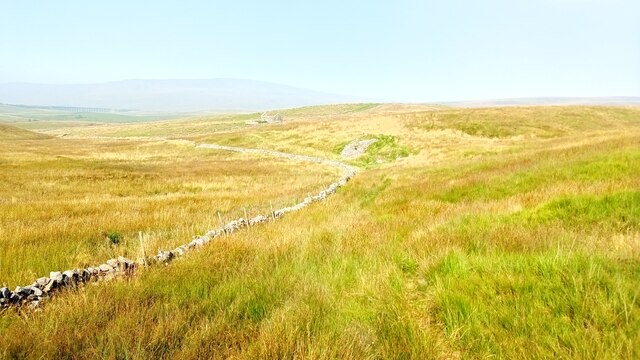
The hill is characterized by its steep slopes, which are covered in a patchwork of heather, grasses, and wildflowers, creating a vibrant and colorful spectacle during the summer months. Its location within the national park ensures that the area is rich in biodiversity, with a variety of flora and fauna calling it home.

Hunter Hill is a popular destination for outdoor enthusiasts, attracting hikers, walkers, and nature lovers from near and far. There are numerous walking trails and footpaths that traverse the hill, allowing visitors to explore its natural beauty at their own pace. The hill's summit offers a particularly impressive view, where on clear days, one can see for miles across the rolling hills of Yorkshire.

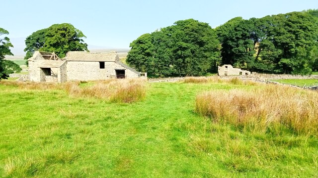
Aside from its natural beauty, Hunter Hill also holds historical significance. The area is dotted with prehistoric remains, including ancient burial sites and stone circles, providing a glimpse into the rich history of the region.

Overall, Hunter Hill in Yorkshire is a captivating destination that showcases the natural wonders and cultural heritage of the North York Moors National Park. Whether for leisurely walks, wildlife spotting, or simply appreciating the breathtaking scenery, visitors to this hill are sure to be left with lasting memories.

If you have any feedback on the listing, please let us know in the comments section below.
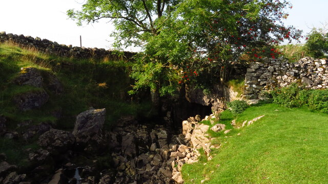
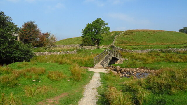
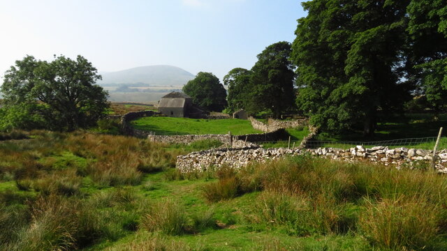
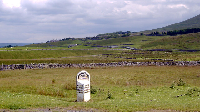
Hunter Hill Images

Images are sourced within 2km of 54.198215/-2.3384714 or Grid Reference SD7878. Thanks to Geograph Open Source API. All images are credited.
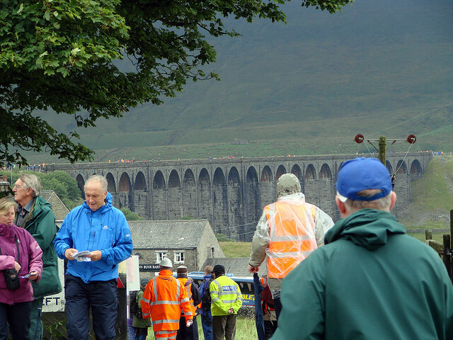
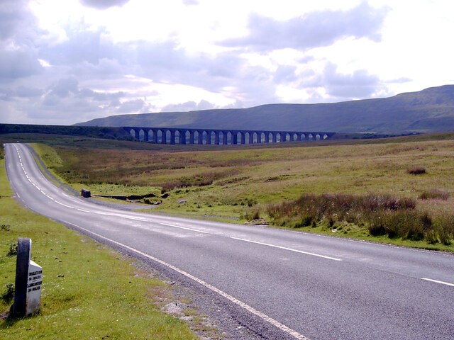
At Far Gearstones Fields near the farm buildings, marked out by traditional dry-stone walls.
At Far Gearstones
Fields near the farm buildings, marked out by traditional dry-stone walls.
On Green Slack Hill A sort of a path on the moor near Gearstones.
On Green Slack Hill
A sort of a path on the moor near Gearstones.
From Green Slack Hill This view taken from the edge of the hill shows Far Gearstones on the left and Gearstones Lodge on the right.
From Green Slack Hill
This view taken from the edge of the hill shows Far Gearstones on the left and Gearstones Lodge on the right.
A view over the upper Ribble valley from Park Fell With the cottages at Gauber visible on the right.
A view over the upper Ribble valley from Park Fell
With the cottages at Gauber visible on the right.
Nether Lodge Ribblesdale Farm.
Nether Lodge
Ribblesdale Farm.
Dry stone wall at Selside Along with the limestone pavement from which the stone was presumably taken, this is typical Ribblesdale scenery.
Dry stone wall at Selside
Along with the limestone pavement from which the stone was presumably taken, this is typical Ribblesdale scenery.
Cars parked at Gearstones This road junction at Ribblehead is popular with both visitors to the famous viaduct, and longer distance walkers.
Cars parked at Gearstones
This road junction at Ribblehead is popular with both visitors to the famous viaduct, and longer distance walkers.
Thorns Old farm, now abandoned.
Thorns
Old farm, now abandoned.
Ribble Way Looking back in the direction of Whernside with a crumbling old lime kiln in the near distance on Thorns Moss.
Ribble Way
Looking back in the direction of Whernside with a crumbling old lime kiln in the near distance on Thorns Moss.
Viaduct walkers An official event allowing people to walk across Ribblehead Viaduct. Here people are awaiting their turn to do the walk. Walkers are seen across the viaduct. This was the last day of repairs to the viaduct and no trains were running.
Viaduct walkers
An official event allowing people to walk across Ribblehead Viaduct. Here people are awaiting their turn to do the walk. Walkers are seen across the viaduct. This was the last day of repairs to the viaduct and no trains were running.
A busy day at Ribblehead On a day when the viaduct was open to walkers.
A busy day at Ribblehead
On a day when the viaduct was open to walkers.
Buses at Ribblehead Transporting walkers for the walking on the Ribblehead viaduct event.
Buses at Ribblehead
Transporting walkers for the walking on the Ribblehead viaduct event.
God's Bridge on the Ribble Way near Selside From the cave entrance it is possible to see daylight from the far end.
God's Bridge on the Ribble Way near Selside
From the cave entrance it is possible to see daylight from the far end.
Footbridge over Cam Beck, Nether Lodge near Selside
Abandoned farmstead at Cove Hole near Ribblehead
Ribblehead [2] Although not the most pleasant of weather, the area around the Ribblehead Viaduct was crowded.
Ribblehead [2]
Although not the most pleasant of weather, the area around the Ribblehead Viaduct was crowded.
Milestone on Blea Moor Road (B6255), Ribblehead A close-up of the milestone can be seen in <a href="https://www.geograph.org.uk/photo/7041937">SD7679 : Milestone on Blea Moor Road (B6255), Ribblehead</a>.
Milestone on Blea Moor Road (B6255), Ribblehead
A close-up of the milestone can be seen in SD7679 : Milestone on Blea Moor Road (B6255), Ribblehead.
Blea Moor Road (B6255) approaching the Ribblehead Viaduct A close-up of the milestone can be seen in <a href="https://www.geograph.org.uk/photo/7041937">SD7679 : Milestone on Blea Moor Road (B6255), Ribblehead</a>.
Blea Moor Road (B6255) approaching the Ribblehead Viaduct
A close-up of the milestone can be seen in SD7679 : Milestone on Blea Moor Road (B6255), Ribblehead.
Show me another place!

Hunter Hill is located at Grid Ref: SD7878 (Lat: 54.198215, Lng: -2.3384714)

Division: West Riding

Administrative County: North Yorkshire

District: Craven

Police Authority: North Yorkshire

What 3 Words

///amps.blatantly.smudges. Near Ingleton, North Yorkshire

Related Wikis

Ribblehead Quarry

Ribblehead Quarry is a former limestone quarry next to Ribblehead railway station in the Yorkshire Dales National Park, North Yorkshire, England. It had...

Ribblehead railway station

Ribblehead is a railway station on the Settle and Carlisle Line, which runs between Carlisle and Leeds via Settle. The station, situated 52 miles 17 chains...

Ribblehead

Ribblehead is the area of moorland at the head of the River Ribble in the area known as Ribblesdale, in the Yorkshire Dales National Park, England. Ribblehead...

Ling Gill

Ling Gill is a gill (or narrow valley) in the Yorkshire Dales in North Yorkshire, England. Cam Beck, a tributary of the River Ribble, flows through the...

High Birkwith

High Birkwith is a hamlet in the Craven district of North Yorkshire, England. It is located north of the village of Horton in Ribblesdale and in the same...

Ribblehead Viaduct

The Ribblehead Viaduct or Batty Moss Viaduct carries the Settle–Carlisle railway across Batty Moss in the Ribble Valley at Ribblehead, in North Yorkshire...

Selside, North Yorkshire

Selside is a small village in Ribblesdale in North Yorkshire, England. It lies 2 miles (3 km) north west of Horton in Ribblesdale. Selside was mentioned...

Alum Pot

Alum Pot is a pothole with a large open shaft at a surface elevation of 343 metres (1,125 ft) on the eastern flanks of Simon Fell, North Yorkshire, England...

Nearby Amenities

Located within 500m of 54.198215,-2.3384714
Pry Hill
Ele: 267
Ele Ft: 875
Natural: peak
Source: OS 1:25k
Lat/Long: 54.2013642/-2.3374665
Barrier: cattle_grid
Source: Bing
Lat/Long: 54.1981202/-2.3427246
Hunter Hill
Natural: peak
Source: OS 1:25k
Lat/Long: 54.198524/-2.3384145
Entrance: yes
Lat/Long: 54.1969089/-2.3369251
Entrance: yes
Lat/Long: 54.1980152/-2.3355872
Entrance: yes
Lat/Long: 54.1959311/-2.3387954
Natural: sinkhole
Source: Bing
Lat/Long: 54.1960444/-2.3349726
Natural: sinkhole
Source: Bing
Lat/Long: 54.1954449/-2.335627
Natural: sinkhole
Source: Bing
Lat/Long: 54.195376/-2.3358738
Natural: sinkhole
Source: Bing
Lat/Long: 54.1953603/-2.3360025
Natural: sinkhole
Source: Bing
Lat/Long: 54.1952001/-2.3360723
Natural: sinkhole
Source: Bing
Lat/Long: 54.1950119/-2.3359811
Natural: sinkhole
Source: Bing
Lat/Long: 54.1967505/-2.333964
Entrance: yes
Source: EsriWorldImageryClarity
Lat/Long: 54.2016204/-2.3346001
Grave Yard
Quakers Grave Yard
Fixme: exact location needs confirming.
Source: OS sheet 96, publ. 1851
Lat/Long: 54.1974895/-2.338044
Ingman Lodge
Place: isolated_dwelling
Source: OS sheet 96, publ. 1851
Lat/Long: 54.1969874/-2.3384094
Power: pole
Lat/Long: 54.1999875/-2.3454811
Power: pole
Lat/Long: 54.199538/-2.3446605
Power: pole
Lat/Long: 54.1991309/-2.3439229
Power: pole
Lat/Long: 54.1986084/-2.342947
Power: pole
Lat/Long: 54.1980484/-2.3419587
Power: pole
Lat/Long: 54.1974184/-2.3415614
Power: pole
Lat/Long: 54.1968302/-2.3411886
Power: pole
Lat/Long: 54.1962486/-2.3407782
Power: pole
Lat/Long: 54.1954886/-2.3402698
Power: pole
Lat/Long: 54.1947154/-2.3397464
Power: pole
Lat/Long: 54.1939366/-2.3392267
Power: pole
Lat/Long: 54.1993073/-2.3451444
Power: pole
Lat/Long: 54.1990099/-2.3457319
Power: pole
Lat/Long: 54.1974845/-2.3407462
Power: pole
Lat/Long: 54.1975616/-2.3398932
Power: pole
Lat/Long: 54.1976244/-2.3391646
Power: pole
Lat/Long: 54.1977092/-2.3382025
Power: pole
Lat/Long: 54.1976167/-2.3367037
Power: pole
Lat/Long: 54.1975274/-2.3352954
Power: pole
Lat/Long: 54.1974338/-2.3339209
Power: pole
Lat/Long: 54.1973567/-2.3325803
Power: pole
Lat/Long: 54.1972653/-2.3312228
Barrier: kissing_gate
Lat/Long: 54.2005254/-2.3444397
Direction: 180
Information: map
Map Size: site
Operator: Ashes Pasture Nature Reserve
Tourism: information
Lat/Long: 54.2005403/-2.3444768
Bench
Lat/Long: 54.2005108/-2.3445256
Bench
Lat/Long: 54.200494/-2.344476
Historic: boundary_stone
Source: survey
Lat/Long: 54.2000205/-2.3439423
The data included in this document is from www.openstreetmap.org. The data is made available under ODbL.

Have you been to Hunter Hill?

Leave your review of Hunter Hill below (or comments, questions and feedback).