Amber Hill

Hill, Mountain in Westmorland Eden

England

Amber Hill

Lowfield Hush in Scordale Scordale is at the south-western corner of the northern Pennines. Although a public right of way exists through the valley, it lies within the MOD Warcop firing range and access is limited to days when no 'live firing' takes place. The valley of Scordale has seen a great deal of activity even before the military occupation and evidence of the now defunct extraction industries is to be seen in this image. The apparent valley above the dry stone wall at the left side of the image is in fact a hush - a relic of lead mining days. To the right, the apparent tunnel is actually an old lime kiln.
Lowfield Hush in Scordale Credit: Trevor Littlewood

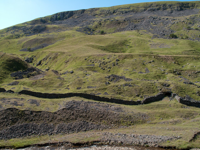
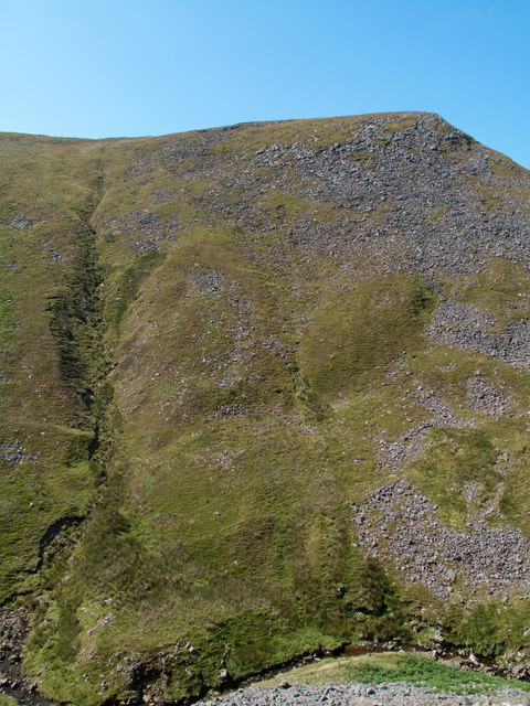
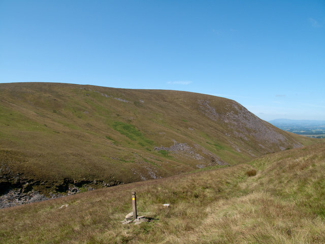
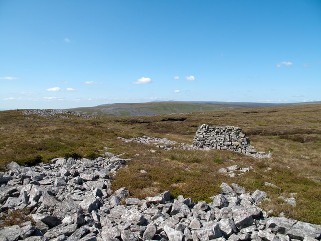
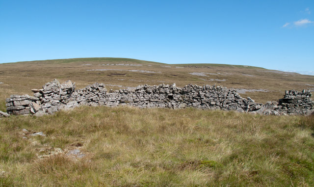
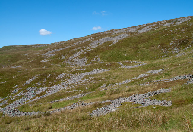
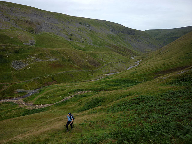
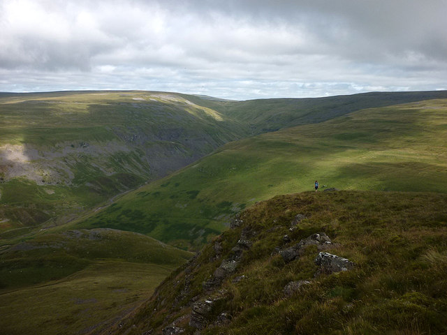
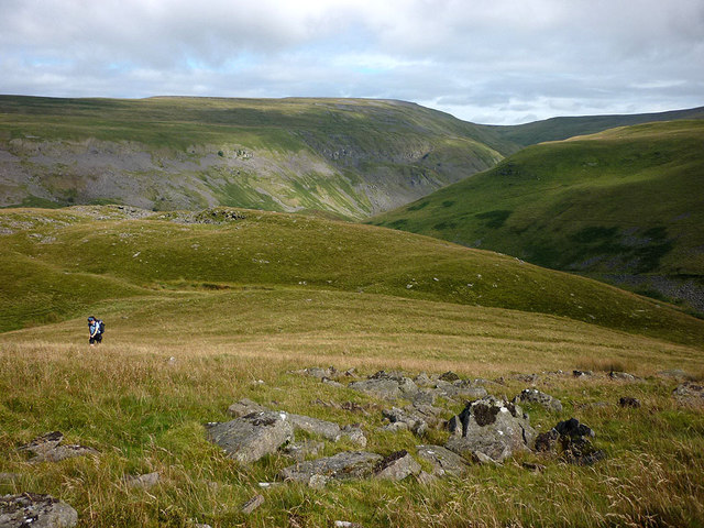
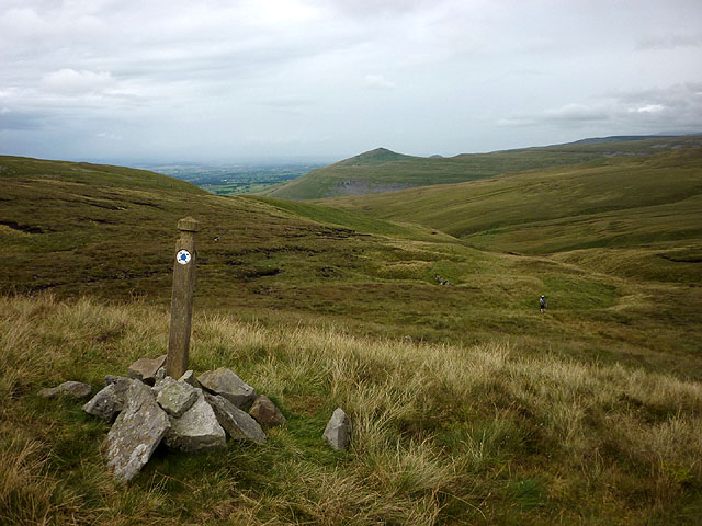
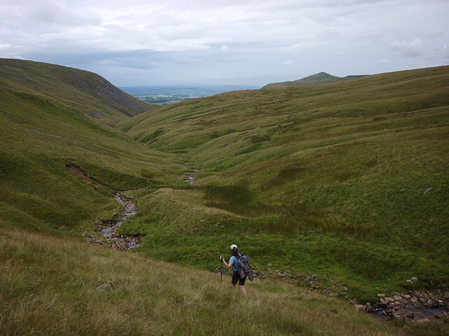
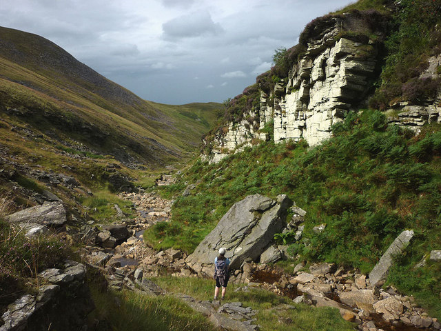
Amber Hill is a small hill located in the Westmorland region of England. Situated in the picturesque Lake District National Park, it is part of the larger range known as the Westmorland Fells. At an elevation of approximately 400 meters (1,300 feet), Amber Hill offers breathtaking panoramic views of the surrounding countryside.

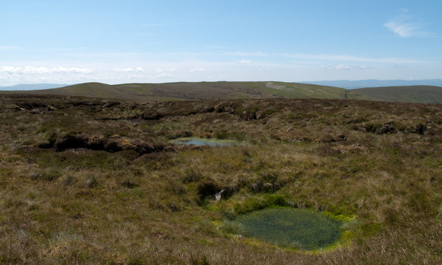
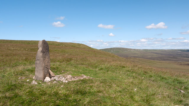
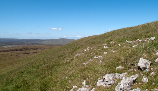
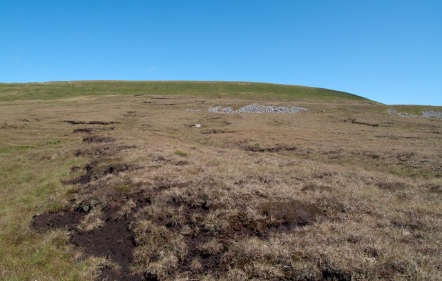
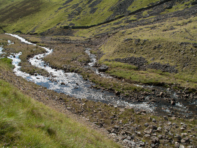
Covered in lush green vegetation and dotted with rocky outcrops, Amber Hill is a popular destination for hikers and nature enthusiasts. Its relatively gentle slopes make it accessible to walkers of all abilities, although some sections may require a moderate level of fitness. The hill is crisscrossed by a network of well-marked trails, allowing visitors to explore its diverse flora and fauna at their own pace.

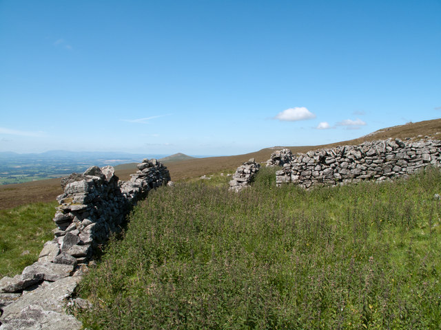
In addition to its natural beauty, Amber Hill has historical significance. It is believed to have been inhabited since prehistoric times, with evidence of ancient settlements and burial sites found in the vicinity. The hill's strategic location also made it an advantageous vantage point during various conflicts in the past.

Today, Amber Hill continues to attract visitors seeking tranquility and respite from the hustle and bustle of city life. Its peaceful surroundings, coupled with the opportunity to immerse oneself in nature, make it a perfect destination for those looking to unwind and reconnect with the great outdoors. Whether it is a leisurely stroll or a challenging hike, Amber Hill offers a memorable experience for all who visit.

If you have any feedback on the listing, please let us know in the comments section below.

Amber Hill Images

Images are sourced within 2km of 54.590752/-2.357923 or Grid Reference NY7621. Thanks to Geograph Open Source API. All images are credited.

Lowfield Hush in Scordale Scordale is at the south-western corner of the northern Pennines. Although a public right of way exists through the valley, it lies within the MOD Warcop firing range and access is limited to days when no 'live firing' takes place. The valley of Scordale has seen a great deal of activity even before the military occupation and evidence of the now defunct extraction industries is to be seen in this image. The apparent valley above the dry stone wall at the left side of the image is in fact a hush - a relic of lead mining days. To the right, the apparent tunnel is actually an old lime kiln.
Lowfield Hush in Scordale
Scordale is at the south-western corner of the northern Pennines. Although a public right of way exists through the valley, it lies within the MOD Warcop firing range and access is limited to days when no 'live firing' takes place. The valley of Scordale has seen a great deal of activity even before the military occupation and evidence of the now defunct extraction industries is to be seen in this image. The apparent valley above the dry stone wall at the left side of the image is in fact a hush - a relic of lead mining days. To the right, the apparent tunnel is actually an old lime kiln.
Roman Fell across Swindale The steep north-eastern face of Roman Fell is largely grassed but with an extensive area of boulders too, the upper ones at least are apparently known as Slape Stones or Fox Yards. In this view from a path across the valley below Swindale Edge, Roman Fell's summit is not in view, being beyond the apparent crest of the hill over a slope at a more gentle angle.
Roman Fell across Swindale
The steep north-eastern face of Roman Fell is largely grassed but with an extensive area of boulders too, the upper ones at least are apparently known as Slape Stones or Fox Yards. In this view from a path across the valley below Swindale Edge, Roman Fell's summit is not in view, being beyond the apparent crest of the hill over a slope at a more gentle angle.
Bridleway above north side of Swindale Swindale is a tributary valley of Scordale; the view here is to the west along a bridleway on its north side. Roman Fell is the hill on Swindale's southern side.
Bridleway above north side of Swindale
Swindale is a tributary valley of Scordale; the view here is to the west along a bridleway on its north side. Roman Fell is the hill on Swindale's southern side.
Walls of sheepfold on south side of Little Fell A disused and derelict sheepfold situated remotely in the MOD Warcop range.
Beyond the sheepfold are slopes of Little Fell dropping to Swindale and distantly, Murton Pike.
Walls of sheepfold on south side of Little Fell
A disused and derelict sheepfold situated remotely in the MOD Warcop range. Beyond the sheepfold are slopes of Little Fell dropping to Swindale and distantly, Murton Pike.
Water filled shake holes on south side of Little Fell Shake holes are thought to be created by the collapse of hollows beneath where limestone has been eroded to create cavities; they're very common in the northern Pennines and generally occur at a certain linear horizon on a hillside. The shake holes here occupy an area rather than a line and those in view are water filled.
The distant skyline is occupied by Tinside Rigg.
Water filled shake holes on south side of Little Fell
Shake holes are thought to be created by the collapse of hollows beneath where limestone has been eroded to create cavities; they're very common in the northern Pennines and generally occur at a certain linear horizon on a hillside. The shake holes here occupy an area rather than a line and those in view are water filled. The distant skyline is occupied by Tinside Rigg.
Boundary stone on south side of Little Fell The 'standing stone' is clearly a boundary stone; it has a 'B' engraved on its north face and 'W' on the south face. Additionally there's a date on the south face but with just the initial digit - 1, and final digit - 7 discernable. The hill in view distantly is Mickle Fell.
Boundary stone on south side of Little Fell
The 'standing stone' is clearly a boundary stone; it has a 'B' engraved on its north face and 'W' on the south face. Additionally there's a date on the south face but with just the initial digit - 1, and final digit - 7 discernable. The hill in view distantly is Mickle Fell.
Grassy slope with rocks at west side of Little Fell The slope lies just below the high point of Little Fell which is a flat area of grass just above. The hill seen distantly is Meldon Hill.
Grassy slope with rocks at west side of Little Fell
The slope lies just below the high point of Little Fell which is a flat area of grass just above. The hill seen distantly is Meldon Hill.
Ground rising to summit of Little Fell Rough grassland with minor peat banks and small areas of boulder rises gently to a steeper slope of finer grass beyond which lies the highest point of Little Fell.
Ground rising to summit of Little Fell
Rough grassland with minor peat banks and small areas of boulder rises gently to a steeper slope of finer grass beyond which lies the highest point of Little Fell.
Boulders on moorland west of Little Fell The hill slopes of the western flank of the northern Pennines are well scattered with boulder rashes; this one lies west of Little Fell. The view beyond is generally to the north with Murton Fell showing in the middle distance; Cross Fell and the Dun Fells are much further away.
Boulders on moorland west of Little Fell
The hill slopes of the western flank of the northern Pennines are well scattered with boulder rashes; this one lies west of Little Fell. The view beyond is generally to the north with Murton Fell showing in the middle distance; Cross Fell and the Dun Fells are much further away.
Wall of ruined sheepfold The sheepfold, known apparently as Standards Fold, lies on the declining western slope of Little Fell, the two domes of which can be seen above the wall.
Wall of ruined sheepfold
The sheepfold, known apparently as Standards Fold, lies on the declining western slope of Little Fell, the two domes of which can be seen above the wall.
Boulder rashes, Scordale Extensive areas of boulder such as are seen here on the western side of Scordale are very common in this side of the northern Pennines. Some of the boulder areas seen here appear to have been formed in to patterns - surely not for decoration!
There's a good many notices attached to low poles probably with 'no dig' symbols showing.  The area is of course in the MOD's Warcop range and such notices do appear occasionally all over the place but there may well be a particular concentration of them in the area.
Boulder rashes, Scordale
Extensive areas of boulder such as are seen here on the western side of Scordale are very common in this side of the northern Pennines. Some of the boulder areas seen here appear to have been formed in to patterns - surely not for decoration! There's a good many notices attached to low poles probably with 'no dig' symbols showing. The area is of course in the MOD's Warcop range and such notices do appear occasionally all over the place but there may well be a particular concentration of them in the area.
Scordale Beck below Amber Hill Scordale Beck, seen here from the path beside it below Amber Hill, splits into three channels - an example of 'braiding'?
Scordale Beck below Amber Hill
Scordale Beck, seen here from the path beside it below Amber Hill, splits into three channels - an example of 'braiding'?
Starting up the north ridge of Roman Fell Leaving the good bridleway in Scordale for the rough and steep climb up the north ridge of Roman Fell. Below is the footbridge over Scordale Beck just upstream of the confluence of Swindale Beck.
Starting up the north ridge of Roman Fell
Leaving the good bridleway in Scordale for the rough and steep climb up the north ridge of Roman Fell. Below is the footbridge over Scordale Beck just upstream of the confluence of Swindale Beck.
Roman Fell Scar After a very steep climb up the north ridge the going eases above Roman Fell Scar. Far below are the deep trenches of Swindale and Scordale.
Roman Fell Scar
After a very steep climb up the north ridge the going eases above Roman Fell Scar. Far below are the deep trenches of Swindale and Scordale.
Climbing up Roman Fell Partway up the north ridge of Roman Fell there is a large flat area known as High Hause with a slight col beyond, Hause Harrows. Above here the ridge is a very steep and bouldery slope called Slape Stones (or Fox Yards). We saw no foxes but encountered clouds of midges which did not abate until a breeze on the summit kept them down.
Climbing up Roman Fell
Partway up the north ridge of Roman Fell there is a large flat area known as High Hause with a slight col beyond, Hause Harrows. Above here the ridge is a very steep and bouldery slope called Slape Stones (or Fox Yards). We saw no foxes but encountered clouds of midges which did not abate until a breeze on the summit kept them down.
This way to Swindale The bridleway across the shoulder of Tinside Rigg is virtually non-existent on the ground, only the line of the route being marked by a series of wooden marker posts. It only becomes a defined track above Swindale before descending into Scordale and so to Hilton. The shapely peak in the distance is Murton Pike.
This way to Swindale
The bridleway across the shoulder of Tinside Rigg is virtually non-existent on the ground, only the line of the route being marked by a series of wooden marker posts. It only becomes a defined track above Swindale before descending into Scordale and so to Hilton. The shapely peak in the distance is Murton Pike.
At the head of Swindale The non-existent bridleway contours along the slope north of the beck, marked only by a line of wooden posts. We decided to follow the bottom of the gill as a more interesting line of return to Scordale. The lowlands of the Eden Valley can be seen between Roman Fell (left) and Murton Pike.
At the head of Swindale
The non-existent bridleway contours along the slope north of the beck, marked only by a line of wooden posts. We decided to follow the bottom of the gill as a more interesting line of return to Scordale. The lowlands of the Eden Valley can be seen between Roman Fell (left) and Murton Pike.
Swindale Beck and Crag Swindale Beck at this point is fairly low in volume since much of it sinks into joints in the limestone further up the gill. The crag is sandstone, broken and a luminous lime green colour due to lichen. On our approach a large bird (owl or buzzard?) flew off from one of its ledges.
Swindale Beck and Crag
Swindale Beck at this point is fairly low in volume since much of it sinks into joints in the limestone further up the gill. The crag is sandstone, broken and a luminous lime green colour due to lichen. On our approach a large bird (owl or buzzard?) flew off from one of its ledges.
Show me another place!

Amber Hill is located at Grid Ref: NY7621 (Lat: 54.590752, Lng: -2.357923)

Administrative County: Cumbria

District: Eden

Police Authority: Cumbria

What 3 Words

///drizzly.cried.building. Near Appleby-in-Westmorland, Cumbria

Nearby Locations

Amber Hill

Related Wikis

Murton Fell

Murton Fell is a hill of 675 metres (2,215 ft) above the village of Murton, Cumbria in Eden district, in the North Pennines. It lies east of the dramatic...

Warcop Training Area

The Warcop Training Area (WTA) is a UK Ministry of Defence military training area near the village of Warcop in Cumbria. Part of the Defence Training...

Appleby Fells

Appleby Fells is a Site of Special Scientific Interest in the Eden district of Cumbria, England, near Appleby-in-Westmorland. The area is approximately...

Murton, Cumbria

Murton is a small village and civil parish in the Eden District of Cumbria, England. The parish had a population of 330 in 2001, rising to 360 at the 2011...

Hilton, Cumbria

Hilton is a village in Cumbria, England, in the civil parish of Murton, about 3 miles (4.8 km) east of Appleby-in-Westmorland and at an elevation of 752...

Mickle Fell

Mickle Fell is a mountain in the Pennines, the range of hills and moors running down the middle of Northern England. It has a maximum elevation of 788...

High Cup Gill

High Cup Gill (or High Cup Nick or just High Cup), almost a geometrically perfect U-shaped chasm, is a valley deeply incised into the Pennine scarp to...

Fox Tower, Cumbria

Fox Tower is a tower built by John Metcalf Carleton, an industrial entrepreneur, as a folly in 1775 on his large estate next to Brough, a village in Cumbria...

Nearby Amenities

Located within 500m of 54.590752,-2.357923
Shake Holes
Note: Possibly mine shafts or Bell Pits
Lat/Long: 54.5892815/-2.36351
The data included in this document is from www.openstreetmap.org. The data is made available under ODbL.

Have you been to Amber Hill?

Leave your review of Amber Hill below (or comments, questions and feedback).