Galey Hill
Hill, Mountain in Yorkshire South Lakeland
England
Galey Hill

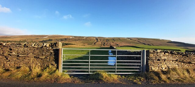
Galey Hill is a prominent hill located in the Yorkshire Dales National Park in Yorkshire, England. Situated near the small village of Galey, it forms part of the Pennines mountain range. Rising to an elevation of approximately 400 meters (1312 feet), Galey Hill offers breathtaking panoramic views of the surrounding countryside.
The hill is predominantly composed of gritstone, which gives it a rugged and weathered appearance. Its slopes are covered with a mixture of heather, grasses, and scattered shrubs, creating a picturesque landscape that changes with the seasons. During spring and summer, the hillside becomes a vibrant tapestry of wildflowers, attracting a variety of butterflies and other insects.
Galey Hill is a popular destination for hikers and walkers, offering numerous trails and footpaths that wind their way up to the summit. The paths range in difficulty, catering to both beginners and experienced hikers. Along the way, visitors can enjoy the diverse wildlife that inhabits the area, including birds of prey, such as kestrels and buzzards, as well as small mammals like rabbits and hares.
At the top of Galey Hill, visitors are rewarded with breathtaking views that stretch for miles in every direction. On a clear day, it is possible to see the rolling hills and valleys of the Yorkshire Dales, as well as distant peaks of the Pennines and even the Lake District. The hill provides an ideal vantage point to soak in the natural beauty of the region and offers a peaceful retreat from the hustle and bustle of everyday life.
If you have any feedback on the listing, please let us know in the comments section below.
Galey Hill Images
Images are sourced within 2km of 54.34048/-2.3555901 or Grid Reference SD7693. Thanks to Geograph Open Source API. All images are credited.


Galey Hill is located at Grid Ref: SD7693 (Lat: 54.34048, Lng: -2.3555901)
Division: West Riding
Administrative County: Cumbria
District: South Lakeland
Police Authority: Cumbria
What 3 Words
///uppermost.copying.stocks. Near Sedbergh, Cumbria
Nearby Locations
Related Wikis

Grisedale
Grisedale (sometimes Grisdale, or Grizedale [archaic]) is a south east facing Dale in Cumbria, England, 8 miles (13 km) east of Sedbergh, and 7 miles...
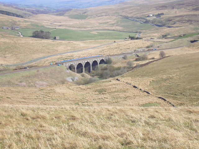
Hawes Junction rail crash
The Hawes Junction rail crash occurred at 5.49 am on 24 December 1910, just north of Lunds Viaduct between Hawes Junction (now known as Garsdale station...

Lunds, North Yorkshire
Lunds is a hamlet in North Yorkshire, England, near to the watershed of the Eden and Ure rivers. It is on the border between Cumbria and North Yorkshire...

Garsdale Head
Garsdale Head is a hamlet mainly within the South Lakeland district of Cumbria, England. Historically part of the West Riding of Yorkshire, the hamlet...

Aisgill
Aisgill is the southernmost of the hamlets that form the parish of Mallerstang in the English county of Cumbria. It is on the B6259 road, at the head of...

Garsdale railway station
Garsdale is a railway station in Cumbria, England (historically in the West Riding of Yorkshire), on the Settle and Carlisle Line, which runs between Carlisle...

Dandry Mire Viaduct
Dandry Mire Viaduct, (or Dandrymire Viaduct), is a railway viaduct on the Settle & Carlisle line in Cumbria, England. It is just north of Garsdale station...

Swarth Fell
Swarth Fell is an approximately 1 mile (1.5 km) stretch of high ground (consisting mainly of limestone capped with millstone grit) situated to the south...
Nearby Amenities
Located within 500m of 54.34048,-2.3555901Have you been to Galey Hill?
Leave your review of Galey Hill below (or comments, questions and feedback).