White Hill

Hill, Mountain in Dorset

England

White Hill

Ascending Bulbarrow Hill The Bulbarrow Hill of the last verse of Thomas Hardy's poem 'Wessex Heights':


So I am found on Ingpen Beacon, or on Wylls-Neck to the west, 
Or else on homely Bulbarrow, or little Pilsdon Crest, 
Where men have never cared to haunt, nor women have walked with me, 
And ghosts then keep their distance; and I know some liberty.
Ascending Bulbarrow Hill Credit: Becky Williamson

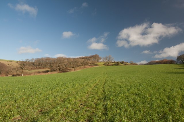
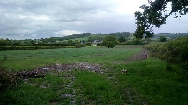
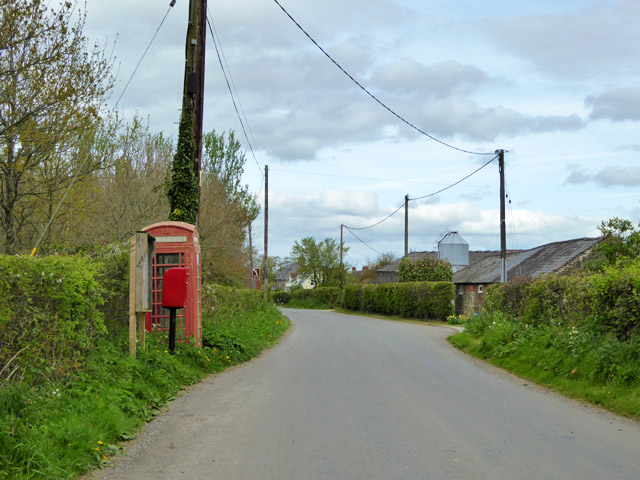
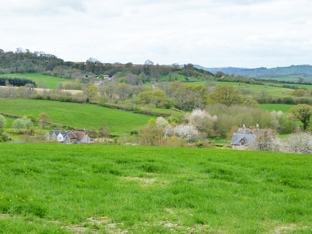
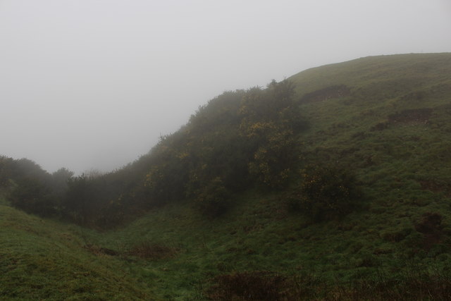
White Hill is a prominent hill located in the county of Dorset, England. Situated on the western edge of the county, it forms part of the stunning landscape of the Dorset Downs, a range of chalk hills and ridges that extends across the region. With an elevation of approximately 214 meters (702 feet), White Hill stands proud as one of the highest points in the area.

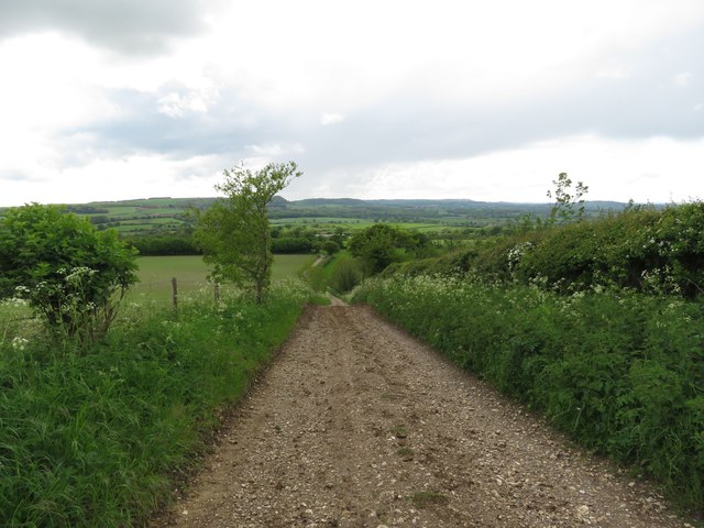
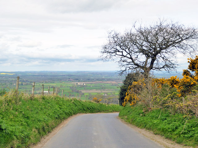
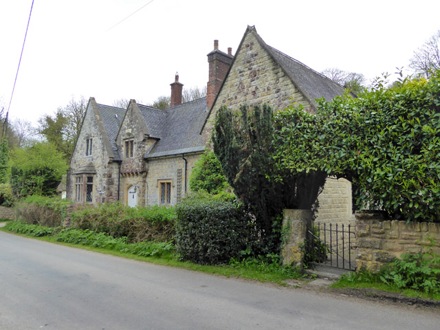
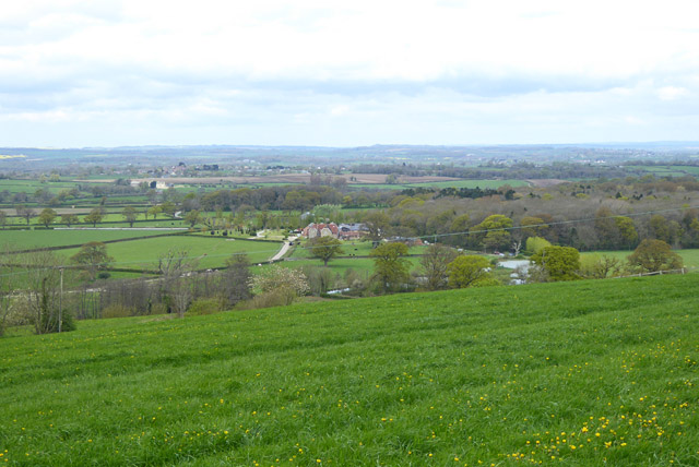
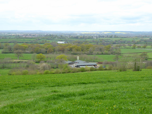
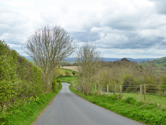
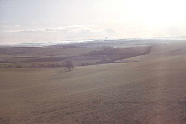
The hill offers breathtaking panoramic views of the surrounding countryside, allowing visitors to admire the picturesque rolling hills, green pastures, and charming villages that dot the landscape. On clear days, it is even possible to catch a glimpse of the English Channel from the summit.

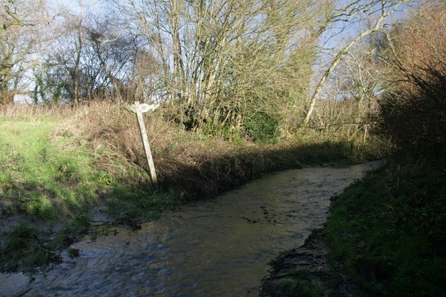
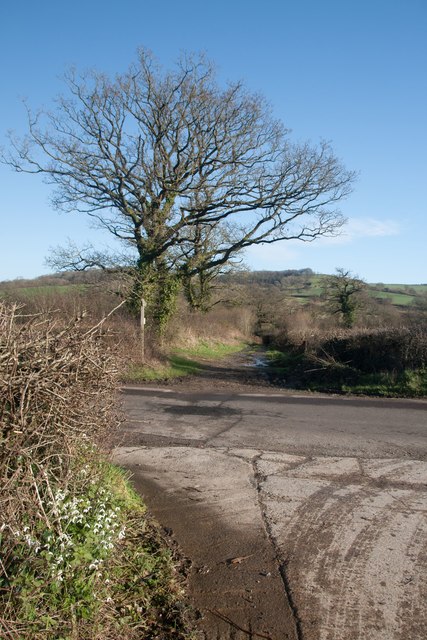
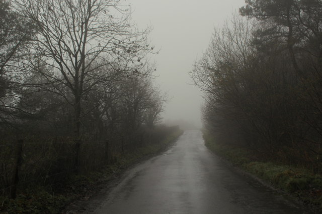
White Hill is a popular destination for outdoor enthusiasts and nature lovers. It is crisscrossed by numerous footpaths and trails, making it ideal for hiking, walking, and cycling. The hill is also home to a diverse range of flora and fauna, including wildflowers, butterflies, and various bird species, making it a haven for wildlife enthusiasts and birdwatchers.

In addition to its natural beauty, White Hill also holds historical significance. It is believed to have been inhabited since prehistoric times, with ancient earthworks and burial mounds found in the vicinity. The hill is also associated with folklore and legends, adding to its allure and mystique.

Overall, White Hill in Dorset is a captivating destination that offers both natural beauty and a glimpse into the region's rich history. It attracts visitors from near and far, seeking to immerse themselves in the idyllic charm of the Dorset countryside.

If you have any feedback on the listing, please let us know in the comments section below.

White Hill Images

Images are sourced within 2km of 50.856501/-2.3394107 or Grid Reference ST7606. Thanks to Geograph Open Source API. All images are credited.

Ascending Bulbarrow Hill The Bulbarrow Hill of the last verse of Thomas Hardy's poem 'Wessex Heights':


So I am found on Ingpen Beacon, or on Wylls-Neck to the west, 
Or else on homely Bulbarrow, or little Pilsdon Crest, 
Where men have never cared to haunt, nor women have walked with me, 
And ghosts then keep their distance; and I know some liberty.
Ascending Bulbarrow Hill
The Bulbarrow Hill of the last verse of Thomas Hardy's poem 'Wessex Heights': So I am found on Ingpen Beacon, or on Wylls-Neck to the west, Or else on homely Bulbarrow, or little Pilsdon Crest, Where men have never cared to haunt, nor women have walked with me, And ghosts then keep their distance; and I know some liberty.
Flooded bridleway ford at Crockers Farm Almost impassable!
Flooded bridleway ford at Crockers Farm
Almost impassable!
Phone mast, Bulbarrow Hill If you look carefully on the right hand side, about half-way up, you can see two work men dangling.
Phone mast, Bulbarrow Hill
If you look carefully on the right hand side, about half-way up, you can see two work men dangling.
Snowdrops at Crockers Farm Looking north-east towards Bulbarrow Hill.
Snowdrops at Crockers Farm
Looking north-east towards Bulbarrow Hill.
Looking back towards Crockers Farm The Wessex Ridgeway runs through this farm between Bulbarrow Hill to the north-east and Minterne Parva to the west.
Looking back towards Crockers Farm
The Wessex Ridgeway runs through this farm between Bulbarrow Hill to the north-east and Minterne Parva to the west.
Ascending the southern slopes of Bulbarrow Hill
View north-west from Bulbarrow Hill
Woolland church A grade II listed building, about 1857. 'Unknown dedication' - odd for such a late church, surely someone must know.
Woolland church
A grade II listed building, about 1857. 'Unknown dedication' - odd for such a late church, surely someone must know.
Notice board, postbox, telephone box, Woolland Across the road from Skinners Farm.
Notice board, postbox, telephone box, Woolland
Across the road from Skinners Farm.
The Old School, Woolland A grade II listed building, from about 1850.
The Old School, Woolland
A grade II listed building, from about 1850.
View north-west from hill above Woolland Looking towards Dairy House Farm.
View north-west from hill above Woolland
Looking towards Dairy House Farm.
View WNW from hill above Woolland
View west from hill above Woolland Hill Farm and nearby cottages are below.
View west from hill above Woolland
Hill Farm and nearby cottages are below.
Road down from Bulbarrow Hill Towards Woolland.
Road down from Bulbarrow Hill
Towards Woolland.
Old Direction Sign - Signpost by Mafeking Lane, Woolland, Dorset Annulus and bar finial - 3 arms; Dorset halo with NGR by the UC road, in parish of Woolland (North Dorset District), Woolland, T-junction with UC road to Ibberton, on embankment in hedgerow.

Surveyed

Milestone Society National ID: DO_ST7707
Old Direction Sign - Signpost by Mafeking Lane, Woolland, Dorset
Annulus and bar finial - 3 arms; Dorset halo with NGR by the UC road, in parish of Woolland (North Dorset District), Woolland, T-junction with UC road to Ibberton, on embankment in hedgerow. Surveyed Milestone Society National ID: DO_ST7707
Wessex Ridgeway East of Crockers Farm A very muddy section this, with a mixture of soft manure thrown in - made more difficult in cold mist and light drizzle.
Wessex Ridgeway East of Crockers Farm
A very muddy section this, with a mixture of soft manure thrown in - made more difficult in cold mist and light drizzle.
Ramparts on Rawlsbury Camp Part of an Iron Age Hillfort on the western edge of Bulbarrow Hill.
The fog was thick on this summit - the second highest in Dorset, from which 5 Counties can be seen. But that is on a clear day.
Ramparts on Rawlsbury Camp
Part of an Iron Age Hillfort on the western edge of Bulbarrow Hill. The fog was thick on this summit - the second highest in Dorset, from which 5 Counties can be seen. But that is on a clear day.
Lane on Bulbarrow Hill Gloomy day on Bulbarrow Hill, beside woodland entitled Ivers, on the map
Lane on Bulbarrow Hill
Gloomy day on Bulbarrow Hill, beside woodland entitled Ivers, on the map
Show me another place!

White Hill is located at Grid Ref: ST7606 (Lat: 50.856501, Lng: -2.3394107)

Unitary Authority: Dorset

Police Authority: Dorset

What 3 Words

///bends.mile.prelude. Near Shillingstone, Dorset

Related Wikis

Stoke Wake

Stoke Wake is a hamlet and civil parish, formerly part of the Whiteway hundred in north Dorset, England. It is situated under Bulbarrow Hill on the edge...

Bulbarrow Hill

Bulbarrow Hill is a 274 metres (899 ft) hill near Woolland, five miles west of Blandford Forum and ten miles (16 km) north of Dorchester in Dorset, England...
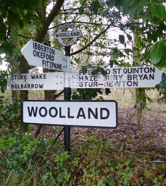
Woolland

Woolland is a village and civil parish in north Dorset, England, situated in the Blackmore Vale under Bulbarrow Hill 7 miles (11 km) west of Blandford...

Dorset Downs

The Dorset Downs are an area of chalk downland in the centre of the county Dorset in south west England. The downs are the most western part of a larger...

Mappowder

Mappowder is a village and civil parish in the county of Dorset in southern England. The parish lies approximately 9 miles (14 kilometres) southeast of...

Ansty, Dorset

Ansty is a village in Dorset, England, north of Cheselbourne and west of Milton Abbas. It consists of the settlements of Higher Ansty, Lower Ansty, Pleck...

Ansty Cross

Ansty Cross is a village in Dorset, England.

Ibberton

Ibberton is a village and civil parish in the county of Dorset in southern England. It is situated in the Blackmore Vale under the scarp face of the Dorset...

Nearby Amenities

Located within 500m of 50.856501,-2.3394107
Stoke Wake
Is In: Dorset, England, UK
Place: hamlet
Lat/Long: 50.8571207/-2.3360775
Power: pole
Source: bing
Lat/Long: 50.8596867/-2.3345223
Poles: bipole
Power: pole
Source: bing
Transformer: distribution
Lat/Long: 50.8577244/-2.3372059
Power: pole
Source: bing
Lat/Long: 50.8579979/-2.3353806
Power: pole
Source: bing
Lat/Long: 50.857909/-2.3359774
Power: pole
Source: bing
Lat/Long: 50.8581257/-2.3345277
Power: pole
Source: bing
Lat/Long: 50.858251/-2.3336881
Power: pole
Source: bing
Lat/Long: 50.8590281/-2.3336586
The data included in this document is from www.openstreetmap.org. The data is made available under ODbL.

Have you been to White Hill?

Leave your review of White Hill below (or comments, questions and feedback).