Lamplands Copse

Wood, Forest in Dorset

England

Lamplands Copse

Ascending Bulbarrow Hill The Bulbarrow Hill of the last verse of Thomas Hardy's poem 'Wessex Heights':


So I am found on Ingpen Beacon, or on Wylls-Neck to the west, 
Or else on homely Bulbarrow, or little Pilsdon Crest, 
Where men have never cared to haunt, nor women have walked with me, 
And ghosts then keep their distance; and I know some liberty.
Ascending Bulbarrow Hill Credit: Becky Williamson

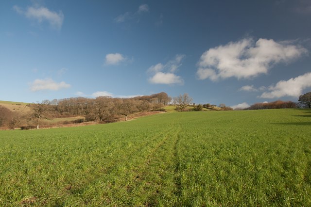
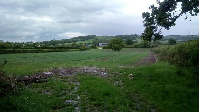
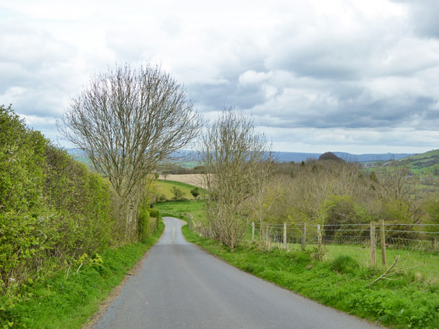
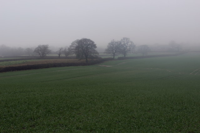
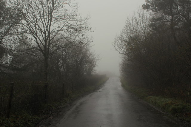
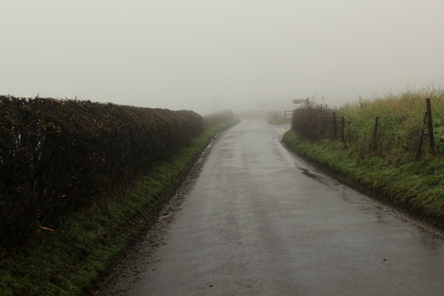
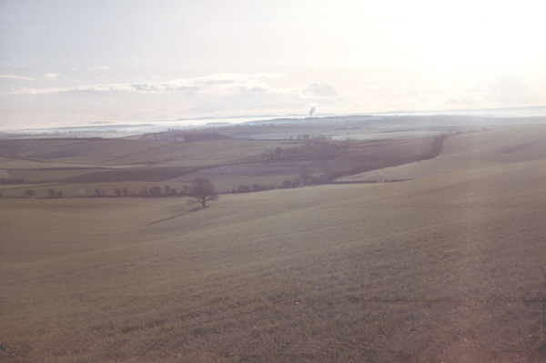
Lamplands Copse is a picturesque woodland located in the county of Dorset, England. Covering an area of approximately 50 acres, it is known for its dense foliage, diverse flora and fauna, and tranquil atmosphere.

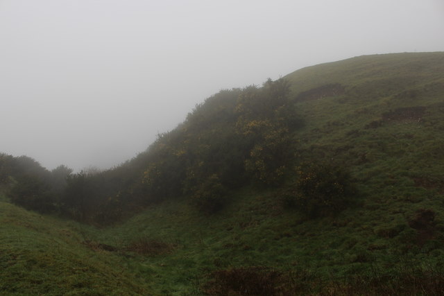
The copse is predominantly composed of native broadleaf trees, including oak, beech, and ash, which create a lush green canopy that filters sunlight and casts beautiful patterns on the forest floor. The undergrowth is rich and varied, with ferns, bluebells, and wild garlic adding splashes of color throughout the seasons.

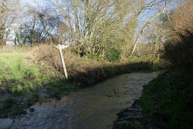
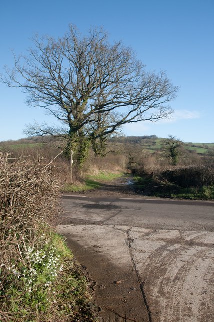
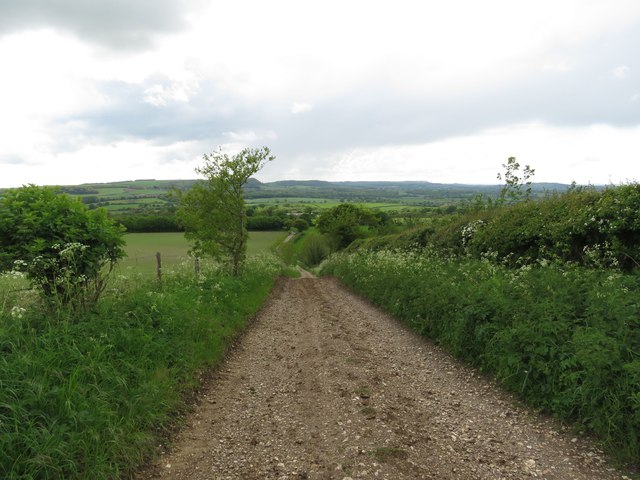
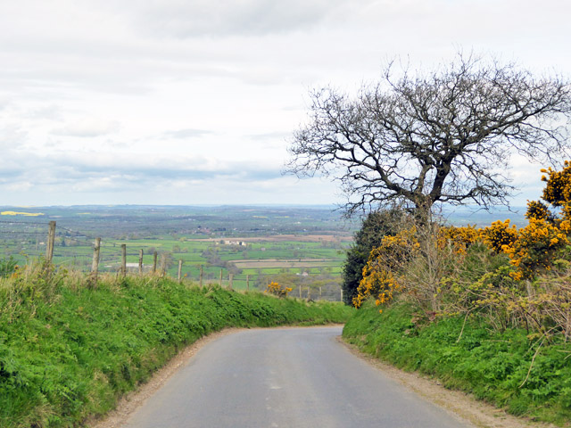
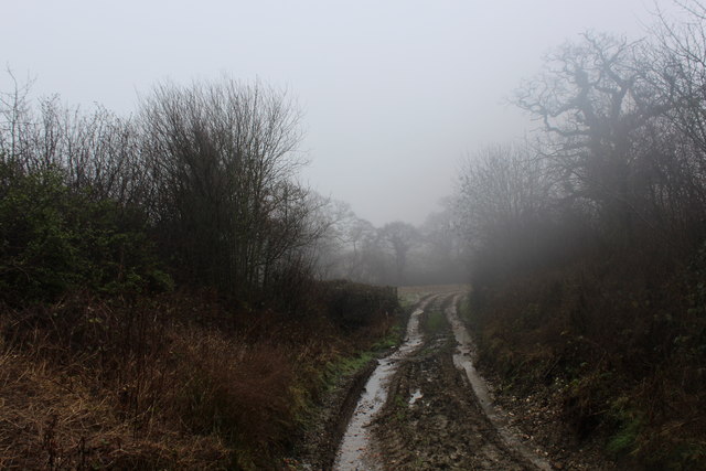
The wood is crisscrossed by a network of well-maintained footpaths, making it a popular destination for walkers, nature enthusiasts, and families alike. These paths lead visitors through a mix of open glades, where sunlight filters through the trees, and more secluded areas, where the tranquility of the woodland can be fully appreciated.

Lamplands Copse is home to a diverse range of wildlife. Birdsong can be heard throughout the year, with species such as robins, blackbirds, and woodpeckers making their homes here. The woodland floor provides a habitat for small mammals, including squirrels and voles, while the surrounding hedgerows attract butterflies and other insects.

In addition to its natural beauty, Lamplands Copse also has historical significance. It is believed that the wood has been in existence for hundreds of years and was once used as a source of timber and firewood. Today, it serves as a valuable sanctuary for both nature and visitors seeking a peaceful retreat in the heart of Dorset.

If you have any feedback on the listing, please let us know in the comments section below.

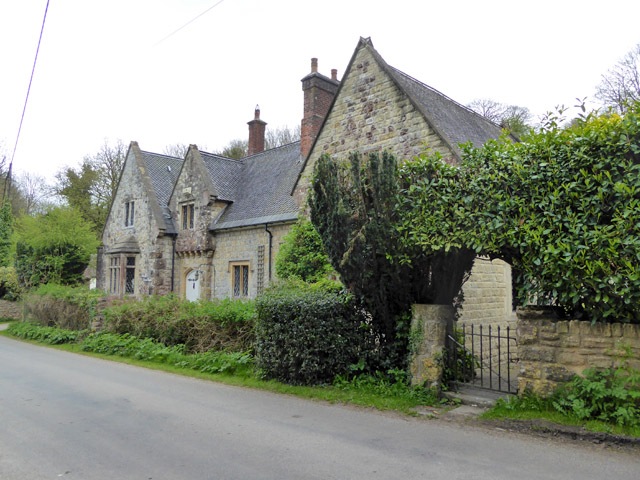
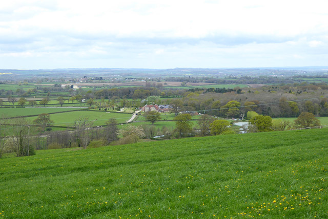
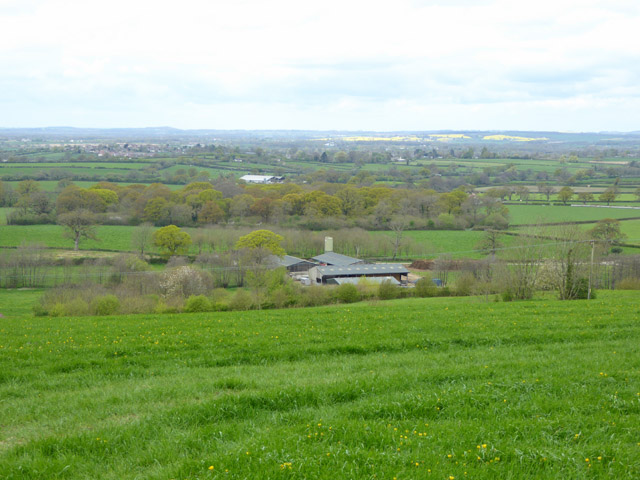
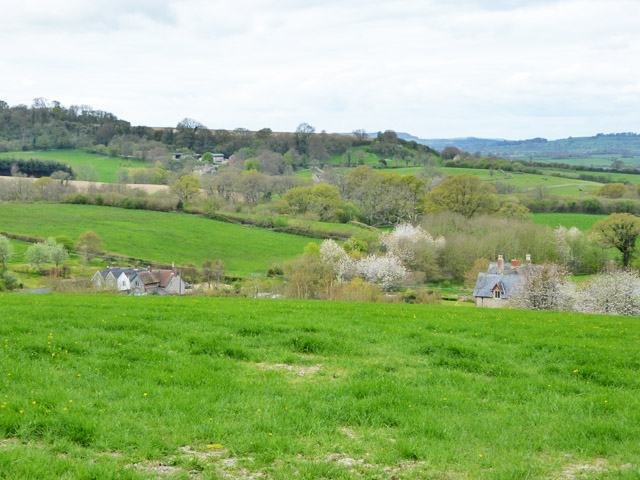
Lamplands Copse Images

Images are sourced within 2km of 50.853463/-2.3390761 or Grid Reference ST7606. Thanks to Geograph Open Source API. All images are credited.

Ascending Bulbarrow Hill The Bulbarrow Hill of the last verse of Thomas Hardy's poem 'Wessex Heights':


So I am found on Ingpen Beacon, or on Wylls-Neck to the west, 
Or else on homely Bulbarrow, or little Pilsdon Crest, 
Where men have never cared to haunt, nor women have walked with me, 
And ghosts then keep their distance; and I know some liberty.
Ascending Bulbarrow Hill
The Bulbarrow Hill of the last verse of Thomas Hardy's poem 'Wessex Heights': So I am found on Ingpen Beacon, or on Wylls-Neck to the west, Or else on homely Bulbarrow, or little Pilsdon Crest, Where men have never cared to haunt, nor women have walked with me, And ghosts then keep their distance; and I know some liberty.
Flooded bridleway ford at Crockers Farm Almost impassable!
Flooded bridleway ford at Crockers Farm
Almost impassable!
Phone mast, Bulbarrow Hill If you look carefully on the right hand side, about half-way up, you can see two work men dangling.
Phone mast, Bulbarrow Hill
If you look carefully on the right hand side, about half-way up, you can see two work men dangling.
Snowdrops at Crockers Farm Looking north-east towards Bulbarrow Hill.
Snowdrops at Crockers Farm
Looking north-east towards Bulbarrow Hill.
Looking back towards Crockers Farm The Wessex Ridgeway runs through this farm between Bulbarrow Hill to the north-east and Minterne Parva to the west.
Looking back towards Crockers Farm
The Wessex Ridgeway runs through this farm between Bulbarrow Hill to the north-east and Minterne Parva to the west.
Ascending the southern slopes of Bulbarrow Hill
View north-west from Bulbarrow Hill
Woolland church A grade II listed building, about 1857. 'Unknown dedication' - odd for such a late church, surely someone must know.
Woolland church
A grade II listed building, about 1857. 'Unknown dedication' - odd for such a late church, surely someone must know.
The Old School, Woolland A grade II listed building, from about 1850.
The Old School, Woolland
A grade II listed building, from about 1850.
View north-west from hill above Woolland Looking towards Dairy House Farm.
View north-west from hill above Woolland
Looking towards Dairy House Farm.
View WNW from hill above Woolland
View west from hill above Woolland Hill Farm and nearby cottages are below.
View west from hill above Woolland
Hill Farm and nearby cottages are below.
Road down from Bulbarrow Hill Towards Woolland.
Road down from Bulbarrow Hill
Towards Woolland.
Wessex Ridgeway heading for Crockers Farm The trail heads across these fields, although there is no evidence of its passage.
Wessex Ridgeway heading for Crockers Farm
The trail heads across these fields, although there is no evidence of its passage.
Wessex Ridgeway East of Crockers Farm A very muddy section this, with a mixture of soft manure thrown in - made more difficult in cold mist and light drizzle.
Wessex Ridgeway East of Crockers Farm
A very muddy section this, with a mixture of soft manure thrown in - made more difficult in cold mist and light drizzle.
Ramparts on Rawlsbury Camp Part of an Iron Age Hillfort on the western edge of Bulbarrow Hill.
The fog was thick on this summit - the second highest in Dorset, from which 5 Counties can be seen. But that is on a clear day.
Ramparts on Rawlsbury Camp
Part of an Iron Age Hillfort on the western edge of Bulbarrow Hill. The fog was thick on this summit - the second highest in Dorset, from which 5 Counties can be seen. But that is on a clear day.
Lane on Bulbarrow Hill Gloomy day on Bulbarrow Hill, beside woodland entitled Ivers, on the map
Lane on Bulbarrow Hill
Gloomy day on Bulbarrow Hill, beside woodland entitled Ivers, on the map
Wessex Ridgeway on Bulbarrow Hill For eastbound walkers on the trail, a long stretch of tarmac awaits over a broad chalk ridge to Ibberton Hill.
For westbound, the delights of Rawlsbury Camp Hillfort before a long descent off Bulbarrow Hill.
Wessex Ridgeway on Bulbarrow Hill
For eastbound walkers on the trail, a long stretch of tarmac awaits over a broad chalk ridge to Ibberton Hill. For westbound, the delights of Rawlsbury Camp Hillfort before a long descent off Bulbarrow Hill.
Show me another place!

Lamplands Copse is located at Grid Ref: ST7606 (Lat: 50.853463, Lng: -2.3390761)

Unitary Authority: Dorset

Police Authority: Dorset

What 3 Words

///gardens.pixel.wonderful. Near Shillingstone, Dorset

Related Wikis

Stoke Wake

Stoke Wake is a hamlet and civil parish, formerly part of the Whiteway hundred in north Dorset, England. It is situated under Bulbarrow Hill on the edge...

Bulbarrow Hill

Bulbarrow Hill is a 274 metres (899 ft) hill near Woolland, five miles west of Blandford Forum and ten miles (16 km) north of Dorchester in Dorset, England...

Woolland

Woolland is a village and civil parish in north Dorset, England, situated in the Blackmore Vale under Bulbarrow Hill 7 miles (11 km) west of Blandford...

Ansty, Dorset

Ansty is a village in Dorset, England, north of Cheselbourne and west of Milton Abbas. It consists of the settlements of Higher Ansty, Lower Ansty, Pleck...

Mappowder

Mappowder is a village and civil parish in the county of Dorset in southern England. The parish lies approximately 9 miles (14 kilometres) southeast of...

Dorset Downs

The Dorset Downs are an area of chalk downland in the centre of the county Dorset in south west England. The downs are the most western part of a larger...

Ibberton

Ibberton is a village and civil parish in the county of Dorset in southern England. It is situated in the Blackmore Vale under the scarp face of the Dorset...

Church of St Eustace, Ibberton

The Parish Church of St Eustace is a Grade II* listed Anglican church in the village of Ibberton, Dorset. It stands to the south of the village, on a steep...

Nearby Amenities

Located within 500m of 50.853463,-2.3390761
Stoke Wake
Is In: Dorset, England, UK
Place: hamlet
Lat/Long: 50.8571207/-2.3360775
Poles: bipole
Power: pole
Source: bing
Transformer: distribution
Lat/Long: 50.8577244/-2.3372059
The data included in this document is from www.openstreetmap.org. The data is made available under ODbL.

Have you been to Lamplands Copse?

Leave your review of Lamplands Copse below (or comments, questions and feedback).