Fair Hill

Hill, Mountain in Yorkshire Ribble Valley

England

Fair Hill

The northern marches of Gisburn Forest The most recently planted part of Gisburn Forest is also the most northerly and forms an isolated outpost not visited by the main mountain bike trails. The Keasden road descends to it over Crutchenber Fell, passing through it to reach the more mature and popular sections around Stocks reservoir.
The northern marches of Gisburn Forest Credit: Andy Waddington

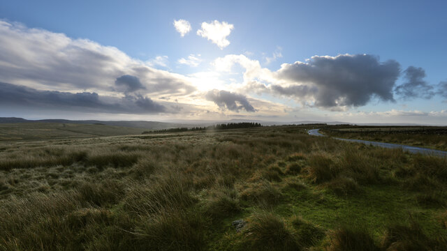
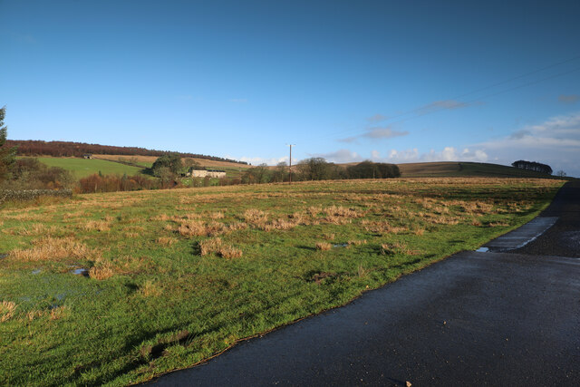
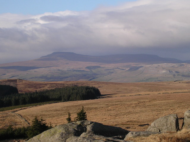
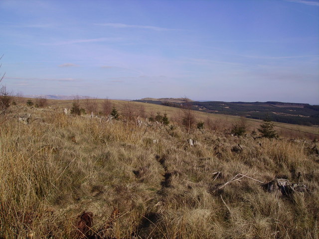
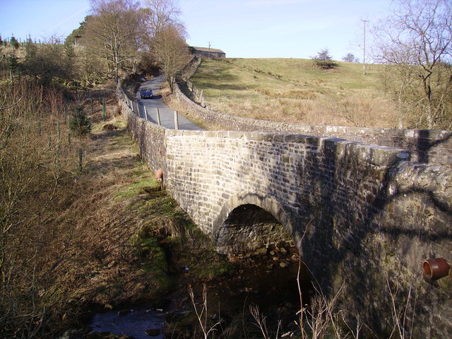
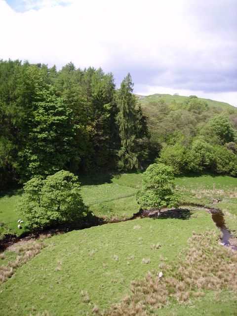
Fair Hill is a prominent hill located in the picturesque county of Yorkshire, England. Standing at an elevation of approximately 300 meters, it offers breathtaking panoramic views of the surrounding countryside. Situated near the village of Fairburn, Fair Hill is a popular destination for outdoor enthusiasts and nature lovers alike.

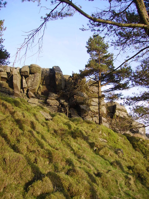
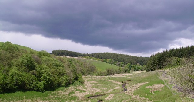
The hill is characterized by its gentle slopes and lush greenery, making it an ideal spot for hiking, picnicking, and birdwatching. Its well-maintained trails provide visitors with easy access to explore its natural beauty, including its diverse flora and fauna. From the top of Fair Hill, visitors can enjoy stunning vistas of the rolling hills and valleys that stretch as far as the eye can see.

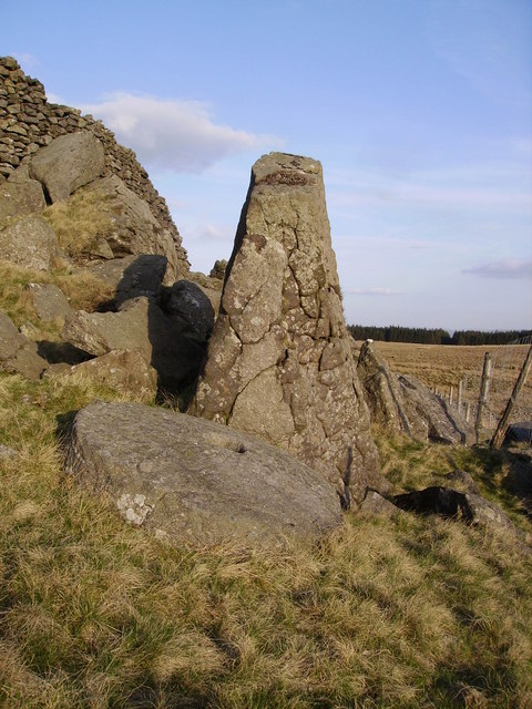
In addition to its natural attractions, Fair Hill is also steeped in history. It is believed to have been inhabited by humans for thousands of years, with archaeological evidence suggesting prehistoric settlements in the area. The hill's strategic location has made it a site of interest throughout history, often being used as a vantage point during battles and conflicts.

Today, Fair Hill continues to be cherished by locals and tourists alike. Its tranquil ambiance and unspoiled landscapes provide a welcome respite from the hustle and bustle of everyday life. Whether it is a leisurely stroll or an adventurous hike, Fair Hill offers an unforgettable experience for those seeking solace in nature's embrace.

If you have any feedback on the listing, please let us know in the comments section below.

Fair Hill Images

Images are sourced within 2km of 54.032322/-2.3837016 or Grid Reference SD7459. Thanks to Geograph Open Source API. All images are credited.

The northern marches of Gisburn Forest The most recently planted part of Gisburn Forest is also the most northerly and forms an isolated outpost not visited by the main mountain bike trails. The Keasden road descends to it over Crutchenber Fell, passing through it to reach the more mature and popular sections around Stocks reservoir.
The northern marches of Gisburn Forest
The most recently planted part of Gisburn Forest is also the most northerly and forms an isolated outpost not visited by the main mountain bike trails. The Keasden road descends to it over Crutchenber Fell, passing through it to reach the more mature and popular sections around Stocks reservoir.
Looking over Coat Rakes to Dale House Dale House is just by the road north from Gisburn Forest towards Clapham in the Yorkshire Dales. The track here goes to Halsteads Farm, whilst a rougher track to the right goes to Cocklick End, not a place to mention in social media posts, as an AI is likely to take exception...
Looking over Coat Rakes to Dale House
Dale House is just by the road north from Gisburn Forest towards Clapham in the Yorkshire Dales. The track here goes to Halsteads Farm, whilst a rougher track to the right goes to Cocklick End, not a place to mention in social media posts, as an AI is likely to take exception...
View of Ingleborough from Whelp Stone Crag From the Millstone Grit south of the Craven fault to the  Carboniferous Limestone to the north. Fell Beck can just be made out terminating in Gaping Gill.
View of Ingleborough from Whelp Stone Crag
From the Millstone Grit south of the Craven fault to the Carboniferous Limestone to the north. Fell Beck can just be made out terminating in Gaping Gill.
Crutchenber Fell Looking towards Gisburn Forest
Crutchenber Fell
Looking towards Gisburn Forest
Coat Rakes Bridge On Hasgill Beck
Coat Rakes Bridge
On Hasgill Beck
Gisburn Forest Claimed to be the biggest in Lancashire. The Barn at Geldard Laithe in view in the centre of the picture is engulfed by trees.
Gisburn Forest
Claimed to be the biggest in Lancashire. The Barn at Geldard Laithe in view in the centre of the picture is engulfed by trees.
Whelp Stone Crag The Crags are a welcome surprise after you have struggled through thick plantations of Gisburn Forest
Whelp Stone Crag
The Crags are a welcome surprise after you have struggled through thick plantations of Gisburn Forest
Millstone Whelp Stone Crag Not the first abandoned millstone I have encountered in Bowland. Looks like it fell off the natural Trig Point shaped rock behind it. Perhaps it's a message saying 'Finding vacant squares to photo is becoming a bit of a millstone....'
Millstone Whelp Stone Crag
Not the first abandoned millstone I have encountered in Bowland. Looks like it fell off the natural Trig Point shaped rock behind it. Perhaps it's a message saying 'Finding vacant squares to photo is becoming a bit of a millstone....'
Holden Moor Flat unplanted patch just south of Whelp Stone Crag. An eastern spur of Gisburn Forest on't skyline.
Holden Moor
Flat unplanted patch just south of Whelp Stone Crag. An eastern spur of Gisburn Forest on't skyline.
Descent to Bottoms Down through Gisburn Forest to a little strath called Bottoms. Stooping very low now to add that Cocklick End is in the next square and Tosside is the nearest village.
Descent to Bottoms
Down through Gisburn Forest to a little strath called Bottoms. Stooping very low now to add that Cocklick End is in the next square and Tosside is the nearest village.
Dob Beck Dob Dale runs along Gisburn Forest Edge at this point before cutting into the Forest on the right. Typical Bank Holiday cloud overhead.
Dob Beck
Dob Dale runs along Gisburn Forest Edge at this point before cutting into the Forest on the right. Typical Bank Holiday cloud overhead.
Sheep and Lambs at Bottoms The sheep in the middle of the picture was a few minutes earlier bungee jumping around on the end of two pine branches which it had become entangled on with its lamb bleating mournfully. I spent 10 minutes disentangling it then watched the joyful reunion. Ahh... another successful Geograph rescue.
Sheep and Lambs at Bottoms
The sheep in the middle of the picture was a few minutes earlier bungee jumping around on the end of two pine branches which it had become entangled on with its lamb bleating mournfully. I spent 10 minutes disentangling it then watched the joyful reunion. Ahh... another successful Geograph rescue.
Dob Dale Beck Soon to become Bottoms Beck Gisburn Forest
Dob Dale Beck
Soon to become Bottoms Beck Gisburn Forest
Old Hedge Line On the edge of Gisburn Forest. It appears to be on the line of a public footpath which looks like it's never used except by Geographers looking for elusive squares like the one with Halstead Farm in view ahead.
Old Hedge Line
On the edge of Gisburn Forest. It appears to be on the line of a public footpath which looks like it's never used except by Geographers looking for elusive squares like the one with Halstead Farm in view ahead.
Gnarled oak, Dob Dale Beck On the forest edge. Halstead farm in view.
Gnarled oak, Dob Dale Beck
On the forest edge. Halstead farm in view.
White Hill House Old barn used for tending to sheep with assorted equipment in it including a variety of domestic fly killers hung up from the beams just inside the big doorway. Gives you a flavour of what it may be like shearing sheep in there on a hot summer's day (if we ever get one).
White Hill House
Old barn used for tending to sheep with assorted equipment in it including a variety of domestic fly killers hung up from the beams just inside the big doorway. Gives you a flavour of what it may be like shearing sheep in there on a hot summer's day (if we ever get one).
Forest Operations Trees planted over 50 years ago around Thorpe Syke being cleared in Gisburn Forest.
Forest Operations
Trees planted over 50 years ago around Thorpe Syke being cleared in Gisburn Forest.
Trig point From Giggleswick to Bowland forest edge and Whelpstone crags.
Trig point
From Giggleswick to Bowland forest edge and Whelpstone crags.
Show me another place!

Fair Hill is located at Grid Ref: SD7459 (Lat: 54.032322, Lng: -2.3837016)

Division: West Riding

Administrative County: Lancashire

District: Ribble Valley

Police Authority: Lancashire

What 3 Words

///dominate.trappings.tensions. Near Settle, North Yorkshire

Related Wikis

Easington, Lancashire

Easington () is a civil parish within the Ribble Valley district of Lancashire, England, with a population in 2001 of 52. The Census 2011 population details...

Tosside

Tosside is a small village on the modern border of North Yorkshire and Lancashire in Northern England. It lies within the Forest of Bowland, and is between...

Stocks Reservoir

Stocks Reservoir is a reservoir situated at the head of the Hodder valley in the Forest of Bowland, Lancashire, England (historically in the West Riding...
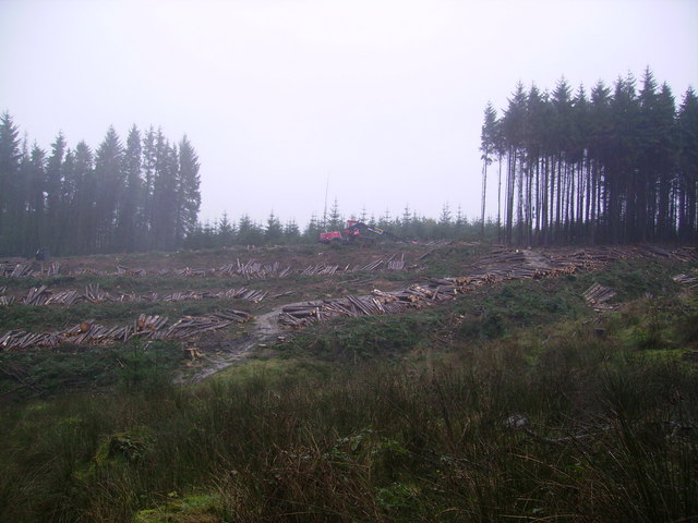
Gisburn Forest

Gisburn Forest is a civil parish in the Ribble Valley, in Lancashire, England. Mainly lying within the Forest of Bowland Area of Outstanding Natural Beauty...

Rathmell

Rathmell is a village and civil parish in the Craven district of North Yorkshire, England. The population of the civil parish in the 2011 census was 305...

Eldroth

Eldroth is a village in North Yorkshire, England. It is in the civil parish of Lawkland, part of the former Craven District, some 3.25 miles (5.23 km)...

Giggleswick railway station

Giggleswick is a railway station on the Bentham Line, which runs between Leeds and Morecambe via Skipton. The station, situated 41+1⁄4 miles (66 km) north...

Manor House, Gisburn Forest

Manor House is an historic building in Gisburn Forest, Lancashire, England. It was built in the early 18th century, but contains a section that is believed...

Related Videos

Gisburn Forest - lost without a map or a phone signal

This was our first time spontaneous visit to Gisburn Forest in the area of the Forest of Bowland in Lancashire. We didn't realise that ...

Gisburn Forest Trail Half Marathon

Gisburn Forest Trail Half Marathon.

Bowland Knotts (Slideshow)

Had a lazy day yesterday so made up for that today with a tough but enjoyable wander up Bowland Knotts. Great walk but ...

Nearby Amenities

Located within 500m of 54.032322,-2.3837016
How Hill
Place: locality
Lat/Long: 54.0309696/-2.3898815
The data included in this document is from www.openstreetmap.org. The data is made available under ODbL.

Have you been to Fair Hill?

Leave your review of Fair Hill below (or comments, questions and feedback).