Aaron's Hill

Hill, Mountain in Somerset South Somerset

England

Aaron's Hill

Tower Road
Tower Road Credit: Chris Heaton

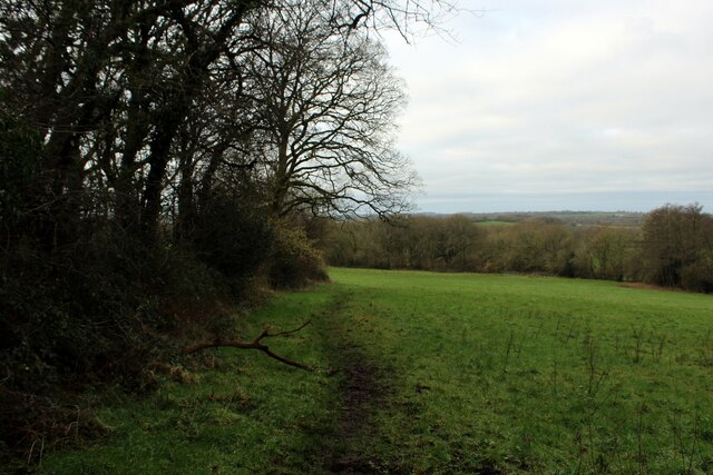
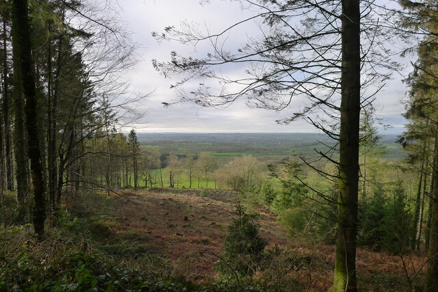
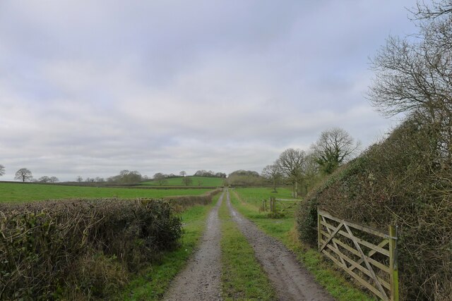
Aaron's Hill is a prominent geographical feature located in the county of Somerset, England. It is classified as a hill, rather than a mountain, due to its relatively modest elevation. The hill is situated in the Mendip Hills Area of Outstanding Natural Beauty, offering breathtaking views of the surrounding landscape.

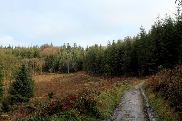
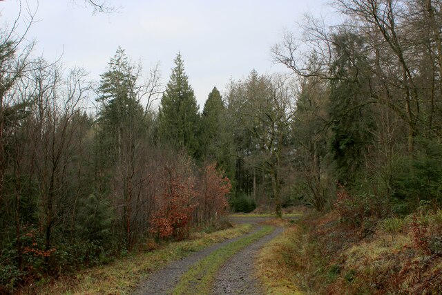
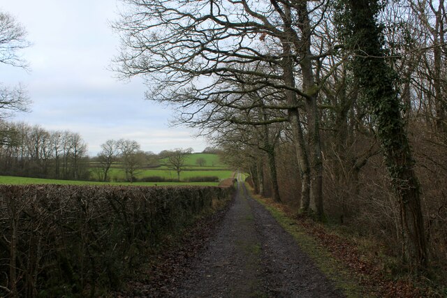
With an elevation of approximately 300 meters (984 feet), Aaron's Hill stands as one of the higher points in the area, making it a popular destination for hikers and nature enthusiasts. The hill is composed of limestone, typical of the region, and its slopes are covered in diverse vegetation, including heather, grasses, and scattered trees.

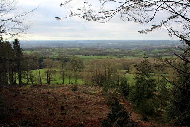
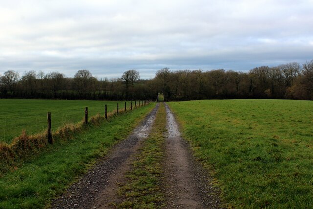
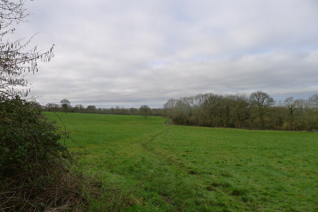
The summit of Aaron's Hill provides visitors with panoramic vistas, stretching out across the rolling countryside and nearby villages. On clear days, it is even possible to catch a glimpse of the Bristol Channel in the distance. The hill is often described as a peaceful and tranquil spot, offering a serene escape from the hustle and bustle of everyday life.

In addition to its natural beauty, Aaron's Hill has historical significance. The surrounding area is home to several archaeological sites, including ancient burial mounds, which date back thousands of years. These remnants of the past add a sense of cultural significance to the hill and its surroundings.

Overall, Aaron's Hill offers a captivating blend of natural splendor and historical intrigue. Whether it be for a leisurely walk, a challenging hike, or simply a moment of peaceful contemplation, visitors to Somerset should not miss the opportunity to experience the beauty and serenity of Aaron's Hill.

If you have any feedback on the listing, please let us know in the comments section below.

Aaron's Hill Images

Images are sourced within 2km of 51.104586/-2.3646212 or Grid Reference ST7433. Thanks to Geograph Open Source API. All images are credited.

Tower Road
Tower Road
Beside Tower Road on the Stourhead Estate
King Alfred's Tower Revisited Huge folly standing on top of Kingsettle Hill, just inside the Somerset border with Wiltshire.
Grade I Listed Building belonging to the National Trust, it was completed in 1772 by Henry Hoare to commemorate the ending of the Seven Years War with France and the accession of George III.
The location is believed to be near Egbert's Stone where Alfred rallied the Anglo-Saxons before the decisive Battle of Edington.
<a href="https://www.geograph.org.uk/photo/286353">ST7435 : Alfred's Tower</a>
The triangular tower is 161 foot high, with a hollow interior containing a spiral staircase.
King Alfred's Tower Revisited
Huge folly standing on top of Kingsettle Hill, just inside the Somerset border with Wiltshire. Grade I Listed Building belonging to the National Trust, it was completed in 1772 by Henry Hoare to commemorate the ending of the Seven Years War with France and the accession of George III. The location is believed to be near Egbert's Stone where Alfred rallied the Anglo-Saxons before the decisive Battle of Edington. ST7435 : Alfred's Tower The triangular tower is 161 foot high, with a hollow interior containing a spiral staircase.
View Eastwards from the Base of King Alfred's Tower In the Stourhead Estate, National Trust
View Eastwards from the Base of King Alfred's Tower
In the Stourhead Estate, National Trust
Track in Beaumont's Wood Tree covered escarpment below King Alfred's Tower - part of the Stourhead Estate, belonging to the National Trust.
The photograph shows the track branching off the Leland Trail/MacMillan Way Long Distance Footpaths.
Track in Beaumont's Wood
Tree covered escarpment below King Alfred's Tower - part of the Stourhead Estate, belonging to the National Trust. The photograph shows the track branching off the Leland Trail/MacMillan Way Long Distance Footpaths.
View from Hilcombe Hanging As seen from the Leland Trail/Macmillan Way long distance footpaths - recent forest felling has opened up the views over the Somerset countryside to the south west.
View from Hilcombe Hanging
As seen from the Leland Trail/Macmillan Way long distance footpaths - recent forest felling has opened up the views over the Somerset countryside to the south west.
Leland Trail in Blackslough Wood The trail in the woods of the Stourhead Estate, before emerging into open countryside
Leland Trail in Blackslough Wood
The trail in the woods of the Stourhead Estate, before emerging into open countryside
Leland Trail emerging from the Woods on the Stourhead Estate This path has been adopted by two long distance footpaths - the relatively short Leland Trail, and the lengthy MacMillan Way.
Here they emerge from extensive woodland into open countryside.
Leland Trail emerging from the Woods on the Stourhead Estate
This path has been adopted by two long distance footpaths - the relatively short Leland Trail, and the lengthy MacMillan Way. Here they emerge from extensive woodland into open countryside.
Leland Trail adopts an Old Coach Road The Leland Trail now adopts a path that describes a perfect straight line on the map for roughly three miles - this is an old coach road heading for Redlynch. Sometimes a track, sometimes a mud quagmire and sometimes pasture with all evidence of a historic route rendered invisible.
Leland Trail adopts an Old Coach Road
The Leland Trail now adopts a path that describes a perfect straight line on the map for roughly three miles - this is an old coach road heading for Redlynch. Sometimes a track, sometimes a mud quagmire and sometimes pasture with all evidence of a historic route rendered invisible.
Leland Trail beside Stavordale Wood The Leland Trail and Macmillan Way long distance footpaths adopt the old coach road that once ran between Stourhead and Redlynch.
Leland Trail beside Stavordale Wood
The Leland Trail and Macmillan Way long distance footpaths adopt the old coach road that once ran between Stourhead and Redlynch.
Log piles, Stourhead Estate The woods are managed on a system called Continuous Cover Forestry, and sustainably produce 4000 tonnes of timber a year (local notice board)
Log piles, Stourhead Estate
The woods are managed on a system called Continuous Cover Forestry, and sustainably produce 4000 tonnes of timber a year (local notice board)
King Alfred's Tower A listed Grade I monument belonging to the National Trust. " ... a 160ft (49m) high folly, designed by Henry Flitcroft for Henry Hoare II in 1772. It is believed to mark the site where King Alfred the Great rallied his troops in 878. The tower commemorates the accession of George III to the throne in 1760 and the end of the Seven Years War." <span class="nowrap"><a title="https://www.nationaltrust.org.uk/stourhead/trails/stourhead-king-alfreds-tower-walk" rel="nofollow ugc noopener" href="https://www.nationaltrust.org.uk/stourhead/trails/stourhead-king-alfreds-tower-walk">Link</a><img style="margin-left:2px;" alt="External link" title="External link - shift click to open in new window" src="https://s1.geograph.org.uk/img/external.png" width="10" height="10"/></span>
And a convenient marker of the eastern end of the Leland Trail, which we will now follow to the west.
King Alfred's Tower
A listed Grade I monument belonging to the National Trust. " ... a 160ft (49m) high folly, designed by Henry Flitcroft for Henry Hoare II in 1772. It is believed to mark the site where King Alfred the Great rallied his troops in 878. The tower commemorates the accession of George III to the throne in 1760 and the end of the Seven Years War." LinkExternal link And a convenient marker of the eastern end of the Leland Trail, which we will now follow to the west.
Footpath maintenance near King Alfred's Tower Cutting back brambles on the Leland Trail
Footpath maintenance near King Alfred's Tower
Cutting back brambles on the Leland Trail
Forest clearing The Stourhead forest is managed on a system called Continuous Cover Forestry  <span class="nowrap"><a title="https://www.ccfg.org.uk/" rel="nofollow ugc noopener" href="https://www.ccfg.org.uk/">Link</a><img style="margin-left:2px;" alt="External link" title="External link - shift click to open in new window" src="https://s1.geograph.org.uk/img/external.png" width="10" height="10"/></span>
Forest clearing
The Stourhead forest is managed on a system called Continuous Cover Forestry LinkExternal link
The Leland Trail / MacMillan Way leaving the Stourhead woods Leaving the higher ground of Cretaceous chalks and sandstones for softer Jurassic terrain
The Leland Trail / MacMillan Way leaving the Stourhead woods
Leaving the higher ground of Cretaceous chalks and sandstones for softer Jurassic terrain
The Redlynch-Stourhead coach road Passing Stavordale Wood.
The Redlynch-Stourhead coach road
Passing Stavordale Wood.
King Alfred's Tower The entrance doorway with statue of Alfred the Great above
King Alfred's Tower
The entrance doorway with statue of Alfred the Great above
King Alfred's Tower The staircase tower with its numerous window slits
King Alfred's Tower
The staircase tower with its numerous window slits
Show me another place!

Aaron's Hill is located at Grid Ref: ST7433 (Lat: 51.104586, Lng: -2.3646212)

Administrative County: Somerset

District: South Somerset

Police Authority: Avon and Somerset

What 3 Words

///skirting.treaties.skinny. Near Kilmington, Wiltshire

Related Wikis

Kenwalch's Castle

Kenwalch's Castle is probably an Iron Age hill fort that may have been converted into a Roman fortress, near Penselwood, Somerset, England, 6.6 kilometres...

Nozarego

Nozarego is a village in the commune of Santa Margherita Ligure in Liguria, Italy. It is a natural terrace over the Bay of Tigullio. Here there is the...
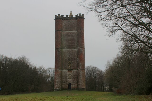
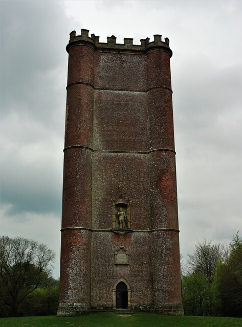
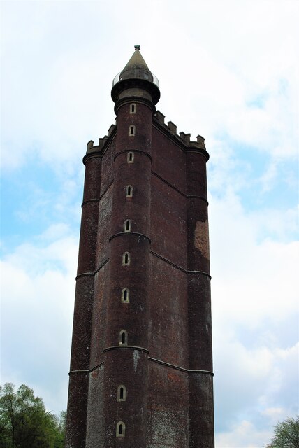
King Alfred's Tower

Alfred's Tower is a folly in Somerset, England, on the edge of the border with Wiltshire, on the Stourhead estate. The tower stands on Kingsettle Hill...

Heath Hill Farm

Heath Hill Farm (grid reference ST757336) is a 20.73 hectare biological Site of Special Scientific Interest near Stourton in Wiltshire, notified in 1997...

Cockroad Wood Castle

Cockroad Wood Castle was a castle near Wincanton but now in the parish of Charlton Musgrove, Somerset, England. == History == Cockroad Wood Castle was...

Stavordale Priory

Stavordale Priory near Charlton Musgrove, Somerset, England was built as a priory of Augustinian canons in the 13th century and was converted into a private...

Penselwood

Penselwood is a village and civil parish in the English county of Somerset. It is located 4 miles (6.4 km) north east of Wincanton, 4 miles (6.4 km) south...

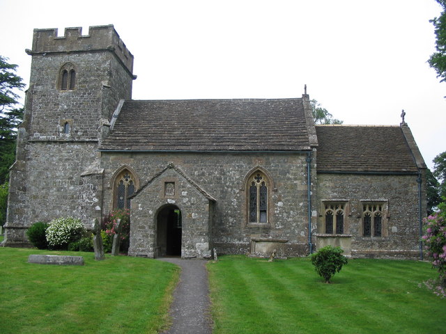
Church of St Michael and All Angels, Penselwood

The Anglican Church of St Michael and All Angels in Penselwood, Somerset, England was built in the 15th century. It is a Grade II* listed building. �...

Nearby Amenities

Located within 500m of 51.104586,-2.3646212
The data included in this document is from www.openstreetmap.org. The data is made available under ODbL.

Have you been to Aaron's Hill?

Leave your review of Aaron's Hill below (or comments, questions and feedback).