Newshield Moss

Hill, Mountain in Cumberland Eden

England

Newshield Moss

View across Clargillhead
View across Clargillhead Credit: Mike Quinn

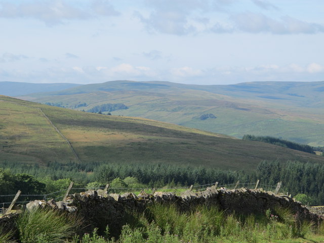
Newshield Moss is a prominent hill located in the district of Cumberland, England. This impressive landform is often referred to as a mountain due to its considerable height and rugged terrain. Rising to an elevation of approximately 1,577 feet (480 meters), it offers breathtaking panoramic views of the surrounding region.

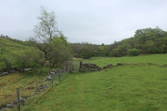
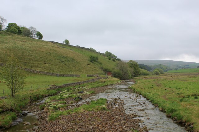
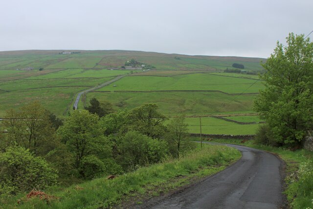
Situated within the picturesque Lake District National Park, Newshield Moss is renowned for its natural beauty and is a popular destination for outdoor enthusiasts. The hill is covered in lush vegetation, including heather and moss, which creates a vibrant and colorful landscape, particularly during the warmer months. The area is also home to a diverse range of wildlife, including various bird species, foxes, and deer.

Newshield Moss is a haven for hikers and nature lovers alike, boasting several well-established trails and paths that cater to different levels of difficulty. These routes enable visitors to explore the hill's diverse flora and fauna while enjoying the tranquility of the surrounding countryside. Additionally, the hill offers opportunities for rock climbing and bouldering, attracting adventure seekers seeking an adrenaline rush.

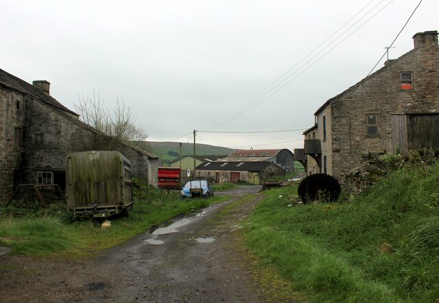
Due to its location within the Lake District National Park, Newshield Moss benefits from a range of amenities and facilities in the nearby towns and villages, including parking areas, accommodation options, and local eateries serving delicious traditional cuisine.

Overall, Newshield Moss is a captivating hill in Cumberland, offering both natural beauty and thrilling outdoor activities for those who venture to its summit.

If you have any feedback on the listing, please let us know in the comments section below.

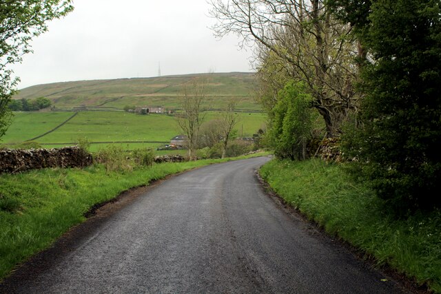
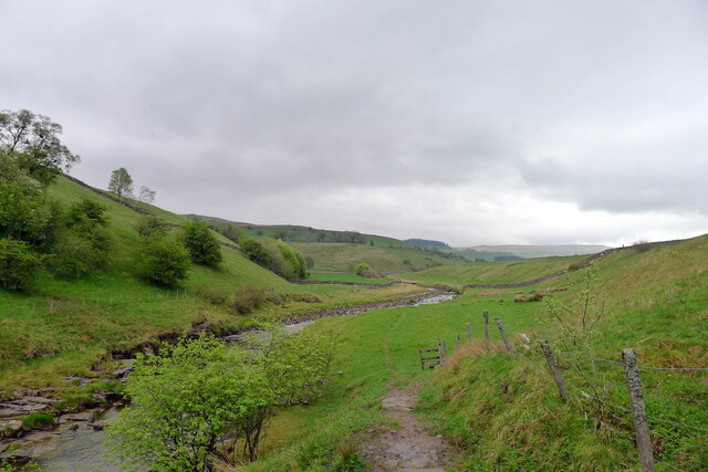
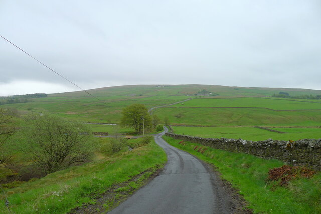
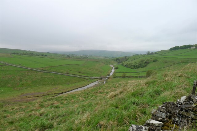
Newshield Moss Images

Images are sourced within 2km of 54.828062/-2.4171471 or Grid Reference NY7348. Thanks to Geograph Open Source API. All images are credited.

View across Clargillhead
Small Waterfall on the River Nent The River Nent is a major tributary of the South Tyne, seen here at Gossipgate near Alston
Small Waterfall on the River Nent
The River Nent is a major tributary of the South Tyne, seen here at Gossipgate near Alston
Access Lane beside the River Nent The river between Alston and Gossipgate, adopted by a long distance footpath that runs under the name of Isaac's Tea Trail
Access Lane beside the River Nent
The river between Alston and Gossipgate, adopted by a long distance footpath that runs under the name of Isaac's Tea Trail
Beside the River Nent A tributary of the South Tyne.
Seen here approaching a patch of woodland between Alston and Blagill, on a long distance footpath which runs under the name of Isaac's Tea Trail.
Beside the River Nent
A tributary of the South Tyne. Seen here approaching a patch of woodland between Alston and Blagill, on a long distance footpath which runs under the name of Isaac's Tea Trail.
Heading West to Gossipgate beside the River Nent Heading downriver towards Gossipgate and Alston, before the Nent reaches the River South Tyne.
Heading West to Gossipgate beside the River Nent
Heading downriver towards Gossipgate and Alston, before the Nent reaches the River South Tyne.
Beside the River Nent between Gossipgate and Blagill Following the Nent, a tributary of the River South Tyne
Beside the River Nent between Gossipgate and Blagill
Following the Nent, a tributary of the River South Tyne
The River Nent near Blagill Taken from the road bridge that spans the River Nent between Blagill and Far Skelgill on the A689.
The River Nent near Blagill
Taken from the road bridge that spans the River Nent between Blagill and Far Skelgill on the A689.
On the Lane between Blagill and High Skelgill on the A689 Quiet lane that runs at right angles across the Nent Valley
On the Lane between Blagill and High Skelgill on the A689
Quiet lane that runs at right angles across the Nent Valley
Blagill Hamlet above the Nent Valley.
Blagill
Hamlet above the Nent Valley.
B6294 between Blagill and Foreshield Bridge Isaac's Tea Trail is a 36 mile circular walk in the North Pennines named after Isaac Holden (c. 1805-57), an itinerant tea seller. Isaac became a familiar figure, out in all weathers, selling tea door to door to the farms, remote hamlets and mining communities scattered over the dales between Alston and Allendale Town. A pious man of humble origin, much involved in charitable work, he gained so much public respect that over 600 people contributed to his memorial. Full details at <span class="nowrap"><a title="https://isaacs-tea-trail.co.uk/" rel="nofollow ugc noopener" href="https://isaacs-tea-trail.co.uk/">Link</a><img style="margin-left:2px;" alt="External link" title="External link - shift click to open in new window" src="https://s1.geograph.org.uk/img/external.png" width="10" height="10"/></span>
B6294 between Blagill and Foreshield Bridge
Isaac's Tea Trail is a 36 mile circular walk in the North Pennines named after Isaac Holden (c. 1805-57), an itinerant tea seller. Isaac became a familiar figure, out in all weathers, selling tea door to door to the farms, remote hamlets and mining communities scattered over the dales between Alston and Allendale Town. A pious man of humble origin, much involved in charitable work, he gained so much public respect that over 600 people contributed to his memorial. Full details at LinkExternal link
Isaac's Tea trail entering Alston Alongside the River Nent
Isaac's Tea trail entering Alston
Alongside the River Nent
The River Nent at Gossipgate Leaving Alston on Isaac's Tea Trail
The River Nent at Gossipgate
Leaving Alston on Isaac's Tea Trail
On Isaac's Tea Trail in a small wood below High Skelgill Isaac's Tea Trail is a 36 mile circular walk in the North Pennines named after Isaac Holden (c. 1805-57), an itinerant tea seller. Isaac became a familiar figure, out in all weathers, selling tea door to door to the farms, remote hamlets and mining communities scattered over the dales between Alston and Allendale Town. A pious man of humble origin, much involved in charitable work, he gained so much public respect that over 600 people contributed to his memorial. Full details at <span class="nowrap"><a title="https://isaacs-tea-trail.co.uk/" rel="nofollow ugc noopener" href="https://isaacs-tea-trail.co.uk/">Link</a><img style="margin-left:2px;" alt="External link" title="External link - shift click to open in new window" src="https://s1.geograph.org.uk/img/external.png" width="10" height="10"/></span>
On Isaac's Tea Trail in a small wood below High Skelgill
Isaac's Tea Trail is a 36 mile circular walk in the North Pennines named after Isaac Holden (c. 1805-57), an itinerant tea seller. Isaac became a familiar figure, out in all weathers, selling tea door to door to the farms, remote hamlets and mining communities scattered over the dales between Alston and Allendale Town. A pious man of humble origin, much involved in charitable work, he gained so much public respect that over 600 people contributed to his memorial. Full details at LinkExternal link
High Force waterfall on the River Nent Not quite as high or forceful as the one on the River Tees
High Force waterfall on the River Nent
Not quite as high or forceful as the one on the River Tees
Nentdale, east of Alston
The road down from Blagill The road drops down from the hamlet of Blagill (behind) to cross the River Nent, and then climbs up to far Skelgill on the A689 main road (distance).
The road down from Blagill
The road drops down from the hamlet of Blagill (behind) to cross the River Nent, and then climbs up to far Skelgill on the A689 main road (distance).
Isaac's Tea Trail on a track to Blagill beside Blagill Burn Blagill = 'Dark ravine' <span class="nowrap"><a title="http://epns.nottingham.ac.uk/search/p/%28placeName%3A%2Ablagill%2A%29" rel="nofollow ugc noopener" href="http://epns.nottingham.ac.uk/search/p/%28placeName%3A%2Ablagill%2A%29">Link</a><img style="margin-left:2px;" alt="External link" title="External link - shift click to open in new window" src="https://s1.geograph.org.uk/img/external.png" width="10" height="10"/></span>
Isaac's Tea Trail on a track to Blagill beside Blagill Burn
Blagill = 'Dark ravine' LinkExternal link
Nentdale, near Blagill Looking west towards Alston, with Park Fell on the misty horizon. The hamlet of Blagill is just off the picture, to the right.
Nentdale, near Blagill
Looking west towards Alston, with Park Fell on the misty horizon. The hamlet of Blagill is just off the picture, to the right.
Show me another place!

Newshield Moss is located at Grid Ref: NY7348 (Lat: 54.828062, Lng: -2.4171471)

Administrative County: Cumbria

District: Eden

Police Authority: Cumbria

What 3 Words

///dusters.patting.chap. Near Alston, Cumbria

Related Wikis

Alston railway station

Alston is a heritage railway station on the South Tynedale Railway. The station, situated 13 miles (21 km) south of Haltwhistle, is in the market town...

Ayle

Ayle is a village in Northumberland, England, situated to the north of Alston. There are six residences in the hamlet. == Governance == Ayle is in the...

Alston Town Hall

Alston Town Hall is a municipal building in Front Street, Alston, Cumbria, England. The town hall, which is currently used as a public library, is a Grade...

Alston Moor

Alston Moor, formerly known as Alston with Garrigill, is a civil parish and electoral ward in the Westmorland and Furness district, in the ceremonial county...

Nearby Amenities

Located within 500m of 54.828062,-2.4171471
Newshield Moss
Place: locality
Lat/Long: 54.8298559/-2.4181811
Man Made: tower
Tower Type: communication
Lat/Long: 54.8251304/-2.4227268
Man Made: tower
Tower Type: communication
Lat/Long: 54.8249712/-2.4222446
Man Made: tower
Tower Type: communication
Lat/Long: 54.8247897/-2.4203905
The data included in this document is from www.openstreetmap.org. The data is made available under ODbL.

Have you been to Newshield Moss?

Leave your review of Newshield Moss below (or comments, questions and feedback).