Higher Hill

Hill, Mountain in Dorset

England

Higher Hill

Cross dyke on Higher Hill Cross dykes apparently formed prehistoric land boundaries. There are quite a few on this ridgeway in this beautiful part of Dorset.
Cross dyke on Higher Hill Credit: Becky Williamson

Higher Hill is a prominent hill located in the county of Dorset, England. Situated near the village of Martinstown, it forms part of the Dorset Downs, a range of chalk hills in the southern part of the county. With an elevation of approximately 213 meters (699 feet), it is not classified as a mountain, but rather as a hill.

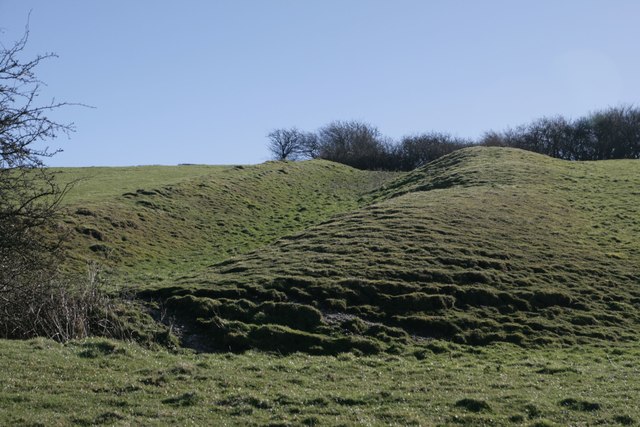
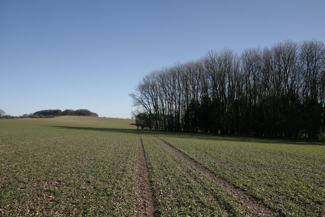
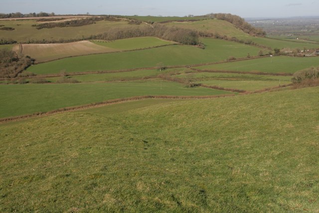
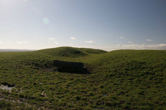
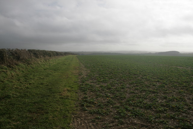
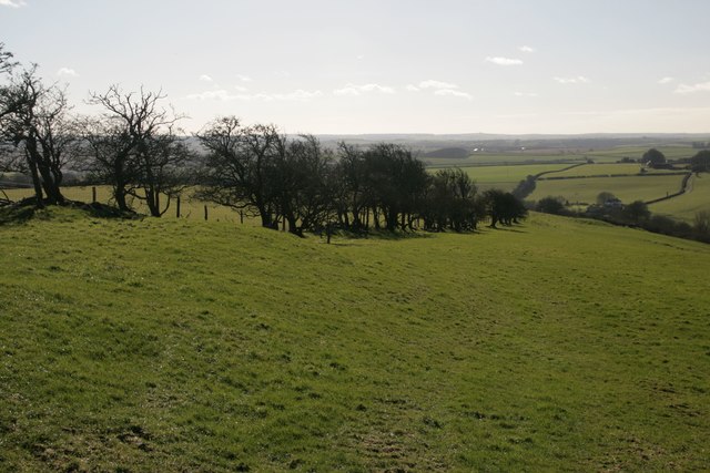
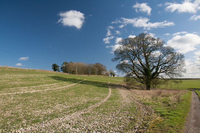
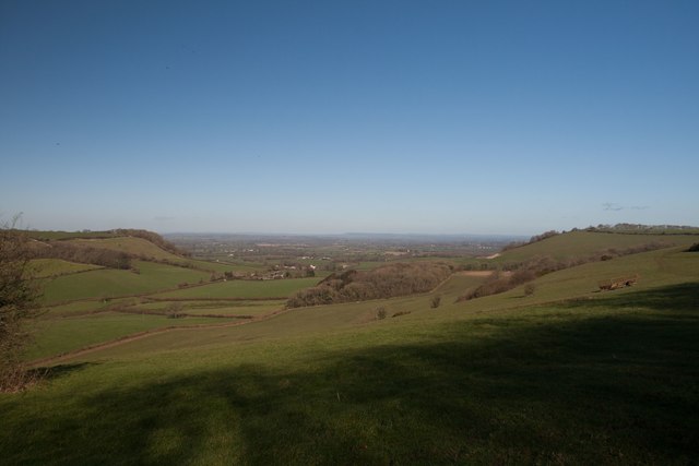
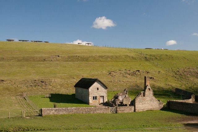
Higher Hill offers stunning panoramic views of the surrounding countryside, making it a popular destination for hikers and nature enthusiasts. The hill is covered in lush greenery, with grassy slopes and scattered patches of trees. Its location within the Dorset Downs, an Area of Outstanding Natural Beauty, adds to its appeal.

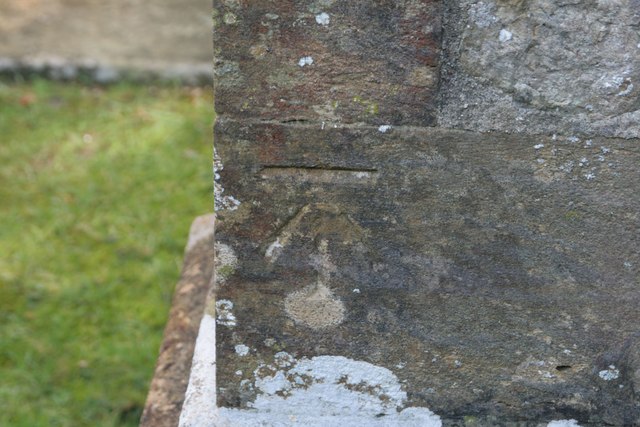
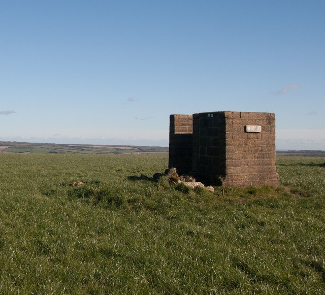
The hill is easily accessible, with footpaths leading up to its summit from Martinstown and other nearby villages. These paths wind their way through fields and meadows, providing a pleasant and scenic route for visitors. At the top, there is a trig point, which offers a clear reference point and serves as a marker for surveying purposes.

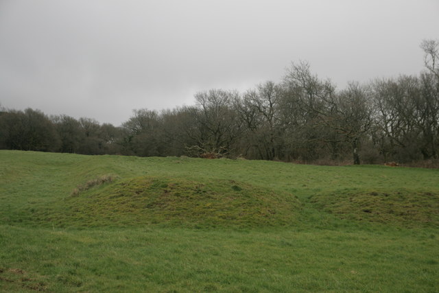
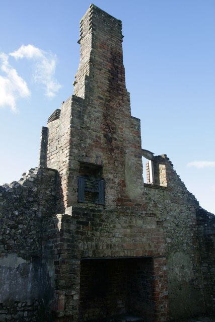
The area surrounding Higher Hill is also rich in historical and archaeological sites. Nearby, there are remnants of ancient settlements and burial mounds, giving insight into the area's past. Additionally, the hill is home to a diverse range of flora and fauna, including rare species of butterflies and wildflowers.

Overall, Higher Hill in Dorset is a picturesque and accessible destination, offering breathtaking views, rich history, and abundant natural beauty.

If you have any feedback on the listing, please let us know in the comments section below.

Higher Hill Images

Images are sourced within 2km of 50.817699/-2.388188 or Grid Reference ST7202. Thanks to Geograph Open Source API. All images are credited.

Cross dyke on Higher Hill Cross dykes apparently formed prehistoric land boundaries. There are quite a few on this ridgeway in this beautiful part of Dorset.
Cross dyke on Higher Hill
Cross dykes apparently formed prehistoric land boundaries. There are quite a few on this ridgeway in this beautiful part of Dorset.
Benchmark, St John the Baptist Church, Plush Ordnance Survey benchmark, described on database at <span class="nowrap"><a title="http://www.bench-marks.org.uk/bm73594" rel="nofollow ugc noopener" href="http://www.bench-marks.org.uk/bm73594">Link</a><img style="margin-left:2px;" alt="External link" title="External link - shift click to open in new window" src="https://s1.geograph.org.uk/img/external.png" width="10" height="10"/></span>. See also <a href="https://www.geograph.org.uk/photo/4833952">ST7102 : St John the Baptist Church, Plush</a>.
Benchmark, St John the Baptist Church, Plush
Ordnance Survey benchmark, described on database at LinkExternal link. See also ST7102 : St John the Baptist Church, Plush.
St John the Baptist Church, Plush I'm not sure if this building is still used as a place of worship, but it can also be used as a concert hall and venue for weddings etc.
St John the Baptist Church, Plush
I'm not sure if this building is still used as a place of worship, but it can also be used as a concert hall and venue for weddings etc.
Triangle of trees on Plush Hill The footpath wends its way through this arable field, past a water tank and on to the trig point at Higher Hill.
Triangle of trees on Plush Hill
The footpath wends its way through this arable field, past a water tank and on to the trig point at Higher Hill.
Benchmark on Old Schoolhouse, Plush Ordnance Survey benchmark, described on database at <span class="nowrap"><a title="http://www.bench-marks.org.uk/bm73593" rel="nofollow ugc noopener" href="http://www.bench-marks.org.uk/bm73593">Link</a><img style="margin-left:2px;" alt="External link" title="External link - shift click to open in new window" src="https://s1.geograph.org.uk/img/external.png" width="10" height="10"/></span>. See also <a href="https://www.geograph.org.uk/photo/4834177">ST7102 : Former Schoolhouse, Plush</a>.
Benchmark on Old Schoolhouse, Plush
Ordnance Survey benchmark, described on database at LinkExternal link. See also ST7102 : Former Schoolhouse, Plush.
Former Schoolhouse, Plush There is an Ordnance Survey benchmark on this cottage. See <a href="https://www.geograph.org.uk/photo/4834176">ST7102 : Benchmark on Old Schoolhouse, Plush</a>.
Former Schoolhouse, Plush
There is an Ordnance Survey benchmark on this cottage. See ST7102 : Benchmark on Old Schoolhouse, Plush.
Cross dyke on Higher Hill Another prehistoric land boundary on this beautiful ridge.
Cross dyke on Higher Hill
Another prehistoric land boundary on this beautiful ridge.
Funny building at footpath crossroads on Nettlecombe Tout This building appears to have no other purpose than being a place to put footpath signs, but maybe I'm missing something.
Funny building at footpath crossroads on Nettlecombe Tout
This building appears to have no other purpose than being a place to put footpath signs, but maybe I'm missing something.
Cross dyke near Higher Melcombe A prehistoric land boundary. There is a plethora of these in the area.
Cross dyke near Higher Melcombe
A prehistoric land boundary. There is a plethora of these in the area.
Bridleway, Thorncombe Farm
New Barn Farm, near Piddletrenthide
Hedge on Hog Hill
Hedge on Hog Hill
Bridleway near Thorncombe Farm
View north from Higher Hill Nettlecombe Tout visible on the left of the photo.
View north from Higher Hill
Nettlecombe Tout visible on the left of the photo.
Celtic Enclosure on the edge of Watcombe Wood
Erstwhile Fox Inn, Folly Now a private residence, one of the only ones in the hamlet of Folly and situated between Plush and Mappowder.
Erstwhile Fox Inn, Folly
Now a private residence, one of the only ones in the hamlet of Folly and situated between Plush and Mappowder.
Ruined cottage, Lyscombe It is unusual to see an upper storey fireplace intact like this one. this cottage would have accommodated the priest for the adjacent chapel, which was restored in 2005 and is now maintained by the Dorset Historic Churches Trust.
Ruined cottage, Lyscombe
It is unusual to see an upper storey fireplace intact like this one. this cottage would have accommodated the priest for the adjacent chapel, which was restored in 2005 and is now maintained by the Dorset Historic Churches Trust.
Lyscombe Chapel and cottage The chapel dates from the 12th century and is situated in the bowl of a beautiful valley, Lyscombe Bottom in the heartland of Dorset. It is built of flint, stone and rock chalk and was part of the endowment of nearby Milton Abbey. The chapel is thought to have become a dwelling place in the 17th century, then a farm-worker's cottage and then a bake house. It is now cared for by the Dorset Historic Churches Trust, and has been beautifully restored to retain some of its original features.
Lyscombe Chapel and cottage
The chapel dates from the 12th century and is situated in the bowl of a beautiful valley, Lyscombe Bottom in the heartland of Dorset. It is built of flint, stone and rock chalk and was part of the endowment of nearby Milton Abbey. The chapel is thought to have become a dwelling place in the 17th century, then a farm-worker's cottage and then a bake house. It is now cared for by the Dorset Historic Churches Trust, and has been beautifully restored to retain some of its original features.
Show me another place!

Higher Hill is located at Grid Ref: ST7202 (Lat: 50.817699, Lng: -2.388188)

Unitary Authority: Dorset

Police Authority: Dorset

What 3 Words

///snowboard.inflamed.hopes. Near Puddletown, Dorset

Related Wikis

Plush, Dorset

Plush is a small village in the English county of Dorset. It lies within the civil parish of Piddletrenthide in the west of the county, and is approximately...

Lyscombe Hill

Lyscombe Hill (262 metres, 860 feet high) is a hill near Melcombe Bingham about 14 kilometres north-northeast of Dorchester in the county of Dorset, England...

Ball Hill, Dorset

At 251 metres, Ball Hill is one of the highest hills in the county of Dorset, England, and is on the Wessex Ridgeway. == Location == The summit of Ball...

Doles Ash

Doles Ash is a farm in Dorset, England, a few kilometers east of Piddletrenthide and south of Plush. The farm features in Thomas Hardy's Tess of the D...

Melcombe Horsey

Melcombe Horsey is a civil parish in the county of Dorset in South West England. It contains the small settlements of Melcombe Bingham, Bingham's Melcombe...

Alton Pancras

Alton Pancras is a small village and civil parish in Dorset, England. In the 2011 census the civil parish had a population of 175. The village church is...

Piddletrenthide

Piddletrenthide ( ) is a village and civil parish in the English county of Dorset. It is sited by the small River Piddle in a valley on the dip slope of...

Piddletrenthide (liberty)

Piddletrenthide Liberty was a liberty in the county of Dorset, England, containing the following parishes: Gorewood (from 1858) Minterne Magna (part)...

Nearby Amenities

Located within 500m of 50.817699,-2.388188
Higher Hill
Man Made: survey_point
Ref: S5943
Lat/Long: 50.817683/-2.3881935
The data included in this document is from www.openstreetmap.org. The data is made available under ODbL.

Have you been to Higher Hill?

Leave your review of Higher Hill below (or comments, questions and feedback).