Lumsdon Law

Hill, Mountain in Northumberland

England

Lumsdon Law

A68 towards Jedburgh
A68 towards Jedburgh Credit: JThomas

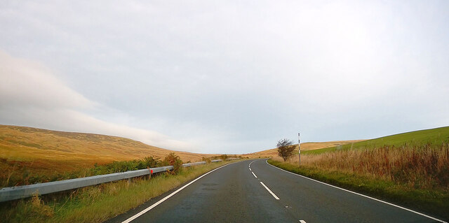
Lumsdon Law is a prominent hill located in Northumberland, England. It is situated near the village of Whittingham and stands at an elevation of approximately 1,043 feet (318 meters) above sea level. Offering panoramic views of the surrounding landscape, Lumsdon Law is a popular destination for hikers, nature enthusiasts, and photographers.

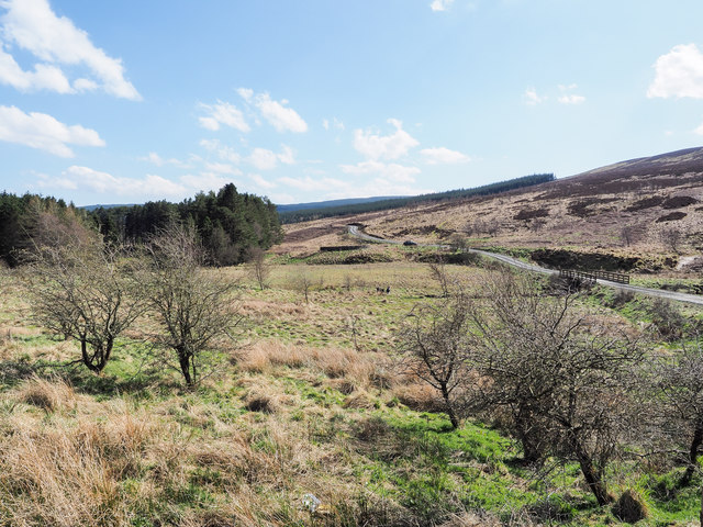
This hill is part of the Cheviot Hills, which form the border between England and Scotland. Lumsdon Law is characterized by its distinctive conical shape, with a relatively steep and rocky ascent. Its slopes are covered in grass and heather, providing a picturesque scenery throughout the year.

Hikers can access the summit of Lumsdon Law by following various trails that wind through the surrounding countryside. The ascent can be challenging, particularly in inclement weather or during the colder months when the hill may be covered in snow. However, the effort is rewarded with breathtaking views of the Cheviot Hills, Northumberland National Park, and the Scottish Borders.

The hill is also known for its rich history, with archaeological remains indicating human activity in the area dating back to the Bronze Age. Lumsdon Law is home to an Iron Age hillfort, which served as a defensive structure during ancient times. The fort's earthworks and ramparts can still be observed today, offering insight into the region's past.

Overall, Lumsdon Law is a captivating natural landmark that combines stunning vistas, challenging hikes, and historical significance, making it a must-visit destination in Northumberland.

If you have any feedback on the listing, please let us know in the comments section below.

Lumsdon Law Images

Images are sourced within 2km of 55.34231/-2.4325335 or Grid Reference NT7205. Thanks to Geograph Open Source API. All images are credited.

A68 towards Jedburgh
A68 near Whitelee Towards Jedburgh.
A68 near Whitelee
Towards Jedburgh.
Hillside grazing near Ramshope Farm
A68 beside Catcleugh reservoir Towards Carter Bar.
A68 beside Catcleugh reservoir
Towards Carter Bar.
Echo Crags A view across the northern part of Echo Crags, illuminated by the low winter afternoon sun.  Hungry Law, from where Echo Crags were reached from, is prominent at the top right of shot.

This photograph was taken during the Coronavirus (COVID-19) pandemic of 2020/21/22.
Echo Crags
A view across the northern part of Echo Crags, illuminated by the low winter afternoon sun. Hungry Law, from where Echo Crags were reached from, is prominent at the top right of shot. This photograph was taken during the Coronavirus (COVID-19) pandemic of 2020/21/22.
Leap Hill Bagged with Adrian Dust after parking at Carter Bar. Wooplaw Edge, Leap Hill, Hungry Law, Greyhound Law and then Ravens Knowe before heading to the Cottonshope road to walk back to collect Dusty's car from the campsite opposite this road beside the A68.
Name: Leap Hill
Hill number: 15929
Height: 471m / 1545ft
Parent (Ma/M): 2302  The Cheviot
Section: 33: The Scottish Border to the River Tyne
Section: 28B: The River Tweed to the English Border
Area: The Cheviots
County/UA: Scottish Borders (UA)
County/UA: Northumberland (CoU)
Class: Tump (400-499m)
Grid ref: NT 72880 07023
Summit feature: fence corner
Drop: 45m
Col: 426m  NT734073
Leap Hill
Bagged with Adrian Dust after parking at Carter Bar. Wooplaw Edge, Leap Hill, Hungry Law, Greyhound Law and then Ravens Knowe before heading to the Cottonshope road to walk back to collect Dusty's car from the campsite opposite this road beside the A68. Name: Leap Hill Hill number: 15929 Height: 471m / 1545ft Parent (Ma/M): 2302 The Cheviot Section: 33: The Scottish Border to the River Tyne Section: 28B: The River Tweed to the English Border Area: The Cheviots County/UA: Scottish Borders (UA) County/UA: Northumberland (CoU) Class: Tump (400-499m) Grid ref: NT 72880 07023 Summit feature: fence corner Drop: 45m Col: 426m NT734073
View Towards Fairwood Fell En route between Leap Hill and Hungry Law in the Cheviot Hills.
View Towards Fairwood Fell
En route between Leap Hill and Hungry Law in the Cheviot Hills.
Hunter's Pike Cairn Hunter's Pike Cairn is not far from the summit of Leap Hill.
Hunter's Pike Cairn
Hunter's Pike Cairn is not far from the summit of Leap Hill.
Mile Stone - A68 NE side of road
Mile Stone - A68
NE side of road
Echo Crags from cairn at Sandy Pike Echo Crags is a cloud-shadowed feature to the right of the dark area of trees near to the centre of the image.  It's possibly the name by which the hill there is known, or that of a rock feature on it. (Or both!)
Echo Crags from cairn at Sandy Pike
Echo Crags is a cloud-shadowed feature to the right of the dark area of trees near to the centre of the image. It's possibly the name by which the hill there is known, or that of a rock feature on it. (Or both!)
Lumsdon Law from the air The 475m Lumsdon Law is at the bottom of the photo, to the left of Catcleugh Reservoir.
Lumsdon Law from the air
The 475m Lumsdon Law is at the bottom of the photo, to the left of Catcleugh Reservoir.
Farm track rising from gate The track climbs from the A68 as it passes along the north side of Catcleugh Reservoir.
Farm track rising from gate
The track climbs from the A68 as it passes along the north side of Catcleugh Reservoir.
Access road for Whitelee Farm The road rises steeply from the A68, just behind the camera position.
Access road for Whitelee Farm
The road rises steeply from the A68, just behind the camera position.
Moorland in upper Redesdale The River Rede flows through the area in view soon to enter Catcleugh Reservoir which is among the trees to the left of the image. A sign at the start of the hill road where it leaves the A68 tells that the Whitelee Reserve of the Northumberland Wildlife Trust lies ahead.
Moorland in upper Redesdale
The River Rede flows through the area in view soon to enter Catcleugh Reservoir which is among the trees to the left of the image. A sign at the start of the hill road where it leaves the A68 tells that the Whitelee Reserve of the Northumberland Wildlife Trust lies ahead.
Catcleugh Reservoir Catcleugh Reservoir is in Northumberland, adjacent to the A68 road. It was constructed between 1884 and 1905 for the Newcastle and Gateshead Water Company.
Catcleugh Reservoir
Catcleugh Reservoir is in Northumberland, adjacent to the A68 road. It was constructed between 1884 and 1905 for the Newcastle and Gateshead Water Company.
Trees on the shoreline of Catcleugh Reservoir Catcleugh Reservoir is in Northumberland, adjacent to the A68 road. It was constructed between 1884 and 1905 for the Newcastle and Gateshead Water Company.
Trees on the shoreline of Catcleugh Reservoir
Catcleugh Reservoir is in Northumberland, adjacent to the A68 road. It was constructed between 1884 and 1905 for the Newcastle and Gateshead Water Company.
A68 descending from Carter Bar
A68 at Whitelee Bridge
Show me another place!

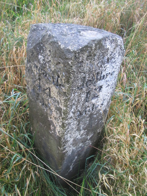
Lumsdon Law is located at Grid Ref: NT7205 (Lat: 55.34231, Lng: -2.4325335)

Unitary Authority: Northumberland

Police Authority: Northumbria

What 3 Words

///intensely.outdoors.dolphin. Near Rochester, Northumberland

Nearby Locations

Lumsdon Law

Related Wikis

Ramshope

Ramshope is a hamlet and former civil parish, now in the parish of Rochester in Northumberland, England located in Northumberland National Park. It lies...

Whitelee Moor

Whitelee Moor is nature reserve of the Northumberland Wildlife Trust, in Northumberland, England, near Carter Bar. A large part of the moor is blanket...

Carter Bar

Carter Bar is a pass in the Cheviot Hills, on the Anglo-Scottish border. It lies east of Carter Fell at the head of Redesdale, and is crossed by the A68...

Raid of the Redeswire

The Raid of the Redeswire, also known as the Redeswire Fray, was a border skirmish between England and Scotland on 7 July 1575 which took place at Carter...

Nearby Amenities

Located within 500m of 55.34231,-2.4325335
Lumsdon Law
Place: locality
Lat/Long: 55.3425776/-2.4315037
Tate's Well
Place: locality
Lat/Long: 55.3388157/-2.4297188
The data included in this document is from www.openstreetmap.org. The data is made available under ODbL.

Have you been to Lumsdon Law?

Leave your review of Lumsdon Law below (or comments, questions and feedback).