Rough Hill

Hill, Mountain in Lancashire

England

Rough Hill

Ruin in the Upper Grane Valley One of many ruins that dot the landscape that constitutes the upper reaches of the River Ogden - very little left of this one.
Ruin in the Upper Grane Valley Credit: Chris Heaton

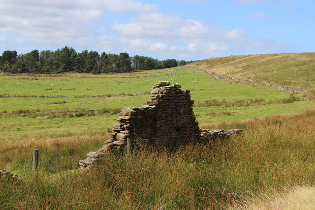
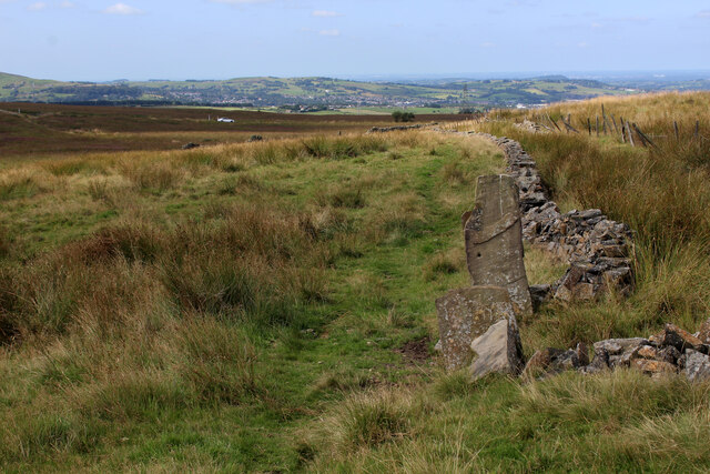
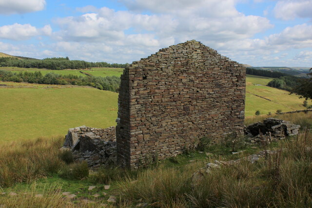
Rough Hill is a prominent hill located in the county of Lancashire, in the northwest region of England. Situated near the town of Colne, it is part of the Pennine Range, a well-known group of hills and mountains that run through the northern part of England. Rough Hill stands at an elevation of approximately 1,315 feet (400 meters) above sea level, making it one of the taller hills in the area.

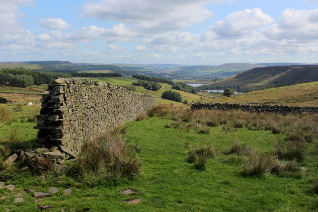
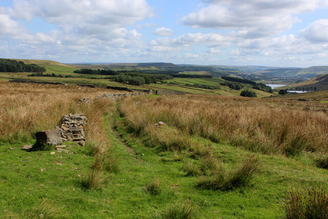
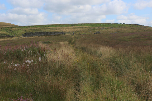
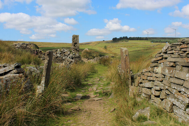
The hill is characterized by its rugged terrain and rocky slopes, which give it its name. It is mainly composed of Millstone Grit, a coarse-grained sandstone that is common in the Pennines. The hill offers breathtaking panoramic views of the surrounding countryside, including the Ribble Valley and the Yorkshire Dales, making it a popular destination for hikers and nature enthusiasts.

Rough Hill is also home to a diverse range of flora and fauna. The hillside is covered in heather and grasses, while the higher slopes are dotted with patches of bracken and bilberry bushes. The area provides habitat for various bird species, including kestrels and peregrine falcons, as well as small mammals such as rabbits and hares.

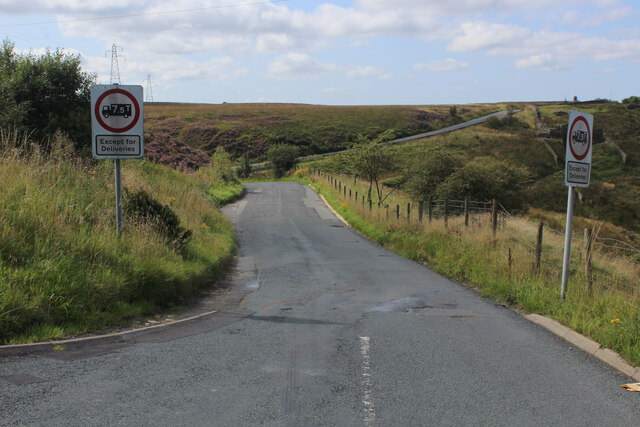
Access to Rough Hill is relatively easy, with a network of footpaths and trails leading to its summit. There are also designated parking areas nearby for visitors who prefer to drive. The hill attracts visitors throughout the year, with its stunning views and opportunities for outdoor activities, making it a cherished natural landmark in Lancashire.

If you have any feedback on the listing, please let us know in the comments section below.
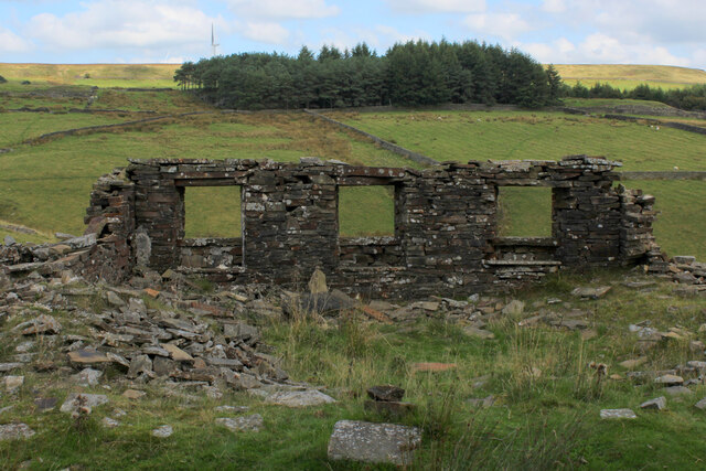
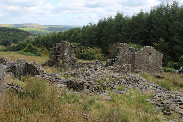
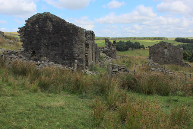
Rough Hill Images

Images are sourced within 2km of 53.703804/-2.4163328 or Grid Reference SD7223. Thanks to Geograph Open Source API. All images are credited.

Ruin in the Upper Grane Valley One of many ruins that dot the landscape that constitutes the upper reaches of the River Ogden - very little left of this one.
Ruin in the Upper Grane Valley
One of many ruins that dot the landscape that constitutes the upper reaches of the River Ogden - very little left of this one.
Heading down Jackson Height Following an indistinct footpath over rough ground towards Pickup Bank
Heading down Jackson Height
Following an indistinct footpath over rough ground towards Pickup Bank
Footpath leading away from the Grane Road Very faint footpath, heavily incumbered by reeds heading towards Pickup Bank
Footpath leading away from the Grane Road
Very faint footpath, heavily incumbered by reeds heading towards Pickup Bank
On Jackson Height
On Jackson Height
Long Hey Lane Descending to cross Mean Brook
Long Hey Lane
Descending to cross Mean Brook
Descending into the Grane Valley (1) Public footpath follows the substantial wall into the head of the Grane Valley - which contains the River Ogden.
Descending into the Grane Valley (1)
Public footpath follows the substantial wall into the head of the Grane Valley - which contains the River Ogden.
Descending into the Grane Valley (2) Footpath descending into the head of the Grane Valley, although it is not visible on the ground - so attention needs to be concentrated on the map.
Descending into the Grane Valley (2)
Footpath descending into the head of the Grane Valley, although it is not visible on the ground - so attention needs to be concentrated on the map.
Footpath heading towards Broadhead Road
Track leading away from Broadhead Road The public footpath concealed and smothered by vegetation
Track leading away from Broadhead Road
The public footpath concealed and smothered by vegetation
Ruins of Peak House, Haslingden Grane Part of Grane Village, once a thriving community of over a thousand souls involved with farming, quarrying and illicit whisky distillation.
The construction of the 3 reservoirs sounded the death knell, depopulating the valley and leaving behind many ruined buildings
Ruins of Peak House, Haslingden Grane
Part of Grane Village, once a thriving community of over a thousand souls involved with farming, quarrying and illicit whisky distillation. The construction of the 3 reservoirs sounded the death knell, depopulating the valley and leaving behind many ruined buildings
Rossendale Way in Haslingden Grane The long distance footpath in the deserted ruins of Grane Village, a once thriving community depopulated after the construction of the three reservoirs.
Rossendale Way in Haslingden Grane
The long distance footpath in the deserted ruins of Grane Village, a once thriving community depopulated after the construction of the three reservoirs.
Ruins of Close Bottom, Haslingden Grane One of many ruins dotted hereabouts, that once made up the community of Grane Village.
Now abandoned and deserted, after the construction of 3 reservoirs along the River Ogden.
Ruins of Close Bottom, Haslingden Grane
One of many ruins dotted hereabouts, that once made up the community of Grane Village. Now abandoned and deserted, after the construction of 3 reservoirs along the River Ogden.
Ruins of Top o' th' Knoll, Haslingden Grane (1) Once substantial premises in the now abandoned Grane Village, passed by on the Rossendale Way.
Ruins of Top o' th' Knoll, Haslingden Grane (1)
Once substantial premises in the now abandoned Grane Village, passed by on the Rossendale Way.
Ruins of Top o' th' Knoll, Haslingden Grane (2) Part of the now deserted community of the once thriving Grane Village - a former farming, quarrying and illicit whisky distillation centre in the upper Ogden Valley
Ruins of Top o' th' Knoll, Haslingden Grane (2)
Part of the now deserted community of the once thriving Grane Village - a former farming, quarrying and illicit whisky distillation centre in the upper Ogden Valley
Heys Lane Straight track between Blacksnape and Hoddlesden
Heys Lane
Straight track between Blacksnape and Hoddlesden
Terraced Houses on Carus Avenue, Hoddlesden Blessed with very long thin garden, separated by wide trimmed hedgerows
Terraced Houses on Carus Avenue, Hoddlesden
Blessed with very long thin garden, separated by wide trimmed hedgerows
Hoddlesden Reservoir Popular local leisure facility - especially with walkers and the fishing fraternity
Hoddlesden Reservoir
Popular local leisure facility - especially with walkers and the fishing fraternity
Hoddlesden Reservoir Embankment Popular destination for walkers and anglers
Hoddlesden Reservoir Embankment
Popular destination for walkers and anglers
Show me another place!

Rough Hill is located at Grid Ref: SD7223 (Lat: 53.703804, Lng: -2.4163328)

Unitary Authority: Blackburn with Darwen

Police Authority: Lancashire

What 3 Words

///confining.snuggled.gobbling. Near Darwen, Lancashire

Related Wikis

Yate and Pickup Bank

Yate and Pickup Bank is a civil parish in the borough of Blackburn with Darwen, Lancashire, England. The population of the civil parish taken at the census...

Bank Fold

Bank Fold is a hamlet near Belthorn in Lancashire, England.

Old St Paul's Church, Hoddlesden

Old St Paul's Church is a former Anglican parish church in the village of Hoddlesden, Lancashire, England. The foundation stone was laid on 27 July 1861...
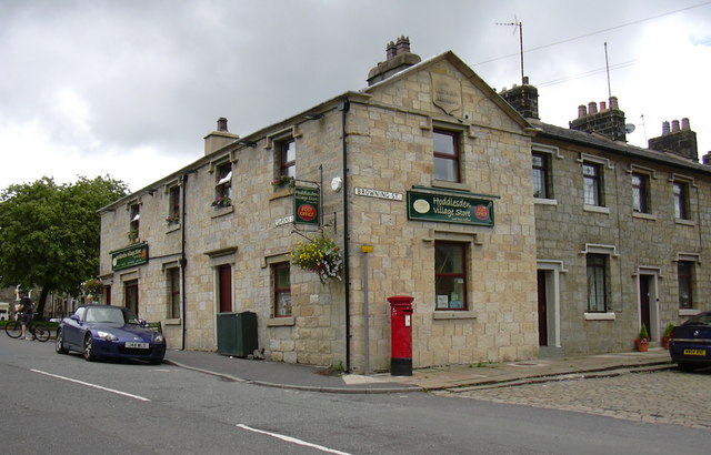
Hoddlesden

Hoddlesden is a village in the borough of Blackburn with Darwen, in Lancashire, England. The village population at the 2011 census was 1,239. It is in...

Nearby Amenities

Located within 500m of 53.703804,-2.4163328
Power: tower
Lat/Long: 53.7073714/-2.4123043
Power: tower
Lat/Long: 53.7042746/-2.4115696
Power: tower
Lat/Long: 53.701433/-2.4150183
Power: tower
Lat/Long: 53.708247/-2.4167109
The data included in this document is from www.openstreetmap.org. The data is made available under ODbL.

Have you been to Rough Hill?

Leave your review of Rough Hill below (or comments, questions and feedback).