Huddox Hill

Hill, Mountain in Somerset

England

Huddox Hill

St John the Baptist Church at Peasdown St John.
St John the Baptist Credit: Wayland Smith

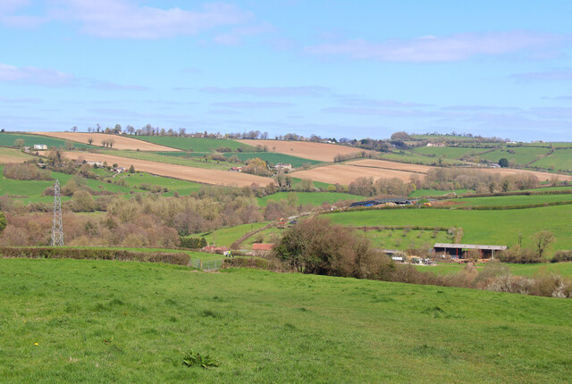
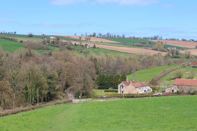
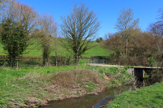
Huddox Hill is a prominent hill located in the county of Somerset, England. It lies approximately 3 miles south of the town of Frome and is part of the Mendip Hills range. Standing at an elevation of around 230 meters (755 feet), it offers breathtaking panoramic views of the surrounding countryside.

The hill is primarily composed of limestone, which is characteristic of the Mendip Hills. This geological feature has resulted in the formation of unique flora and fauna on Huddox Hill, making it a site of special scientific interest. The hill is home to several rare and protected plant species, including the Cheddar pink and the yellow whitlowgrass.

Huddox Hill is also rich in archaeological heritage. The remains of Iron Age hillforts can be found on its slopes, indicating human habitation in the area dating back centuries. Additionally, there are several ancient burial mounds scattered across the hill, providing further evidence of its historical significance.

The hill is a popular destination for outdoor enthusiasts and nature lovers. Numerous walking trails and footpaths traverse the area, allowing visitors to explore the picturesque landscape and enjoy the tranquility of the countryside. The summit of Huddox Hill provides an excellent vantage point for birdwatching and admiring the stunning sunsets that often grace the Somerset skies.

Overall, Huddox Hill is a captivating natural landmark in Somerset, offering a combination of geological, ecological, and historical interest. Its beauty and accessibility make it a cherished destination for locals and tourists alike.

If you have any feedback on the listing, please let us know in the comments section below.
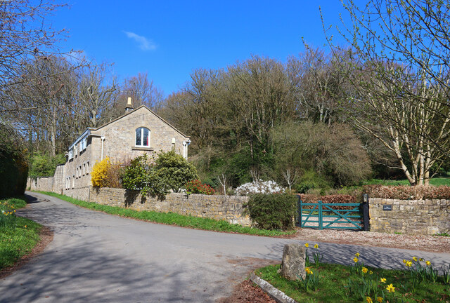
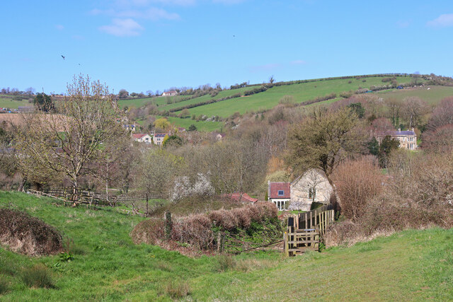
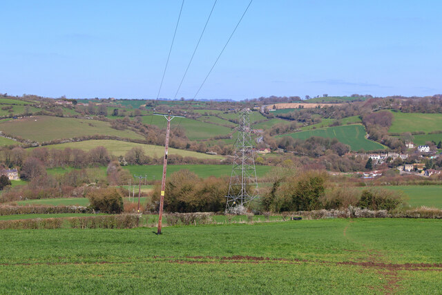
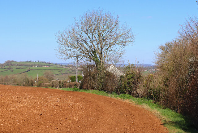
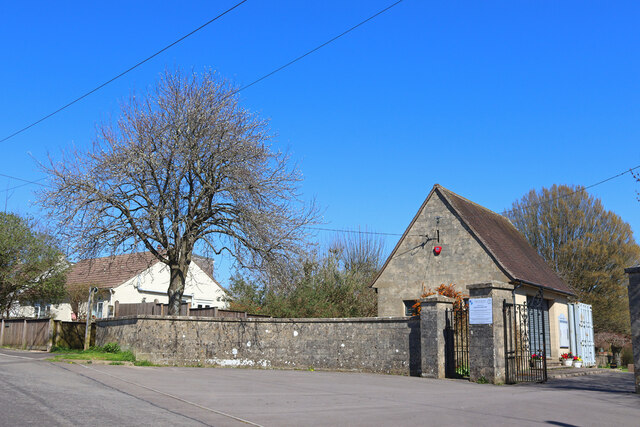
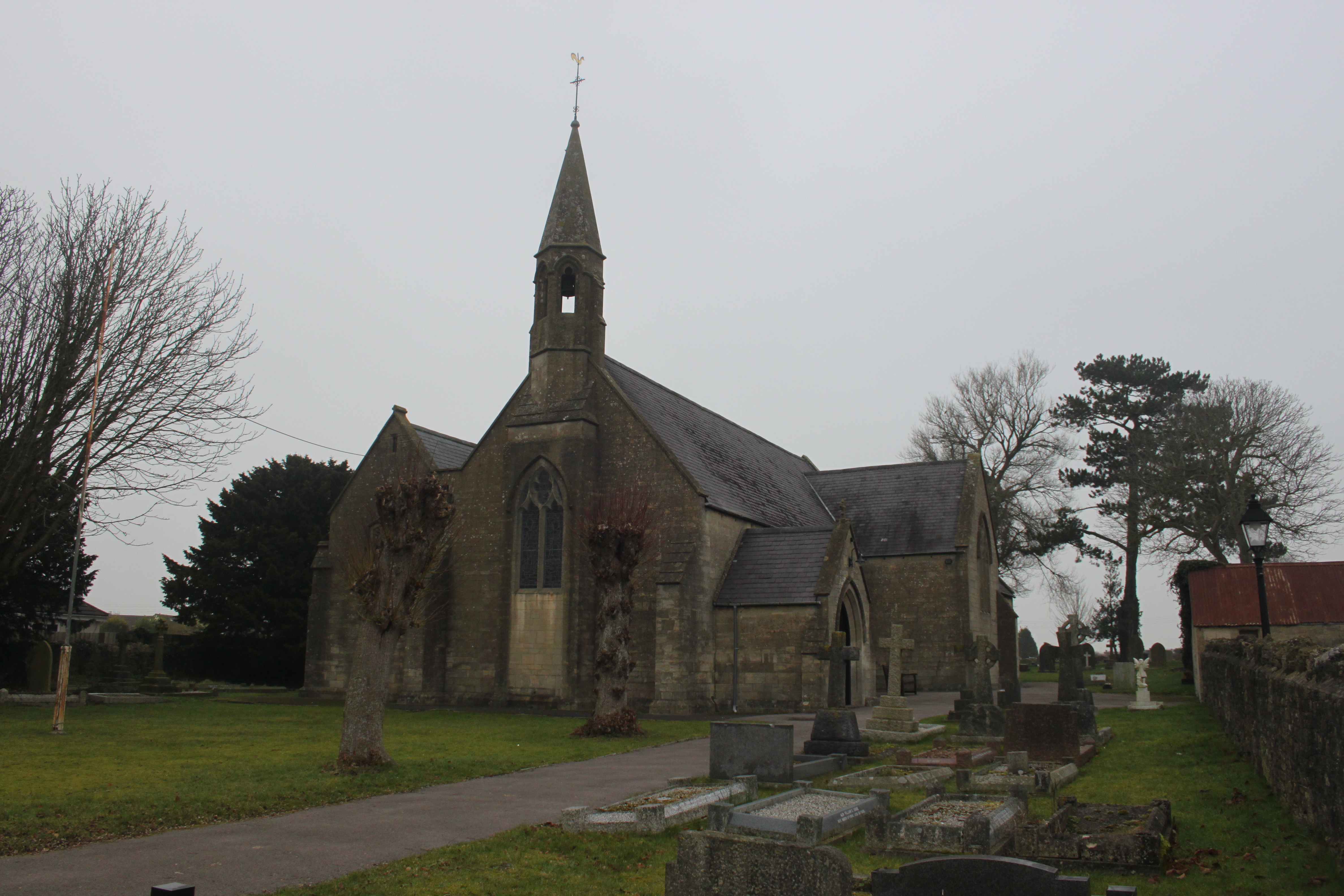
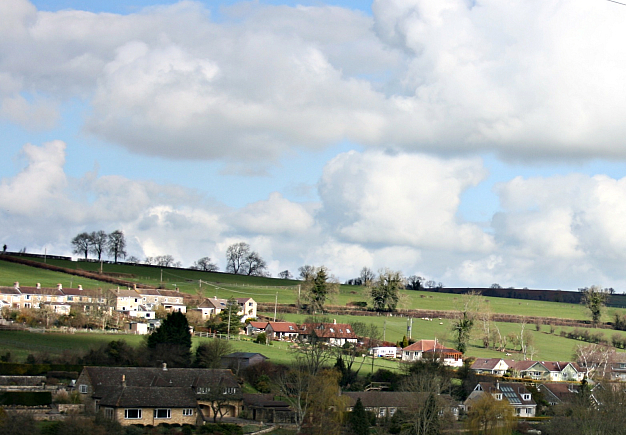
Huddox Hill Images

Images are sourced within 2km of 51.316649/-2.4218305 or Grid Reference ST7057. Thanks to Geograph Open Source API. All images are credited.

St John the Baptist Church at Peasdown St John.
St John the Baptist
Church at Peasdown St John.
Unsuitable for wide users A footpath/road has some conflicts of restriction.
Unsuitable for wide users
A footpath/road has some conflicts of restriction.
It's an old question The chicken was one of several that were roaming free on the quiet roads hereabouts, calmly and serenely exploring for morsels. There was a moment to pose the obvious; he stopped for a short pause but said he had other plots to hatch.
It's an old question
The chicken was one of several that were roaming free on the quiet roads hereabouts, calmly and serenely exploring for morsels. There was a moment to pose the obvious; he stopped for a short pause but said he had other plots to hatch.
Stoneage Lane An unusual name for a lane, but one that is quite old.
Stoneage Lane
An unusual name for a lane, but one that is quite old.
St John's hall Next to the church is a metal-clad hall. It stands where the original church stood in the past.
St John's hall
Next to the church is a metal-clad hall. It stands where the original church stood in the past.
Carlingcott Methodist church The building was founded in 1851, along with a schoolroom, as a United Free Methodist church. They faced some competition not far up the road in the form of a Wesleyan chapel. The Free church later became the Carlingcott Methodist chapel, before closure a few years ago. The church, its attached gates, piers and flanking walls are Grade II listed.
Carlingcott Methodist church
The building was founded in 1851, along with a schoolroom, as a United Free Methodist church. They faced some competition not far up the road in the form of a Wesleyan chapel. The Free church later became the Carlingcott Methodist chapel, before closure a few years ago. The church, its attached gates, piers and flanking walls are Grade II listed.
Difficult to notice Carlingcott Methodist church appears to have been disused for a few years, as the old wooden notice shows.
Difficult to notice
Carlingcott Methodist church appears to have been disused for a few years, as the old wooden notice shows.
Barrier Chicane on Colliers Way NCN24 Photograph of wooden barrier chicane on Colliers Way NCN24 between Radstock and Shooscombe.
Spacing between the gates is over 1m.
Path surface here is tarmac in generally good condition.
Barrier Chicane on Colliers Way NCN24
Photograph of wooden barrier chicane on Colliers Way NCN24 between Radstock and Shooscombe. Spacing between the gates is over 1m. Path surface here is tarmac in generally good condition.
Under Dunkerton Bridge The Cam Brook trickles under the A367.
Under Dunkerton Bridge
The Cam Brook trickles under the A367.
Bath Road, Peasedown St John Bath Road bisects Peasedown St John and contains most of its shops and services. On the right are the premises of the former 'Daily Bread' bakery (which did not long survive a bad food hygiene rating in 2018). Beyond it are the Zodiac Hair Studio <span class="nowrap"><a title="http://zodiac-hair-studio.edan.io/" rel="nofollow ugc noopener" href="http://zodiac-hair-studio.edan.io/">Link</a><img style="margin-left:2px;" alt="External link" title="External link - shift click to open in new window" src="https://s1.geograph.org.uk/img/external.png" width="10" height="10"/></span> and the Barber Zone <span class="nowrap"><a title="https://barber-zone-peasedown-st-john.business.site/" rel="nofollow ugc noopener" href="https://barber-zone-peasedown-st-john.business.site/">Link</a><img style="margin-left:2px;" alt="External link" title="External link - shift click to open in new window" src="https://s1.geograph.org.uk/img/external.png" width="10" height="10"/></span> ; the latter replacing a coffee shop which was presumably killed off by closure in the pandemic.
Bath Road, Peasedown St John
Bath Road bisects Peasedown St John and contains most of its shops and services. On the right are the premises of the former 'Daily Bread' bakery (which did not long survive a bad food hygiene rating in 2018). Beyond it are the Zodiac Hair Studio LinkExternal link and the Barber Zone LinkExternal link ; the latter replacing a coffee shop which was presumably killed off by closure in the pandemic.
Off Firgrove Lane Looking across fields towards Splott Farm.
Off Firgrove Lane
Looking across fields towards Splott Farm.
Splott Farm Near Carlingcott.
Splott Farm
Near Carlingcott.
Cam Brook Small bridge over the brook.
Cam Brook
Small bridge over the brook.
The Hollow Dwelling on the edge of Dunkerton.
The Hollow
Dwelling on the edge of Dunkerton.
Near Dunkerton Climbing away from the church at Dunkerton.
Near Dunkerton
Climbing away from the church at Dunkerton.
Intersection of Infrastructure Power lines cross in a field south of Dunkerton.
Intersection of Infrastructure
Power lines cross in a field south of Dunkerton.
Footpath near Peasdown St John Field footpath near Peasdown St John.
Footpath near Peasdown St John
Field footpath near Peasdown St John.
Ashgrove Cemetery Ashgrove Cemetery, Peasdown St John.
Ashgrove Cemetery
Ashgrove Cemetery, Peasdown St John.
Show me another place!

Huddox Hill is located at Grid Ref: ST7057 (Lat: 51.316649, Lng: -2.4218305)

Unitary Authority: Bath and North East Somerset

Police Authority: Avon and Somerset

What 3 Words

///mural.hood.faced. Near Peasedown St John, Somerset

Related Wikis

Peasedown St John

Peasedown St John (commonly referred to as Peasedown) is a village and civil parish in Somerset, England, standing on a hilltop roughly 5 miles (8 km)...

St John's Church, Peasedown St John

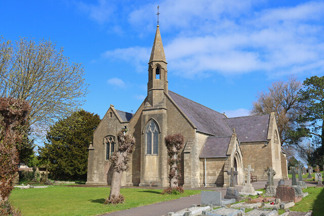
St John's Church, Peasedown St John (or more formally the Church of St John the Baptist, Peasedown) is the Anglican parish church for the village of Peasedown...

Dunkerton railway station

Dunkerton railway station served the village of Dunkerton, Somerset, England from 1910 to 1925. It was constructed as part of the extension of the original...

Church of All Saints, Dunkerton

The Church of All Saints is an Anglican parish church in Dunkerton Somerset, England. It was built in the 14th century with the tower being added in the...

Shoscombe

Shoscombe is a small village and civil parish in the valley of the Wellow Brook in north-east Somerset, about 7 miles (11 km) south of Bath, England. The...

Radstock rail accident

The Radstock rail accident took place on the Somerset and Dorset Joint Railway in south west England, on 7 August 1876. Two trains collided on a single...

Dunkerton, Somerset

Dunkerton is a small village in the civil parish of Dunkerton and Tunley, 4 miles (6.4 km) north east of Radstock, and 5 miles (8.0 km) south west of Bath...

Camerton Court

Camerton Court is a historic house in the village of Camerton, Somerset, England. It has been designated as a Grade II listed building. == House == The...

Nearby Amenities

Located within 500m of 51.316649,-2.4218305
Peasedown St. John
Place: village
Wikidata: Q2582516
Wikipedia: en:Peasedown St John
Lat/Long: 51.3151315/-2.4224588
Crossing
Crossing: marked
Crossing Island: no
Crossing Markings: yes
Kerb: lowered
Tactile Paving: yes
Lat/Long: 51.3156307/-2.4270313
Post Box
Collection Times: Mo-Fr 09:00; Sa 07:00
Operator: Royal Mail
Operator Wikidata: Q638098
Ref: BA2 23
Royal Cypher: EIIR
Royal Cypher Wikidata: Q33102113
Lat/Long: 51.3181023/-2.4217307
Toilets
Lat/Long: 51.3156655/-2.4285375
Barrier: kissing_gate
Lat/Long: 51.3140428/-2.416253
Barrier: kissing_gate
Lat/Long: 51.3132879/-2.4172957
Post Box
Collection Times: Mo-Fr 17:00; Sa 11:45
Operator: Royal Mail
Operator Wikidata: Q638098
Ref: BA2 179
Royal Cypher: EVIIR
Royal Cypher Wikidata: Q33102324
Lat/Long: 51.3154798/-2.4274065
Bus Stop
Braysdown Lane
Bench: no
Bin: no
Bus: yes
Naptan AtcoCode: 0180BAC30815
Naptan Bearing: W
Naptan CommonName: Braysdown Lane
Naptan Indicator: W-bound
Naptan NaptanCode: bthdjag
Naptan Street: Bath Road
Naptan Verified: no
Public Transport: platform
Shelter: yes
Lat/Long: 51.3157095/-2.4265315
Bus Stop
Russet Way
Bus: yes
Naptan AtcoCode: 0180BAC23456
Naptan Bearing: NW
Naptan CommonName: Russet Way
Naptan Crossing: Russet Way
Naptan NaptanCode: bthmjta
Naptan Street: Orchard Way
Naptan Verified: no
Public Transport: platform
Source: naptan_import
Lat/Long: 51.312586/-2.4204484
Bus Stop
French Close
Bus: yes
Naptan AtcoCode: 0180BAC23457
Naptan Bearing: NE
Naptan BusStopType: CUS
Naptan CommonName: French Close
Naptan Crossing: French Close
Naptan NaptanCode: bthmjtd
Naptan Street: Orchard Way
Naptan Verified: no
Public Transport: platform
Source: naptan_import
Lat/Long: 51.3143943/-2.420221
Bus Stop
Faulkland View
Bus: yes
Naptan AtcoCode: 0180BAC23458
Naptan Bearing: NE
Naptan BusStopType: CUS
Naptan CommonName: Faukland View
Naptan Crossing: Faukland View
Naptan NaptanCode: bthmjtg
Naptan Street: Orchard Way
Naptan Verified: no
Public Transport: platform
Source: naptan_import
Lat/Long: 51.3154669/-2.416988
Bus Stop
Ashgrove
Bench: yes
Bus: yes
Naptan AtcoCode: 0180BAC30810
Naptan Bearing: N
Naptan CommonName: Ashgrove
Naptan NaptanCode: bthdjgj
Naptan Street: Dunkerton Hill
Naptan Verified: no
Public Transport: platform
Shelter: yes
Source: naptan_import
Lat/Long: 51.3205493/-2.4189714
Bus Stop
Ashgrove
Bench: no
Bin: yes
Bus: yes
Naptan AtcoCode: 0180BAC30811
Naptan Bearing: SW
Naptan CommonName: Ashgrove
Naptan Crossing: Eckweek Lane
Naptan NaptanCode: bthdjgd
Naptan Street: Ashgrove
Naptan Verified: no
Public Transport: platform
Shelter: yes
Source: naptan_import
Tactile Paving: no
Lat/Long: 51.3198283/-2.419424
Bus Stop
Keels Hill
Bench: no
Bin: yes
Bus: yes
Lit: no
Naptan AtcoCode: 0180BAC30812
Naptan Bearing: NE
Naptan CommonName: Keels Hill
Naptan Crossing: Eckweek Road
Naptan NaptanCode: bthdjdt
Naptan Street: Ashgrove
Naptan Verified: no
Public Transport: platform
Shelter: yes
Source: naptan_import
Tactile Paving: no
Lat/Long: 51.3180302/-2.4218353
Bus Stop
Keels Hill
Bench: no
Bin: yes
Bus: yes
Lit: no
Naptan AtcoCode: 0180BAC30813
Naptan Bearing: SW
Naptan CommonName: Keels Hill
Naptan Crossing: Eckweek Gardens
Naptan NaptanCode: bthdjdm
Naptan Street: Ashgrove
Naptan Verified: no
Public Transport: platform
Shelter: no
Source: naptan_import
Tactile Paving: no
Lat/Long: 51.317787/-2.4219596
Bus Stop
Methodist Ch
Bench: yes
Bin: yes
Bus: yes
Naptan AtcoCode: 0180BAC30814
Naptan Bearing: E
Naptan CommonName: Methodist Ch
Naptan NaptanCode: bthdjam
Naptan Street: Bath Road
Naptan Verified: no
Public Transport: platform
Shelter: yes
Source: naptan_import
Lat/Long: 51.3158361/-2.4264684
Bus Stop
Faulkland View
Bus: yes
Naptan AtcoCode: 0180BAC30821
Naptan Bearing: SW
Naptan CommonName: Faukland View
Naptan Crossing: Faukland View
Naptan NaptanCode: bthdjgt
Naptan Street: Orchard Way
Naptan Verified: no
Public Transport: platform
Source: naptan_import
Lat/Long: 51.3153321/-2.4169724
Bus Stop
French Close
Bus: yes
Naptan AtcoCode: 0180BAC30822
Naptan Bearing: SW
Naptan CommonName: French Close
Naptan Crossing: Underleaf Way
Naptan NaptanCode: bthdjga
Naptan Street: Orchard Way
Naptan Verified: no
Public Transport: platform
Source: naptan_import
Lat/Long: 51.314151/-2.420348
Bus Stop
Russet Way
Bus: yes
Naptan AtcoCode: 0180BAC30823
Naptan Bearing: SE
Naptan CommonName: Russet Way
Naptan Crossing: Russet Way
Naptan NaptanCode: bthdjdw
Naptan Street: Orchard Way
Naptan Verified: no
Public Transport: platform
Source: naptan_import
Lat/Long: 51.3128288/-2.4204507
Atm
Tesco
Check Date: 2022-04-07
Lat/Long: 51.3161106/-2.4258904
Barrier: cycle_barrier
Lat/Long: 51.3167984/-2.4183601
Barrier: cycle_barrier
Lat/Long: 51.3168017/-2.4184666
Barrier: bollard
Lat/Long: 51.3180079/-2.415956
Barrier: cycle_barrier
Lat/Long: 51.3179979/-2.4160018
Crossing
Crossing Island: yes
Lat/Long: 51.3157063/-2.416572
Barrier: cycle_barrier
Lat/Long: 51.3149152/-2.4205192
Barrier: cycle_barrier
Lat/Long: 51.315277/-2.4228394
Barrier: cycle_barrier
Lat/Long: 51.3145714/-2.4223031
Barrier: cycle_barrier
Lat/Long: 51.3146097/-2.4229425
Barrier: cycle_barrier
Cycle Barrier: double
Cycle Barrier Installation: fixed
Lat/Long: 51.3185512/-2.4282392
Barrier: cycle_barrier
Cycle Barrier: double
Cycle Barrier Installation: fixed
Lat/Long: 51.3167655/-2.4263307
Fuel
Arleen Coach & Hire Services
Addr Housenumber: 14
Addr Postcode: BA2 8DH
Addr Street: Bath Road
Brand: Murco
Brand Wikidata: Q16998281
Fuel Diesel: yes
Fuel Octane 95: yes
Lat/Long: 51.3153449/-2.4277438
Turning Circle
Lat/Long: 51.3188268/-2.4229387
Huddox Hill
Ele: 168
Natural: peak
Lat/Long: 51.3163523/-2.4222204
Location Transition: yes
Material: wood
Power: pole
Lat/Long: 51.3174953/-2.4288763
Material: wood
Power: pole
Lat/Long: 51.3178057/-2.4277351
Material: wood
Power: pole
Lat/Long: 51.3180381/-2.4269295
Material: wood
Power: pole
Lat/Long: 51.3183509/-2.425765
Material: wood
Power: pole
Lat/Long: 51.3187379/-2.4274805
Peasedown Lunch Club
Addr Housename: Beacon Hall
Addr Postcode: BA2 8SN
Addr Street: French Close
Club: yes
Fhrs Id: 914712
Website: http://www.beaconhall.org.uk/
Lat/Long: 51.3152454/-2.420582
Social Facility
Somer Valley Foodbank (Peasedown St John)
Addr City: Bath
Addr Housename: Peasedown Methodist Church
Addr Postcode: BA2 8DN
Addr Street: Bath Road
Fhrs Id: 1365996
Social Facility: food_bank
Lat/Long: 51.3157911/-2.4268838
Southside Family Project
Addr Housename: Beacon Hall
Addr Postcode: BA2 8SN
Addr Street: French Close
Club: yes
Fhrs Id: 1250304
Website: http://www.beaconhall.org.uk/
Lat/Long: 51.3152565/-2.4204806
The data included in this document is from www.openstreetmap.org. The data is made available under ODbL.

Have you been to Huddox Hill?

Leave your review of Huddox Hill below (or comments, questions and feedback).