Isle of Whithorn

Settlement in Wigtownshire

Scotland

Isle of Whithorn

Isle of Whithorn Harbour Viewed from the B7004.
Isle of Whithorn Harbour Credit: Billy McCrorie

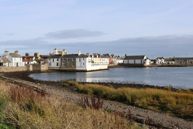
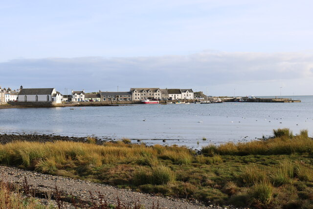
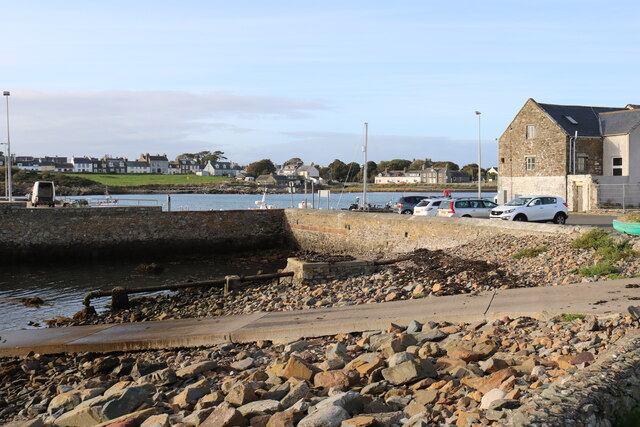
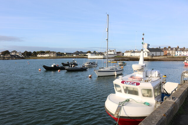
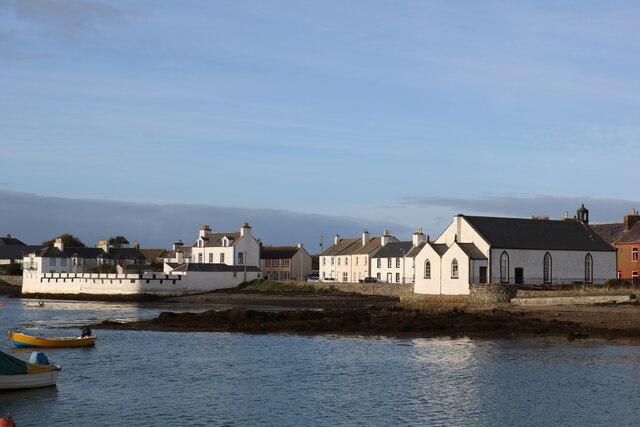
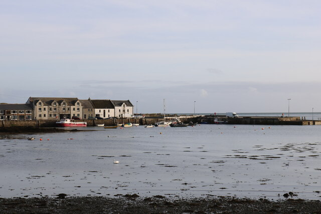
The Isle of Whithorn is a small village located on the southern coast of Scotland, in the historical county of Wigtownshire. Situated on the Machars Peninsula, it overlooks the picturesque Luce Bay and is surrounded by stunning natural beauty. With a population of around 400 residents, it is known for its peaceful ambiance and close-knit community.

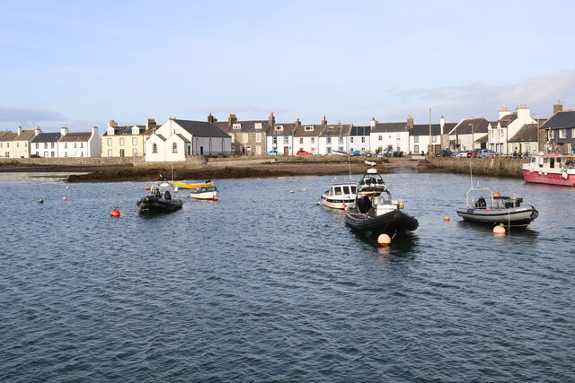
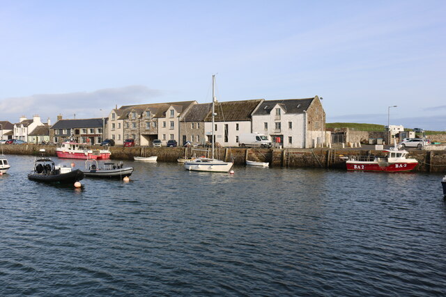
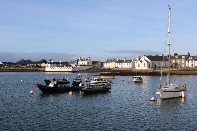
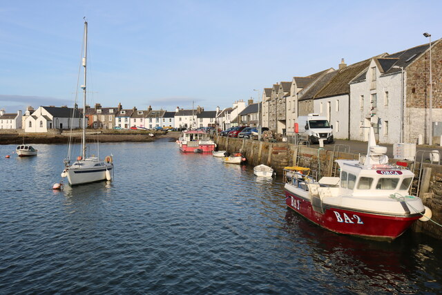
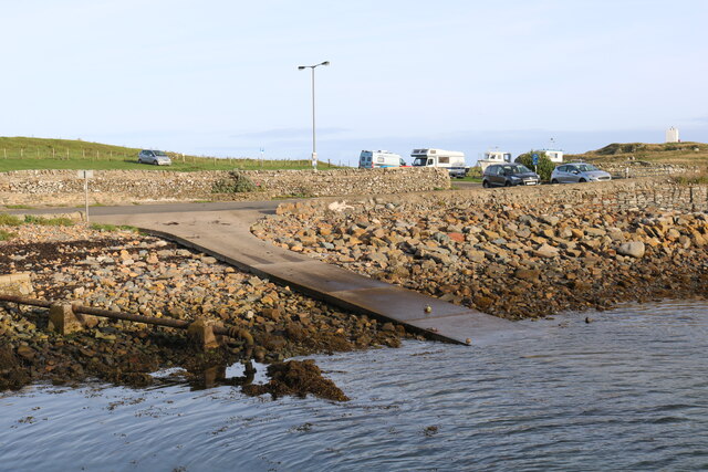
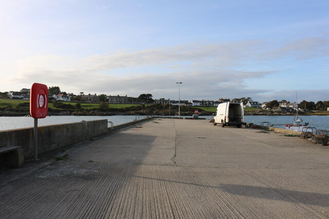
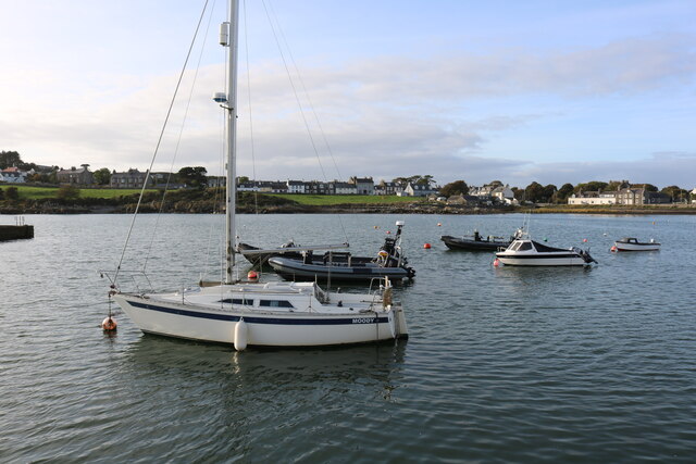
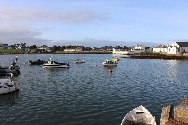
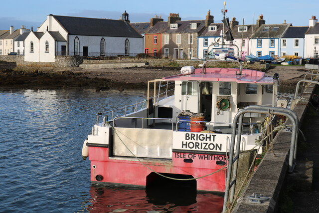
The village has a rich history, dating back to ancient times. It was originally a busy port, with evidence of human settlement dating back to prehistoric times. Today, the harbor remains the heart of the village, providing shelter for a small fleet of fishing boats and leisure crafts. The Isle of Whithorn is also home to the ruins of a 13th-century chapel, dedicated to St. Ninian, which is a popular tourist attraction.

Nature enthusiasts are drawn to the area for its scenic coastal walks, offering breathtaking views of the surrounding cliffs and rugged coastline. The nearby Mull of Galloway, the southernmost point of Scotland, is a popular spot for birdwatching and observing seals and dolphins in their natural habitat.

Although a small village, the Isle of Whithorn offers a range of amenities to its residents and visitors. These include a local shop, a pub, a tearoom, and a hotel, providing a comfortable and welcoming environment for tourists exploring the area.

Overall, the Isle of Whithorn is a charming and beautiful destination, perfect for those seeking tranquility, natural beauty, and a touch of history.

If you have any feedback on the listing, please let us know in the comments section below.

Isle of Whithorn Images

Images are sourced within 2km of 54.700818/-4.367089 or Grid Reference NX4736. Thanks to Geograph Open Source API. All images are credited.

Isle of Whithorn Harbour Viewed from the B7004.
Isle of Whithorn Harbour
Viewed from the B7004.
Isle of Whithorn Harbour As seen from the B7004.
Isle of Whithorn Harbour
As seen from the B7004.
Slipway, Isle of Whithorn
"Orca" Isle of Whithorn On a lovely day in October.
"Orca" Isle of Whithorn
On a lovely day in October.
Harbour, Isle of Whithorn
Harbour, Isle of Whithorn On a lovely day in October.
Harbour, Isle of Whithorn
On a lovely day in October.
Isle of Whithorn Harbour
Harbour, Isle of Whithorn On a nice day in October.
Harbour, Isle of Whithorn
On a nice day in October.
Slipway, Isle of Whithorn
Pier, Isle of Whithorn
"Moody" Isle of Whithorn
Harbour at Isle of Whithorn
White Buildings, Isle of Whithorn The one on the right is the Church of Scotland.
White Buildings, Isle of Whithorn
The one on the right is the Church of Scotland.
"Bright Horizon" Isle of Whithorn White building on the left is the Church of Scotland.
"Bright Horizon" Isle of Whithorn
White building on the left is the Church of Scotland.
Flower Planter, Isle of Whithorn
St. Ninian's Tea Room, Isle of Whithorn Viewed from Main Street.
St. Ninian's Tea Room, Isle of Whithorn
Viewed from Main Street.
Tropical Isle of Whithorn Only wish, viewed from Main Street on a calm cool day in October.
Tropical Isle of Whithorn
Only wish, viewed from Main Street on a calm cool day in October.
Harbour, Isle of Whithorn Viewed from Main Street.
Harbour, Isle of Whithorn
Viewed from Main Street.
Show me another place!

Isle of Whithorn is located at Grid Ref: NX4736 (Lat: 54.700818, Lng: -4.367089)

Unitary Authority: Dumfries and Galloway

Police Authority: Dumfries and Galloway

What 3 Words

///shielding.orders.knocking. Near Whithorn, Dumfries & Galloway

Related Wikis

Isle of Whithorn

Isle of Whithorn (Port Rosnait in Gaelic) is one of the most southerly villages and seaports in Scotland, lying on the coast north east of Burrow Head...

Burrow Head

Burrow Head is a headland located approximately two miles south-west of Isle of Whithorn, Wigtownshire, Scotland, and is the second southernmost point...

Candida Casa

Candida Casa was the name given to the church established by St Ninian in Whithorn, Galloway, southern Scotland, in the mid fifth century AD. The name...

Whithorn Priory

Whithorn Priory was a medieval Scottish monastery that also served as a cathedral, located at 6 Bruce Street in Whithorn, Wigtownshire, Dumfries and Galloway...

Whithorn

Whithorn (Scots pronunciation: [ˈʍɪthorn], Taigh Mhàrtainn in modern Gaelic), is a royal burgh in the historic county of Wigtownshire in Dumfries and Galloway...

Whithorn railway station

Whithorn is the closed terminus of the Wigtownshire Railway branch, from Newton Stewart, of the Portpatrick and Wigtownshire Joint Railway. It served...

St Ninian's Cave

St Ninian's Cave is a cave in Physgill Glen, Whithorn, Dumfries and Galloway, Scotland. It features in the climax of the acclaimed 1973 horror film The...

Rispain Camp

Rispain Camp is the remains of a fortified farmstead 1 mile west of Whithorn, Dumfries and Galloway, Scotland. It is one of the major Iron Age archaeological...

Nearby Amenities

Located within 500m of 54.700818,-4.367089
Source: PGS
Lat/Long: 54.6970362/-4.3631986
Source: PGS
Lat/Long: 54.6999532/-4.3601359
Source: PGS
Lat/Long: 54.70058/-4.3601778
Source: PGS
Lat/Long: 54.7006723/-4.3594965
Isle of Whithorn
Name En: Isle of Whithorn
Name Gd: Port Rosnait
Name Sco: The Isle
Place: village
Lat/Long: 54.7007757/-4.3633686
Bus Stop
Main St
Naptan AtcoCode: 680000294111
Naptan Bearing: NW
Naptan CommonName: Main St
Naptan Indicator: Terminus
Naptan Landmark: Harbour
Naptan NaptanCode: 34236942
Naptan Notes: none
Naptan Street: Main Street
Naptan Verified: no
Source: naptan_import
Lat/Long: 54.7008491/-4.3647686
Bus Stop
Main Street
Bus: yes
Naptan AtcoCode: 680000294501
Naptan Bearing: SE
Naptan CommonName: Main Street
Naptan Indicator: Shelter
Naptan Landmark: B7063
Naptan NaptanCode: 34236939
Naptan Notes: none
Naptan Street: Main Street
Naptan Verified: no
Public Transport: platform
Source: naptan_import
Lat/Long: 54.7009918/-4.3675864
Bus Stop
Main Street
Bus: yes
Naptan AtcoCode: 680000294502
Naptan Bearing: NW
Naptan CommonName: Main Street
Naptan Indicator: opp Shelter
Naptan Landmark: B7063
Naptan NaptanCode: 34236943
Naptan Notes: none
Naptan Street: Main Street
Naptan Verified: no
Public Transport: platform
Source: naptan_import
Lat/Long: 54.7010579/-4.3675987
Toilets
Fee: no
Lat/Long: 54.7011747/-4.3646166
Parking
Access: customers
Fee: no
Parking: surface
Lat/Long: 54.7012251/-4.3647389
Seamark Light Character: Q
Seamark Light Colour: green
Seamark Light Height: 4
Seamark Light Range: 5
Seamark Light Reference: A 4622
Seamark Type: light_minor
Source: US NGA Pub. 114. 2011-05-26.
Lat/Long: 54.6983237/-4.3640605
Toilets
Access: yes
Unisex: yes
Wheelchair: yes
Lat/Long: 54.6981719/-4.3624925
Playground: slide
Lat/Long: 54.6974055/-4.3620391
Grit Bin
Access: yes
Colour: Yellow
Material: plastic
Lat/Long: 54.6982956/-4.362849
Defibrillator
Defibrillator Location: Isle of Whithorn. St Ninian's Community Hall. External wall.
Emergency: defibrillator
Indoor: no
Lat/Long: 54.7011803/-4.3647249
Defibrillator
Defibrillator Location: Isle of Whithorn. Harbour Row. External wall of passage to car park.
Emergency: defibrillator
Indoor: no
Lat/Long: 54.6986741/-4.3625685
Power: pole
Lat/Long: 54.7035339/-4.3721954
Power: pole
Lat/Long: 54.7031468/-4.37146
Power: pole
Lat/Long: 54.7026512/-4.3705187
Power: pole
Lat/Long: 54.702374/-4.3699831
Power: pole
Lat/Long: 54.7019354/-4.3691447
Power: pole
Lat/Long: 54.701494/-4.368325
Power: pole
Lat/Long: 54.7026001/-4.3722769
Power: pole
Lat/Long: 54.7020888/-4.373036
Power: pole
Lat/Long: 54.7015626/-4.3738255
Power: pole
Lat/Long: 54.7011576/-4.3744193
Power: pole
Lat/Long: 54.7007983/-4.3733411
Power: pole
Lat/Long: 54.7001699/-4.3729336
Power: pole
Lat/Long: 54.7022771/-4.3694032
Power: pole
Lat/Long: 54.702156/-4.3678942
Power: pole
Lat/Long: 54.7020269/-4.3663083
Power: pole
Lat/Long: 54.7021816/-4.3655794
Power: pole
Lat/Long: 54.7022166/-4.3653931
Power: pole
Lat/Long: 54.7023633/-4.3646596
Power: pole
Lat/Long: 54.7020699/-4.3631855
Power: pole
Lat/Long: 54.7043762/-4.3630784
Power: pole
Lat/Long: 54.703659/-4.3639167
Power: pole
Lat/Long: 54.7029311/-4.3647271
Power: pole
Lat/Long: 54.6981843/-4.37028
Power: pole
Lat/Long: 54.6978667/-4.3700005
Power: pole
Lat/Long: 54.6975679/-4.3697187
Power: pole
Lat/Long: 54.6972315/-4.3694463
Power: pole
Lat/Long: 54.6968843/-4.3691715
Power: pole
Lat/Long: 54.6965519/-4.3688897
Pub
The Steam Packet Inn
Lat/Long: 54.6988445/-4.3623461
Post Box
Collection Times: Mo-Fr 09:00; Sa 07:00
Operator: Royal Mail
Post Box Type: lamp
Ref: DG8 11D
Royal Cypher: scottish_crown
Lat/Long: 54.699282/-4.3620054
Post Box
Collection Times: Mo-Fr 16:00; Sa 11:15
Operator: Royal Mail
Post Box Type: lamp
Ref: DG8 31
Royal Cypher: scottish_crown
Lat/Long: 54.7006614/-4.3662618
Leisure: picnic_table
Lat/Long: 54.6976977/-4.3622359
Bench
Backrest: yes
Lat/Long: 54.697668/-4.3621573
Bench
Backrest: no
Lat/Long: 54.6974935/-4.3618659
The data included in this document is from www.openstreetmap.org. The data is made available under ODbL.

Have you been to Isle of Whithorn?

Leave your review of Isle of Whithorn below (or comments, questions and feedback).