Abington Vale

Settlement in Northamptonshire

England

Abington Vale

Billing Aquadrome on the Nene Some of the many holiday, or weekend, dwellings of the Aquadrome can be seen in the distance to the right.
Billing Aquadrome on the Nene Credit: Kokai

Abington Vale is a suburban area located in Northamptonshire, England. Situated just two miles east of the town center of Northampton, it is a popular residential neighborhood known for its peaceful atmosphere and convenient amenities.

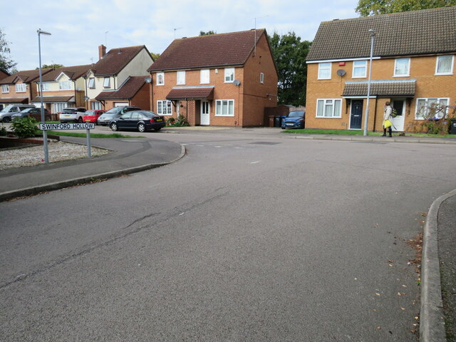
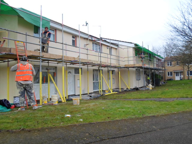
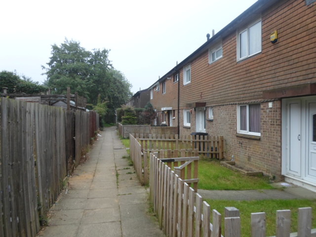
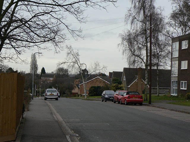
The area is predominantly residential, featuring a mix of detached and semi-detached houses, as well as some apartment buildings. The properties in Abington Vale are generally well-maintained and showcase a variety of architectural styles, contributing to the area's charm.

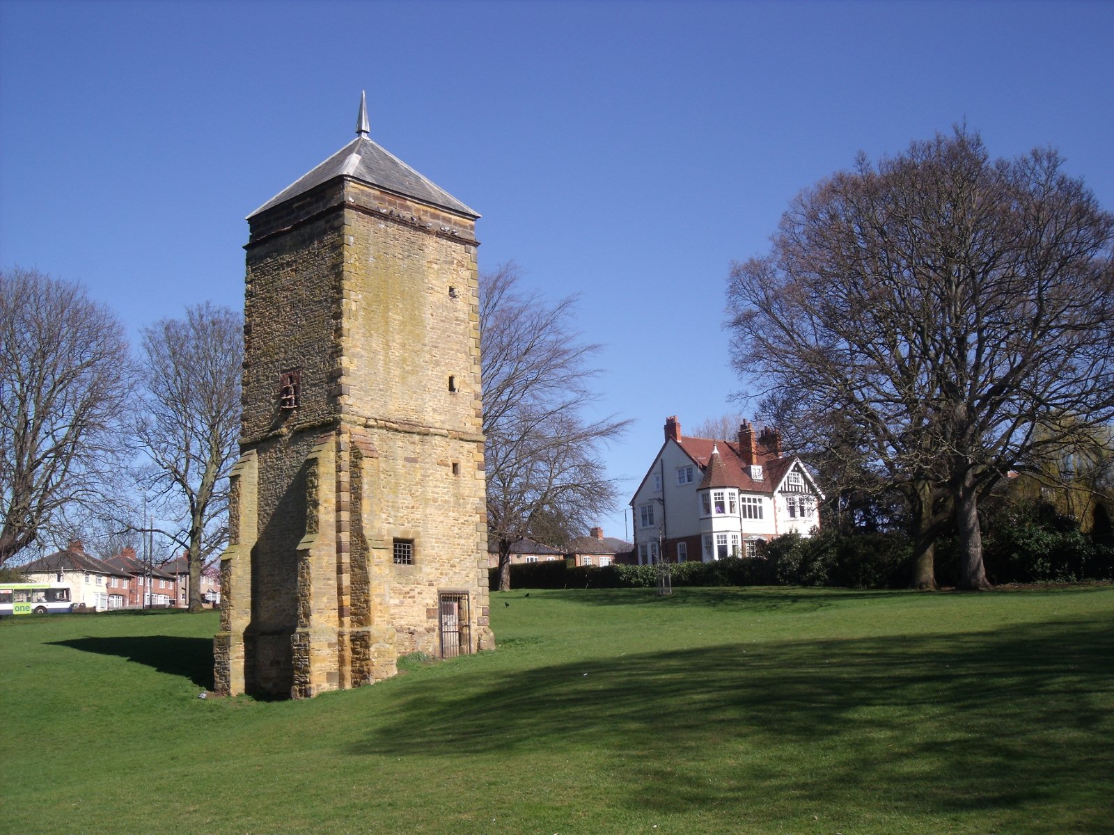
Abington Vale benefits from its proximity to various amenities. Residents have easy access to several local shops, supermarkets, and restaurants, providing convenient options for their daily needs. Additionally, Abington Park, one of Northampton's largest and most beautiful parks, is located nearby, offering vast green spaces, a lake, and leisure facilities such as tennis courts and a children's playground.

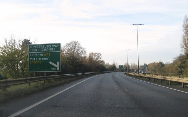
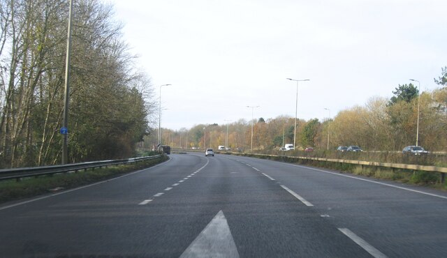
The community is well-served by public transportation, with regular bus services connecting Abington Vale to the town center and other surrounding areas. For those commuting by car, the A45 and A508 main roads are easily accessible, providing connections to nearby cities like Milton Keynes and Leicester.

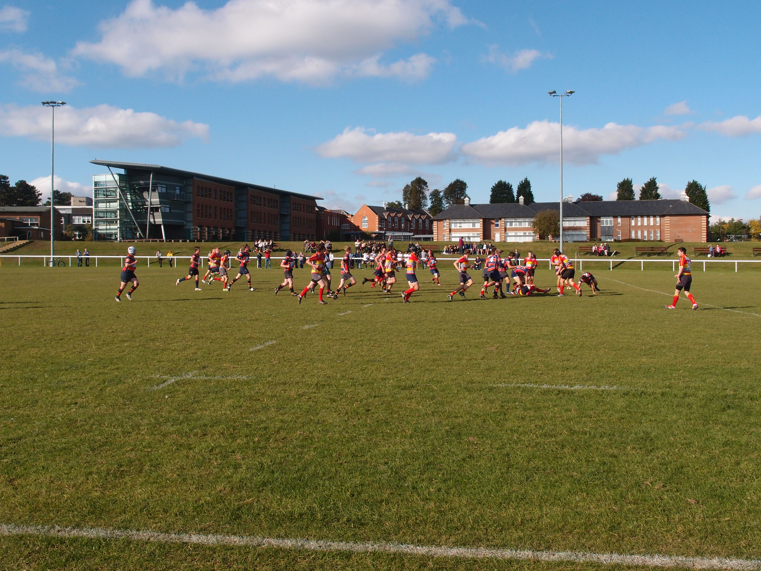
Families are attracted to Abington Vale due to its proximity to reputable schools, including Abington Vale Primary School and Northampton School for Girls, both of which are highly regarded for their academic achievements.

Overall, Abington Vale offers a peaceful and family-friendly environment, with its well-maintained properties, convenient amenities, and excellent educational facilities making it an attractive place to reside in Northamptonshire.

If you have any feedback on the listing, please let us know in the comments section below.

Abington Vale Images

Images are sourced within 2km of 52.241293/-0.851818 or Grid Reference SP7860. Thanks to Geograph Open Source API. All images are credited.

Billing Aquadrome on the Nene Some of the many holiday, or weekend, dwellings of the Aquadrome can be seen in the distance to the right.
Billing Aquadrome on the Nene
Some of the many holiday, or weekend, dwellings of the Aquadrome can be seen in the distance to the right.
Steam engine, Clifford Hill Mill. A 1928 French built Piguet engine from Lyon-Anzin. Was workable up to 1980 and removed in 1983. It remains in store at Bugbrooke flour mills.
A steam turbine is visible in the background (I think it was an Allen-KKK turbine).
Steam engine, Clifford Hill Mill.
A 1928 French built Piguet engine from Lyon-Anzin. Was workable up to 1980 and removed in 1983. It remains in store at Bugbrooke flour mills. A steam turbine is visible in the background (I think it was an Allen-KKK turbine).
Rousselot Gelatine Ltd, Clifford Hill Mill Rousselot was French and the steam engine was from Lyon - a rare beastie in the UK. Now all gone.
Rousselot Gelatine Ltd, Clifford Hill Mill
Rousselot was French and the steam engine was from Lyon - a rare beastie in the UK. Now all gone.
Swinford Hollow Road junction where Swinford Hollow meets Longford Avenue.
Swinford Hollow
Road junction where Swinford Hollow meets Longford Avenue.
A45 westbound
A45 westbound
A45 westbound
A45 westbound
Steam engine, Clifford Hill Mill A 1928 French built Piguet engine from Lyon-Anzin. Was workable up to 1980 and removed in 1983. It remains in store at Bugbrooke flour mills.
Steam engine, Clifford Hill Mill
A 1928 French built Piguet engine from Lyon-Anzin. Was workable up to 1980 and removed in 1983. It remains in store at Bugbrooke flour mills.
Billing Aquadrome From Clifford Hill Mill lock.
Billing Aquadrome
From Clifford Hill Mill lock.
Narrowboat on the River Nene
River Nene Near Billing Aquadrome.
River Nene
Near Billing Aquadrome.
Billing Aquadrome Mobile home park.
Billing Aquadrome
Mobile home park.
River Nene A weir near Billing Aquadrome.
River Nene
A weir near Billing Aquadrome.
River Nene Bridge near Clifford Hill.
River Nene
Bridge near Clifford Hill.
Stockmead Road 1970s council houses in Little Billing.
Stockmead Road
1970s council houses in Little Billing.
Stockmead Road Insulating concrete council houses in Little Billing.
Stockmead Road
Insulating concrete council houses in Little Billing.
Leyswell Court Exterior insulation being applied to council houses in Little Billing.
Leyswell Court
Exterior insulation being applied to council houses in Little Billing.
Longford Avenue 1980s houses in Little Billing.
Longford Avenue
1980s houses in Little Billing.
Brickwell Court 1970s council houses in Standens Barn.
Brickwell Court
1970s council houses in Standens Barn.
Show me another place!

Abington Vale is located at Grid Ref: SP7860 (Lat: 52.241293, Lng: -0.851818)

Unitary Authority: West Northamptonshire

Police Authority: Northamptonshire

What 3 Words

///fits.leads.barn. Near Northampton, Northamptonshire

Nearby Locations

Abington Vale

Related Wikis

Abington Vale

Abington Vale is an area of Northampton in Northamptonshire, England. Abington Vale lies just to the north of the A45 road and the River Nene; Abington...

Abington Meadows

Abington Meadows is a 9.6-hectare (24-acre) nature reserve in Northampton. It is owned by Northamptonshire County Council and managed by the Wildlife Trust...

Northampton ON Chenecks F.C.

Northampton Old Northamptonian Chenecks F.C. are a football club based in Northampton, England. They play in the Spartan South Midlands League Division...

Abington, Northamptonshire

Abington is a district of the town of Northampton and former civil parish, now in the parish of Northampton, in the West Northamptonshire district, in...

Weston Favell

Weston Favell is an area and former civil parish near the eastern end of Northampton, now in the parish of Northampton, in the West Northamptonshire district...

Northampton School for Boys

Northampton School for Boys (NSB) is an 11–18 boys secondary school in Northampton, England. It was founded as Northampton Town and County Grammar School...

Abington Park

Abington Park, in the Abington district of Northampton, Northamptonshire, England, has lakes, aviaries, and a museum, as well as trees and grassy open...

County Cricket Ground, Northampton

The County Ground is a cricket venue on Wantage Road in the Abington area of Northampton, England. It is home to Northamptonshire County Cricket Club,...

Nearby Amenities

Located within 500m of 52.241293,-0.851818
Post Box
Brand: Royal Mail
Brand Wikidata: Q638098
Brand Wikipedia: en:Royal Mail
Operator: Royal Mail
Operator Wikidata: Q638098
Ref: NN3 114
Royal Cypher: EIIR
Royal Cypher Wikidata: Q33102113
Lat/Long: 52.2422247/-0.8567536
Mace Express
Addr City: Northampton
Addr Country: GB
Addr Housenumber: 53
Addr Postcode: NN3 3LN
Addr Street: Landcross Drive
Brand: Mace
Brand Wikidata: Q75240338
Fhrs Authority: Northampton
Fhrs Id: 171793
Fhrs Local Authority Id: PI/000021344
Shop: convenience
Lat/Long: 52.242068/-0.8567413
Fast Food
Abington Plaice
Addr City: Northampton
Addr Country: GB
Addr Housenumber: 43
Addr Postcode: NN3 3LN
Addr Street: Landcross Drive
Fhrs Authority: Northampton
Fhrs Id: 742253
Fhrs Local Authority Id: PI/000084726
Source Addr: FHRS Open Data
Lat/Long: 52.2422874/-0.856621
Post Office
Landcross Drive Post Office
Addr City: Northampton
Addr Country: GB
Addr Housenumber: 53
Addr Postcode: NN3 3LN
Addr Street: Landcross Drive
Ref Pol Id: 127038
Lat/Long: 52.2421132/-0.8567168
Lara Boot Hairdressing
Shop: hairdresser
Lat/Long: 52.2421743/-0.856685
Abington Vale Supermarket
Addr City: Northampton
Addr Country: GB
Addr Housenumber: 45/47
Addr Postcode: NN3 3LN
Addr Street: Landcross Drive
Shop: convenience
Lat/Long: 52.2422238/-0.8566578
Just Curls
Shop: hairdresser
Lat/Long: 52.2421397/-0.8567027
Crossing
Crossing: marked
Crossing Island: no
Crossing Markings: yes
Lat/Long: 52.2401558/-0.8585211
Mini Roundabout
Direction: clockwise
Lat/Long: 52.2452019/-0.8522387
Pub
Road To Morocco
Addr City: Northampton
Addr Country: GB
Addr Postcode: NN3 3BB
Addr Street: Bridgewater Drive
Fhrs Authority: Northampton
Fhrs Id: 164171
Fhrs Local Authority Id: PI/000005908
Source Addr: FHRS Open Data
Lat/Long: 52.2451127/-0.8488449
Turning Circle
Lat/Long: 52.2396476/-0.8513706
Mini Roundabout
Direction: clockwise
Lat/Long: 52.2422816/-0.8485393
Post Box
Brand: Royal Mail
Brand Wikidata: Q638098
Brand Wikipedia: en:Royal Mail
Operator: Royal Mail
Operator Wikidata: Q638098
Ref: NN3 195
Royal Cypher: GVIR
Royal Cypher Wikidata: Q33102169
Lat/Long: 52.240979/-0.8536917
Bus Stop
Bus: yes
Naptan AtcoCode: 300000001A
Naptan NaptanCode: nthamamw
Public Transport: platform
Lat/Long: 52.2417881/-0.8503984
Bus Stop
Bus: yes
Public Transport: platform
Lat/Long: 52.2416078/-0.8506143
Bus Stop
Bus: yes
Naptan AtcoCode: 300000001BR
Naptan NaptanCode: nthamapd
Public Transport: platform
Shelter: no
Lat/Long: 52.2405203/-0.8560731
Bus Stop
Bus: yes
Naptan AtcoCode: 300000001BE
Naptan NaptanCode: nthamapa
Public Transport: platform
Shelter: yes
Lat/Long: 52.2403612/-0.8564291
Bus Stop
Bus: yes
Naptan AtcoCode: 300000001LD
Naptan NaptanCode: nthamapt
Public Transport: platform
Shelter: yes
Lat/Long: 52.2406218/-0.8571083
Bus Stop
Bus: yes
Naptan AtcoCode: 300000001L
Naptan NaptanCode: nthamapm
Public Transport: platform
Shelter: no
Lat/Long: 52.2408045/-0.8573426
Bus Stop
Bus: yes
Naptan AtcoCode: 300000001D
Naptan NaptanCode: nthamapg
Public Transport: platform
Lat/Long: 52.2427445/-0.846919
Bus Stop
Bus: yes
Naptan AtcoCode: 300000001DR
Naptan NaptanCode: nthamapj
Public Transport: platform
Lat/Long: 52.2426133/-0.8469159
Power: tower
Lat/Long: 52.2385101/-0.8484041
Power: tower
Lat/Long: 52.2396631/-0.8461403
Power: tower
Lat/Long: 52.2373439/-0.8507376
Post Box
Brand: Royal Mail
Brand Wikidata: Q638098
Brand Wikipedia: en:Royal Mail
Operator: Royal Mail
Operator Wikidata: Q638098
Ref: NN3 334
Royal Cypher: EIIR
Royal Cypher Wikidata: Q33102113
Lat/Long: 52.2451444/-0.8523925
Crossing
Crossing: unmarked
Crossing Island: yes
Crossing Markings: no
Lat/Long: 52.2422064/-0.8484678
Bus Stop
Bus: yes
Naptan AtcoCode: 300000620SO
Naptan NaptanCode: nthdgtdp
Public Transport: platform
Shelter: no
Lat/Long: 52.2427471/-0.8565972
Crossing
Crossing: unmarked
Crossing Island: yes
Crossing Markings: no
Tactile Paving: no
Lat/Long: 52.2403209/-0.8568176
Crossing
Crossing: unmarked
Crossing Island: yes
Crossing Markings: no
Tactile Paving: no
Lat/Long: 52.2402404/-0.8572123
Bus Stop
Bus: yes
Public Transport: platform
Shelter: no
Lat/Long: 52.2431637/-0.8564462
Turning Circle
Lat/Long: 52.2395414/-0.8541334
Turning Circle
Lat/Long: 52.2394503/-0.8484404
Crossing
Lat/Long: 52.2418723/-0.8499419
Man Made: tower
Tower Construction: mast
Tower Type: communication
Lat/Long: 52.2402534/-0.8567139
The data included in this document is from www.openstreetmap.org. The data is made available under ODbL.

Have you been to Abington Vale?

Leave your review of Abington Vale below (or comments, questions and feedback).