Castle Hill

Hill, Mountain in Shropshire

England

Castle Hill

Shropshire Union Canal View north over locks to Snow's Bridge from Bagley Lane Bridge
Shropshire Union Canal Credit: Kevin Waterhouse

Castle Hill is an imposing hill located in the county of Shropshire, England. Rising to a height of approximately 155 meters (509 feet), it dominates the landscape with its distinctive shape and prominent position. The hill is part of the Shropshire Hills Area of Outstanding Natural Beauty, contributing to its allure and popularity among locals and tourists alike.

At the summit of Castle Hill, the ruins of an ancient hillfort can be found, dating back to the Iron Age. These well-preserved remains provide a fascinating insight into the history and strategic importance of the site. The hillfort covers an area of around 4.5 hectares and is encircled by earthen ramparts, offering magnificent views of the surrounding countryside.

The hill is covered in a mix of grassland and woodland, creating a diverse habitat for a wide range of flora and fauna. It is home to a variety of bird species, including kestrels, buzzards, and ravens, making it a haven for birdwatchers. The woodlands are also a popular spot for nature enthusiasts, with an array of wildflowers and woodland creatures to discover.

Visitors can explore Castle Hill via several walking trails that lead to the summit, offering a chance to immerse themselves in the natural beauty of the area. The hill is a popular destination for hikers, providing a challenging yet rewarding ascent. On a clear day, the breathtaking panoramic views from the top extend for miles, showcasing the picturesque Shropshire countryside.

Overall, Castle Hill in Shropshire is an exceptional natural landmark, combining historical significance with stunning natural beauty, making it a must-visit destination for nature lovers, history enthusiasts, and outdoor adventurers.

If you have any feedback on the listing, please let us know in the comments section below.

Castle Hill Images

Images are sourced within 2km of 52.961843/-2.5012146 or Grid Reference SJ6640. Thanks to Geograph Open Source API. All images are credited.
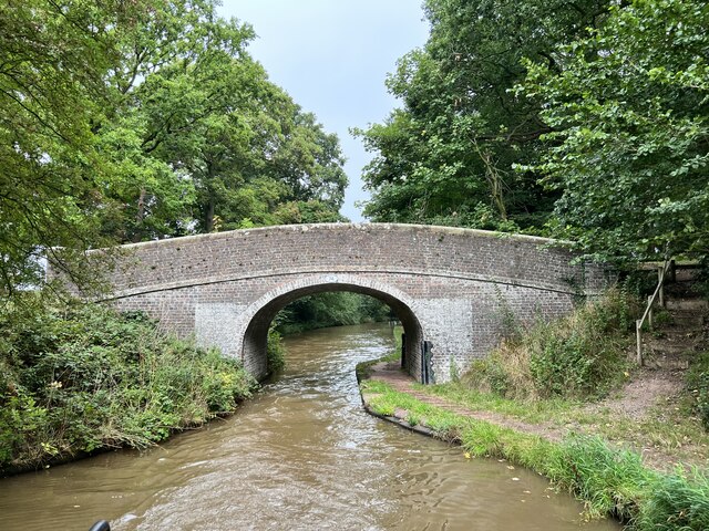
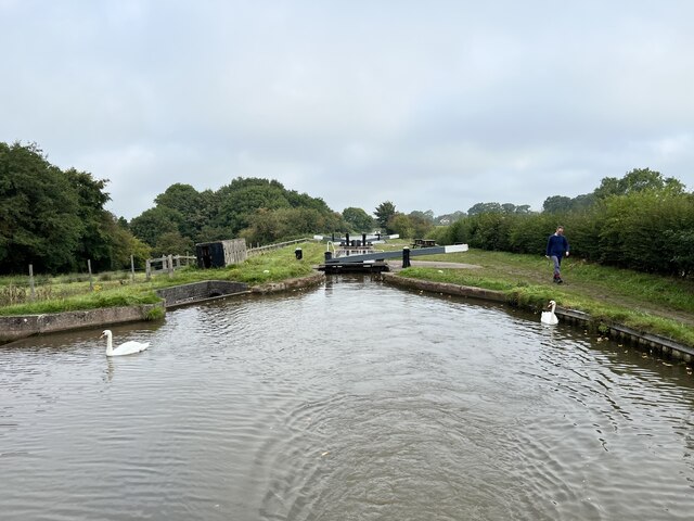
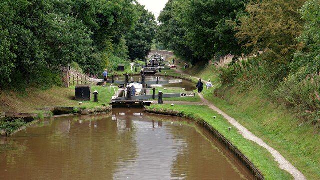
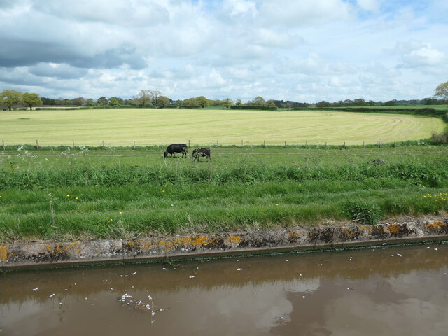
Shropshire Union Canal View north over locks to Snow's Bridge from Bagley Lane Bridge
Shropshire Union Canal
View north over locks to Snow's Bridge from Bagley Lane Bridge
View from Hawkesmoor Bridge Near Adderley.
View from Hawkesmoor Bridge
Near Adderley.
Adderley Pool Bridge Grade II listed. Listing number 1176472. Canal bridge. Circa 1830. Thomas Telford and Alexander Easton, engineers. Limewashed red brick with some blue brick dressings. Elliptical arch. Humped-back shape with chamfered stone string course and parapet with square end piers and rounded stone coping. Slightly battered and curved abutments. Cast-iron corner posts on towpath side with grooves caused by rope haulage. Oval cast-iron number plate to south-east.
Adderley Pool Bridge
Grade II listed. Listing number 1176472. Canal bridge. Circa 1830. Thomas Telford and Alexander Easton, engineers. Limewashed red brick with some blue brick dressings. Elliptical arch. Humped-back shape with chamfered stone string course and parapet with square end piers and rounded stone coping. Slightly battered and curved abutments. Cast-iron corner posts on towpath side with grooves caused by rope haulage. Oval cast-iron number plate to south-east.
Shropshire Union Canal North of Adderley.
Shropshire Union Canal
North of Adderley.
Milepost on the towpath On the Shropshire Union Canal.
Milepost on the towpath
On the Shropshire Union Canal.
Bridge 74 on the Shropshire Union Canal Grade II listed. Listing number 1320255. Accommodation bridge. 1827-30. Telford design. Brick, with stone band and copings. Single elliptical arch. Slightly cambered solid parapet, and piers. 2 iron rope fenders. Brick paved towpath beneath bridge.
Bridge 74 on the Shropshire Union Canal
Grade II listed. Listing number 1320255. Accommodation bridge. 1827-30. Telford design. Brick, with stone band and copings. Single elliptical arch. Slightly cambered solid parapet, and piers. 2 iron rope fenders. Brick paved towpath beneath bridge.
Former lock keeper's cottage At bridge 74 on the Shropshire Union Canal
Former lock keeper's cottage
At bridge 74 on the Shropshire Union Canal
Bridge 75 on the Shropshire Union Canal Grade II listed. Listing number 1115818. Accommodation bridge. C1827-30 and later Telford design. Brick, with stone band and copings. Single elliptical arch. Slightly cambered solid parapet, and piers. Parapets partly rebuilt at later date. 2 iron rope fenders. Brick paved towpath beneath bridge.
Bridge 75 on the Shropshire Union Canal
Grade II listed. Listing number 1115818. Accommodation bridge. C1827-30 and later Telford design. Brick, with stone band and copings. Single elliptical arch. Slightly cambered solid parapet, and piers. Parapets partly rebuilt at later date. 2 iron rope fenders. Brick paved towpath beneath bridge.
Between locks On the Shropshire Union Canal.
Between locks
On the Shropshire Union Canal.
Lock at Bagley Lane bridge On the Shropshire Union Canal.
Lock at Bagley Lane bridge
On the Shropshire Union Canal.
Threatening clouds over Rectory Lane, Adderley And it did indeed rain heavily, very soon.
Threatening clouds over Rectory Lane, Adderley
And it did indeed rain heavily, very soon.
Approaching Hawksmoor Bridge [no 72] Looking northwards on the Shropshire Union canal.
Approaching Hawksmoor Bridge [no 72]
Looking northwards on the Shropshire Union canal.
Wooded landscape near Adderley Pool Farmland or parkland? Difficult to tell. On the west bank of the Shropshire Union canal.
Wooded landscape near Adderley Pool
Farmland or parkland? Difficult to tell. On the west bank of the Shropshire Union canal.
Cattle grazing on a strip of land The grazing area has been fenced off from the larger field behind. North of Adderley, on the east bank of the canal.
Cattle grazing on a strip of land
The grazing area has been fenced off from the larger field behind. North of Adderley, on the east bank of the canal.
Dark clouds over mown fields, Adderley On the east bank of the Shropshire Union canal.
Dark clouds over mown fields, Adderley
On the east bank of the Shropshire Union canal.
Tisbuts House, Swanbach The sign reads "Built with Tis Buts 1865" - "Tis Buts" being small amounts of money put aside with the statement "'tis but [insert amount], but it will grow".
Tisbuts House, Swanbach
The sign reads "Built with Tis Buts 1865" - "Tis Buts" being small amounts of money put aside with the statement "'tis but [insert amount], but it will grow".
Tisbuts House, Swanbach (detail) The sign reads "Built with Tis Buts 1865" - "Tis Buts" being small amounts of money put aside with the statement "'tis but [insert amount], but it will grow".
Tisbuts House, Swanbach (detail)
The sign reads "Built with Tis Buts 1865" - "Tis Buts" being small amounts of money put aside with the statement "'tis but [insert amount], but it will grow".
Railway bridge identification code near Adderley in Shropshire This is on the brickwork of Station Road Bridge.
Railway bridge identification code near Adderley in Shropshire
This is on the brickwork of Station Road Bridge.
Show me another place!

Castle Hill is located at Grid Ref: SJ6640 (Lat: 52.961843, Lng: -2.5012146)

Unitary Authority: Shropshire

Police Authority: West Mercia

What 3 Words

///switched.lamppost.sugars. Near Audlem, Cheshire

Related Wikis

Adderley railway station

Adderley railway station was a station serving the village of Adderley in the English county of Shropshire. == History == The station was built by the...

Adderley

Adderley is a village and civil parish in the English county of Shropshire, several kilometres north of Market Drayton. It is known as Eldredelei in the...

St Peter's Church, Adderley

St Peter's Church is an Anglican church in the village of Adderley, Shropshire, England. It is recorded in the National Heritage List for England as a...

Highfields, Buerton

Highfields is a small country house in the civil parish of Buerton, Cheshire, England. It is recorded in the National Heritage List for England as a designated...

Nearby Amenities

Located within 500m of 52.961843,-2.5012146
Adderley
Historic Railway: station
Railway: site
Wikidata: Q4681053
Wikipedia: en:Adderley railway station
Lat/Long: 52.9578726/-2.5038774
Barrier: kissing_gate
Lat/Long: 52.9652919/-2.4985224
The data included in this document is from www.openstreetmap.org. The data is made available under ODbL.

Have you been to Castle Hill?

Leave your review of Castle Hill below (or comments, questions and feedback).