Bleaberry Hill

Hill, Mountain in Yorkshire Craven

England

Bleaberry Hill

Junction of Low Street and Burton Hill The end of terrace house is Pye Cottage; there is an Ordnance Survey cut benchmark on the bottom of the wall adjacent to the large slate kerbstone (photograph <a href="https://www.geograph.org.uk/photo/7160532">SD6572 : Benchmark, Mount View, Burton in Lonsdale</a>).
The green bin is labelled ‘Grit/Salt’ and this is provided to assist vehicles on the steep Burton Hill in winter weather.
Junction of Low Street and Burton Hill Credit: Adrian Taylor

Bleaberry Hill is a prominent landmark located in the county of Yorkshire, England. Situated within the picturesque region of the Yorkshire Dales National Park, this hill is a popular destination for hikers and outdoor enthusiasts alike.

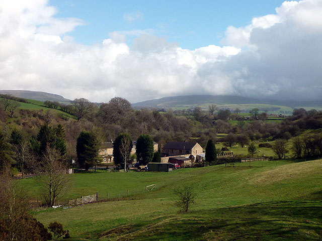
Rising to an elevation of approximately 589 meters (1,932 feet), Bleaberry Hill offers breathtaking panoramic views of the surrounding countryside. Its distinctive shape and lush green slopes make it a standout feature within the landscape, attracting visitors from far and wide. The hill is characterized by its rocky terrain, with scattered outcrops and boulders adding to its charm.

The ascent to Bleaberry Hill can be challenging, but it rewards those who make the effort with incredible vistas. The surrounding area is teeming with diverse flora and fauna, making it a haven for nature lovers. During the spring and summer months, the hillside is adorned with colorful wildflowers, creating a picturesque backdrop for outdoor activities.

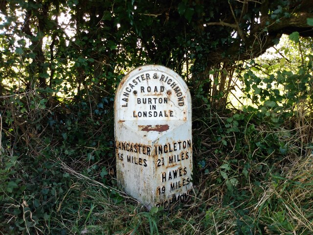
The hill is part of a network of walking trails, including the famous Pennine Way, which passes close by. This makes Bleaberry Hill a popular stop for hikers on long-distance treks. Additionally, the nearby village of Hawes provides amenities and accommodations for those looking to explore the area further.

Overall, Bleaberry Hill offers a unique and immersive experience for visitors. Its natural beauty, coupled with its accessibility and proximity to other attractions, makes it an ideal destination for anyone seeking to explore the stunning Yorkshire countryside.

If you have any feedback on the listing, please let us know in the comments section below.

Bleaberry Hill Images

Images are sourced within 2km of 54.139838/-2.5185217 or Grid Reference SD6671. Thanks to Geograph Open Source API. All images are credited.

Junction of Low Street and Burton Hill The end of terrace house is Pye Cottage; there is an Ordnance Survey cut benchmark on the bottom of the wall adjacent to the large slate kerbstone (photograph <a href="https://www.geograph.org.uk/photo/7160532">SD6572 : Benchmark, Mount View, Burton in Lonsdale</a>).
The green bin is labelled ‘Grit/Salt’ and this is provided to assist vehicles on the steep Burton Hill in winter weather.
Junction of Low Street and Burton Hill
The end of terrace house is Pye Cottage; there is an Ordnance Survey cut benchmark on the bottom of the wall adjacent to the large slate kerbstone (photograph SD6572 : Benchmark, Mount View, Burton in Lonsdale). The green bin is labelled ‘Grit/Salt’ and this is provided to assist vehicles on the steep Burton Hill in winter weather.
Benchmark, Mount View, Burton in Lonsdale Detail of an Ordnance Survey cut benchmark on the plinth of Pye Cottage at the corner of Low Street and Burton Hill.  The benchmark marks a height of 79.6351m above mean sea level (Ordnance Datum Newlyn) last verified in 1970 (location photograph <a href="https://www.geograph.org.uk/photo/7160518">SD6572 : Junction of Low Street and Burton Hill</a>).
Benchmark, Mount View, Burton in Lonsdale
Detail of an Ordnance Survey cut benchmark on the plinth of Pye Cottage at the corner of Low Street and Burton Hill. The benchmark marks a height of 79.6351m above mean sea level (Ordnance Datum Newlyn) last verified in 1970 (location photograph SD6572 : Junction of Low Street and Burton Hill).
All Saints Church, Burton in Lonsdale The church was built between 1868 and 1876, and designed by the Lancaster partnership of Paley and Austin. People note that it was seems a large church for what is a small town, but this is because it was thought the railway would come to the village and its population would expand.

<span class="nowrap"><a title="https://en.wikipedia.org/wiki/All_Saints_Church,_Burton_in_Lonsdale" rel="nofollow ugc noopener" href="https://en.wikipedia.org/wiki/All_Saints_Church,_Burton_in_Lonsdale">Link</a><img style="margin-left:2px;" alt="External link" title="External link - shift click to open in new window" src="https://s1.geograph.org.uk/img/external.png" width="10" height="10"/></span>
All Saints Church, Burton in Lonsdale
The church was built between 1868 and 1876, and designed by the Lancaster partnership of Paley and Austin. People note that it was seems a large church for what is a small town, but this is because it was thought the railway would come to the village and its population would expand. LinkExternal link
Stile, Dumb Tom's Lane The stile is on the public footpath from High Bentham to Ingleton on the north side of Dumb Tom’s Lane.
Stile, Dumb Tom's Lane
The stile is on the public footpath from High Bentham to Ingleton on the north side of Dumb Tom’s Lane.
Bentham Golf Course The path in the grass is the route of the public footpath from High Bentham to Ingleton which crosses the golf course.
Turf has been stripped for use elsewhere on the golf course.
Bentham Golf Course
The path in the grass is the route of the public footpath from High Bentham to Ingleton which crosses the golf course. Turf has been stripped for use elsewhere on the golf course.
Old milestone The second West Riding CC milestone north of the Lancashire/Yorkshire boundary  found almost hidden in the undergrowth.  Compare with <a href="https://www.geograph.org.uk/photo/6043998">SD6572 : Old Milestone by the A687, east of Bogg Bridge, Burton in Lonsdale Parish</a> after it had been lifted and repainted in 2013.
Old milestone
The second West Riding CC milestone north of the Lancashire/Yorkshire boundary found almost hidden in the undergrowth. Compare with SD6572 : Old Milestone by the A687, east of Bogg Bridge, Burton in Lonsdale Parish after it had been lifted and repainted in 2013.
Old milestone The second West Riding milestone north of the Lancashire border after some vegetation had been cleared.   At the base of the right face, RICHMOND almost hidden/43 MILES under soil level.   The rusty bit on the bevel - WILLIAM TOWLER/GLOBE FOUNDRY/LEEDS.
Old milestone
The second West Riding milestone north of the Lancashire border after some vegetation had been cleared. At the base of the right face, RICHMOND almost hidden/43 MILES under soil level. The rusty bit on the bevel - WILLIAM TOWLER/GLOBE FOUNDRY/LEEDS.
Haybers Isolated, semi-ruinous barn on the crest of a hill north of High Bentham.
Haybers
Isolated, semi-ruinous barn on the crest of a hill north of High Bentham.
The view to Ingleborough From the footpath near Haybers, Ingleborough rises beyond the houses on the edge of High Bentham.
The view to Ingleborough
From the footpath near Haybers, Ingleborough rises beyond the houses on the edge of High Bentham.
Eller Gill A pleasant little gill running between drumlin hills north west of High Bentham. Gragareth on the skyline.
Eller Gill
A pleasant little gill running between drumlin hills north west of High Bentham. Gragareth on the skyline.
Footpath above Ellergill Beck Heading south towards High Bentham.
Footpath above Ellergill Beck
Heading south towards High Bentham.
Public footpath to Bankhead Farm and beyond Running west from High Bentham's Robin Lane. Bankhead Farm is the building in the distance.
Public footpath to Bankhead Farm and beyond
Running west from High Bentham's Robin Lane. Bankhead Farm is the building in the distance.
Sun on the road to Bentham A car heads uphill out of Burton after crossing the bridge over the River Greta.
Sun on the road to Bentham
A car heads uphill out of Burton after crossing the bridge over the River Greta.
The valley of the River Greta near Burton-in-Lonsdale Waterside Pottery in the foreground. The clouded height of Ingleborough beyond. The Greta is formed when the Rivers Twiss and Doe combine at Ingleton but does not seem to have a valley named after it (eg Gretadale or Greta Valley). Oddly, Burton-in-Lonsdale is not actually in the valley of the Lune.
The valley of the River Greta near Burton-in-Lonsdale
Waterside Pottery in the foreground. The clouded height of Ingleborough beyond. The Greta is formed when the Rivers Twiss and Doe combine at Ingleton but does not seem to have a valley named after it (eg Gretadale or Greta Valley). Oddly, Burton-in-Lonsdale is not actually in the valley of the Lune.
The valley of the Greta from Bentham Moor Road Faccon Farm on the right and cloud-obscured Ingleborough beyond. The shallow u-shaped valley on the skyline is Chapel-le-Dale, source of the River Doe which combines with the Twiss at Ingleton to form the Greta.
The valley of the Greta from Bentham Moor Road
Faccon Farm on the right and cloud-obscured Ingleborough beyond. The shallow u-shaped valley on the skyline is Chapel-le-Dale, source of the River Doe which combines with the Twiss at Ingleton to form the Greta.
Path by the Greta Fourlands Hill just visible above.
Path by the Greta
Fourlands Hill just visible above.
Sheep pastures near Raygill House Ingleborough hidden by cloud beyond.
Sheep pastures near Raygill House
Ingleborough hidden by cloud beyond.
Stepping stones, Raygill The "stones" are actually cubes of concrete and two are worn away (and yes, my foot slipped in!). The access track to Raygill House (strictly private below the footpath according to a sign) can be glimpsed on the right.
Stepping stones, Raygill
The "stones" are actually cubes of concrete and two are worn away (and yes, my foot slipped in!). The access track to Raygill House (strictly private below the footpath according to a sign) can be glimpsed on the right.
Show me another place!

Bleaberry Hill is located at Grid Ref: SD6671 (Lat: 54.139838, Lng: -2.5185217)

Division: West Riding

Administrative County: North Yorkshire

District: Craven

Police Authority: North Yorkshire

What 3 Words

///vanish.crouches.vowel. Near High Bentham, North Yorkshire

Related Wikis

Nearby Amenities

Located within 500m of 54.139838,-2.5185217
Barnoldswick
Created By: Potlatch 0.10f
Is In: Craven
Place: hamlet
Lat/Long: 54.1424086/-2.5125747
Barrier: stile
Lat/Long: 54.144068/-2.5202979
Generator Method: photovoltaic
Generator Solar Modules: 16
Generator Source: solar
Generator Type: solar_photovoltaic_panel
Power: generator
Lat/Long: 54.1389097/-2.5126874
Bentham Moor
Place: locality
Lat/Long: 54.1378797/-2.5252143
Bleaberry Hill
Natural: peak
Lat/Long: 54.1397227/-2.5190483
Fourlands Hill
Natural: peak
Lat/Long: 54.1370028/-2.5135763
Power: pole
Lat/Long: 54.1416359/-2.5235808
Power: pole
Lat/Long: 54.1423031/-2.524583
Power: pole
Lat/Long: 54.1392392/-2.5119294
Power: pole
Lat/Long: 54.1388109/-2.5124435
Power: pole
Lat/Long: 54.1384559/-2.5125543
Power: pole
Lat/Long: 54.1380207/-2.5126581
Power: pole
Lat/Long: 54.1377762/-2.5127241
Power: pole
Lat/Long: 54.1374612/-2.5128443
Power: pole
Lat/Long: 54.1418279/-2.5127264
Power: pole
Lat/Long: 54.1416884/-2.5115686
The data included in this document is from www.openstreetmap.org. The data is made available under ODbL.

Have you been to Bleaberry Hill?

Leave your review of Bleaberry Hill below (or comments, questions and feedback).