The Gair
Hill, Mountain in Cumberland Carlisle
England
The Gair
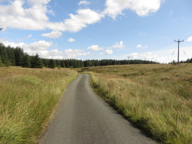
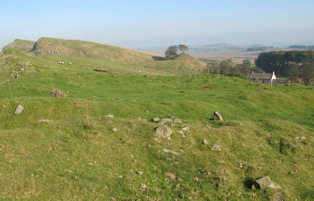
The Gair, located in Cumberland, is a prominent hill/mountain that stands at an elevation of approximately 2,500 feet above sea level. It is situated in the northern region of England, within the picturesque Lake District National Park. The Gair is part of a range of hills known as the Western Fells, which are renowned for their stunning natural beauty and challenging hiking trails.
The Gair offers breathtaking panoramic views of the surrounding landscape, including nearby valleys, lakes, and other peaks such as Pillar and Great Borne. Its distinctive shape and rugged terrain make it a popular destination for outdoor enthusiasts, particularly hikers and mountaineers seeking a challenging ascent.
The hill/mountain is predominantly composed of volcanic rock, giving it a unique geological makeup. The Gair is covered in a mixture of grass, heather, and scattered boulders, creating a diverse and visually stunning landscape. Its slopes are often steep and rocky, requiring careful navigation and a moderate level of fitness to reach the summit.
The Gair is a haven for wildlife, providing a habitat for various species of birds, including peregrine falcons, as well as some rare plant species that thrive in the region's unique microclimate. The hill/mountain is also steeped in history, with evidence of ancient settlements and mining activity dating back centuries.
Overall, The Gair in Cumberland offers outdoor enthusiasts a challenging and rewarding adventure, combining breathtaking views, diverse flora and fauna, and a rich historical background. It is a must-visit destination for those seeking an authentic and memorable experience in the Lake District National Park.
If you have any feedback on the listing, please let us know in the comments section below.
The Gair Images
Images are sourced within 2km of 55.054797/-2.5360446 or Grid Reference NY6573. Thanks to Geograph Open Source API. All images are credited.


The Gair is located at Grid Ref: NY6573 (Lat: 55.054797, Lng: -2.5360446)
Administrative County: Cumbria
District: Carlisle
Police Authority: Cumbria
What 3 Words
///draw.safety.thickened. Near Greenhead, Northumberland
Nearby Locations
Related Wikis

Churnsike Lodge
Churnsike Lodge is an early Victorian hunting lodge situated in the parish of Greystead, West Northumberland, England. Constructed in 1850 by the Charlton...

RAF Spadeadam
RAF Spadeadam (pronounced "Spade Adam") (IATA: N/A, ICAO: EGOM) is a Royal Air Force (RAF) station in Cumbria, England, close to the border with Northumberland...

Popping Stone
The Popping Stone is a group of three rounded boulders in the Irthing Gorge near the village of Gilsland. It was not always this shape, however, and photographs...

Gilsland Spa
Gilsland Spa is the present-day name of a hotel at Gilsland, Cumbria, England. It is named from the sulphurous spring which issues from a cliff below...

Northumbria
Northumbria (; Old English: Norþanhymbra rīċe; Latin: Regnum Northanhymbrorum) was an early medieval Anglo-Saxon kingdom in what is now Northern England...

St Mary Magdalene's Church, Gilsland
St Mary Magdalene’s Church is a small mid-Victorian Anglican church on an isolated hillside in north-east Cumbria, England. Dedicated to Jesus' companion...
Milecastle 45
Milecastle 45 (Walltown) was a milecastle on Hadrian's Wall (grid reference NY67716657). == Description == Milecastle 45 is on the top of Walltown Crags...
Allolee to Walltown
Allolee to Walltown is the name given to a Site of Special Scientific Interest (SSSI) in Northumberland, England. The site, which follows the path of a...
Nearby Amenities
Located within 500m of 55.054797,-2.5360446Have you been to The Gair?
Leave your review of The Gair below (or comments, questions and feedback).