Arnbarrow Hill

Hill, Mountain in Kincardineshire

Scotland

Arnbarrow Hill

Road to the Catterin' Bridge A nice walking path up the side of the burn
Road to the Catterin' Bridge Credit: Ralph Greig

Arnbarrow Hill, located in Kincardineshire, Scotland, is a prominent hill that offers breathtaking views and an enriching experience for nature enthusiasts and hikers. Rising to a height of approximately 400 meters (1,312 feet), it is classified as a hill rather than a mountain due to its lower elevation.

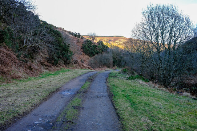
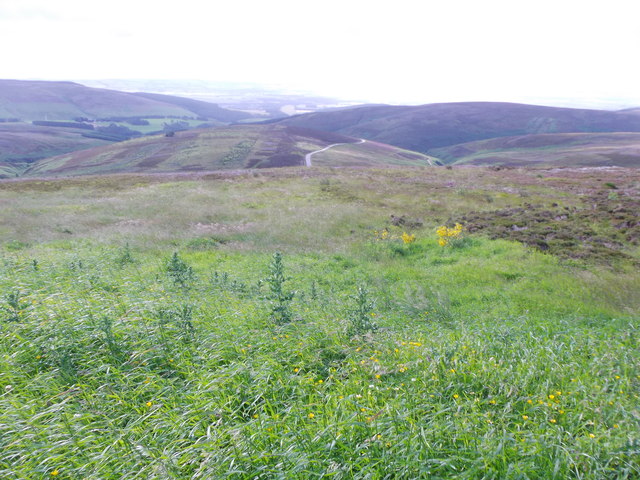
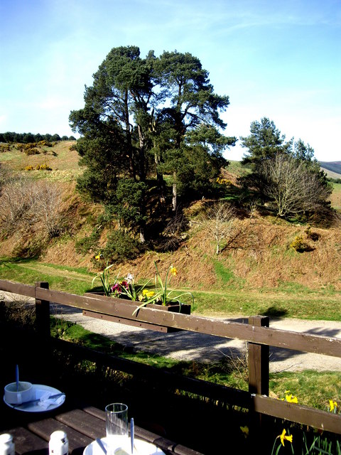
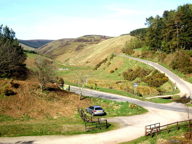
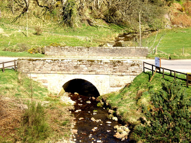
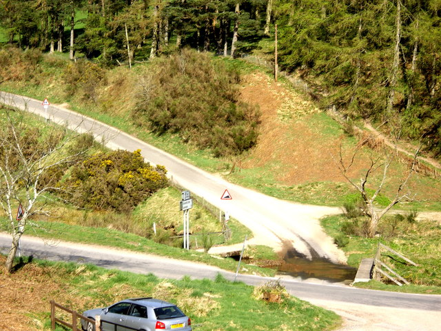
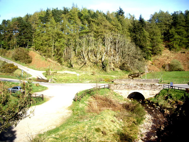
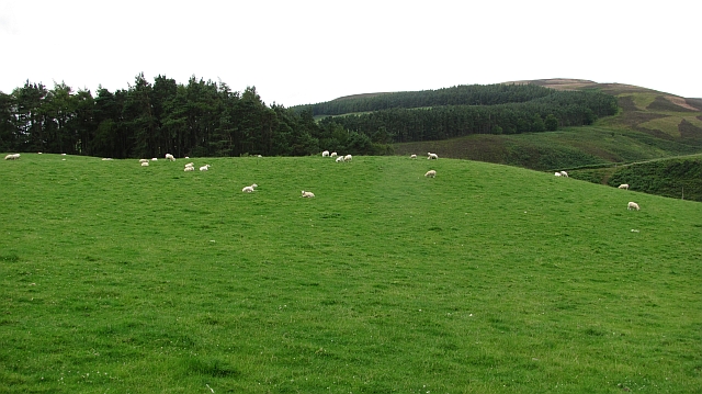
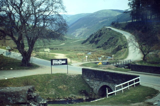
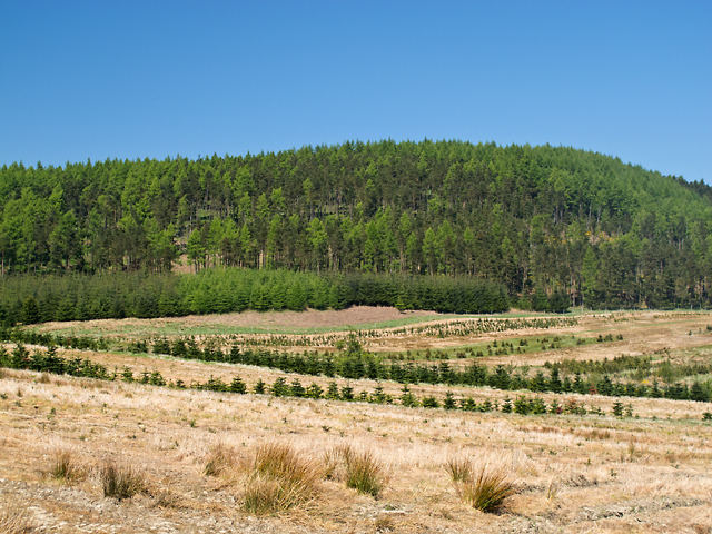
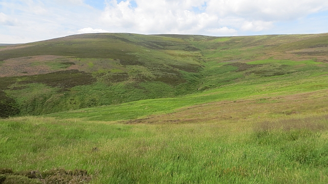
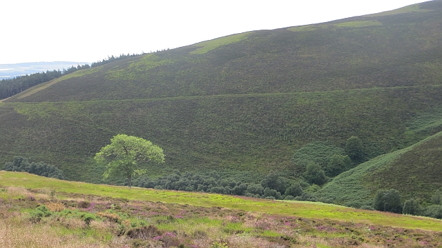
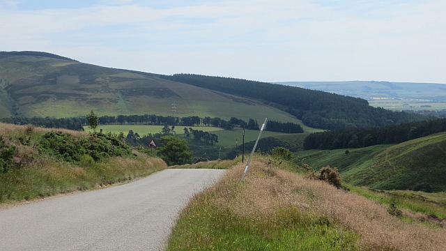
The hill is situated in a picturesque landscape, surrounded by lush greenery, rolling hills, and meandering streams. Its location provides visitors with an opportunity to explore the diverse flora and fauna of the region. The hill is covered in heather and grass, creating a vibrant and colorful scenery throughout the year.

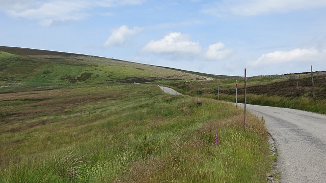
Hikers can enjoy a moderately challenging trail that leads to the summit of Arnbarrow Hill. The trail is well-marked and offers stunning panoramic views of the surrounding countryside, including the North Sea and nearby towns. On clear days, the hill offers a glimpse of the distant mountains of the Cairngorms National Park.

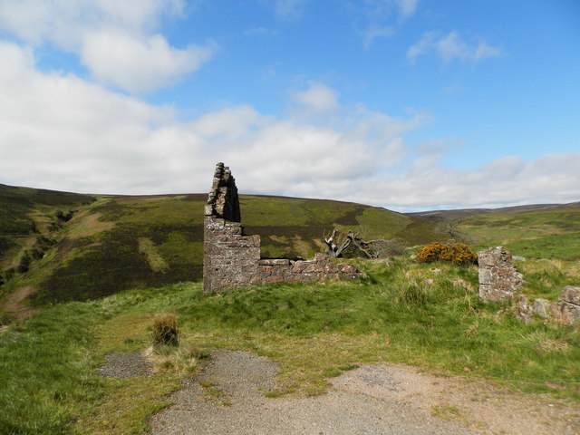
In addition to its natural beauty, Arnbarrow Hill also has historical significance. It is believed to have been used as a lookout point during ancient times, providing strategic advantages for the local inhabitants. Archaeological remains, such as stone circles and burial sites, have been found in the vicinity, adding to the hill's cultural value.

Overall, Arnbarrow Hill is a remarkable destination for those seeking tranquility, natural beauty, and a touch of history. Whether it's hiking, birdwatching, or simply enjoying the serene surroundings, visitors to Arnbarrow Hill are guaranteed an unforgettable experience in the heart of Kincardineshire.

If you have any feedback on the listing, please let us know in the comments section below.

Arnbarrow Hill Images

Images are sourced within 2km of 56.892113/-2.5742779 or Grid Reference NO6578. Thanks to Geograph Open Source API. All images are credited.

Road to the Catterin' Bridge A nice walking path up the side of the burn
Road to the Catterin' Bridge
A nice walking path up the side of the burn
B974 below Cairn O'Mount carpark and viewpoint Descent to Clatterin Brig and Fettercairn.
B974 below Cairn O'Mount carpark and viewpoint
Descent to Clatterin Brig and Fettercairn.
Pine trees By the Clatterin' Brig restaurant
Pine trees
By the Clatterin' Brig restaurant
Snow gates on Cairn O'Mount road Seen from the Clatterin' Brig restaurant.
Snow gates on Cairn O'Mount road
Seen from the Clatterin' Brig restaurant.
Bridge over the Slack Burn Carrying the Old Military Road between Fettercairn and Feughside over the Cairn O'Mount.
Bridge over the Slack Burn
Carrying the Old Military Road between Fettercairn and Feughside over the Cairn O'Mount.
Triple crossing of the Slack Burn The vehicle ford is flanked left by an elevated cycle track, and right by a footbridge.
Triple crossing of the Slack Burn
The vehicle ford is flanked left by an elevated cycle track, and right by a footbridge.
A 'major' road junction in the hills Access to Glensaugh from the old military road at Clatterin' Brig.
A 'major' road junction in the hills
Access to Glensaugh from the old military road at Clatterin' Brig.
Sheep, Glensaugh Grassland above Clattrin Brig.
Sheep, Glensaugh
Grassland above Clattrin Brig.
B974 between Gateside and Clatterin Brig
Clatterin' Brig Stone arched bridge across the Devilly burn and minor road junction at the southern foot of the Cairn o' Mount road.
Clatterin' Brig
Stone arched bridge across the Devilly burn and minor road junction at the southern foot of the Cairn o' Mount road.
Brunt Hill Agricultural land on the lower slopes of Brunt Hill, with Garrol Wood visible in the distance.
Brunt Hill
Agricultural land on the lower slopes of Brunt Hill, with Garrol Wood visible in the distance.
Back Burn of Arnbarrow
Moorland, Cairn o' Mount The steep, southern side of the pass on the Highland Boundary Fault, drained here by the Stag Burn.
Moorland, Cairn o' Mount
The steep, southern side of the pass on the Highland Boundary Fault, drained here by the Stag Burn.
Cairn o' Mount The steeper southern side of the pass.
Cairn o' Mount
The steeper southern side of the pass.
Knowegreens Burn Steep sided V shaped valley beneath the Cairn o' Mount road.
Knowegreens Burn
Steep sided V shaped valley beneath the Cairn o' Mount road.
Cairn o' Mount road The steep southern side of the pass.
Cairn o' Mount road
The steep southern side of the pass.
A view SW up Arnbarrow Hill From by the ruined building on the Old Military Road (B974) up Redstone Hill.
A view SW up Arnbarrow Hill
From by the ruined building on the Old Military Road (B974) up Redstone Hill.
Ruin at roadside of Cairn O' Mount Road See also<a href="https://www.geograph.org.uk/photo/9172">NO6578 : Ruin on the Cairn o Mount road</a> The tree from that time has died back
Ruin at roadside of Cairn O' Mount Road
See alsoNO6578 : Ruin on the Cairn o Mount road The tree from that time has died back
Show me another place!

Arnbarrow Hill is located at Grid Ref: NO6578 (Lat: 56.892113, Lng: -2.5742779)

Unitary Authority: Aberdeenshire

Police Authority: North East

What 3 Words

///stupidly.flesh.expel. Near Laurencekirk, Aberdeenshire

Nearby Locations

Arnbarrow Hill

Related Wikis

Fasque House

Fasque, also known as Fasque House or Fasque Castle, is a mansion in Aberdeenshire, Scotland, situated near the village of Fettercairn, in the former county...

Cairn O' Mounth

Cairn O' Mounth/Cairn O' Mount (Scottish Gaelic: Càrn Mhon) is a high mountain pass in Aberdeenshire, Scotland. The place name is a survival of the ancient...

Kincardine, Aberdeenshire

Kincardine was a burgh in Scotland, near the present-day village of Fettercairn. It served as the first county town of Kincardineshire. The settlement...

Fettercairn distillery

Fettercairn distillery is a whisky distillery in Fettercairn. Situated under the Grampian foothills in the Howe of Mearns, Fettercairn town’s name is...

Nearby Amenities

Located within 500m of 56.892113,-2.5742779
Arnbarrow Hill
Ele: 323
Natural: peak
Lat/Long: 56.8914685/-2.5726045
The data included in this document is from www.openstreetmap.org. The data is made available under ODbL.

Have you been to Arnbarrow Hill?

Leave your review of Arnbarrow Hill below (or comments, questions and feedback).