Hartside Height

Hill, Mountain in Cumberland Eden

England

Hartside Height

Old Milestone by the A686, west of Rowgill Cleugh Carved stone post by the A686, in parish of GLASSONBY (EDEN District), East of Hartside Cafe, 100m above old house, opposite, on grass verge, on South side of road. Alston stone, erected by the Alston turnpike trust in the 19th century. 

Inscription reads:-
ALSTON
5
PENRITH
14 
Cancelled Carved benchmark on front top, rivet on top.

Grade II Listed. List Entry Number: 1327032
<span class="nowrap"><a title="https://historicengland.org.uk/listing/the-list/list-entry/1327032" rel="nofollow ugc noopener" href="https://historicengland.org.uk/listing/the-list/list-entry/1327032">Link</a><img style="margin-left:2px;" alt="External link" title="External link - shift click to open in new window" src="https://s1.geograph.org.uk/img/external.png" width="10" height="10"/></span>

Milestone Society National ID: CU_ALPR05.
Old Milestone by the A686, west of Rowgill Cleugh Credit: Barbara Todd

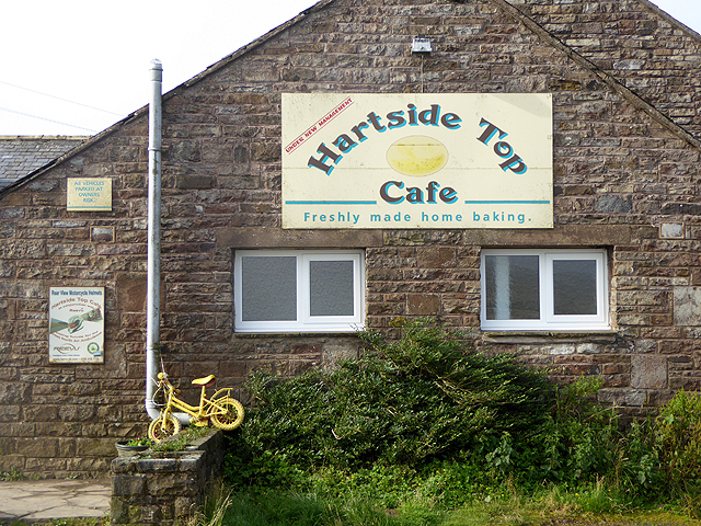
Hartside Height, located in Cumberland, England, is a prominent hill/mountain that offers stunning views and attracts both nature enthusiasts and hikers alike. Rising to an impressive height of 579 meters (1,900 feet), it is one of the highest points in the region and offers panoramic vistas of the surrounding countryside.

Situated in the North Pennines Area of Outstanding Natural Beauty, Hartside Height is known for its rugged and wild terrain, making it a popular destination for adventure seekers. The hill/mountain is covered in a mixture of heather moorland, grassy slopes, and scattered patches of woodland, creating a diverse and picturesque landscape.

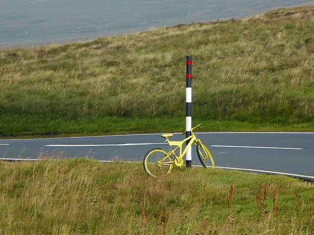
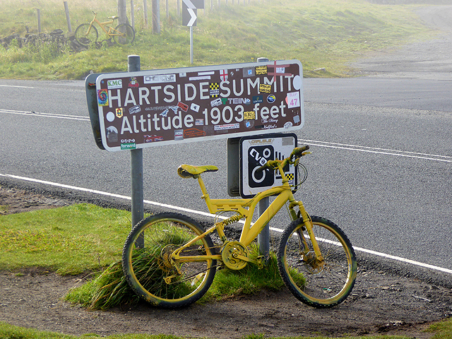
The summit of Hartside Height is marked by a trig point, which serves as a navigational aid for hikers and adds a touch of historical significance to the area. On clear days, visitors are rewarded with breathtaking views stretching across the Lake District, the Solway Firth, and even as far as the Scottish borders.

The hill/mountain is also home to a variety of wildlife, including birds of prey, such as kestrels and buzzards, as well as grouse and other upland species. It is not uncommon to spot sheep grazing peacefully on the slopes, adding to the charm and tranquility of the surroundings.

Hartside Height can be accessed via several walking routes, with the most popular starting from the nearby village of Melmerby. The ascent to the summit can be challenging at times, but the reward of reaching the top and taking in the breathtaking views makes it all worthwhile. Whether you are a seasoned hiker or simply looking for a peaceful retreat in nature, Hartside Height offers a memorable experience in the heart of Cumberland.

If you have any feedback on the listing, please let us know in the comments section below.

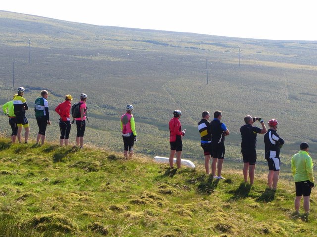
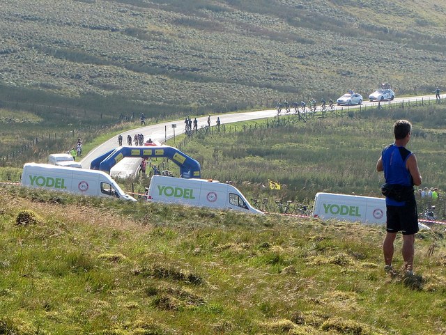
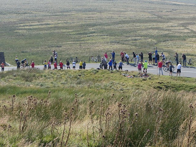
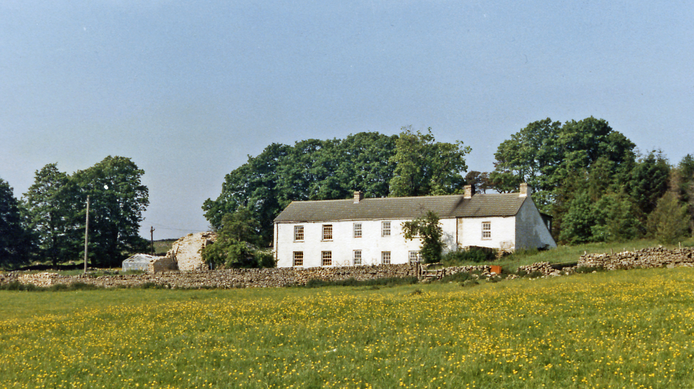
Hartside Height Images

Images are sourced within 2km of 54.777557/-2.544155 or Grid Reference NY6542. Thanks to Geograph Open Source API. All images are credited.

Old Milestone by the A686, west of Rowgill Cleugh Carved stone post by the A686, in parish of GLASSONBY (EDEN District), East of Hartside Cafe, 100m above old house, opposite, on grass verge, on South side of road. Alston stone, erected by the Alston turnpike trust in the 19th century. 

Inscription reads:-
ALSTON
5
PENRITH
14 
Cancelled Carved benchmark on front top, rivet on top.

Grade II Listed. List Entry Number: 1327032
<span class="nowrap"><a title="https://historicengland.org.uk/listing/the-list/list-entry/1327032" rel="nofollow ugc noopener" href="https://historicengland.org.uk/listing/the-list/list-entry/1327032">Link</a><img style="margin-left:2px;" alt="External link" title="External link - shift click to open in new window" src="https://s1.geograph.org.uk/img/external.png" width="10" height="10"/></span>

Milestone Society National ID: CU_ALPR05.
Old Milestone by the A686, west of Rowgill Cleugh
Carved stone post by the A686, in parish of GLASSONBY (EDEN District), East of Hartside Cafe, 100m above old house, opposite, on grass verge, on South side of road. Alston stone, erected by the Alston turnpike trust in the 19th century. Inscription reads:- ALSTON 5 PENRITH 14 Cancelled Carved benchmark on front top, rivet on top. Grade II Listed. List Entry Number: 1327032 LinkExternal link Milestone Society National ID: CU_ALPR05.
The yellow bikes of Hartside (1) Stage 5 of the Aviva Tour of Britain on September 10th runs from Prudhoe in the Tyne valley to the finish on Hartside Pass, the second highest A road in England. The sting in the tail is the gruelling climb on the A686 from Melmerby up to the summit, which gains 414 metres in elevation over a distance of 7.9 km - a climb which is scheduled to take the riders only 10 to 13 minutes!

In anticipation of the arrival of the Tour, large numbers of yellow bikes have been installed  in and around the villages of Langwathby and Melmerby and a handful have now appeared on Hartside summit.
The yellow bikes of Hartside (1)
Stage 5 of the Aviva Tour of Britain on September 10th runs from Prudhoe in the Tyne valley to the finish on Hartside Pass, the second highest A road in England. The sting in the tail is the gruelling climb on the A686 from Melmerby up to the summit, which gains 414 metres in elevation over a distance of 7.9 km - a climb which is scheduled to take the riders only 10 to 13 minutes! In anticipation of the arrival of the Tour, large numbers of yellow bikes have been installed in and around the villages of Langwathby and Melmerby and a handful have now appeared on Hartside summit.
The yellow bikes of Hartside (2) Stage 5 of the Aviva Tour of Britain on September 10th runs from Prudhoe in the Tyne valley to the finish on Hartside Pass, the second highest A road in England. The sting in the tail is the gruelling climb on the A686 from Melmerby up to the summit, which gains 414 metres in elevation over a distance of 7.9 km - a climb which is scheduled to take the riders only 10 to 13 minutes!

In anticipation of the arrival of the Tour, large numbers of yellow bikes have been installed  in and around the villages of Langwathby and Melmerby and a handful have now appeared on Hartside summit.
The yellow bikes of Hartside (2)
Stage 5 of the Aviva Tour of Britain on September 10th runs from Prudhoe in the Tyne valley to the finish on Hartside Pass, the second highest A road in England. The sting in the tail is the gruelling climb on the A686 from Melmerby up to the summit, which gains 414 metres in elevation over a distance of 7.9 km - a climb which is scheduled to take the riders only 10 to 13 minutes! In anticipation of the arrival of the Tour, large numbers of yellow bikes have been installed in and around the villages of Langwathby and Melmerby and a handful have now appeared on Hartside summit.
The yellow bikes of Hartside (3) Stage 5 of the Aviva Tour of Britain on September 10th runs from Prudhoe in the Tyne valley to the finish on Hartside Pass, the second highest A road in England. The sting in the tail is the gruelling climb on the A686 from Melmerby up to the summit, which gains 414 metres in elevation over a distance of 7.9 km - a climb which is scheduled to take the riders only 10 to 13 minutes!

In anticipation of the arrival of the Tour, large numbers of yellow bikes have been installed  in and around the villages of Langwathby and Melmerby and a handful have now appeared on Hartside summit.
The yellow bikes of Hartside (3)
Stage 5 of the Aviva Tour of Britain on September 10th runs from Prudhoe in the Tyne valley to the finish on Hartside Pass, the second highest A road in England. The sting in the tail is the gruelling climb on the A686 from Melmerby up to the summit, which gains 414 metres in elevation over a distance of 7.9 km - a climb which is scheduled to take the riders only 10 to 13 minutes! In anticipation of the arrival of the Tour, large numbers of yellow bikes have been installed in and around the villages of Langwathby and Melmerby and a handful have now appeared on Hartside summit.
Tour of Britain at Hartside finish The fifth and hardest stage of the Tour of Britain cycle race on 10th September 2015 was 166km from Prudhoe in Northumberland to Hartside in Cumbria where there was a summit finish on the road close to the cafe after a  gruelling 8.9km climb from Melmerby <a href="https://www.geograph.org.uk/photo/1745492">NY6441 : Hartside summit</a>

Wout Poels (Team Sky) won the stage, overtaking Edvald Boasson Hagen (MTN-Qhubeka) in the final straight, with Benat Intxausti finishing third, some way behind. Boasson Hagen, did enough to take the overall race lead by a single second.

It is thought that over 5,000 people made the climb to Hartside Fell, by bicycle and on foot, to watch the finish.
Tour of Britain at Hartside finish
The fifth and hardest stage of the Tour of Britain cycle race on 10th September 2015 was 166km from Prudhoe in Northumberland to Hartside in Cumbria where there was a summit finish on the road close to the cafe after a gruelling 8.9km climb from Melmerby NY6441 : Hartside summit Wout Poels (Team Sky) won the stage, overtaking Edvald Boasson Hagen (MTN-Qhubeka) in the final straight, with Benat Intxausti finishing third, some way behind. Boasson Hagen, did enough to take the overall race lead by a single second. It is thought that over 5,000 people made the climb to Hartside Fell, by bicycle and on foot, to watch the finish.
Team buses on closed A686 east of Hartside summit The fifth and hardest stage of the Tour of Britain cycle race on 10th September 2015 was 166km from Prudhoe in Northumberland to Hartside in Cumbria where there was a summit finish on the road close to the cafe after a  gruelling 8.9km climb from Melmerby <a href="https://www.geograph.org.uk/photo/1745492">NY6441 : Hartside summit</a>

Wout Poels (Team Sky) won the stage, overtaking Edvald Boasson Hagen (MTN-Qhubeka) in the final straight, with Benat Intxausti finishing third, some way behind. Boasson Hagen, did enough to take the overall race lead by a single second.

It is thought that over 5,000 people made the climb to Hartside Fell, by bicycle and on foot, to watch the finish.
Team buses on closed A686 east of Hartside summit
The fifth and hardest stage of the Tour of Britain cycle race on 10th September 2015 was 166km from Prudhoe in Northumberland to Hartside in Cumbria where there was a summit finish on the road close to the cafe after a gruelling 8.9km climb from Melmerby NY6441 : Hartside summit Wout Poels (Team Sky) won the stage, overtaking Edvald Boasson Hagen (MTN-Qhubeka) in the final straight, with Benat Intxausti finishing third, some way behind. Boasson Hagen, did enough to take the overall race lead by a single second. It is thought that over 5,000 people made the climb to Hartside Fell, by bicycle and on foot, to watch the finish.
Tour of Britain at Hartside finish The fifth and hardest stage of the Tour of Britain cycle race on 10th September 2015 was 166km from Prudhoe in Northumberland to Hartside in Cumbria where there was a summit finish on the road close to the cafe after a  gruelling 8.9km climb from Melmerby <a href="https://www.geograph.org.uk/photo/1745492">NY6441 : Hartside summit</a>

Wout Poels (Team Sky) won the stage, overtaking Edvald Boasson Hagen (MTN-Qhubeka) in the final straight, with Benat Intxausti finishing third, some way behind. Boasson Hagen, did enough to take the overall race lead by a single second.

It is thought that over 5,000 people made the climb to Hartside Fell, by bicycle and on foot, to watch the finish.
Tour of Britain at Hartside finish
The fifth and hardest stage of the Tour of Britain cycle race on 10th September 2015 was 166km from Prudhoe in Northumberland to Hartside in Cumbria where there was a summit finish on the road close to the cafe after a gruelling 8.9km climb from Melmerby NY6441 : Hartside summit Wout Poels (Team Sky) won the stage, overtaking Edvald Boasson Hagen (MTN-Qhubeka) in the final straight, with Benat Intxausti finishing third, some way behind. Boasson Hagen, did enough to take the overall race lead by a single second. It is thought that over 5,000 people made the climb to Hartside Fell, by bicycle and on foot, to watch the finish.
Tour of Britain at Hartside finish First view of the race.
Tour of Britain at Hartside finish
First view of the race.
Tour of Britain at Hartside finish Race leaders approaching '1km to go' banner.
Tour of Britain at Hartside finish
Race leaders approaching '1km to go' banner.
Tour of Britain at Hartside finish Leading pair of riders within last kilometre.
Tour of Britain at Hartside finish
Leading pair of riders within last kilometre.
Tour of Britain at Hartside finish Leading three riders approaching the finish line at Hartside summit. Wout Poels (Team Sky), here in second place, was to overtake Edvald Boasson Hagen (MTN-Qhubeka) in the final few hundred metres of uphill sprint to win the stage with a 2 seconds advantage.
Tour of Britain at Hartside finish
Leading three riders approaching the finish line at Hartside summit. Wout Poels (Team Sky), here in second place, was to overtake Edvald Boasson Hagen (MTN-Qhubeka) in the final few hundred metres of uphill sprint to win the stage with a 2 seconds advantage.
Tour of Britain at Hartside finish Alberto Bettiol leads out his Team Cannondale Garmin leader, Dylan Van Baarle, for 16th position. The third rider, Robert Kiserlovski riding for Tinkoff-Saxo, overtook Bettiol for 17th place. All three were overtaken in the final sprint by the last two in this racing group, Graham Briggs (JLT Condor) finishing 14th and Gorka Izgirre Insausti (Movistar) 15th.
Tour of Britain at Hartside finish
Alberto Bettiol leads out his Team Cannondale Garmin leader, Dylan Van Baarle, for 16th position. The third rider, Robert Kiserlovski riding for Tinkoff-Saxo, overtook Bettiol for 17th place. All three were overtaken in the final sprint by the last two in this racing group, Graham Briggs (JLT Condor) finishing 14th and Gorka Izgirre Insausti (Movistar) 15th.
Tour of Britain at Hartside finish The fifth and hardest stage of the Tour of Britain cycle race on 10th September 2015 was 166km from Prudhoe in Northumberland to Hartside in Cumbria where there was a summit finish on the road close to the cafe after a  gruelling 8.9km climb from Melmerby <a href="https://www.geograph.org.uk/photo/1745492">NY6441 : Hartside summit</a>

Wout Poels (Team Sky) won the stage, overtaking Edvald Boasson Hagen (MTN-Qhubeka) in the final straight, with Benat Intxausti finishing third, some way behind. Boasson Hagen, did enough to take the overall race lead by a single second.

It is thought that over 5,000 people made the climb to Hartside Fell, by bicycle and on foot, to watch the finish.
Tour of Britain at Hartside finish
The fifth and hardest stage of the Tour of Britain cycle race on 10th September 2015 was 166km from Prudhoe in Northumberland to Hartside in Cumbria where there was a summit finish on the road close to the cafe after a gruelling 8.9km climb from Melmerby NY6441 : Hartside summit Wout Poels (Team Sky) won the stage, overtaking Edvald Boasson Hagen (MTN-Qhubeka) in the final straight, with Benat Intxausti finishing third, some way behind. Boasson Hagen, did enough to take the overall race lead by a single second. It is thought that over 5,000 people made the climb to Hartside Fell, by bicycle and on foot, to watch the finish.
Tour of Britain at Hartside finish Sir Bradley Wiggins (left, at rear of group) finishes Stage 5 at Hartside in 97th place. This group look more pleased just to finish rather than racing for every second. Wiggins team-mate, Andrew Tennant, is on the right.
Tour of Britain at Hartside finish
Sir Bradley Wiggins (left, at rear of group) finishes Stage 5 at Hartside in 97th place. This group look more pleased just to finish rather than racing for every second. Wiggins team-mate, Andrew Tennant, is on the right.
Tour of Britain at Hartside finish Presentation of yellow jersey to Edvald Boasson Hagen of team MTN-Qhubeka, live and on giant TV screen behind.
Tour of Britain at Hartside finish
Presentation of yellow jersey to Edvald Boasson Hagen of team MTN-Qhubeka, live and on giant TV screen behind.
Police motorcycles after the race The fifth and hardest stage of the Tour of Britain cycle race on 10th September 2015 was 166km from Prudhoe in Northumberland to Hartside in Cumbria where there was a summit finish on the road close to the cafe after a  gruelling 8.9km climb from Melmerby <a href="https://www.geograph.org.uk/photo/1745492">NY6441 : Hartside summit</a>

Wout Poels (Team Sky) won the stage, overtaking Edvald Boasson Hagen (MTN-Qhubeka) in the final straight, with Benat Intxausti finishing third, some way behind. Boasson Hagen, did enough to take the overall race lead by a single second.

It is thought that over 5,000 people made the climb to Hartside Fell, by bicycle and on foot, to watch the finish.
Police motorcycles after the race
The fifth and hardest stage of the Tour of Britain cycle race on 10th September 2015 was 166km from Prudhoe in Northumberland to Hartside in Cumbria where there was a summit finish on the road close to the cafe after a gruelling 8.9km climb from Melmerby NY6441 : Hartside summit Wout Poels (Team Sky) won the stage, overtaking Edvald Boasson Hagen (MTN-Qhubeka) in the final straight, with Benat Intxausti finishing third, some way behind. Boasson Hagen, did enough to take the overall race lead by a single second. It is thought that over 5,000 people made the climb to Hartside Fell, by bicycle and on foot, to watch the finish.
Show me another place!

Hartside Height is located at Grid Ref: NY6542 (Lat: 54.777557, Lng: -2.544155)

Administrative County: Cumbria

District: Eden

Police Authority: Cumbria

What 3 Words

///disprove.undivided.wrong. Near Alston, Cumbria

Related Wikis

Black Fell (Pennines)

Black Fell is a hill in the North Pennines, England. It is located just north of the A686 road, west of Alston and is one of the most northerly parts of...

Busk, Cumbria

Busk is a hamlet in Cumbria, England. It is located 3.7 miles (6.0 km) by road to the east of Kirkoswald. == See also == List of places in Cumbria ��2...

Unthank, Glassonby

Unthank is a village near Gamblesby in the civil parish of Glassonby in Cumbria, England. It is first mentioned in writing as Unthanke in 1332. == See... ==

Gamblesby

Gamblesby is a village near Melmerby, and former civil parish, now in the parish of Glassonby, in the Westmorland and Furness district, in the ceremonial...

St John's Church, Gamblesby

St. John's Church was a Victorian parish Church of England church in the village of Gamblesby, Cumbria, England.The Gothic Revival-style church, with tall...

Renwick, Cumbria

Renwick, formerly known as Ravenwick, is a small village and former civil parish, now in the parish of Kirkoswald, in the Eden district, in the county...

Leadgate, Cumbria

Leadgate is a small hamlet located at the foot of Hartside Fell between the town of Alston and the village of Garrigill in the parish of Alston Moor in...

Bayles, Cumbria

Bayles is a hamlet near Alston in Cumbria, England.

Nearby Amenities

Located within 500m of 54.777557,-2.544155
Hartside Height
Ele: 620
Natural: peak
Lat/Long: 54.7774634/-2.5444526
Natural: sinkhole
Lat/Long: 54.7776696/-2.5386512
Natural: sinkhole
Lat/Long: 54.7776696/-2.5380238
Natural: sinkhole
Lat/Long: 54.7774549/-2.5381972
Natural: sinkhole
Lat/Long: 54.777496/-2.5390388
Abandoned: yes
Man Made: mineshaft
Lat/Long: 54.777766/-2.5374583
Abandoned: yes
Man Made: mineshaft
Lat/Long: 54.7779936/-2.5392873
Abandoned: yes
Man Made: mineshaft
Lat/Long: 54.7780167/-2.5391402
Abandoned: yes
Man Made: mineshaft
Lat/Long: 54.7787988/-2.5397777
Abandoned: yes
Man Made: mineshaft
Lat/Long: 54.7792484/-2.5408364
Abandoned: yes
Man Made: mineshaft
Lat/Long: 54.7797484/-2.5407114
Abandoned: yes
Man Made: mineshaft
Lat/Long: 54.7791763/-2.5381896
Abandoned: yes
Man Made: mineshaft
Lat/Long: 54.7791594/-2.5394442
Abandoned: yes
Man Made: mineshaft
Lat/Long: 54.778419/-2.5366766
Abandoned: yes
Man Made: mineshaft
Lat/Long: 54.7788613/-2.5367724
Abandoned: yes
Man Made: mineshaft
Lat/Long: 54.7789839/-2.5369767
Natural: sinkhole
Lat/Long: 54.7777772/-2.5367307
Abandoned: yes
Man Made: mineshaft
Lat/Long: 54.779892/-2.5394617
Abandoned: yes
Man Made: mineshaft
Lat/Long: 54.7802887/-2.53932
Abandoned: yes
Man Made: mineshaft
Lat/Long: 54.7800291/-2.5417001
Abandoned: yes
Man Made: mineshaft
Lat/Long: 54.7801204/-2.5427963
Abandoned: yes
Man Made: mineshaft
Lat/Long: 54.779106/-2.5422086
Abandoned: yes
Man Made: mineshaft
Lat/Long: 54.7805745/-2.5426552
Abandoned: yes
Man Made: mineshaft
Lat/Long: 54.78122/-2.5435992
Abandoned: yes
Man Made: mineshaft
Lat/Long: 54.7786286/-2.5414205
Abandoned: yes
Man Made: mineshaft
Lat/Long: 54.7819191/-2.5428469
Abandoned: yes
Man Made: mineshaft
Lat/Long: 54.7818386/-2.5440824
Abandoned: yes
Man Made: mineshaft
Lat/Long: 54.7765434/-2.5415934
The data included in this document is from www.openstreetmap.org. The data is made available under ODbL.

Have you been to Hartside Height?

Leave your review of Hartside Height below (or comments, questions and feedback).