Black Hill

Hill, Mountain in Northumberland

England

Black Hill

Track, Knaresdale
Track, Knaresdale Credit: Andrew Smith

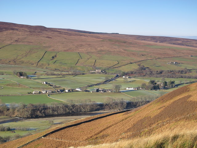
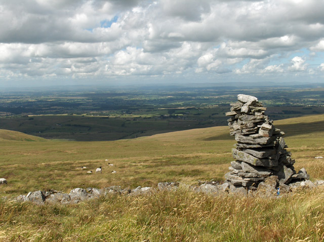
Black Hill is a prominent hill located in the county of Northumberland, England. It stands at an elevation of 610 meters (2,001 feet) above sea level and is part of the Cheviot Hills, which form a natural border between England and Scotland.

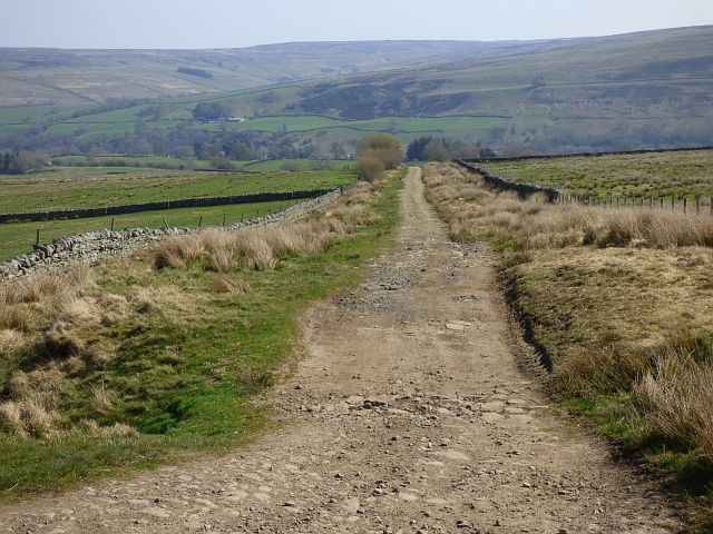
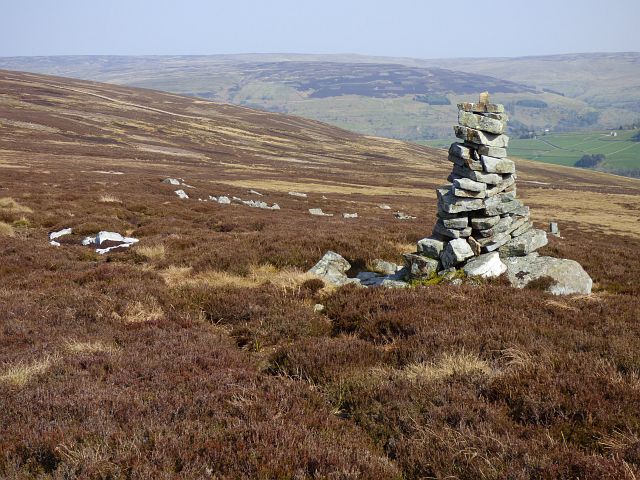
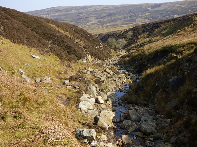
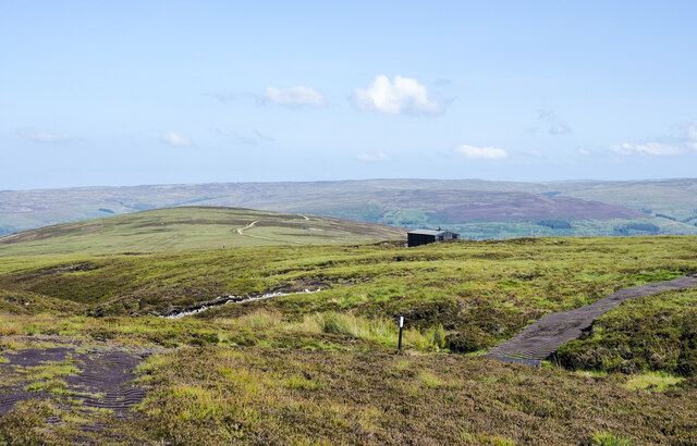
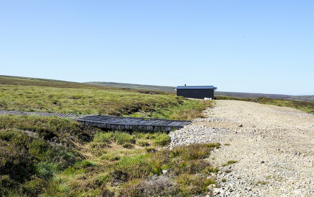
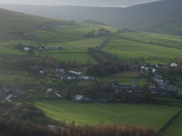
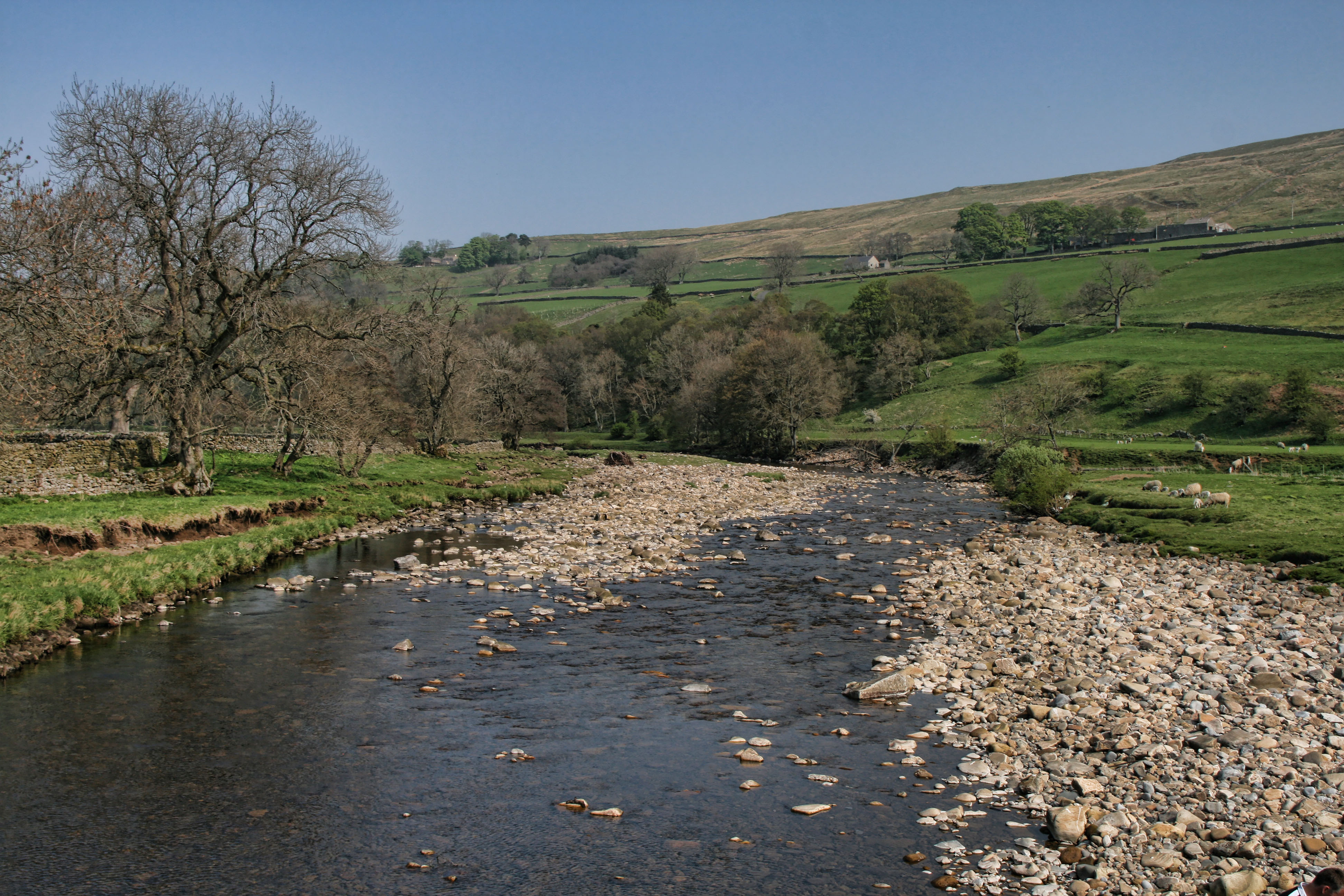
The hill is situated within the Northumberland National Park, renowned for its stunning landscapes and diverse wildlife. Black Hill is surrounded by picturesque moorland, offering breathtaking panoramic views of the surrounding countryside. The summit provides an excellent vantage point to admire the vast expanse of Northumberland, with its rolling hills, deep valleys, and ancient woodlands.

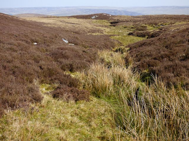
The terrain of Black Hill is characterized by rugged slopes and rocky outcrops, adding to its dramatic and wild appeal. The hill is a popular destination for outdoor enthusiasts, attracting hikers, walkers, and nature lovers year-round. There are various well-marked trails and footpaths that lead to the summit, catering to different levels of difficulty and providing opportunities for exploration and adventure.

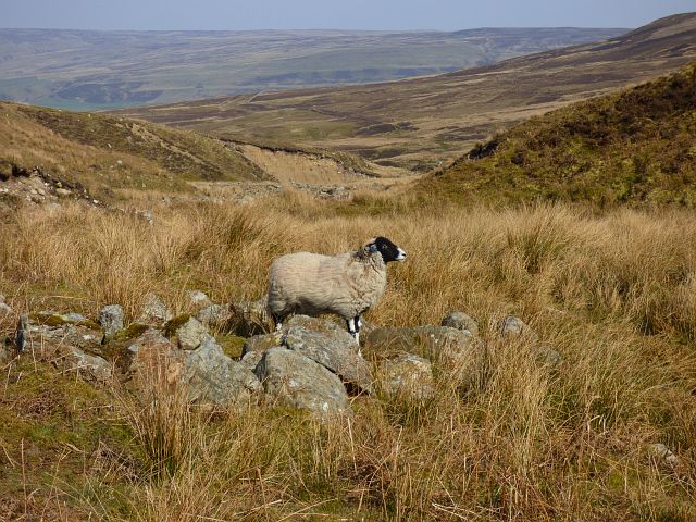
The vegetation on Black Hill is predominantly heather, which blooms in vibrant hues of purple during the summer months, creating a striking contrast against the green landscape. The area is also home to a diverse range of wildlife, including red grouse, curlews, and golden plovers.

Overall, Black Hill offers visitors a unique opportunity to immerse themselves in the natural beauty and tranquility of Northumberland. Whether it's for a challenging hike, a peaceful walk, or simply to enjoy the breathtaking views, this iconic hill is a must-visit destination for nature enthusiasts in the region.

If you have any feedback on the listing, please let us know in the comments section below.

Black Hill Images

Images are sourced within 2km of 54.868569/-2.5451469 or Grid Reference NY6552. Thanks to Geograph Open Source API. All images are credited.

Track, Knaresdale
Track, Knaresdale
Pastures, Knaresdale
Track and moorland, Knaresdale
Bridleway and Hut Burn, Knaresdale
Moorland, Knaresdale
Money Currick and moorland, Knaresdale
Moorland, Knaresdale
Pastures, Knaresdale Looking down on Knar in the valley of Knar Burn.
Pastures, Knaresdale
Looking down on Knar in the valley of Knar Burn.
Road in valley of Knar Burn The road as far as the nearest trees is a public one - yellow on OS maps. At the trees it divides with a branch going to the property at the left edge of the image, Far House; it's unclear whether that road is private. The other branch descends behind the trees as an 'other route with public access'; it goes down to a fine stone bridge over the Knar Burn. From the bridge onwards there are only paths and bridleways.
Road in valley of Knar Burn
The road as far as the nearest trees is a public one - yellow on OS maps. At the trees it divides with a branch going to the property at the left edge of the image, Far House; it's unclear whether that road is private. The other branch descends behind the trees as an 'other route with public access'; it goes down to a fine stone bridge over the Knar Burn. From the bridge onwards there are only paths and bridleways.
Rough grazing on slope of Knars Dale The cultivated, yet still roughly grassed  field is on the north side of a minor road descending to the valley of Knars Dale. The trees are in the valley bottom beyond which there's more cultivation before the ground rises to the moorland of Black Fell.
Rough grazing on slope of Knars Dale
The cultivated, yet still roughly grassed field is on the north side of a minor road descending to the valley of Knars Dale. The trees are in the valley bottom beyond which there's more cultivation before the ground rises to the moorland of Black Fell.
Wall and bridleway north of Hut Burn The wall separates cultivated land on its far side from what is effectively moorland where the bridleway runs. Despite the nature of that land, it's not classified as open access land!
Wall and bridleway north of Hut Burn
The wall separates cultivated land on its far side from what is effectively moorland where the bridleway runs. Despite the nature of that land, it's not classified as open access land!
Grassed over quarry area near to Hanging Shaw The disused quarry is presumably into limestone as there's a lime kiln on the site; it's the tall wall to the left of the tallest tree. The barn is at Hanging Shaw Farm.
Grassed over quarry area near to Hanging Shaw
The disused quarry is presumably into limestone as there's a lime kiln on the site; it's the tall wall to the left of the tallest tree. The barn is at Hanging Shaw Farm.
Plastic matting of hill road crossing moorland An estate road climbs out of Knars Dale bypassing the rounded dome of Black Fell in the middle distance; it continues to end at the shooting hut which is right of centre. From there its nature changes; the route continues as the plastic matting seen wandering over the nearer moorland. The route followed by the matting is shown approximately on OS maps at the 1:25 000 scale but the two do not coincide exactly.
Plastic matting of hill road crossing moorland
An estate road climbs out of Knars Dale bypassing the rounded dome of Black Fell in the middle distance; it continues to end at the shooting hut which is right of centre. From there its nature changes; the route continues as the plastic matting seen wandering over the nearer moorland. The route followed by the matting is shown approximately on OS maps at the 1:25 000 scale but the two do not coincide exactly.
Shooting hut near Mardy's Cleugh An estate road climbs out of Knars Dale bypassing the dome of Black Fell; it continues to end at the shooting hut in the image. From there its nature changes; the route continues as the plastic matting seen branching away to the left, crossing some large timbers. OS mapping at the 1:25 000 scale displays faithfully the route followed by the road as far as the hut but the matting way beyond is shown only approximately.
Shooting hut near Mardy's Cleugh
An estate road climbs out of Knars Dale bypassing the dome of Black Fell; it continues to end at the shooting hut in the image. From there its nature changes; the route continues as the plastic matting seen branching away to the left, crossing some large timbers. OS mapping at the 1:25 000 scale displays faithfully the route followed by the road as far as the hut but the matting way beyond is shown only approximately.
Show me another place!

Black Hill is located at Grid Ref: NY6552 (Lat: 54.868569, Lng: -2.5451469)

Unitary Authority: Northumberland

Police Authority: Northumbria

What 3 Words

///thrilled.mystified.strapping. Near Alston, Cumbria

Nearby Locations

Black Hill

Related Wikis

Aules Hill Meadows

Aules Hill Meadows is the name given to a Site of Special Scientific Interest (SSSI) in Northumberland, England. The site, listed since 1992, is a set...

Slaggyford

Slaggyford is a village in the civil parish of Knaresdale with Kirkhaugh, in Northumberland, England about 5 miles (8 km) north of Alston, Cumbria. It...

Knarsdale

Knarsdale, historically Knaresdale, is a village and former civil parish, now in the parish of Knaresdale with Kirkhaugh, in Northumberland, England about...

Slaggyford railway station

Slaggyford was a railway station on the Alston Line, which ran between Haltwhistle and Alston. The station served the village of Slaggyford in Northumberland...

Geltsdale & Glendue Fells

Geltsdale & Glendue Fells is a Site of Special Scientific Interest in the North Pennines, England. The site has an area of 8059 ha, partly in Cumbria...

Lintley Halt railway station

Lintley Halt is a railway station on the South Tynedale Railway, which runs between Slaggyford and Alston. The station is located about 1+1⁄4 miles (2...

Cold Fell (Pennines)

Cold Fell is a mountain in the northern Pennines, in Cumbria, England. Lying among the northernmost uplands of the North Pennines AONB, it is the most...

Kirkhaugh

Kirkhaugh is a very small village and former civil parish, now in the parish of Knaresdale with Kirkhaugh, adjacent to the River South Tyne in Northumberland...

Nearby Amenities

Located within 500m of 54.868569,-2.5451469
Black Hill
Ele: 484
Natural: peak
Lat/Long: 54.868649/-2.544929
Hunting Stand
Lat/Long: 54.8677757/-2.540211
Hunting Stand
Lat/Long: 54.8676652/-2.5395146
Hunting Stand
Lat/Long: 54.8675498/-2.538852
Hunting Stand
Lat/Long: 54.8674575/-2.5383793
Hunting Stand
Lat/Long: 54.8673519/-2.5377821
Man Made: cairn
Lat/Long: 54.8660608/-2.5399514
The data included in this document is from www.openstreetmap.org. The data is made available under ODbL.

Have you been to Black Hill?

Leave your review of Black Hill below (or comments, questions and feedback).