Warren Hill

Hill, Mountain in Somerset South Somerset

England

Warren Hill

Primary School, North Cadbury
Primary School, North Cadbury Credit: Roger Cornfoot

Warren Hill is a prominent landmark located in Somerset, England. Situated in the Mendip Hills Area of Outstanding Natural Beauty, it is widely regarded as one of the most picturesque and scenic areas in the region. Rising to an elevation of approximately 325 meters (1,066 feet), Warren Hill is classified as a hill rather than a mountain due to its height falling just short of the 600-meter (1,968-foot) threshold.

The hill is characterized by its rolling green slopes, adorned with lush grasslands and scattered pockets of woodland. Its location within the Mendip Hills provides visitors with breathtaking panoramic views of the surrounding landscape, including the nearby cities of Bristol and Bath. On clear days, it is even possible to catch a glimpse of the Bristol Channel and the Welsh mountains in the distance.

Warren Hill is a popular destination for outdoor enthusiasts, offering a range of activities such as hiking, walking, and birdwatching. The hill is home to a diverse array of flora and fauna, including rare plant species and a variety of birdlife. Its tranquil and serene ambiance makes it a haven for nature lovers and those seeking a peaceful escape from the bustling city life.

Additionally, Warren Hill has historical significance, with evidence of human activity dating back to the Neolithic period. Archaeological discoveries have unearthed ancient burial mounds and artifacts, adding to the area's allure and intrigue.

In conclusion, Warren Hill is a stunning natural landmark in Somerset, boasting picturesque views, diverse flora and fauna, and a rich historical background. It offers visitors the opportunity to immerse themselves in the beauty of the Mendip Hills and reconnect with nature.

If you have any feedback on the listing, please let us know in the comments section below.
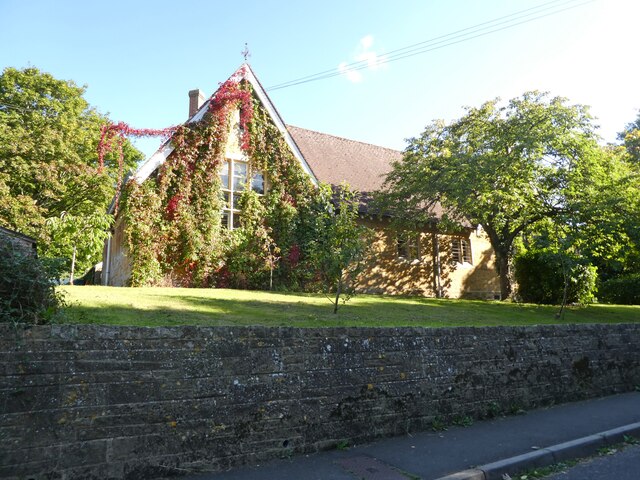
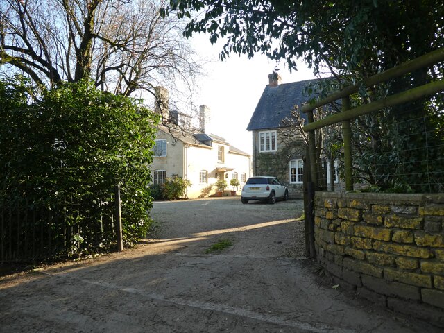
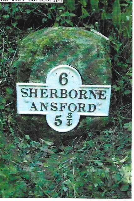
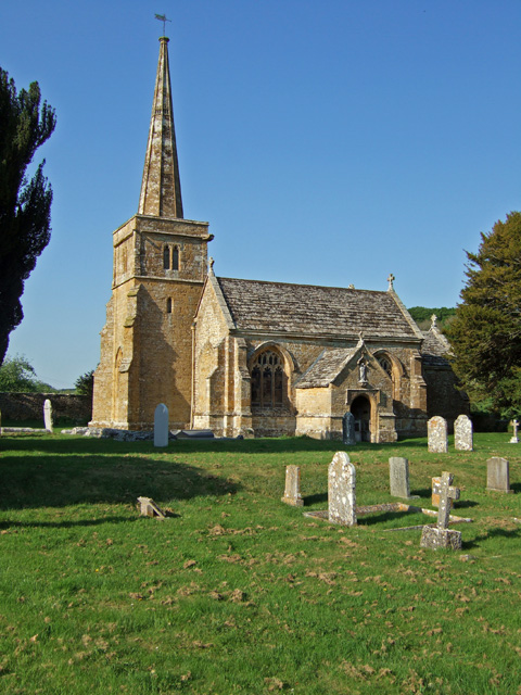
Warren Hill Images

Images are sourced within 2km of 51.035724/-2.5025908 or Grid Reference ST6426. Thanks to Geograph Open Source API. All images are credited.

Primary School, North Cadbury
The Catash Inn
The Catash Inn
Turning for North Cadbury
Rose Cottage
Rose Cottage
Horseshoe Villas
Horseshoe Villas
Entrance, Woolston Manor Farmhouse
Barns at Woolston Manor Farm
'Saltersford' Appears to have replaced a row of cottages.
'Saltersford'
Appears to have replaced a row of cottages.
Crossroads, near Woolston
Teals farm shop at South Cadbury This large farm shop includes a cafe, a deli and a butcher's. It even has its own cider orchard and beehives.
Teals farm shop at South Cadbury
This large farm shop includes a cafe, a deli and a butcher's. It even has its own cider orchard and beehives.
The gable end of Teals farm shop at South Cadbury
Old Milestone by road, SouthWest of Blackford The Milestone is located buried in hedge on the E of the road.  Parish of Compton Pauncefoot (South Somerset District). Metal plate attached to stone post, Sherbourne iron plate design, erected by the Sherborne turnpike trust in the 19th Century, very rusty. An earlier photograph can be found here: <a title="https://www.geograph.org.uk/photo/6102260" href="https://www.geograph.org.uk/photo/6102260">Link</a> 

Inscription reads:-   
6 / SHERBORNE / ANSFORD / 5¾ 

Grade II listed. List Entry Number: 1056556 <span class="nowrap"><a title="https://historicengland.org.uk/listing/the-list/list-entry/1056556" rel="nofollow ugc noopener" href="https://historicengland.org.uk/listing/the-list/list-entry/1056556">Link</a><img style="margin-left:2px;" alt="External link" title="External link - shift click to open in new window" src="https://s1.geograph.org.uk/img/external.png" width="10" height="10"/></span> 

Milestone Society National ID: SO_SBAF06
Old Milestone by road, SouthWest of Blackford
The Milestone is located buried in hedge on the E of the road.  Parish of Compton Pauncefoot (South Somerset District). Metal plate attached to stone post, Sherbourne iron plate design, erected by the Sherborne turnpike trust in the 19th Century, very rusty. An earlier photograph can be found here: Link  Inscription reads:- 6 / SHERBORNE / ANSFORD / 5¾ Grade II listed. List Entry Number: 1056556 LinkExternal link Milestone Society National ID: SO_SBAF06
Compton Pauncefoot : Road A road off the A303.
Compton Pauncefoot : Road
A road off the A303.
Compton Pauncefoot: near the church and manor house In the 19th century the Manor House was Compton Farm's farmhouse. The church is dedicated to the Blessed Virgin Mary
Compton Pauncefoot: near the church and manor house
In the 19th century the Manor House was Compton Farm's farmhouse. The church is dedicated to the Blessed Virgin Mary
Compton Pauncefoot: church path The church is dedicated to the Blessed Virgin Mary
Compton Pauncefoot: church path
The church is dedicated to the Blessed Virgin Mary
Compton Pauncefoot: edge of the village Houses near the western end of Hockley Lane
Compton Pauncefoot: edge of the village
Houses near the western end of Hockley Lane
Compton Pauncefoot: Downyard This barn complex, now known as Downyard, was part of Compton Farm in the late 19th century. The barns have been converted and now provide residential accommodation
Compton Pauncefoot: Downyard
This barn complex, now known as Downyard, was part of Compton Farm in the late 19th century. The barns have been converted and now provide residential accommodation
Compton Pauncefoot: church and manor house Seen from a field path to Lower Woolston
Compton Pauncefoot: church and manor house
Seen from a field path to Lower Woolston
Show me another place!

Warren Hill is located at Grid Ref: ST6426 (Lat: 51.035724, Lng: -2.5025908)

Administrative County: Somerset

District: South Somerset

Police Authority: Avon and Somerset

What 3 Words

///oiled.scribble.assurance. Near Castle Cary, Somerset

Related Wikis

Compton Pauncefoot

Compton Pauncefoot is a village and civil parish in Somerset, England, situated beside the A303 road, 5 miles (8.0 km) south west of Wincanton in the South...

Church of St Mary, Compton Pauncefoot

The Anglican Church of St Mary in Compton Pauncefoot, Somerset, England was built in the 15th century. It is a Grade II* listed building. == History... ==

Church of St Michael, Blackford

The Anglican Church of St Michael in Blackford, Somerset, England was built in the 11th or 12th century. It is a Grade II* listed building. == History... ==

Blackford, Somerset

Blackford is a village and former civil parish in the county of Somerset, England, beside the A303 road, 4 miles (6.4 km) south west of Wincanton. There...

North Cadbury Court

North Cadbury Court in North Cadbury, Somerset, England is a country house built around 1580–1610, by Sir Francis Hastings. It has been designated as a...

Church of St Michael, North Cadbury

The Church of St Michael in North Cadbury, Somerset, England, dates from 1417, although the tower was built a few years earlier. It has been designated...

Woolston Manor

Woolston Manor was an estate that covered about 230 acres (93 ha) in Somerset, England. It included arable land and pasturage, worked by a tenant farmer...

South Cadbury

South Cadbury is a village and former civil parish, now in the parish of South Cadbury and Sutton Montis, in the Somerset district of the ceremonial county...

Nearby Amenities

Located within 500m of 51.035724,-2.5025908
Compton Pauncefoot
Is In: Somerset, England, UK
Place: village
Source: NPE
Wikidata: Q5157171
Wikipedia: en:Compton Pauncefoot
Lat/Long: 51.0326705/-2.5069117
Material: wood
Power: pole
Lat/Long: 51.0368425/-2.5072276
Power: pole
Lat/Long: 51.0367808/-2.5056352
Material: wood
Power: pole
Lat/Long: 51.0367279/-2.504052
Power: pole
Lat/Long: 51.036678/-2.5024969
Material: wood
Power: pole
Lat/Long: 51.0366516/-2.5003674
Power: pole
Lat/Long: 51.0366516/-2.4977756
Power: pole
Lat/Long: 51.0361259/-2.4954779
Power: pole
Lat/Long: 51.0364694/-2.5092953
The data included in this document is from www.openstreetmap.org. The data is made available under ODbL.

Have you been to Warren Hill?

Leave your review of Warren Hill below (or comments, questions and feedback).