Boulzie Hill

Hill, Mountain in Angus

Scotland

Boulzie Hill

Rocky shore at the east end of the West Links, Arbroath
Rocky shore at the east end of the West Links, Arbroath Credit: Mike Pennington

Boulzie Hill is a prominent hill located in the county of Angus, Scotland. It is situated approximately 5 miles southwest of the town of Forfar, and stands at an elevation of 1,407 feet (429 meters). The hill is part of the Sidlaw Hills range, which stretches across the eastern part of Scotland.

Boulzie Hill boasts a distinctive conical shape, with steep grassy slopes that provide a challenging ascent for hikers and hillwalkers. It offers panoramic views of the surrounding countryside, including the fertile farmland of Strathmore and the rolling hills of Angus.

The hill is known for its rich historical significance. It is home to the Boulzie Limekilns, which are a group of well-preserved limekilns dating back to the 19th century. Lime was an important commodity during this time, used for agricultural improvement and construction. The kilns were used to burn limestone, producing lime which was then spread on fields or used in building materials.

Boulzie Hill is also a popular destination for wildlife enthusiasts. The hill is home to a variety of bird species, including buzzards, kestrels, and peregrine falcons. Visitors may also spot hares, foxes, and other small mammals in the area.

Access to Boulzie Hill is relatively easy, with a number of footpaths and trails leading to its summit. It provides an excellent opportunity for outdoor enthusiasts to enjoy a challenging hike while taking in the beautiful scenery and historical landmarks of Angus.

If you have any feedback on the listing, please let us know in the comments section below.
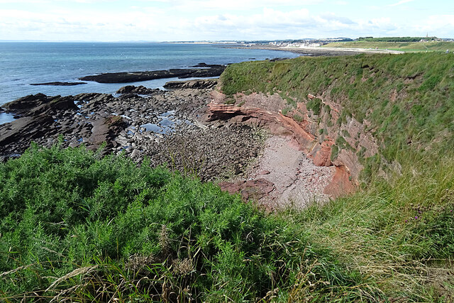
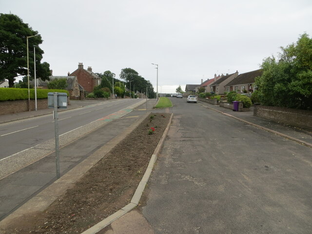
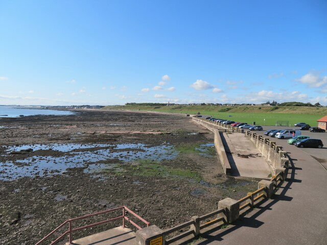
Boulzie Hill Images

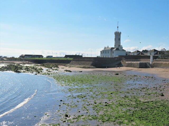
Images are sourced within 2km of 56.56096/-2.5745701 or Grid Reference NO6441. Thanks to Geograph Open Source API. All images are credited.
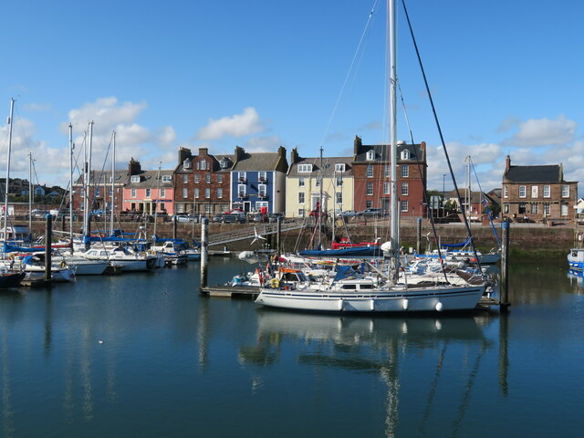
Rocky shore at the east end of the West Links, Arbroath
Stony Beach The only land in this square is the beach of stones south of the West Links.
Stony Beach
The only land in this square is the beach of stones south of the West Links.
Beach giving way to stones, West Links, Arbroath
Low tide, West Links, Arbroath
Whiting Ness This is the end of the cliffs, and the place where the <a href="https://www.geograph.org.uk/photo/5496385">NO6541 : Angular Unconformity</a> is easiest to see without slithering over the rocks at sea level.
Whiting Ness
This is the end of the cliffs, and the place where the NO6541 : Angular Unconformity is easiest to see without slithering over the rocks at sea level.
The Blowhole One of several holes where sea spray is deflected up through a hole in stormy weather.
The Blowhole
One of several holes where sea spray is deflected up through a hole in stormy weather.
Dickmont's Den This is the largest of the inlets created by collapsed sea caves along this stretch of cliffs.
Dickmont's Den
This is the largest of the inlets created by collapsed sea caves along this stretch of cliffs.
Blowhole One of several holes where sea spray is deflected up through a hole in stormy weather.
Blowhole
One of several holes where sea spray is deflected up through a hole in stormy weather.
The Needle's E'e Looking through the Eye of the Needle. This arch is unusual in being parallel to the shore.
The Needle's E'e
Looking through the Eye of the Needle. This arch is unusual in being parallel to the shore.
Through cave to Mermaid's Kirk This is how the sea gets into Mermaid's Kirk. At this low tide level - 1.2 m - most of this is wadeable.
Through cave to Mermaid's Kirk
This is how the sea gets into Mermaid's Kirk. At this low tide level - 1.2 m - most of this is wadeable.
The Crusie from below
The Crusie and Crusie West Cave The Crusie blowhole/arch is on the right and Crusie W cave on the left. Taken very near a 0.7 m fairly low low tide. This is why kelp is partly above water on the left.
The Crusie and Crusie West Cave
The Crusie blowhole/arch is on the right and Crusie W cave on the left. Taken very near a 0.7 m fairly low low tide. This is why kelp is partly above water on the left.
Housing on Carnie Road (A933), Arbroath Looking south-eastward.
Housing on Carnie Road (A933), Arbroath
Looking south-eastward.
Promenade and Victoria Park A long curving promenade backed by a road and a large open green area known as Victoria park at the NE end of Arbroath.
Promenade and Victoria Park
A long curving promenade backed by a road and a large open green area known as Victoria park at the NE end of Arbroath.
Inner harbour and marina, Arbroath Plenty of yachts and other boats in the attractive inner harbour, which is backed by some colourful period buildings.
Inner harbour and marina, Arbroath
Plenty of yachts and other boats in the attractive inner harbour, which is backed by some colourful period buildings.
Signal tower museum, Arbroath Built in 1813 as a communications tower for the bell Rock lighthouse which stands some 9 miles offshore. The work of Robert Stevenson. This reminds me of similar structures on the islands of Erraid and Tiree, all works of the Stevenson family.
Signal tower museum, Arbroath
Built in 1813 as a communications tower for the bell Rock lighthouse which stands some 9 miles offshore. The work of Robert Stevenson. This reminds me of similar structures on the islands of Erraid and Tiree, all works of the Stevenson family.
Westhaven memorial by the harbour The Westhaven was an Arbroath fishing boat that was lost at sea on 10th March 1997 with the loss of four crew. The circumstances were not associated with bad weather, but because fishing gear had become trapped in an underwater obstacle [a pipeline] and the boat capsized.
Westhaven memorial by the harbour
The Westhaven was an Arbroath fishing boat that was lost at sea on 10th March 1997 with the loss of four crew. The circumstances were not associated with bad weather, but because fishing gear had become trapped in an underwater obstacle [a pipeline] and the boat capsized.
Gayfield Park Home of Arbroath Football Club, known as the 'Red Lichties' [whatever that means]. The club appear to be on the up and in the current 2021-22 season are playing in the Scottish Championship alongside such clubs as Inverness and Kilmarnock. The ground capacity is 6600 of which there are just 861 seats.
Gayfield Park
Home of Arbroath Football Club, known as the 'Red Lichties' [whatever that means]. The club appear to be on the up and in the current 2021-22 season are playing in the Scottish Championship alongside such clubs as Inverness and Kilmarnock. The ground capacity is 6600 of which there are just 861 seats.
Show me another place!

Boulzie Hill is located at Grid Ref: NO6441 (Lat: 56.56096, Lng: -2.5745701)

Unitary Authority: Angus

Police Authority: Tayside

What 3 Words

///issued.tower.atom. Near Arbroath, Angus

Related Wikis

Nearby Amenities

Located within 500m of 56.56096,-2.5745701
Source: PGS
Lat/Long: 56.5574256/-2.5752273
Source: PGS
Lat/Long: 56.5582139/-2.5733733
Source: PGS
Lat/Long: 56.5591607/-2.5713133
Source: PGS
Lat/Long: 56.5599171/-2.56994
Source: PGS
Lat/Long: 56.5603191/-2.5683521
Mini Roundabout
Direction: clockwise
Lat/Long: 56.5579799/-2.57517
Bus Stop
Abbey Path
Naptan AtcoCode: 6490IM047
Naptan Bearing: NE
Naptan CommonName: Abbey Path
Naptan Indicator: at Abbey
Naptan NaptanCode: 26426389
Naptan Verified: no
Source: naptan_import
Lat/Long: 56.5617351/-2.5818524
Bus Stop
Seaton Road
Naptan AtcoCode: 6490IM1083
Naptan Bearing: N
Naptan CommonName: Seaton Road
Naptan Indicator: near Gowanlea
Naptan Landmark: Gowanlea
Naptan NaptanCode: 26423548
Naptan Street: Seaton Road
Naptan Verified: no
Source: naptan_import
Lat/Long: 56.5635914/-2.5734756
Bus Stop
Old and Abbey Church
Naptan AtcoCode: 6490IM1193
Naptan Bearing: S
Naptan CommonName: Old and Abbey Church
Naptan Indicator: at Abbey Path
Naptan Landmark: Old and Abbey Church
Naptan NaptanCode: 26426386
Naptan Street: Abbey Park
Naptan Verified: no
Source: naptan_import
Lat/Long: 56.5614498/-2.5819366
Bus Stop
Horologe Hill
Naptan AtcoCode: 6490IM1250
Naptan Bearing: S
Naptan CommonName: Horologe Hill
Naptan Indicator: near Seaton Road
Naptan Landmark: Hayshead School
Naptan NaptanCode: 26423295
Naptan Street: Horologe Hill
Naptan Verified: no
Source: naptan_import
Lat/Long: 56.5650775/-2.5726845
Bus Stop
Hayshead Road
Naptan AtcoCode: 6490IM1453
Naptan Bearing: S
Naptan BusStopType: CUS
Naptan CommonName: Hayshead Road
Naptan Indicator: opp Hayswell Park
Naptan Landmark: Park
Naptan NaptanCode: 26425874
Naptan Street: Hayshead Road
Naptan Verified: no
Source: naptan_import
Lat/Long: 56.5649858/-2.5769628
Bus Stop
Hayshead Road
Naptan AtcoCode: 6490IM1454
Naptan Bearing: NW
Naptan CommonName: Hayshead Road
Naptan Indicator: at Seaton Road
Naptan NaptanCode: 26425875
Naptan Street: Hayshead Road
Naptan Verified: no
Source: naptan_import
Lat/Long: 56.5629628/-2.5753536
Bus Stop
Hayshead Road
Naptan AtcoCode: 6490IM1455
Naptan Bearing: SE
Naptan BusStopType: CUS
Naptan CommonName: Hayshead Road
Naptan Indicator: near Seaton Road
Naptan NaptanCode: 26425876
Naptan Street: Hayshead Road
Naptan Verified: no
Source: naptan_import
Lat/Long: 56.5630099/-2.5748987
Bus Stop
Boulziehill Place
Bus: yes
Local Ref: AT
Naptan AtcoCode: 6490IM1676
Naptan Bearing: SW
Naptan BusStopType: CUS
Naptan CommonName: Boulziehill Place
Naptan Indicator: at
Naptan NaptanCode: 26426958
Naptan Street: Cliffburn Road
Naptan Verified: no
Public Transport: platform
Source: naptan_import
Lat/Long: 56.5618046/-2.5712846
Bus Stop
Edradour Gardens
Local Ref: AT
Naptan AtcoCode: 6490IM1677
Naptan Bearing: SW
Naptan BusStopType: CUS
Naptan CommonName: Edradour Gardens
Naptan Indicator: at
Naptan NaptanCode: 26426959
Naptan Street: Cliffburn Road
Naptan Verified: no
Source: naptan_import
Lat/Long: 56.5627541/-2.5679958
Bus Stop
Clyde Court
Bus: yes
Local Ref: AT
Naptan AtcoCode: 6490IM1678
Naptan Bearing: NW
Naptan BusStopType: CUS
Naptan CommonName: Clyde Court
Naptan Indicator: at
Naptan NaptanCode: 26426962
Naptan Street: Cliffburn Road
Naptan Verified: no
Public Transport: platform
Source: naptan_import
Lat/Long: 56.5618802/-2.5743772
Bus Stop
Hayshead Road
Naptan AtcoCode: 6490IM2017
Naptan Bearing: W
Naptan CommonName: Hayshead Road
Naptan Indicator: at Hayswell Park
Naptan Landmark: Park
Naptan NaptanCode: 26425845
Naptan Street: Hayshead Road
Naptan Verified: no
Source: naptan_import
Lat/Long: 56.5650111/-2.5773211
Bus Stop
High Street
Naptan AtcoCode: 6490IM211
Naptan Bearing: W
Naptan CommonName: High Street
Naptan Indicator: at Gala Club
Naptan Landmark: Gala Club
Naptan NaptanCode: 26423472
Naptan Street: High Street
Naptan Verified: no
Source: naptan_import
Lat/Long: 56.559115/-2.5816893
Bus Stop
ACCESS Office
Local Ref: AT
Naptan AtcoCode: 6490IM329
Naptan Bearing: NW
Naptan CommonName: ACCESS Office
Naptan Indicator: at
Naptan Landmark: Old Parish Church
Naptan NaptanCode: 26423586
Naptan Street: West Abbey Street
Naptan Verified: no
Source: naptan_import
Lat/Long: 56.5600816/-2.5805652
Bus Stop
Clyde Court
Naptan AtcoCode: 6490IM352
Naptan Bearing: E
Naptan CommonName: Clyde Court
Naptan Indicator: opp
Naptan NaptanCode: 26423425
Naptan Street: Cliffburn Road
Naptan Verified: no
Source: naptan_import
Lat/Long: 56.5620151/-2.5743467
Bus Stop
Crown Inn
Naptan AtcoCode: 6490IM386
Naptan Bearing: W
Naptan CommonName: Crown Inn
Naptan Indicator: opp Crown Inn
Naptan Landmark: Crown Inn
Naptan NaptanCode: 26423589
Naptan Street: West Abbey Street
Naptan Verified: no
Source: naptan_import
Lat/Long: 56.5611443/-2.5819319
Bus Stop
Abbey Health Centre
Naptan AtcoCode: 6490IM538
Naptan Bearing: W
Naptan CommonName: Abbey Health Centre
Naptan Indicator: at East Abbey Street
Naptan Landmark: Abbey Health Centre
Naptan NaptanCode: 26423454
Naptan Street: East Abbey Street
Naptan Verified: no
Source: naptan_import
Lat/Long: 56.5616635/-2.5812626
Bus Stop
Crown Inn
Naptan AtcoCode: 6490IM567
Naptan Bearing: SE
Naptan CommonName: Crown Inn
Naptan Indicator: at Crown Inn
Naptan Landmark: Crown Inn
Naptan NaptanCode: 26423587
Naptan Street: West Abbey Street
Naptan Verified: no
Source: naptan_import
Lat/Long: 56.5611637/-2.5816394
Bus Stop
3
Naptan AtcoCode: 6490IM678
Naptan Bearing: E
Naptan CommonName: Abbey Health Centre
Naptan Indicator: East Abbey Street at Health Centre
Naptan Landmark: Abbey Health Centre
Naptan NaptanCode: 26423453
Naptan Street: East Abbey Street
Naptan Verified: no
Source: naptan_import
Lat/Long: 56.5617588/-2.581162
Bus Stop
Edradour Gardens
Naptan AtcoCode: 6490IM727
Naptan Bearing: N
Naptan CommonName: Edradour Gardens
Naptan Indicator: opp
Naptan NaptanCode: 26423427
Naptan Street: Cliffburn Road
Naptan Verified: no
Source: naptan_import
Lat/Long: 56.5629607/-2.5679989
Bus Stop
Springfield Health Centre
Naptan AtcoCode: 6490IM880
Naptan Bearing: N
Naptan CommonName: Springfield Health Centre
Naptan Indicator: opposite Health Centre
Naptan Landmark: Fire Station
Naptan NaptanCode: 26423538
Naptan Street: Ponderlaw Street
Naptan Verified: no
Source: naptan_import
Lat/Long: 56.5609248/-2.5769986
Bus Stop
Springfield Medical Centre
Naptan AtcoCode: 6490IM881
Naptan Bearing: NE
Naptan BusStopType: CUS
Naptan CommonName: Springfield Medical Centre
Naptan Indicator: at Health Centre
Naptan Landmark: opp Fire Station
Naptan NaptanCode: 26423539
Naptan Street: Ponderlaw Street
Naptan Verified: no
Source: naptan_import
Lat/Long: 56.5610045/-2.5772276
Bus Stop
Boulziehill Place
Naptan AtcoCode: 6490IM882
Naptan Bearing: NE
Naptan CommonName: Boulziehill Place
Naptan Indicator: opp
Naptan NaptanCode: 26423426
Naptan Street: Cliffburn Road
Naptan Verified: no
Source: naptan_import
Lat/Long: 56.5619748/-2.571401
Bus Stop
Seaton Road
Naptan AtcoCode: 6490IM888
Naptan Bearing: S
Naptan CommonName: Seaton Road
Naptan Indicator: opp Gowanlea
Naptan Landmark: Gowanlea
Naptan NaptanCode: 26423562
Naptan Street: Seaton Road
Naptan Verified: no
Source: naptan_import
Lat/Long: 56.5632129/-2.5737303
Taxi
Kirk Square Taxi Rank
Naptan AtcoCode: 6490TX003
Naptan CommonName: Kirk Square Taxi Rank
Naptan Landmark: Near Library
Naptan Street: Kirk Square
Naptan Verified: no
Source: naptan_import
Lat/Long: 56.5598452/-2.5811636
Post Box
Operator: Royal Mail
Operator Wikidata: Q638098
Post Box Apertures: 4
Post Box Type: wall
Lat/Long: 56.5585272/-2.5805226
Telephone
Kirk Square
Booth: K6
Covered: booth
Listed Status: Category B
Lat/Long: 56.5598903/-2.5809218
Bank
Santander
Addr City: Arbroath
Addr Housenumber: 167
Addr Postcode: DD11 1DY
Addr Street: High Street
Atm: yes
Brand: Santander
Brand Wikidata: Q7420065
Brand Wikipedia: en:Santander Bank
Lat/Long: 56.5598667/-2.581312
Atm
Operator: Royal Bank of Scotland
Lat/Long: 56.5605436/-2.5823769
Fire Station
Arbroath Fire Station
Lat/Long: 56.5607447/-2.5771789
WHSmith
Brand: WHSmith
Brand Wikidata: Q1548712
Brand Wikipedia: en:WHSmith
Shop: newsagent
Lat/Long: 56.5604847/-2.5824497
Pharmacy
Boots
Addr City: Arbroath
Addr Housenumber: 142-146
Addr Postcode: DD11 1HN
Addr Street: High Street
Branch: Arbroath
Brand: Boots
Brand Wikidata: Q6123139
Brand Wikipedia: en:Boots UK
Dispensing: yes
Drive Through: no
Healthcare: pharmacy
Opening Hours: Mo-Sa 09:00-17:30 open "Store" || Mo-Sa 09:00-13:00, 13:30-17:30 open "Pharmacy"
Operator: Boots
Website: https://www.boots.com/stores/670-arbroath-high-street-dd11-1hn
Lat/Long: 56.5597652/-2.581772
Kindergarten
Lat/Long: 56.5622039/-2.578496
Shop: car_repair
Lat/Long: 56.5586369/-2.579766
Fleming
Shop: butcher
Lat/Long: 56.5604176/-2.5788552
Pub
The Abbey Inn
Lat/Long: 56.5601718/-2.5791248
Musical Instrument: guitar
Shop: musical_instrument
Lat/Long: 56.5597076/-2.5807961
Post Box
Ref: DD11 301
Lat/Long: 56.5610807/-2.5770998
Arbroath
Alt Name Sco: Aiberbrothock
Burgh: royal
Burgh Start Date: 1599
Ele: 18
Loc Name Sco: Arbroad
Name Gd: Obar Bhrothaig
Name Sco: Arbroath
Old Name: Aberbrothock
Place: town
Population: 23040
Start Date: 1174
Wikidata: Q630668
Wikipedia: en:Arbroath
Lat/Long: 56.5586729/-2.5815669
Fit o' the Toon
Alt Name: Foot of the Town
Place: suburb
Lat/Long: 56.5574649/-2.5790701
David Cargill Fishmongers
Addr City: Arbroath
Addr Housenumber: 31
Addr Postcode: DD11 1BZ
Addr Street: West Newgate Street
Building: industrial
Craft: smokehouse
Phone: +44 1241 873958
Product: arbroath_smokie
Shop: seafood
Lat/Long: 56.5581689/-2.5779793
Post Box
Drive Through: no
Operator: Royal Mail
Lat/Long: 56.563164/-2.5801596
Crossing
Lat/Long: 56.5635023/-2.5783971
Shop: farm
Lat/Long: 56.5604258/-2.5824617
Bench
Lat/Long: 56.5598824/-2.5812045
Bench
Lat/Long: 56.5598762/-2.5812601
Man Made: surveillance
Surveillance Type: camera
Lat/Long: 56.5598485/-2.5814988
Farmfoods
Addr City: Arbroath
Addr Housenumber: 183-187
Addr Postcode: DD11 1DY
Addr Street: High Street
Brand: Farmfoods
Brand Wikidata: Q5435841
Brand Wikipedia: en:Farmfoods
Fhrs Id: 52271
Shop: frozen_food
Lat/Long: 56.5601846/-2.5817388
The data included in this document is from www.openstreetmap.org. The data is made available under ODbL.

Have you been to Boulzie Hill?

Leave your review of Boulzie Hill below (or comments, questions and feedback).