Ingsdons Hill

Hill, Mountain in Somerset Mendip

England

Ingsdons Hill

Doulting cross
Doulting cross Credit: thejackrustles

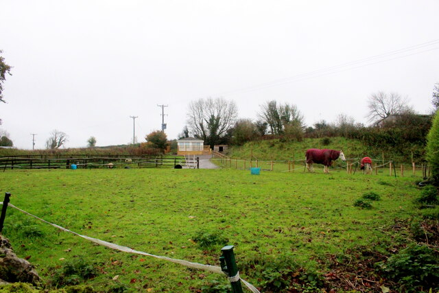
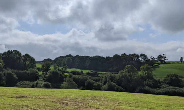
Ingsdons Hill is a small but prominent hill located in the county of Somerset, England. It is part of the Mendip Hills, a range of limestone hills known for their natural beauty and diverse flora and fauna. Rising to a height of approximately 260 meters (850 feet), Ingsdons Hill offers stunning panoramic views of the surrounding countryside.

The hill is covered in lush green grassland, speckled with patches of wildflowers such as bluebells and primroses during the spring season. It is also home to a variety of wildlife, including rabbits, foxes, and an array of bird species, making it a popular spot for nature enthusiasts and birdwatchers.

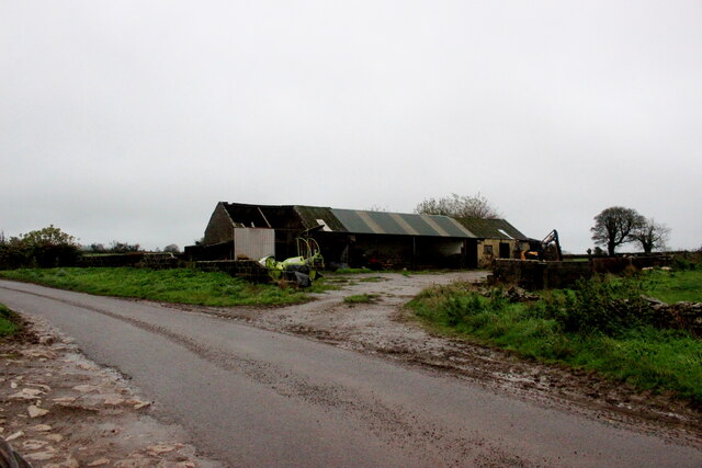
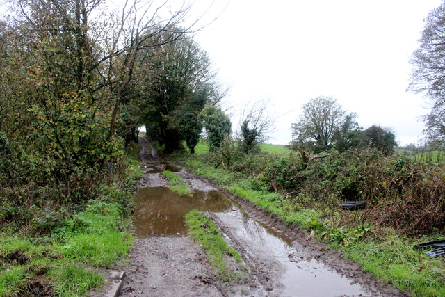
Ingsdons Hill is traversed by a network of footpaths and bridleways, allowing visitors to explore the hill and enjoy its natural beauty. The paths offer pleasant walks through rolling hills and quiet woodlands, providing a peaceful and serene environment for hikers and walkers.

The hill is also steeped in history, with evidence of human activity dating back to the Iron Age. Archaeological finds, such as ancient burial mounds, have been discovered in the vicinity, adding to its historical significance.

Overall, Ingsdons Hill is a picturesque and tranquil location, offering breathtaking views, diverse wildlife, and a rich history. It is a must-visit destination for those seeking a peaceful escape in the heart of Somerset's countryside.

If you have any feedback on the listing, please let us know in the comments section below.

Ingsdons Hill Images

Images are sourced within 2km of 51.192855/-2.5145882 or Grid Reference ST6443. Thanks to Geograph Open Source API. All images are credited.

Doulting cross
Doulting cross
Lane Doulting
Lane Doulting
OS Cut Mark - Doulting, St Aldhelm's Church <span class="nowrap"><a title="https://www.bench-marks.org.uk/bm59804" rel="nofollow ugc noopener" href="https://www.bench-marks.org.uk/bm59804">Link</a><img style="margin-left:2px;" alt="External link" title="External link - shift click to open in new window" src="https://s1.geograph.org.uk/img/external.png" width="10" height="10"/></span>
OS Cut Mark - Doulting, St Aldhelm's Church
Section of St Aldhelm's Church, Doulting
Houses on Church Lane Doulting At the far end of the house on the right is a small structure housing an old hand pump which was the supply of fresh water for the village . A bit further away is St Aldhelms well which is a much larger spring and the source of the River Sheppey.
Houses on Church Lane Doulting
At the far end of the house on the right is a small structure housing an old hand pump which was the supply of fresh water for the village . A bit further away is St Aldhelms well which is a much larger spring and the source of the River Sheppey.
Old Water Pump in Doulting  The pump handle of this pump is now locked. It has an undated brass plate in memory of Scot Pike.
Old Water Pump in Doulting
The pump handle of this pump is now locked. It has an undated brass plate in memory of Scot Pike.
Water Pump in Doulting (detail) This shows the Brass memorial plate in memory of Scot Pike
Water Pump in Doulting (detail)
This shows the Brass memorial plate in memory of Scot Pike
Horse Paddock on Bodden Lane A small paddock on the edge of this tiny hamlet with a pair of windswept ponies.
Horse Paddock on Bodden Lane
A small paddock on the edge of this tiny hamlet with a pair of windswept ponies.
Bodden Lane Bodden Lane runs south from the small hamlet of Boddeen downhill to the town of Shepton Mallet
Bodden Lane
Bodden Lane runs south from the small hamlet of Boddeen downhill to the town of Shepton Mallet
Farm Buildings at Higher Farm Higher Farm is the most northerly of the farms located at the hamlet of Bodden just north east of Shepton Mallet.
Farm Buildings at Higher Farm
Higher Farm is the most northerly of the farms located at the hamlet of Bodden just north east of Shepton Mallet.
A  Wet Day on the Fosse Way The route of the old Roman road can be clearly seen at this point and the track that now runs on this route is an ORPA. Other route with public access.
A Wet Day on the Fosse Way
The route of the old Roman road can be clearly seen at this point and the track that now runs on this route is an ORPA. Other route with public access.
Overgrown Roman Road This small footpath marks the line of what used to be the Fosse Way. It runs north straight up to and over the summit of Beacon Hill showing Roman road building engineers had little regard for physical obstructions
Overgrown Roman Road
This small footpath marks the line of what used to be the Fosse Way. It runs north straight up to and over the summit of Beacon Hill showing Roman road building engineers had little regard for physical obstructions
Crossroads on Waggon and Horses Hill This is the crossroads where King's Road running up Waggon and Horses Hill crosses Bolters Lane.
Crossroads on Waggon and Horses Hill
This is the crossroads where King's Road running up Waggon and Horses Hill crosses Bolters Lane.
Collett Park Park gifted to the town of Shepton Mallet by John Kyte Collett in 1906, who had bought the land when it was being auctioned off.  John Kyte Collett was born in the town in 1836.
Collett Park
Park gifted to the town of Shepton Mallet by John Kyte Collett in 1906, who had bought the land when it was being auctioned off. John Kyte Collett was born in the town in 1836.
Junction on the A361 on the east side of Shepton Mallett, looking west
The A361 heading east
Steam engine in the distance near Doulting
Houses in Doulting
Houses in Doulting
Show me another place!

Ingsdons Hill is located at Grid Ref: ST6443 (Lat: 51.192855, Lng: -2.5145882)

Administrative County: Somerset

District: Mendip

Police Authority: Avon and Somerset

What 3 Words

///cheering.snowboard.tanks. Near Shepton Mallet, Somerset

Related Wikis

Doulting

Doulting is a village and civil parish 1.5 miles (2 km) east of Shepton Mallet, on the A361, in the Mendip district of Somerset, England. == History... ==

St Aldhelm's Well

St Aldhelm's Well in Doulting, Somerset, England, is an ancient spring which is the source of the River Sheppey. The site is a Grade II listed building...

Doulting Stone Quarry

Doulting Stone Quarry (grid reference ST648436) is a limestone quarry at Doulting, on the Mendip Hills, Somerset, England. At present there are only three...

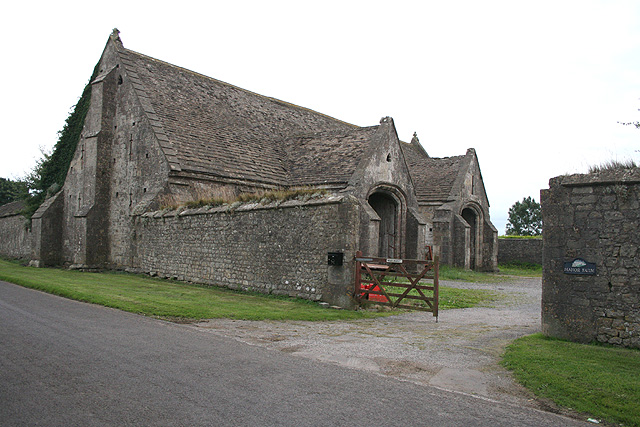
Tithe Barn, Manor Farm, Doulting

The Tithe Barn at Manor Farm (also known as Abbey Barn) in Doulting, Somerset, England, was built in the 15th century, and has been designated as a Grade...
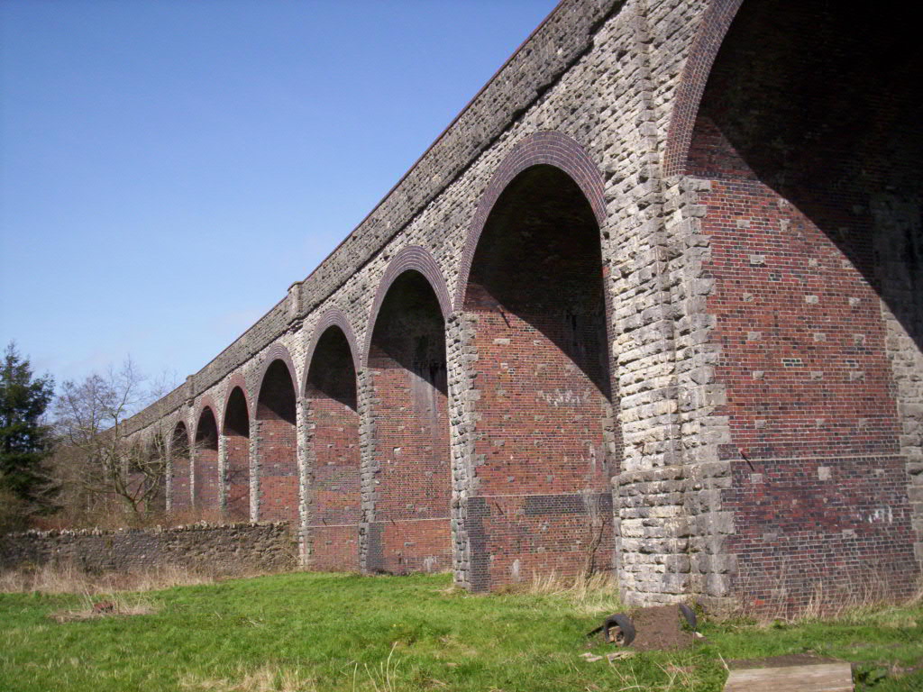
Charlton Viaduct

Charlton Viaduct is a disused railway bridge in Shepton Mallet within the English county of Somerset. It is a Grade II* listed building.The bridge was...

Mendip Vale railway station

Mendip Vale is the western terminus of the East Somerset Railway. == Services == All trains terminate at Mendip Vale, with a 5-10 minute wait while the...

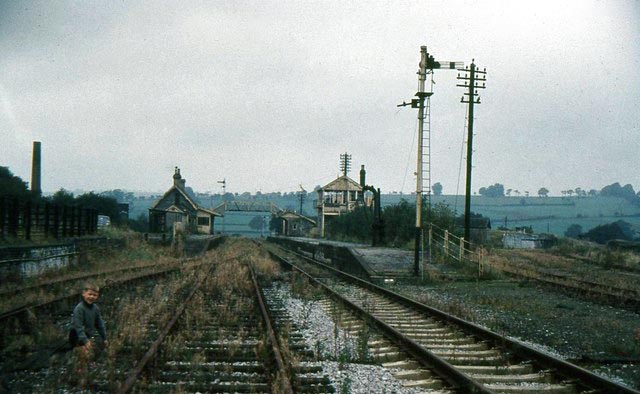
Shepton Mallet (Charlton Road) railway station

Shepton Mallet (Charlton Road) was a station on the Somerset and Dorset Joint Railway in the county of Somerset in England. Opened as Shepton Mallet on...

Kilver Court

Kilver Court is a historic house and gardens in Shepton Mallet in the English county of Somerset. The River Sheppey powered textile mills and it later...

Nearby Amenities

Located within 500m of 51.192855,-2.5145882
Bodden
Place: hamlet
Source: NPE
Lat/Long: 51.1954451/-2.5160569
Ingsdons Hill
Natural: peak
Lat/Long: 51.1909455/-2.5199666
The data included in this document is from www.openstreetmap.org. The data is made available under ODbL.

Have you been to Ingsdons Hill?

Leave your review of Ingsdons Hill below (or comments, questions and feedback).