Invermoidart

Settlement in Inverness-shire

Scotland

Invermoidart

Gated road to Shona Beag
Gated road to Shona Beag Credit: Steven Brown

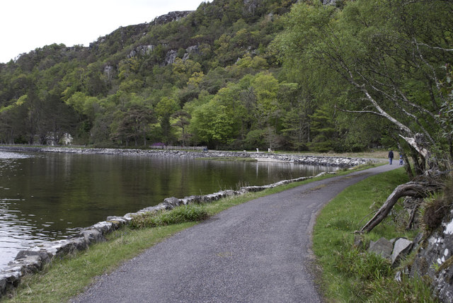
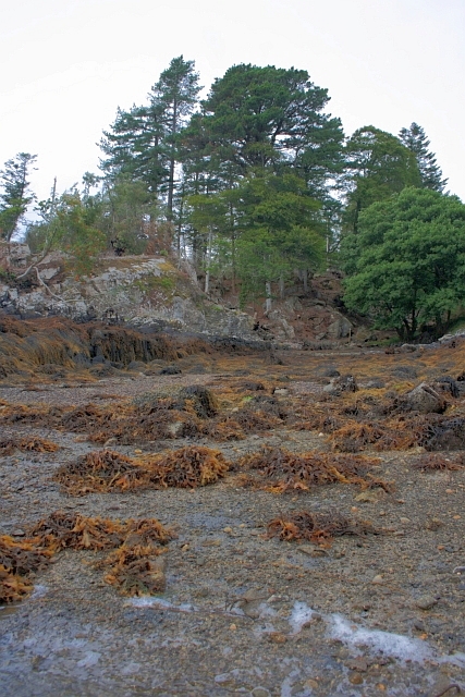
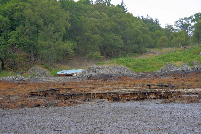
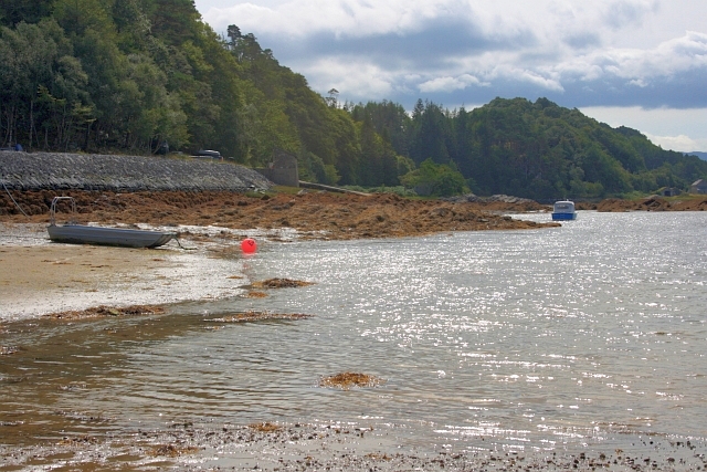
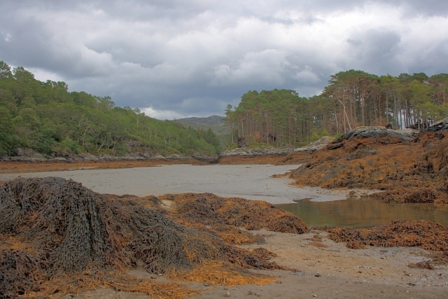
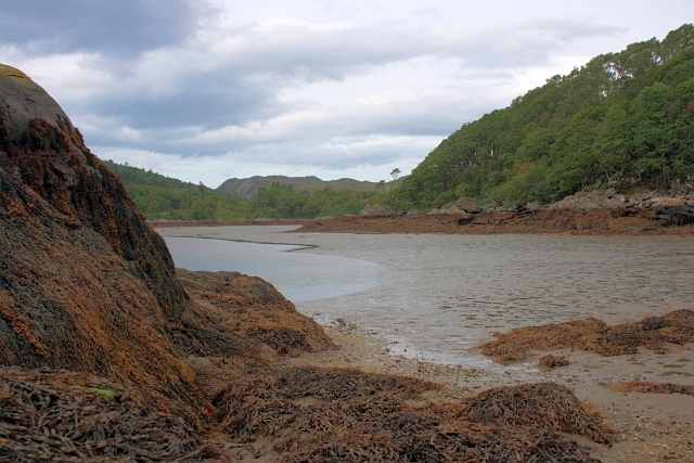
Invermoidart is a small village located in the historic region of Inverness-shire, Scotland. Situated on the western coast, it rests on the shores of Loch Moidart, a stunning sea loch that stretches into the Atlantic Ocean. The village is nestled amidst picturesque landscapes, surrounded by rolling hills, dense forests, and rugged mountains, offering breathtaking views for residents and visitors alike.

With a population of just over 100 people, Invermoidart is a tight-knit community that exudes a sense of tranquility and charm. The village is known for its peaceful atmosphere and a strong connection to nature, making it an idyllic retreat for those seeking solace in the Scottish Highlands.

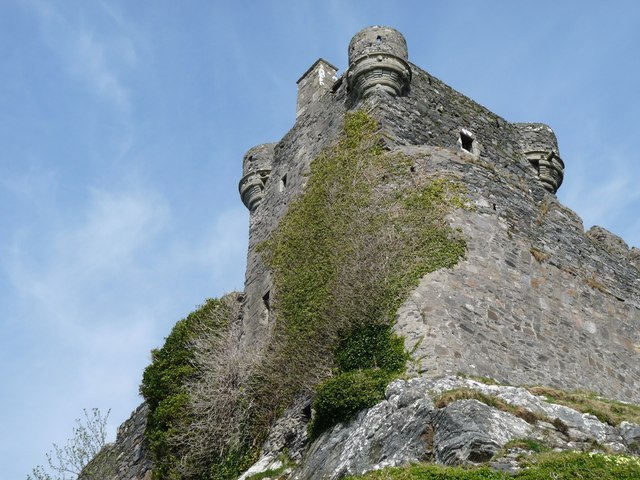
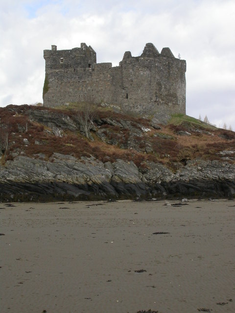
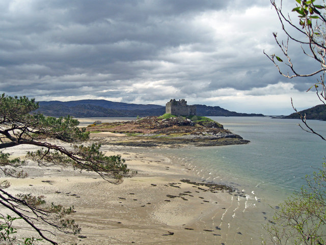
Invermoidart is steeped in history, boasting a rich heritage that dates back centuries. The ruins of Castle Tioram, a 13th-century fortress, stand proudly near the village, serving as a testament to its past. This majestic structure offers a glimpse into the area's medieval past and attracts history enthusiasts from far and wide.

Although small in size, Invermoidart offers a range of outdoor activities for adventurers. The surrounding area provides ample opportunities for hiking, mountaineering, fishing, and wildlife spotting, making it a haven for nature lovers. Additionally, the nearby Ardnamurchan Peninsula offers stunning landscapes and is renowned for its diverse wildlife, including red deer, golden eagles, and otters.

Invermoidart is an ideal destination for those seeking a peaceful retreat in the heart of the Scottish Highlands, with its breathtaking natural beauty and rich historical heritage serving as the perfect backdrop for a serene getaway.

If you have any feedback on the listing, please let us know in the comments section below.

Invermoidart Images

Images are sourced within 2km of 56.789547/-5.8330384 or Grid Reference NM6673. Thanks to Geograph Open Source API. All images are credited.

Gated road to Shona Beag
A861 near Shona Beag
Forest at Egnaig
Forest at Egnaig
Ruin at Egnaig
Ruin at Egnaig
Castle Tioram This most exposed corner which was in danger of collapse has now been saved by the owner being granted permission at long last to restore the castle to its former habitable state.
Castle Tioram
This most exposed corner which was in danger of collapse has now been saved by the owner being granted permission at long last to restore the castle to its former habitable state.
Castle Tioram
Castle Tioram
Castle Tioram from the Silver Walk At low water the beach between the island and the headland is exposed.
Castle Tioram from the Silver Walk
At low water the beach between the island and the headland is exposed.
Road by the Loch Side
Castle Tioram - High Tide
Castle Tioram - 1987 Or Castle Tiorlair on the largest scale OS maps. A view from just south of the causeway that connects the castle with the mainland when the tide is out. Behind is Eilean Shona.
Castle Tioram - 1987
Or Castle Tiorlair on the largest scale OS maps. A view from just south of the causeway that connects the castle with the mainland when the tide is out. Behind is Eilean Shona.
Eilean Shona and Castle Tioram A view northwest from near the causeway that allows access to the castle at low tide.
Eilean Shona and Castle Tioram
A view northwest from near the causeway that allows access to the castle at low tide.
Shoreline near Eilean Shona House At low tide.
Shoreline near Eilean Shona House
At low tide.
Oyster Cages I think these are disused cages used for cultivating oysters. Near Eilean Shona House.
Oyster Cages
I think these are disused cages used for cultivating oysters. Near Eilean Shona House.
Shoreline below Cnoc a'Chrochaidh
Caisteal Tioram From Riska Island The Dry Castle. Due to the fact that it can be reached by a sandy strand. not quite an island.

The castle was first recorded in 1373 and was intentionally burnt down in 1715 by Alan, the 14th chief, who was off to join the Jacobite Rebellion and had a premonition of his own death.
Caisteal Tioram From Riska Island
The Dry Castle. Due to the fact that it can be reached by a sandy strand. not quite an island. The castle was first recorded in 1373 and was intentionally burnt down in 1715 by Alan, the 14th chief, who was off to join the Jacobite Rebellion and had a premonition of his own death.
Remains of Small Building at Caisteal Tioram Containing human excrement. Not a nice sight for the many tourists exploring the castle.
Remains of Small Building at Caisteal Tioram
Containing human excrement. Not a nice sight for the many tourists exploring the castle.
Channel Between Shona Beag and Eilean na Gruagaig A narrow channel between two islands, Shona Beag on the left, Eilean na Gruagaig on the right. Dry at low tide.
Channel Between Shona Beag and Eilean na Gruagaig
A narrow channel between two islands, Shona Beag on the left, Eilean na Gruagaig on the right. Dry at low tide.
Shoreline of Shona Beag Looking towards the muddy bay of Port Thairbeirt Dheas. At low tide.
Shoreline of Shona Beag
Looking towards the muddy bay of Port Thairbeirt Dheas. At low tide.
Show me another place!

Invermoidart is located at Grid Ref: NM6673 (Lat: 56.789547, Lng: -5.8330384)

Unitary Authority: Highland

Police Authority: Highlands and Islands

What 3 Words

///glimmers.scores.outlooks. Near Arisaig, Highland

Related Wikis

Castle Tioram

Castle Tioram (; Scottish Gaelic: Caisteal Tioram, meaning "dry castle") is a ruined castle that sits on the tidal island Eilean Tioram in Loch Moidart...

Eilean Shona

Eilean Shona (Scottish Gaelic: Eilean SeĆ²na) is a tidal island in Loch Moidart, Scotland. The modern name may be from the Old Norse for "sea island". The...

Loch Moidart

Loch Moidart is a sea loch (sea inlet) in the district of Moidart in Highland, Scotland. It is on the west coast of Scotland, and runs about 8 km (5 miles...

Newton of Ardtoe

Newton of Ardtoe is a scattered crofting hamlet near Acharacle in Lochaber, Scottish Highlands and is in the council area of Highland.

Nearby Amenities

Located within 500m of 56.789547,-5.8330384
Source: PGS
Lat/Long: 56.7863323/-5.8277133
Source: PGS
Lat/Long: 56.786474/-5.8281377
Source: PGS
Lat/Long: 56.7866327/-5.8284141
Source: PGS
Lat/Long: 56.7869632/-5.8295448
Source: PGS
Lat/Long: 56.7869988/-5.8296686
Source: PGS
Lat/Long: 56.7871021/-5.8298818
Source: PGS
Lat/Long: 56.7874326/-5.8305292
Source: PGS
Lat/Long: 56.7878386/-5.8309204
Source: PGS
Lat/Long: 56.7880101/-5.8311868
Source: PGS
Lat/Long: 56.7887928/-5.8310852
Source: PGS
Lat/Long: 56.7889861/-5.8308041
Source: PGS
Lat/Long: 56.7892116/-5.8298913
Source: PGS
Lat/Long: 56.7891985/-5.8296354
Source: PGS
Lat/Long: 56.7890232/-5.8278029
Source: PGS
Lat/Long: 56.7886633/-5.8263422
Source: PGS
Lat/Long: 56.7884079/-5.8253653
Source: PGS
Lat/Long: 56.7911358/-5.8261934
Source: PGS
Lat/Long: 56.7911158/-5.8267198
Source: PGS
Lat/Long: 56.7911208/-5.8268815
Source: PGS
Lat/Long: 56.791137/-5.8270408
Source: PGS
Lat/Long: 56.7920689/-5.8292681
Source: PGS
Lat/Long: 56.7936754/-5.8332001
Source: PGS
Lat/Long: 56.7935056/-5.833238
Source: PGS
Lat/Long: 56.7931324/-5.8338713
Source: PGS
Lat/Long: 56.7930723/-5.8342065
Source: PGS
Lat/Long: 56.7929576/-5.8345082
Source: PGS
Lat/Long: 56.7928734/-5.8348642
Source: PGS
Lat/Long: 56.7926809/-5.8351755
Source: PGS
Lat/Long: 56.7924939/-5.8352289
Source: PGS
Lat/Long: 56.7921299/-5.8352399
Source: PGS
Lat/Long: 56.7919369/-5.8357366
Source: PGS
Lat/Long: 56.7915652/-5.8365205
Source: PGS
Lat/Long: 56.791649/-5.8363884
Source: PGS
Lat/Long: 56.7917915/-5.8362495
Source: PGS
Lat/Long: 56.7907455/-5.8366044
Source: PGS
Lat/Long: 56.7899958/-5.8374259
Source: PGS
Lat/Long: 56.7901469/-5.8371882
Source: PGS
Lat/Long: 56.7902297/-5.8369396
Source: PGS
Lat/Long: 56.7911713/-5.836144
Source: PGS
Lat/Long: 56.791424/-5.8364741
Source: PGS
Lat/Long: 56.7918817/-5.8360415
Source: PGS
Lat/Long: 56.7920548/-5.8353721
Source: PGS
Lat/Long: 56.7921838/-5.8351863
Source: PGS
Lat/Long: 56.7922376/-5.8351647
Source: PGS
Lat/Long: 56.7927269/-5.8351356
Source: PGS
Lat/Long: 56.7930125/-5.8346377
Source: PGS
Lat/Long: 56.7929612/-5.8344621
Source: PGS
Lat/Long: 56.7929807/-5.8344011
Source: PGS
Lat/Long: 56.7931416/-5.8339701
Source: PGS
Lat/Long: 56.7930756/-5.8336971
Source: PGS
Lat/Long: 56.7930592/-5.8336171
Source: PGS
Lat/Long: 56.7930592/-5.8335253
Source: PGS
Lat/Long: 56.7932229/-5.8332521
Source: PGS
Lat/Long: 56.7933293/-5.8332292
Source: PGS
Lat/Long: 56.7938519/-5.8330954
Source: PGS
Lat/Long: 56.7939182/-5.833068
Source: PGS
Lat/Long: 56.7932271/-5.8293743
Source: PGS
Lat/Long: 56.79252/-5.8293213
Source: PGS
Lat/Long: 56.7919969/-5.8291393
Source: PGS
Lat/Long: 56.7914225/-5.8280972
Source: PGS
Lat/Long: 56.7913823/-5.8279757
Source: PGS
Lat/Long: 56.791186/-5.8272814
Source: PGS
Lat/Long: 56.7913039/-5.8276568
Source: PGS
Lat/Long: 56.7914896/-5.8282261
Source: PGS
Lat/Long: 56.7916764/-5.8284817
Source: PGS
Lat/Long: 56.7918924/-5.828836
Source: PGS
Lat/Long: 56.7919368/-5.8289354
Source: PGS
Lat/Long: 56.7920283/-5.8292149
Source: PGS
Lat/Long: 56.7921209/-5.8292973
Source: PGS
Lat/Long: 56.7924177/-5.8293361
Source: PGS
Lat/Long: 56.7927192/-5.829235
Source: PGS
Lat/Long: 56.7928455/-5.829238
Source: PGS
Lat/Long: 56.7935447/-5.8295842
Source: PGS
Lat/Long: 56.7931419/-5.8333178
Source: PGS
Lat/Long: 56.793081/-5.8334325
Source: PGS
Lat/Long: 56.7931262/-5.8340545
Source: PGS
Lat/Long: 56.7929644/-5.8345508
Source: PGS
Lat/Long: 56.7927666/-5.8350828
Source: PGS
Lat/Long: 56.7925928/-5.8352161
Source: PGS
Lat/Long: 56.7919758/-5.8355866
Source: PGS
Lat/Long: 56.7918416/-5.8361696
Source: PGS
Lat/Long: 56.7913659/-5.8363099
Source: PGS
Lat/Long: 56.7910436/-5.8362302
Source: PGS
Lat/Long: 56.7903466/-5.8368091
Source: PGS
Lat/Long: 56.7908544/-5.8365553
Source: PGS
Lat/Long: 56.7909156/-5.8364621
Source: PGS
Lat/Long: 56.7911047/-5.8361709
Source: PGS
Lat/Long: 56.7912457/-5.836156
Source: PGS
Lat/Long: 56.7913121/-5.8362134
Source: PGS
Lat/Long: 56.7902765/-5.836862
Source: PGS
Lat/Long: 56.7901784/-5.8371115
Source: PGS
Lat/Long: 56.7899014/-5.8376301
Source: PGS
Lat/Long: 56.7898512/-5.8376982
Source: PGS
Lat/Long: 56.7897292/-5.8378199
Source: PGS
Lat/Long: 56.7896509/-5.8379972
Source: PGS
Lat/Long: 56.7895589/-5.8381275
Source: PGS
Lat/Long: 56.7895268/-5.8381971
Source: PGS
Lat/Long: 56.7895078/-5.8382777
Source: PGS
Lat/Long: 56.7894961/-5.8383811
Source: PGS
Lat/Long: 56.7894795/-5.838857
Source: PGS
Lat/Long: 56.7894368/-5.8391382
Source: PGS
Lat/Long: 56.7893648/-5.8392941
Source: PGS
Lat/Long: 56.7892943/-5.8393942
Source: PGS
Lat/Long: 56.7892295/-5.839434
Source: PGS
Lat/Long: 56.7891613/-5.8394203
Source: PGS
Lat/Long: 56.7891154/-5.8393843
Source: PGS
Lat/Long: 56.7890686/-5.8393287
Source: PGS
Lat/Long: 56.7890285/-5.8392627
Source: PGS
Lat/Long: 56.7889984/-5.8391914
Source: PGS
Lat/Long: 56.7889799/-5.8391224
Source: PGS
Lat/Long: 56.7889705/-5.8390505
Source: PGS
Lat/Long: 56.7889771/-5.8388773
Source: PGS
Lat/Long: 56.7886477/-5.838484
Source: PGS
Lat/Long: 56.7884358/-5.8385934
Source: PGS
Lat/Long: 56.787983/-5.838805
Source: PGS
Lat/Long: 56.7878704/-5.838908
Source: PGS
Lat/Long: 56.7876013/-5.8395478
Source: PGS
Lat/Long: 56.7871524/-5.8397578
Power: pole
Lat/Long: 56.7927999/-5.8369991
Power: pole
Lat/Long: 56.7925179/-5.8374819
Power: pole
Lat/Long: 56.7919332/-5.8376187
The data included in this document is from www.openstreetmap.org. The data is made available under ODbL.

Have you been to Invermoidart?

Leave your review of Invermoidart below (or comments, questions and feedback).