Invermoriston

Settlement in Inverness-shire

Scotland

Invermoriston

Etape Loch Ness, approaching Invermoriston Some of the leading group of riders, heading along the A82. This is a small downhill section, just before a sharp corner in Invermorison.
Etape Loch Ness, approaching Invermoriston Credit: Craig Wallace

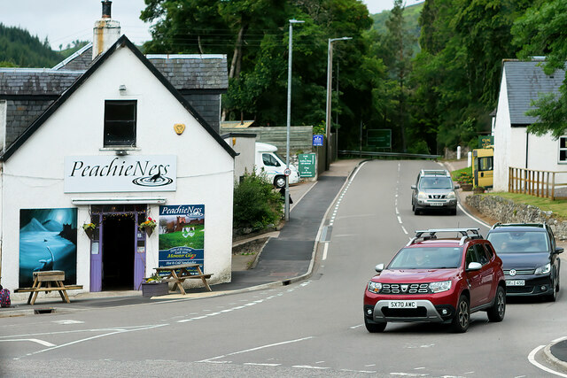
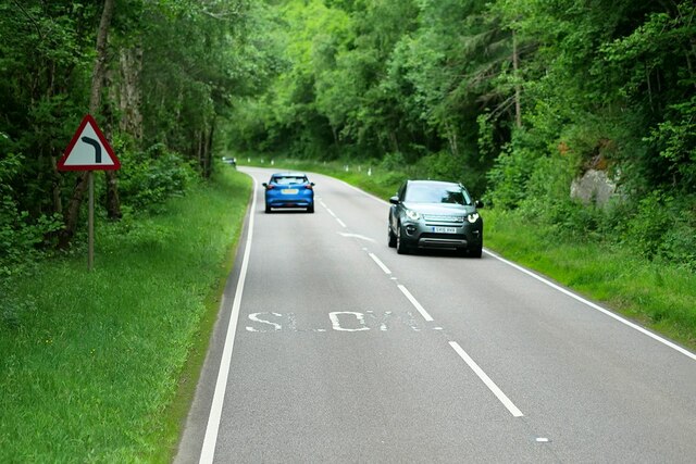
Invermoriston is a small village located in the Scottish Highlands, in the county of Inverness-shire. Situated along the banks of the River Moriston, the village is surrounded by stunning natural beauty, with rolling hills and lush green forests providing a picturesque backdrop.

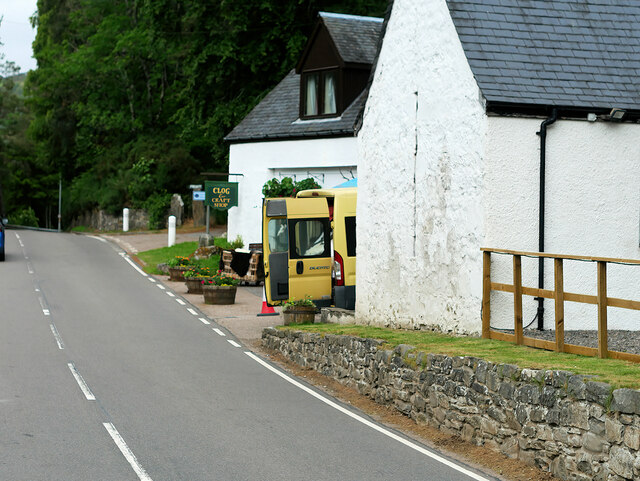
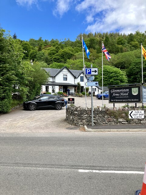
Invermoriston is known for its charming stone buildings, many of which date back to the 18th and 19th centuries. The village is home to a handful of shops, cafes, and restaurants, as well as a historic church and a picturesque waterfall, the Invermoriston Falls, which is a popular tourist attraction.

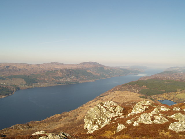
Outdoor enthusiasts will find plenty to do in Invermoriston, with opportunities for hiking, fishing, and wildlife spotting in the surrounding area. The village is located near the famous Loch Ness, where visitors can try their luck at spotting the elusive Loch Ness Monster.

Overall, Invermoriston is a peaceful and idyllic village that offers a taste of rural Scottish life, with plenty of natural beauty and outdoor activities to enjoy.

If you have any feedback on the listing, please let us know in the comments section below.

Invermoriston Images

Images are sourced within 2km of 57.215054/-4.618707 or Grid Reference NH4116. Thanks to Geograph Open Source API. All images are credited.

Etape Loch Ness, approaching Invermoriston Some of the leading group of riders, heading along the A82. This is a small downhill section, just before a sharp corner in Invermorison.
Etape Loch Ness, approaching Invermoriston
Some of the leading group of riders, heading along the A82. This is a small downhill section, just before a sharp corner in Invermorison.
Etape support station, Invermoriston The car park at Invermoriston was a support station for the Etape Loch Ness. It included water, food, toilets, first aid, and bike repair. This was after most riders had passed through.
Etape support station, Invermoriston
The car park at Invermoriston was a support station for the Etape Loch Ness. It included water, food, toilets, first aid, and bike repair. This was after most riders had passed through.
Southbound A82 near Invermoriston, The A82 runs from Glasgow to Fort William and Inverness, passing along the shores of Loch Lomond and Loch Ness and in the shadow of Ben Nevis along the way. The majority of the route is a trunk road and hence managed by Transport Scotland, who view the road as a vitally important link through the Scottish Highlands and beyond. 

At 167 miles, the road is the second longest A-road in Scotland (after the A9) and along its route uses pieces of road first built in the 1750s.
Southbound A82 near Invermoriston,
The A82 runs from Glasgow to Fort William and Inverness, passing along the shores of Loch Lomond and Loch Ness and in the shadow of Ben Nevis along the way. The majority of the route is a trunk road and hence managed by Transport Scotland, who view the road as a vitally important link through the Scottish Highlands and beyond. At 167 miles, the road is the second longest A-road in Scotland (after the A9) and along its route uses pieces of road first built in the 1750s.
Invermoriston The A887, which links with the A87 to Skye, turns off the A82 at Invermoriston.
Invermoriston
The A887, which links with the A87 to Skye, turns off the A82 at Invermoriston.
A82 approaching Invermoriston The A82 runs from Glasgow to Fort William and Inverness, passing along the shores of Loch Lomond and Loch Ness and in the shadow of Ben Nevis along the way. The majority of the route is a trunk road and hence managed by Transport Scotland, who view the road as a vitally important link through the Scottish Highlands and beyond. 

At 167 miles, the road is the second longest A-road in Scotland (after the A9) and along its route uses pieces of road first built in the 1750s.
A82 approaching Invermoriston
The A82 runs from Glasgow to Fort William and Inverness, passing along the shores of Loch Lomond and Loch Ness and in the shadow of Ben Nevis along the way. The majority of the route is a trunk road and hence managed by Transport Scotland, who view the road as a vitally important link through the Scottish Highlands and beyond. At 167 miles, the road is the second longest A-road in Scotland (after the A9) and along its route uses pieces of road first built in the 1750s.
Clog and Craft Shop, Invermoriston The A887 is essentially a link road through Glen Moriston from the A82 to the A87 for traffic travelling between Inverness and Kyle of Lochalsh and the Isle of Skye. Although a trunk route, traffic volumes are relatively low.

The A887 runs for 14½ miles from a turning off the A82 at the small village of Invermoriston near the shore of Loch Ness to the A87 junction at Bunloyne. Traffic for Skye continues along the A87.
Clog and Craft Shop, Invermoriston
The A887 is essentially a link road through Glen Moriston from the A82 to the A87 for traffic travelling between Inverness and Kyle of Lochalsh and the Isle of Skye. Although a trunk route, traffic volumes are relatively low. The A887 runs for 14½ miles from a turning off the A82 at the small village of Invermoriston near the shore of Loch Ness to the A87 junction at Bunloyne. Traffic for Skye continues along the A87.
A887 at Invermoriston The A887 is essentially a link road through Glen Moriston from the A82 to the A87 for traffic travelling between Inverness and Kyle of Lochalsh and the Isle of Skye. Although a trunk route, traffic volumes are relatively low.

The A887 runs for 14½ miles from a turning off the A82 at the small village of Invermoriston near the shore of Loch Ness to the A87 junction at Bunloyne. Traffic for Skye continues along the A87.
A887 at Invermoriston
The A887 is essentially a link road through Glen Moriston from the A82 to the A87 for traffic travelling between Inverness and Kyle of Lochalsh and the Isle of Skye. Although a trunk route, traffic volumes are relatively low. The A887 runs for 14½ miles from a turning off the A82 at the small village of Invermoriston near the shore of Loch Ness to the A87 junction at Bunloyne. Traffic for Skye continues along the A87.
A887 leaving Invermoriston The A887 is essentially a link road through Glen Moriston from the A82 to the A87 for traffic travelling between Inverness and Kyle of Lochalsh and the Isle of Skye. Although a trunk route, traffic volumes are relatively low.

The A887 runs for 14½ miles from a turning off the A82 at the small village of Invermoriston near the shore of Loch Ness to the A87 junction at Bunloyne. Traffic for Skye continues along the A87.
A887 leaving Invermoriston
The A887 is essentially a link road through Glen Moriston from the A82 to the A87 for traffic travelling between Inverness and Kyle of Lochalsh and the Isle of Skye. Although a trunk route, traffic volumes are relatively low. The A887 runs for 14½ miles from a turning off the A82 at the small village of Invermoriston near the shore of Loch Ness to the A87 junction at Bunloyne. Traffic for Skye continues along the A87.
A887 near Levishie The A887 is essentially a link road through Glen Moriston from the A82 to the A87 for traffic travelling between Inverness and Kyle of Lochalsh and the Isle of Skye. Although a trunk route, traffic volumes are relatively low.

The A887 runs for 14½ miles from a turning off the A82 at the small village of Invermoriston near the shore of Loch Ness to the A87 junction at Bunloyne. Traffic for Skye continues along the A87.
A887 near Levishie
The A887 is essentially a link road through Glen Moriston from the A82 to the A87 for traffic travelling between Inverness and Kyle of Lochalsh and the Isle of Skye. Although a trunk route, traffic volumes are relatively low. The A887 runs for 14½ miles from a turning off the A82 at the small village of Invermoriston near the shore of Loch Ness to the A87 junction at Bunloyne. Traffic for Skye continues along the A87.
Forestry road near Invermoriston
Invermoriston village The Glenmoriston Arms is the large building on the right of the road
Invermoriston village
The Glenmoriston Arms is the large building on the right of the road
Glenmoriston Millennium Hall
Loch Ness south of Invermoriston
Cemetery entrance, Invermoriston Clachan an Inbhir burial ground. A gate with a pair of stone pillars, and a tree-lined track towards the cemetery.
The burial ground and gate piers are Category B listed. <span class="nowrap"><a title="https://portal.historicenvironment.scot/designation/LB15023" rel="nofollow ugc noopener" href="https://portal.historicenvironment.scot/designation/LB15023">Link</a><img style="margin-left:2px;" alt="External link" title="External link - shift click to open in new window" src="https://s1.geograph.org.uk/img/external.png" width="10" height="10"/></span>
Cemetery entrance, Invermoriston
Clachan an Inbhir burial ground. A gate with a pair of stone pillars, and a tree-lined track towards the cemetery. The burial ground and gate piers are Category B listed. LinkExternal link
Etape Loch Ness, approaching Invermoriston Some of the leading group of riders, heading along the A82.
Etape Loch Ness, approaching Invermoriston
Some of the leading group of riders, heading along the A82.
Glenmoriston Arms Hotel In the village of Invermoriston.
Glenmoriston Arms Hotel
In the village of Invermoriston.
Show me another place!

Invermoriston is located at Grid Ref: NH4116 (Lat: 57.215054, Lng: -4.618707)

Unitary Authority: Highland

Police Authority: Highlands and Islands

What 3 Words

///taxpayers.skews.playroom. Near Drumnadrochit, Highland

Nearby Locations

Invermoriston

Related Wikis

Invermoriston

Invermoriston (Inbhir Mhoireastain in Gaelic) (grid reference NH420167) is a small village 11 kilometres (7 miles) north of Fort Augustus, Highland, Scotland...

River Moriston

The River Moriston (Scottish Gaelic: Abhainn Mhoireastain) is a river in Inverness-shire, Scotland. It flows broadly east-north-east from the outfall of...

Achnaconeran

Achnaconeran is a remote crofting settlement in the Inverness committee area of Highland and is in the Scottish council area of Highland. Achnaconeran...

Loch a' Bhainne

Loch a' Bhainne is a small, upland freshwater loch approximately 2 miles (3.2 km) north of the east end of Loch Garry and 3.5 miles (5.6 km) north-west...

Nearby Amenities

Located within 500m of 57.215054,-4.618707
Invermoriston
Name Gd: Inbhir Moireasdan
Name Sco: Innermoriston
Place: village
Wikidata: Q280410
Wikipedia: en:Invermoriston
Lat/Long: 57.2148494/-4.6174311
Moriston (Lower)
Whitewater: put_in
Lat/Long: 57.2132752/-4.6193832
top fall
Rapids: 4
Waterway: rapids
Lat/Long: 57.2136813/-4.6184715
drainpipe
Rapids: 5
Waterway: rapids
Lat/Long: 57.2119598/-4.6172453
Description: pinning spot
Whitewater: hazard
Lat/Long: 57.2130337/-4.6185402
Rapids: 3
Waterway: rapids
Lat/Long: 57.2130282/-4.618675
bottom falls, stopper at end
Rapids: 4
Waterway: rapids
Lat/Long: 57.2112632/-4.615137
Bus Stop
opp. Public Hall
Bench: yes
Bin: no
Bus: yes
Naptan AtcoCode: 670020007
Naptan Bearing: N
Naptan CommonName: Public Hall
Naptan Indicator: opp Public Hall
Naptan Landmark: Public Hall
Naptan NaptanCode: 45323745
Naptan Street: A82
Naptan Verified: no
Network: Scottish Citylink
Public Transport: platform
Shelter: yes
Source: naptan_import
Tactile Paving: no
Lat/Long: 57.2133256/-4.6177963
Bus Stop
Public Hall
Bench: yes
Bin: no
Naptan AtcoCode: 670084840
Naptan Bearing: S
Naptan CommonName: Public Hall
Naptan Indicator: o/s Public Hall
Naptan Landmark: Public Hall
Naptan NaptanCode: 45323742
Naptan Street: A82
Naptan Verified: no
Network: Scottish Citylink
Shelter: yes
Source: naptan_import
Tactile Paving: yes
Lat/Long: 57.2137413/-4.6173305
Bus Stop
Invermoriston Hotel
Naptan AtcoCode: 670085864
Naptan Bearing: E
Naptan CommonName: Invermoriston Hotel
Naptan Indicator: o/s
Naptan Landmark: Invermoriston Hotel
Naptan NaptanCode: 45323793
Naptan Street: A887
Naptan Verified: no
Source: naptan_import
Lat/Long: 57.2148411/-4.6179533
Bus Stop
Invermoriston Hotel
Naptan AtcoCode: 670085864A
Naptan Bearing: W
Naptan CommonName: Invermoriston Hotel
Naptan Indicator: o/s Post Office
Naptan Landmark: Invermoriston Hotel
Naptan NaptanCode: 45324724
Naptan Street: A887
Naptan Verified: no
Source: naptan_import
Lat/Long: 57.2146661/-4.6181563
Invermoriston War Memorial
Historic: memorial
Memorial: obelisk
Wikidata: Q114168570
Lat/Long: 57.2146993/-4.6173408
Post Box
Collection Times: Mo-Fr 16:45; Sa 15:30
Old Ref: IV3 146
Operator: Royal Mail
Post Box Type: lamp
Ref: IV63 146
Royal Cypher: scottish_crown
Lat/Long: 57.2145746/-4.6176316
Recycling
Recycling Clothes: yes
Recycling Glass: no
Recycling Glass Bottles: yes
Recycling Type: container
Lat/Long: 57.2142599/-4.6167791
Parking
Source: survey
Lat/Long: 57.2139152/-4.6134907
St Columba's Well
Drinking Water: no
Natural: spring
Lat/Long: 57.2141619/-4.6175367
Bus Stop
Lat/Long: 57.2144468/-4.6175573
Tourism: picnic_site
Lat/Long: 57.2142669/-4.6164626
Telephone
Booth: KX100
Covered: booth
Lat/Long: 57.2139016/-4.617307
Noexit: yes
Lat/Long: 57.216447/-4.6257332
Inter
Name En: Invermoriston falls
Waterway: waterfall
Lat/Long: 57.2118629/-4.6169736
Power: pole
Lat/Long: 57.2111718/-4.6180822
Power: pole
Lat/Long: 57.2117393/-4.618985
Power: pole
Lat/Long: 57.2122939/-4.6198698
Power: pole
Lat/Long: 57.2128873/-4.620825
Power: pole
Lat/Long: 57.2133097/-4.6221156
Power: pole
Lat/Long: 57.2136705/-4.6231247
Power: pole
Lat/Long: 57.2140069/-4.6241517
Power: pole
Lat/Long: 57.2143807/-4.6252746
Power: pole
Lat/Long: 57.2147471/-4.6263615
Charging Station
Capacity: 2
Operator: ChargePlace Scotland
Operator Wikidata: Q105359316
Lat/Long: 57.2149403/-4.6176889
Drinking Water: yes
Man Made: water_tap
Lat/Long: 57.2134362/-4.6173677
Bench
Lat/Long: 57.2180754/-4.6169878
Toilets
Access: yes
Fee: yes
Wheelchair: yes
Lat/Long: 57.2134501/-4.6172939
The data included in this document is from www.openstreetmap.org. The data is made available under ODbL.

Have you been to Invermoriston?

Leave your review of Invermoriston below (or comments, questions and feedback).