Barcheston

Settlement in Warwickshire Stratford-on-Avon

England

Barcheston

Tree near Tidmington Probably a pine of some description.
Tree near Tidmington Credit: Stephen Richards

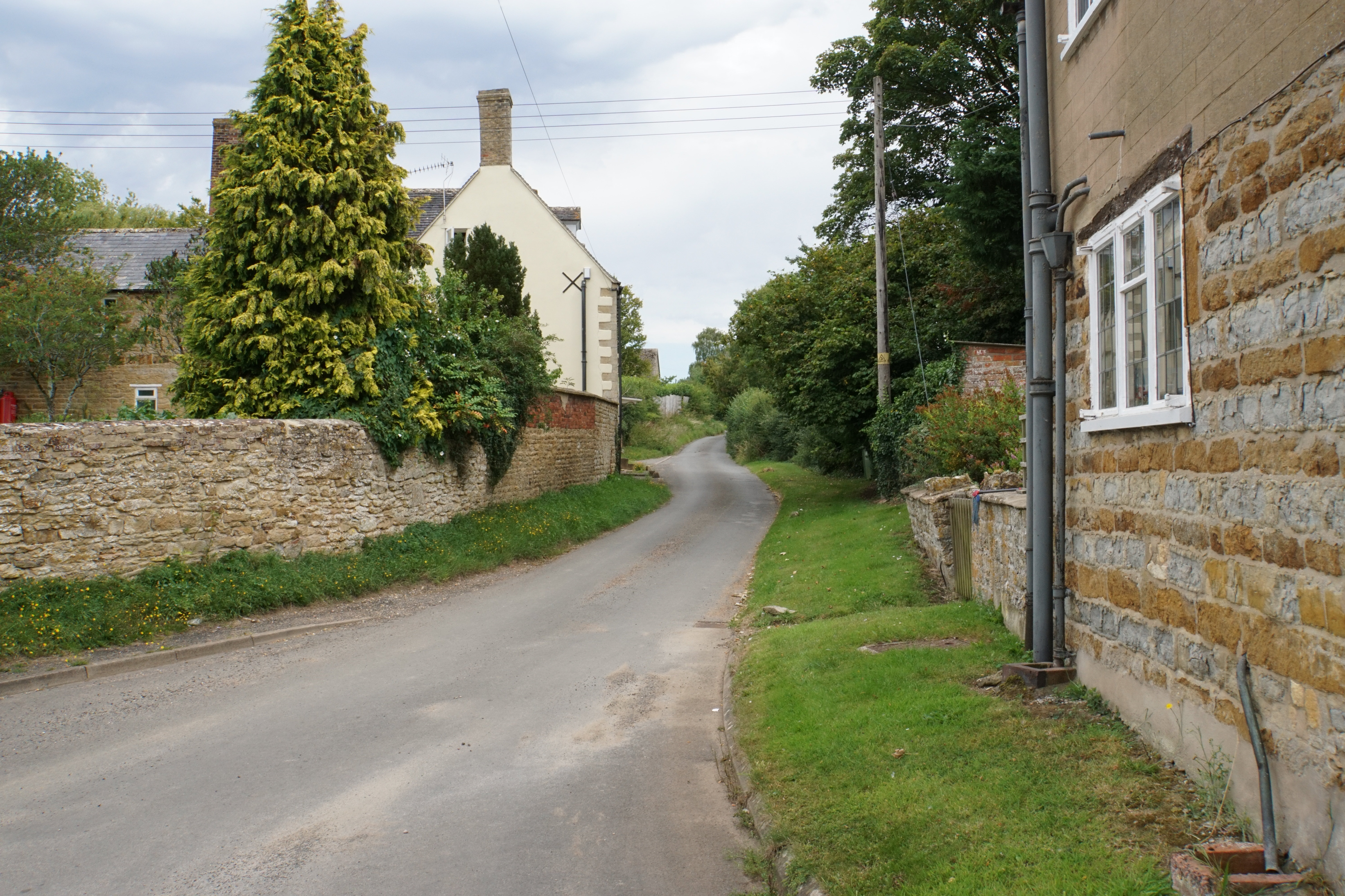
Barcheston is a small village located in the county of Warwickshire, England. Situated approximately 4 miles southeast of Shipston-on-Stour, it falls within the Stratford-on-Avon district. The village is nestled in the picturesque countryside, surrounded by rolling hills and fields, offering residents and visitors a peaceful and idyllic setting.

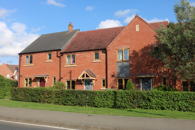
With a population of just over 100 people, Barcheston exudes a strong sense of community and charm. The village is characterized by its traditional stone buildings, many of which date back several centuries, giving it a distinct historical ambiance. The centerpiece of Barcheston is St. Martin's Church, a Grade I listed building that dates back to the 13th century, showcasing stunning medieval architecture and intricate stained glass windows.

Despite its small size, Barcheston boasts a rich history. The village was mentioned in the Domesday Book of 1086 and has remained relatively unchanged over the centuries. Today, Barcheston offers visitors the opportunity to step back in time and experience the beauty of a quintessential English village.

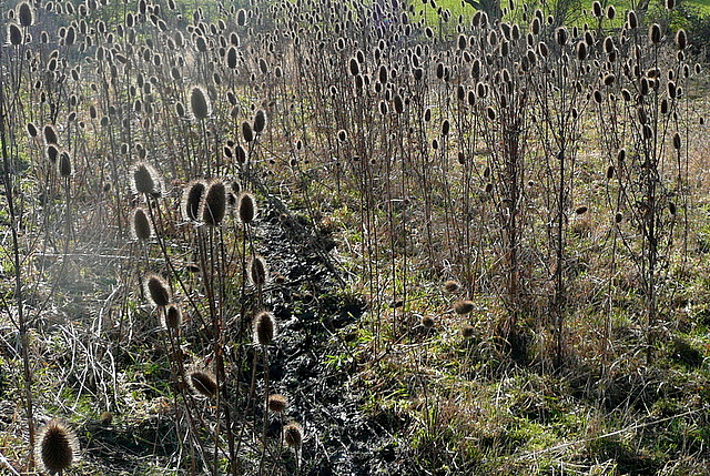
Surrounded by the Warwickshire countryside, Barcheston is a haven for nature lovers and outdoor enthusiasts. The village is situated close to the Cotswolds Area of Outstanding Natural Beauty, providing ample opportunities for countryside walks, cycling, and exploring the scenic landscapes.

While Barcheston may be a tranquil retreat, it is conveniently located near larger towns and cities. Shipston-on-Stour, with its range of amenities including shops, pubs, and restaurants, is just a short drive away, ensuring residents have access to essential services and entertainment options.

In summary, Barcheston is a charming village in Warwickshire, offering a glimpse into England's rich history and providing a peaceful haven in the midst of picturesque countryside.

If you have any feedback on the listing, please let us know in the comments section below.

Barcheston Images

Images are sourced within 2km of 52.057604/-1.614176 or Grid Reference SP2639. Thanks to Geograph Open Source API. All images are credited.

Tree near Tidmington Probably a pine of some description.
Tree near Tidmington
Probably a pine of some description.
Barcheston church It is difficult to get a good view of the church from this direction.  This is from Shakespeare's Way, which runs through a thinly populated orchard here.
Barcheston church
It is difficult to get a good view of the church from this direction. This is from Shakespeare's Way, which runs through a thinly populated orchard here.
Barcheston hamlet The Shakespeare's Way guide describes Barcheston as "minute hamlet" which seems somewhat tautologous.  Unless of course the guide is thinking of a miniature version of the Prince of Denmark, of whom there was no evidence.  There is a cast iron village water pump adjacent to this barn conversion though.
Barcheston hamlet
The Shakespeare's Way guide describes Barcheston as "minute hamlet" which seems somewhat tautologous. Unless of course the guide is thinking of a miniature version of the Prince of Denmark, of whom there was no evidence. There is a cast iron village water pump adjacent to this barn conversion though.
Teasels on the path We were heading directly in to low winter sun, which was backlighting this profusion of teasels adjacent to the footpath, part of Shakespeare's Way.
Teasels on the path
We were heading directly in to low winter sun, which was backlighting this profusion of teasels adjacent to the footpath, part of Shakespeare's Way.
Shakespeare's Way near Willington The path crosses this pasture adjacent to the River Stour, with more pasture on the far bank.
Shakespeare's Way near Willington
The path crosses this pasture adjacent to the River Stour, with more pasture on the far bank.
Bridge at Bridge Farm This bridge carries a farm access track across the River Stour, and is also a public footpath.  It is not used by Shakespeare's Way though, which stays on this side.
Bridge at Bridge Farm
This bridge carries a farm access track across the River Stour, and is also a public footpath. It is not used by Shakespeare's Way though, which stays on this side.
Cottage in Willington Shakespeare's Way passes the door.  Note the bread oven.
Cottage in Willington
Shakespeare's Way passes the door. Note the bread oven.
Cottages in Willington A corner of the village showing a couple of the cottages, the postbox and the village noticeboard.  Shakespeare's Way passes here.
Cottages in Willington
A corner of the village showing a couple of the cottages, the postbox and the village noticeboard. Shakespeare's Way passes here.
Rest near College Farm College Farm is in the background.  Shakespeare's Way passes this bench, a good point for a tea stop.
Rest near College Farm
College Farm is in the background. Shakespeare's Way passes this bench, a good point for a tea stop.
Approaching Willington Straight ahead for Willington, and also Shakespeare's Way.
Approaching Willington
Straight ahead for Willington, and also Shakespeare's Way.
Towards Ivy Ground Spinney Shakespeare's Way uses this footpath, diagonally across this field towards the spinney, on the right, and beyond.  It contains very claggy clay soil.
Towards Ivy Ground Spinney
Shakespeare's Way uses this footpath, diagonally across this field towards the spinney, on the right, and beyond. It contains very claggy clay soil.
Near Ivy Ground Spinney The spinney is to the left.  The footpath, used by Shakespeare's Way, crosses from one claggy clay field to another here.
Near Ivy Ground Spinney
The spinney is to the left. The footpath, used by Shakespeare's Way, crosses from one claggy clay field to another here.
Lane to Willington Looking SSW down the lane with a recently ploughed field on the left.
Lane to Willington
Looking SSW down the lane with a recently ploughed field on the left.
View west from lane to Willington Looking west across the fields towards the church at Barcheston.
View west from lane to Willington
Looking west across the fields towards the church at Barcheston.
Hall on Old Road, Shipston on Stour It looks like a public toilets, but there's only one door on the entrance.
Hall on Old Road, Shipston on Stour
It looks like a public toilets, but there's only one door on the entrance.
Old Road, Shipston on Stour
West Street at the junction of Old Road
New houses on Stratford Road, Shipston on Stour
Show me another place!

Barcheston is located at Grid Ref: SP2639 (Lat: 52.057604, Lng: -1.614176)

Administrative County: Warwickshire

District: Stratford-on-Avon

Police Authority: Warwickshire

What 3 Words

///archives.hockey.shed. Near Shipston on Stour, Warwickshire

Nearby Locations

Barcheston Willington

Related Wikis

Willington, Warwickshire

Willington is a village in Warwickshire, England. Population details are included within Barcheston. The origin of the place-name is from Old English tun...
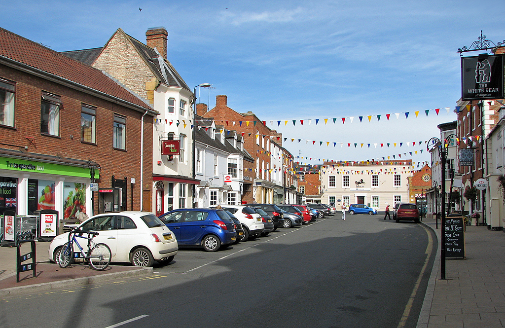
Shipston-on-Stour

Shipston-on-Stour is a town and civil parish in the Stratford-on-Avon District in southern Warwickshire, England. It is located on the banks of the River...

Shipston-on-Stour Rural District

Shipston on Stour was a rural district in England from 1894 to 1974. [1] The district covered an area around Shipston-on-Stour. Originally it was a detached...

Evolution of Worcestershire county boundaries since 1844

The administrative boundaries of Worcestershire, England have been fluid for over 150 years since the first major changes in 1844. There were many detached...

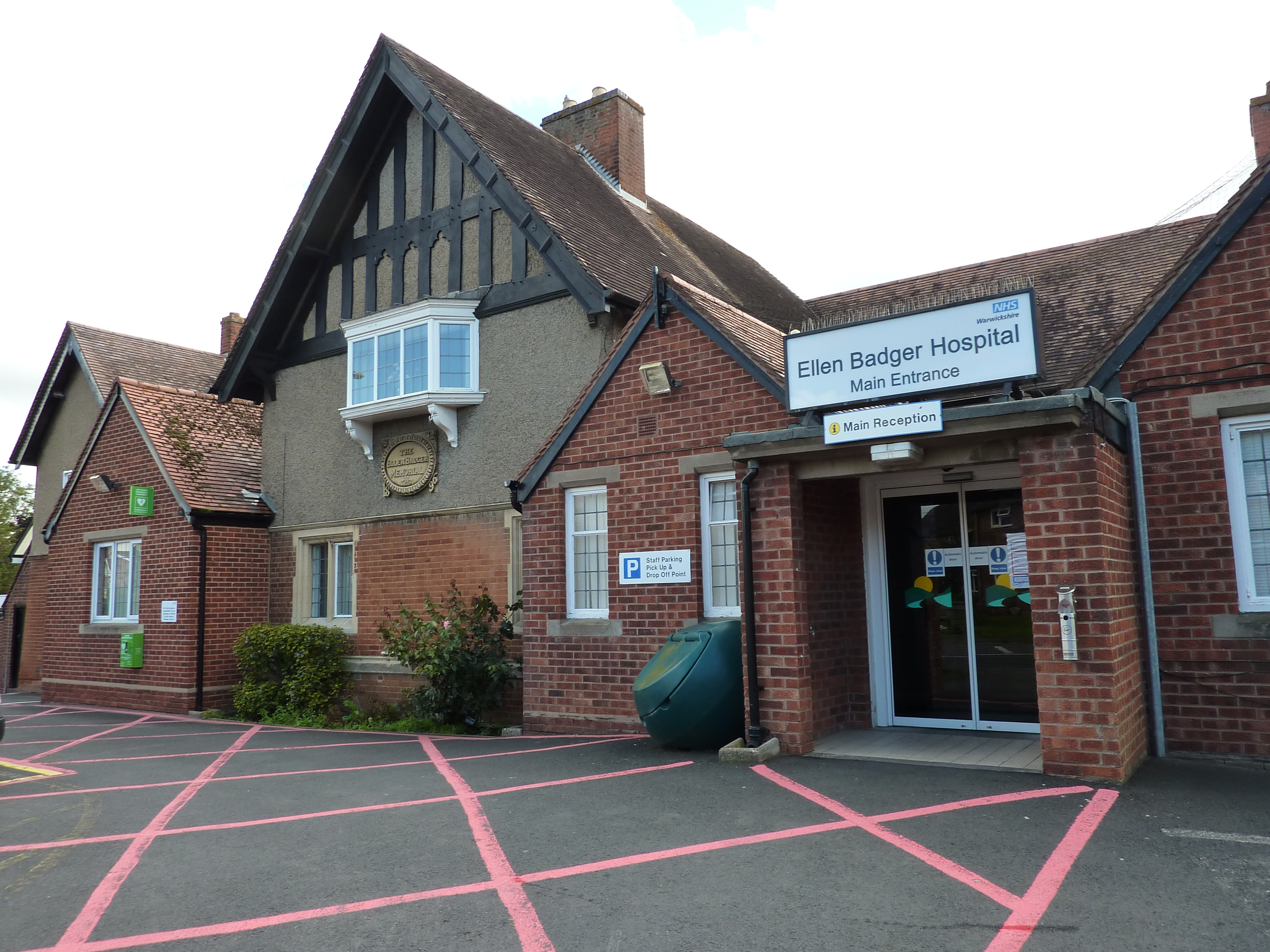
Ellen Badger Hospital

The Ellen Badger is a small community NHS hospital located within the town of Shipston-on-Stour in Warwickshire, England. It is operated by South Warwickshire...

Shipston-on-Stour railway station

Shipston-on-Stour railway station was a railway station which served the town of Shipston-on-Stour, Warwickshire. It was the terminus of the Shipston-on...

Shipston-on-Stour RFC

Shipston-on-Stour Rugby Football Club is an English rugby union team based in Shipston-on-Stour in Warwickshire. They currently play in Regional 2 South...

Shipston High School

Shipston High School is a coeducational secondary school with academy status in Shipston-on-Stour in Warwickshire, England. It is situated in the North...

Related Videos

1 Cotswold Round long distance hiking trail. Wild camping in Rab Silwing Tarp and OEX Bush Pro Bivvi

Day one on The Cotswold Round a 349 km / 217 miles long distance footpath circuit in South central England covering parts of 6 ...

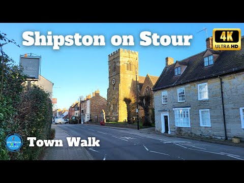
A Town Awakens: 4K Walk Through Shipston on Stour's Heart

Embark on a journey through Shipston in South Warwickshire as we commence our walk with a scenic view of the River Stour.

50 Shipston Bus ride. Stagecoach in Warwickshire.

50 Shipston Bus ride. Stagecoach in Warwickshire. Travel by Alexander Dennis Enviro 400 Diesel Double Decker Bus.

When I chatted to Dottie, Founder of The British Craft House

We talked everything Journals. Custom Journals. Leather Journals. Putting schemes together. Customisation options.

Nearby Amenities

Located within 500m of 52.057604,-1.614176
Turn
Naptan AtcoCode: 4200F005200
Naptan Bearing: NW
Naptan BusStopType: CUS
Naptan CommonName: Turn
Naptan Indicator: Adj
Naptan NaptanCode: waradgdj
Naptan Street: Shipston Road
Naptan Verified: no
Source: naptan_import
Lat/Long: 52.0599787/-1.6171457
Barrier: stile
Source: survey
Lat/Long: 52.054704/-1.6096086
Barrier: stile
Lat/Long: 52.0542442/-1.6131382
Barrier: kissing_gate
Lat/Long: 52.0592745/-1.6196319
Barcheston
Place: hamlet
Source: npe
Lat/Long: 52.0564805/-1.6152495
Water Pump
Historic: monument
Source: visual survey;bing
Url: http://www.geograph.org.uk/photo/2024114
Lat/Long: 52.0570359/-1.6143723
Grit Bin
Source: survey
Lat/Long: 52.056408/-1.6143375
Hardiman Fields
Operator: Warwickshire GirlGuides
Tourism: camp_pitch
Website: https://hardimanfields.co.uk/
Lat/Long: 52.0557591/-1.6197488
Barcheston Girl Guides Site
Location Transition: yes
Material: wood
Power: pole
Ref: 770525
Source: wpd_opendata
Transformer: distribution
Voltage Primary: 11000
Lat/Long: 52.0551187/-1.6200422
Material: wood
Power: pole
Source: bing
Lat/Long: 52.055407/-1.6192268
Material: wood
Power: pole
Source: bing
Lat/Long: 52.0556819/-1.6183913
Material: wood
Power: pole
Source: bing
Lat/Long: 52.0559079/-1.6177247
Power: pole
Lat/Long: 52.0560349/-1.6173519
Material: wood
Power: pole
Source: bing
Lat/Long: 52.0564018/-1.6162509
Material: wood
Power: pole
Source: bing
Lat/Long: 52.0570244/-1.6170368
Material: wood
Power: pole
Source: bing
Lat/Long: 52.0576083/-1.6177341
Material: wood
Power: pole
Source: bing
Lat/Long: 52.0581855/-1.6183886
Material: wood
Power: pole
Source: bing
Lat/Long: 52.058705/-1.6190296
Material: wood
Power: pole
Source: bing
Lat/Long: 52.0593086/-1.6195929
Material: wood
Power: pole
Source: bing
Lat/Long: 52.0602667/-1.619719
Material: wood
Power: pole
Source: bing
Lat/Long: 52.0607219/-1.6193971
Give Way
Direction: forward
Lat/Long: 52.0585484/-1.6094063
St Martins - Trans
Power: pole
Transformer: distribution
Voltage Primary: 11000
Lat/Long: 52.0566501/-1.6157627
Crossing
Crossing: unmarked
Crossing Markings: yes
Lat/Long: 52.0550619/-1.6163247
Pigbrook footbridge
Lat/Long: 52.0551055/-1.6162052
Barrier: kissing_gate
Foot: yes
Lat/Long: 52.057729/-1.6175041
The data included in this document is from www.openstreetmap.org. The data is made available under ODbL.

Have you been to Barcheston?

Leave your review of Barcheston below (or comments, questions and feedback).