Black Rigg

Hill, Mountain in Cumberland Carlisle

England

Black Rigg

View to Rob's Pike through gateway on NW side of rural road
View to Rob's Pike through gateway on NW side of rural road Credit: Luke Shaw

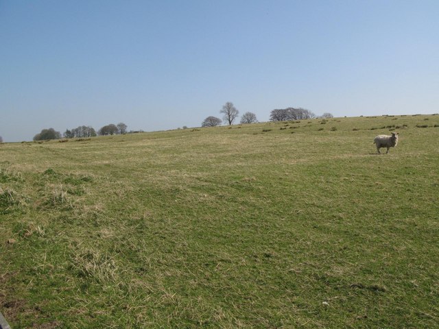
Black Rigg is a prominent hill located in the county of Cumberland, in the northwest region of England. It is situated in the North Pennines Area of Outstanding Natural Beauty, offering stunning views and a haven for outdoor enthusiasts.

Rising to an elevation of approximately 627 meters (2,057 feet), Black Rigg is classified as a hill rather than a mountain. Despite this, its rugged and steep slopes make it a challenging and rewarding climb. The hill is composed of various types of rock, including limestone and sandstone, which contribute to its distinctive appearance.

The summit of Black Rigg provides panoramic views of the surrounding countryside, including the nearby towns of Alston and Nenthead. On a clear day, it is even possible to catch a glimpse of the Lake District National Park to the west. The hill is also home to a diverse range of flora and fauna, with heather, grasses, and wildflowers adorning its slopes, and various bird species soaring overhead.

Black Rigg is a popular destination for hikers and walkers, with several well-marked trails leading to the summit. These routes vary in difficulty, allowing both experienced and novice adventurers to enjoy the hill's natural beauty. The area is also frequented by mountain bikers, who can tackle the challenging terrain and take advantage of the numerous tracks in the vicinity.

Overall, Black Rigg offers a wonderful opportunity to explore the stunning landscapes of Cumberland, providing a challenging outdoor experience and breathtaking views that are sure to captivate visitors.

If you have any feedback on the listing, please let us know in the comments section below.

Black Rigg Images

Images are sourced within 2km of 54.956815/-2.6005904 or Grid Reference NY6162. Thanks to Geograph Open Source API. All images are credited.

View to Rob's Pike through gateway on NW side of rural road
Gateway to field next to woodland on SW side of rural road
Old Milestone by the A69, Nether Denton parish Metal plate attached to stone post by the A69, in parish of NETHER DENTON (CARLISLE District), Trywell Lodge, Upper Denton West of Temon Bridge, on grass verge, on North side of road. Military Road plate, erected by the Carlisle & Temon (Military Road) turnpike trust in the 18th century. 

Inscription reads:-
: TO NEW / CASTLE / 41 / MILES : : TO CAR / LISLE / 15 / MILES :
Carved benchmark and pivot on top.

Grade II listed. 
List Entry Number: 1087561 <span class="nowrap"><a title="https://historicengland.org.uk/listing/the-list/list-entry/1087561" rel="nofollow ugc noopener" href="https://historicengland.org.uk/listing/the-list/list-entry/1087561">Link</a><img style="margin-left:2px;" alt="External link" title="External link - shift click to open in new window" src="https://s1.geograph.org.uk/img/external.png" width="10" height="10"/></span>

Milestone Society National ID: CU_CLNC15.
Old Milestone by the A69, Nether Denton parish
Metal plate attached to stone post by the A69, in parish of NETHER DENTON (CARLISLE District), Trywell Lodge, Upper Denton West of Temon Bridge, on grass verge, on North side of road. Military Road plate, erected by the Carlisle & Temon (Military Road) turnpike trust in the 18th century. Inscription reads:- : TO NEW / CASTLE / 41 / MILES : : TO CAR / LISLE / 15 / MILES : Carved benchmark and pivot on top. Grade II listed. List Entry Number: 1087561 LinkExternal link Milestone Society National ID: CU_CLNC15.
Old Milestone by the A69, Nether Denton parish Metal plate attached to stone post by the A69, in parish of NETHER DENTON (CARLISLE District), Trywell Lodge, Upper Denton West of Temon Bridge, on grass verge, on North side of road. Military Road plate, erected by the Carlisle & Temon (Military Road) turnpike trust in the 18th century. 

Inscription reads:-
: TO NEW / CASTLE / 41 / MILES : : TO CAR / LISLE / 15 / MILES :
Carved benchmark and pivot on top.

Grade II listed.  
List Entry Number: 1087561 <span class="nowrap"><a title="https://historicengland.org.uk/listing/the-list/list-entry/1087561" rel="nofollow ugc noopener" href="https://historicengland.org.uk/listing/the-list/list-entry/1087561">Link</a><img style="margin-left:2px;" alt="External link" title="External link - shift click to open in new window" src="https://s1.geograph.org.uk/img/external.png" width="10" height="10"/></span>

Milestone Society National ID: CU_CLNC15.
Old Milestone by the A69, Nether Denton parish
Metal plate attached to stone post by the A69, in parish of NETHER DENTON (CARLISLE District), Trywell Lodge, Upper Denton West of Temon Bridge, on grass verge, on North side of road. Military Road plate, erected by the Carlisle & Temon (Military Road) turnpike trust in the 18th century. Inscription reads:- : TO NEW / CASTLE / 41 / MILES : : TO CAR / LISLE / 15 / MILES : Carved benchmark and pivot on top. Grade II listed. List Entry Number: 1087561 LinkExternal link Milestone Society National ID: CU_CLNC15.
A69 road junction
A69 road junction
Country road approaching the A69 Tall grass and wild flowers growing on the verges obscure dry stone walls either side, which can be seen in a similar view taken the previous winter - <a href="https://www.geograph.org.uk/photo/325079">NY5963 : Junction A69</a> .
Country road approaching the A69
Tall grass and wild flowers growing on the verges obscure dry stone walls either side, which can be seen in a similar view taken the previous winter - NY5963 : Junction A69 .
Gateways on NE side of road between A69 and Lane Head Ordnance Survey documents indicate that a benchmark levelled at 185.934m above Newlyn Datum was verified in 1955 on a gatepost at the right side of the right hand gateway
Gateways on NE side of road between A69 and Lane Head
Ordnance Survey documents indicate that a benchmark levelled at 185.934m above Newlyn Datum was verified in 1955 on a gatepost at the right side of the right hand gateway
North end of minor road from Cleugh Head  to junction with A69 Ordnance Survey documents describe a benchmark levelled at 213.348m above Newlyn Datum verified in 1955 on the wall at this location
North end of minor road from Cleugh Head to junction with A69
Ordnance Survey documents describe a benchmark levelled at 213.348m above Newlyn Datum verified in 1955 on the wall at this location
A69 approaching Cleugh Head junction 42 miles from Newcastle There is a milestone <a href="https://www.geograph.org.uk/photo/7495524">NY5963 : Milestone with benchmark on north side of A69 14 miles from Carlisle</a> on the verge
A69 approaching Cleugh Head junction 42 miles from Newcastle
Junction A69 Small farm road crosses the A69. It pays to take it easy on the A69 too many crossings like this one.
Junction A69
Small farm road crosses the A69. It pays to take it easy on the A69 too many crossings like this one.
Dusk Mole Hills Looking across fields to Cleugh Head.
Dusk Mole Hills
Looking across fields to Cleugh Head.
Rough pastures west of Closegill
Rough Pasture above Birch Craig
Road to Cleugh Head
Road to Cleugh Head
Thirlwall Common (South Side)
Farm building, Low Closegill
Rough pasture, Low Closegill
The A69 heading east, Low Closegill Towards Haltwhistle.
The A69 heading east, Low Closegill
Towards Haltwhistle.
Show me another place!

Black Rigg is located at Grid Ref: NY6162 (Lat: 54.956815, Lng: -2.6005904)

Administrative County: Cumbria

District: Carlisle

Police Authority: Cumbria

What 3 Words

///solution.domain.keen. Near Greenhead, Northumberland

Related Wikis

Nether Denton

Nether Denton is a scattered settlement and civil parish in rural Cumbria, England, situated about 12 miles (19 km) north-east of Carlisle, by the A69...

Upper Denton

Upper Denton is a small village and civil parish in the north of Cumbria, England, about 1 km north of the A69 road linking Haltwhistle and Brampton. The...

Low Row railway station

Low Row is a former railway station on the Tyne Valley Line, which served the village of Low Row in Cumbria between 1836 and 1965. == History == The station...

Tindale, Cumbria

Tindale or Tindale Fell is a hamlet in the parish of Farlam in the City of Carlisle district of the English county of Cumbria. It is to the south of the...
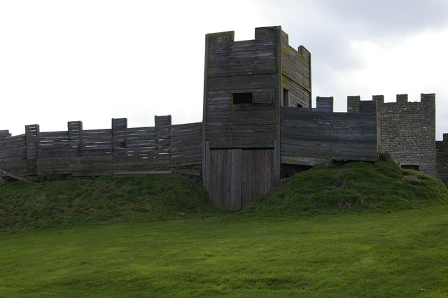
Milecastle 50TW

Milecastle 50TW (High House) was a milecastle on the Turf Wall section of Hadrian's Wall (grid reference NY60716583). The milecastle is located close...

Milecastle 50

Milecastle 50 (High House) was a milecastle on Hadrian's Wall (grid reference NY60676601). == Description == Milecastle 50 is west of Birdoswald fort....

Banna (Birdoswald)

Birdoswald Roman Fort was known as Banna ("horn" in Celtic) in Roman times, reflecting the geography of the site on a triangular spur of land bounded by...

Birdoswald

Birdoswald is a former farm in the civil parish of Waterhead in the English county of Cumberland. It stands on the site of the Roman fort of Banna. �...

Nearby Amenities

Located within 500m of 54.956815,-2.6005904
Black Rigg
Place: locality
Lat/Long: 54.957053/-2.6051239
Building: yes
Lat/Long: 54.9561666/-2.6082607
Power: pole
Lat/Long: 54.9566576/-2.6078702
Power: pole
Lat/Long: 54.9566843/-2.6065954
Power: pole
Lat/Long: 54.9567087/-2.6051425
Power: pole
Lat/Long: 54.9567355/-2.6036897
Power: pole
Lat/Long: 54.956761/-2.6022915
Power: pole
Lat/Long: 54.9567936/-2.6008831
The data included in this document is from www.openstreetmap.org. The data is made available under ODbL.

Have you been to Black Rigg?

Leave your review of Black Rigg below (or comments, questions and feedback).