Barnedge Hill

Hill, Mountain in Gloucestershire Forest of Dean

England

Barnedge Hill

Cycleway and former railway The trackbed of the former Severn and Wye Valley near Serridge Inclosure.
Cycleway and former railway Credit: Philip Halling

Barnedge Hill is a prominent landmark located in the county of Gloucestershire, England. Situated near the small village of Barnedge, this hill is part of the Cotswold Hills, a designated Area of Outstanding Natural Beauty.

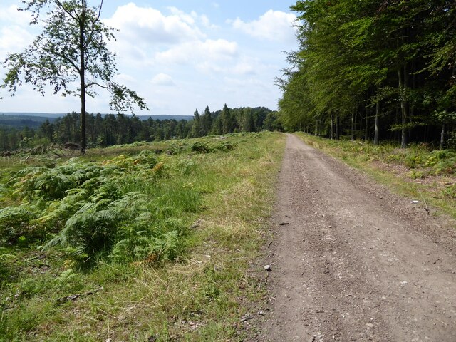
Rising to an elevation of 278 meters (912 feet), Barnedge Hill is often referred to as a hill rather than a mountain due to its modest height. Nonetheless, its commanding presence and panoramic views make it a popular destination for hikers, nature enthusiasts, and photographers alike.

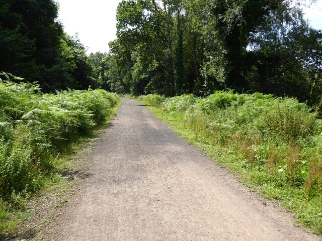
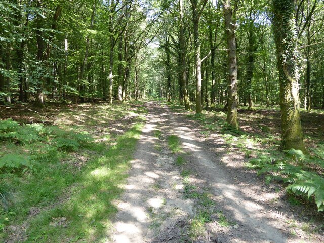
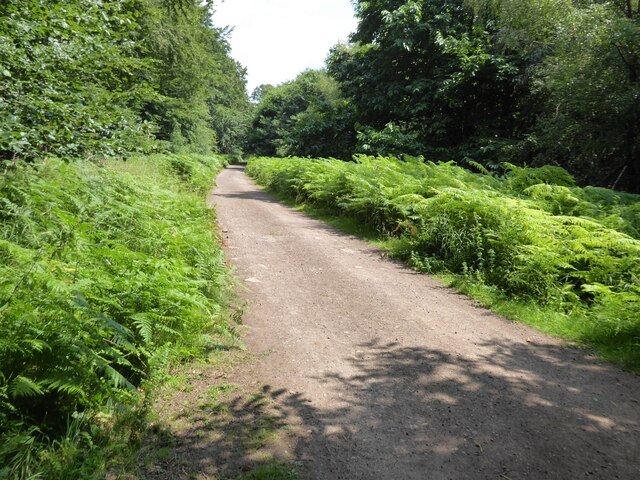
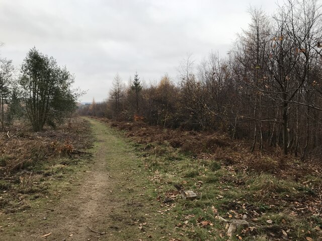
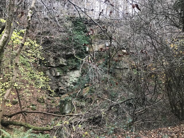
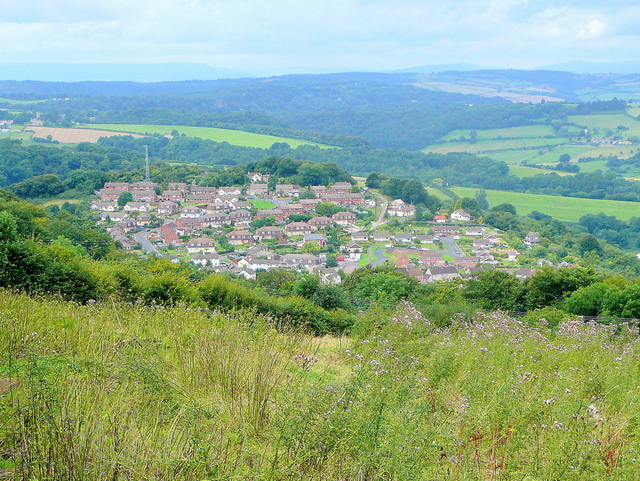
The hill is covered in lush green vegetation, with patches of woodland and open grassland dotting its slopes. The landscape is characterized by gentle undulations and rolling hills, typical of the Cotswold region. The summit offers breathtaking vistas of the surrounding countryside, including the picturesque Cotswold stone villages that are scattered throughout the area.

Barnedge Hill is also home to a variety of wildlife, with many species of birds, mammals, and insects inhabiting its rich ecosystems. It provides a habitat for several rare and protected species, including the Skylark and the Brown Hare.

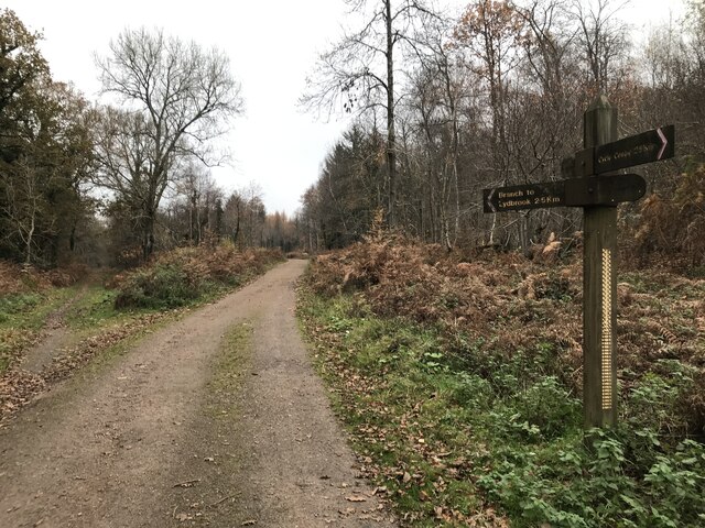
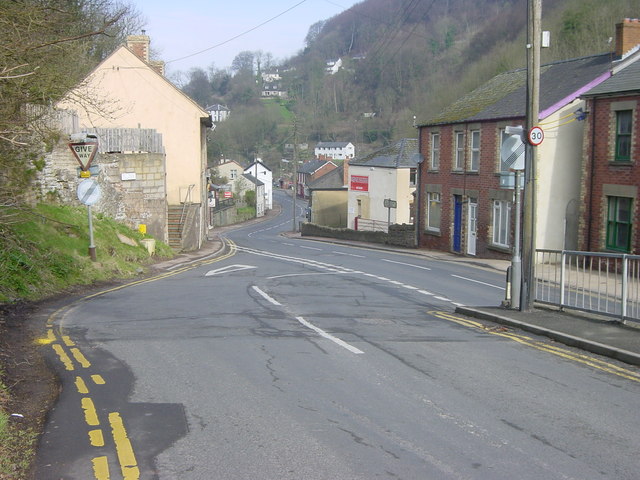
Access to Barnedge Hill is relatively easy, with public footpaths and bridleways crisscrossing the area, allowing visitors to explore its natural beauty. The hill attracts visitors throughout the year, with each season bringing its own charm. In spring, vibrant wildflowers carpet the hillside, while autumn reveals a tapestry of colors as the leaves change.

Overall, Barnedge Hill is a captivating and idyllic destination, offering visitors a chance to immerse themselves in the peaceful and picturesque landscapes of Gloucestershire's countryside.

If you have any feedback on the listing, please let us know in the comments section below.

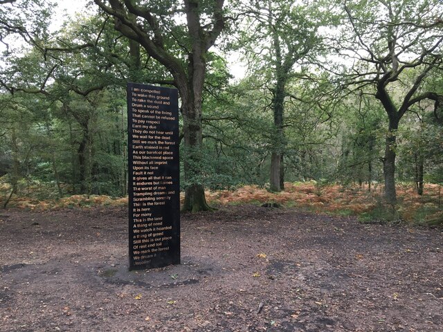
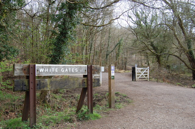
Barnedge Hill Images

Images are sourced within 2km of 51.832182/-2.5630603 or Grid Reference SO6114. Thanks to Geograph Open Source API. All images are credited.

Cycleway and former railway The trackbed of the former Severn and Wye Valley near Serridge Inclosure.
Cycleway and former railway
The trackbed of the former Severn and Wye Valley near Serridge Inclosure.
Forest track Forest track in Serridge Inclosure in the Forest of Dean.
Forest track
Forest track in Serridge Inclosure in the Forest of Dean.
The Wysis Way The Wysis Way following a track in Serridge Inclosure.  The Wysis Way is a long distance path connecting Offa's Dyke and the start of the Thames Path.
The Wysis Way
The Wysis Way following a track in Serridge Inclosure. The Wysis Way is a long distance path connecting Offa's Dyke and the start of the Thames Path.
Forest track Forest track near Serridge Green in the Forest of Dean.
Forest track
Forest track near Serridge Green in the Forest of Dean.
Area of clearfell Area of clearfell at Serridge Green.  With the trees felled there are extensive views over the forest.
Area of clearfell
Area of clearfell at Serridge Green. With the trees felled there are extensive views over the forest.
Soil Unsoiled, Forest of Dean Sculpture Trail
White Gates Paths and tracks in all directions
White Gates
Paths and tracks in all directions
Forest ride
Forest ride
Old railway junction
Mirystock Bridge
Mirystock Bridge
Old chapel and recreation ground
Old railway
Old railway
Old quarry
Old quarry
Sallowvallets track
Sallowvallets track
Sharp turn in the forest track
Old Boundary Marker Estate Boundary Marker east of a forest track and just north of the A4136 near Mirystock House. Lydbrook parish. inscribed Bourts Inclosure and 1842 this perhaps records the enclosure of part of the Forest of Dean.

Milestone Society National ID: GL_LYDBR01em
Old Boundary Marker
Estate Boundary Marker east of a forest track and just north of the A4136 near Mirystock House. Lydbrook parish. inscribed Bourts Inclosure and 1842 this perhaps records the enclosure of part of the Forest of Dean. Milestone Society National ID: GL_LYDBR01em
Modern Boundary Stone, Ruardean High on the Northern embankment of "Townsend". One of the many replacement boundary stone delineating the periphery of the "Forest of Dean". The "Forest" is very specific because resident have "rights in common" like grazing sheep and coal mining, though you may have to be born there to classify as a "free miner". 

Inscription: D. F. / No 116 / 2010 

Milestone Society National ID: GL_DFRUAR116em
Modern Boundary Stone, Ruardean
High on the Northern embankment of "Townsend". One of the many replacement boundary stone delineating the periphery of the "Forest of Dean". The "Forest" is very specific because resident have "rights in common" like grazing sheep and coal mining, though you may have to be born there to classify as a "free miner". Inscription: D. F. / No 116 / 2010 Milestone Society National ID: GL_DFRUAR116em
Modern Boundary Stone, The Pludds On the North verge of Highbeech Road. One of the many replacement boundary stone delineating the periphery of the "Forest of Dean". The "Forest" is very specific because resident have "rights in common" like grazing sheep and coal mining, though you may have to be born there to classify as a "free miner".

Inscription: D. F. / 20005 / Nᴼ. 118

Milestone Society National ID: GL_DFRUAR118em
Modern Boundary Stone, The Pludds
On the North verge of Highbeech Road. One of the many replacement boundary stone delineating the periphery of the "Forest of Dean". The "Forest" is very specific because resident have "rights in common" like grazing sheep and coal mining, though you may have to be born there to classify as a "free miner". Inscription: D. F. / 20005 / Nᴼ. 118 Milestone Society National ID: GL_DFRUAR118em
Show me another place!

Barnedge Hill is located at Grid Ref: SO6114 (Lat: 51.832182, Lng: -2.5630603)

Administrative County: Gloucestershire

District: Forest of Dean

Police Authority: Gloucestershire

What 3 Words

///workshops.radically.erupt. Near Lydbrook, Gloucestershire

Related Wikis

Upper Lydbrook railway station

Upper Lydbrook railway station served the civil parish of Lydbrook, Gloucestershire, England, from 1875 to 1929 on the Severn and Wye Railway. == History... ==

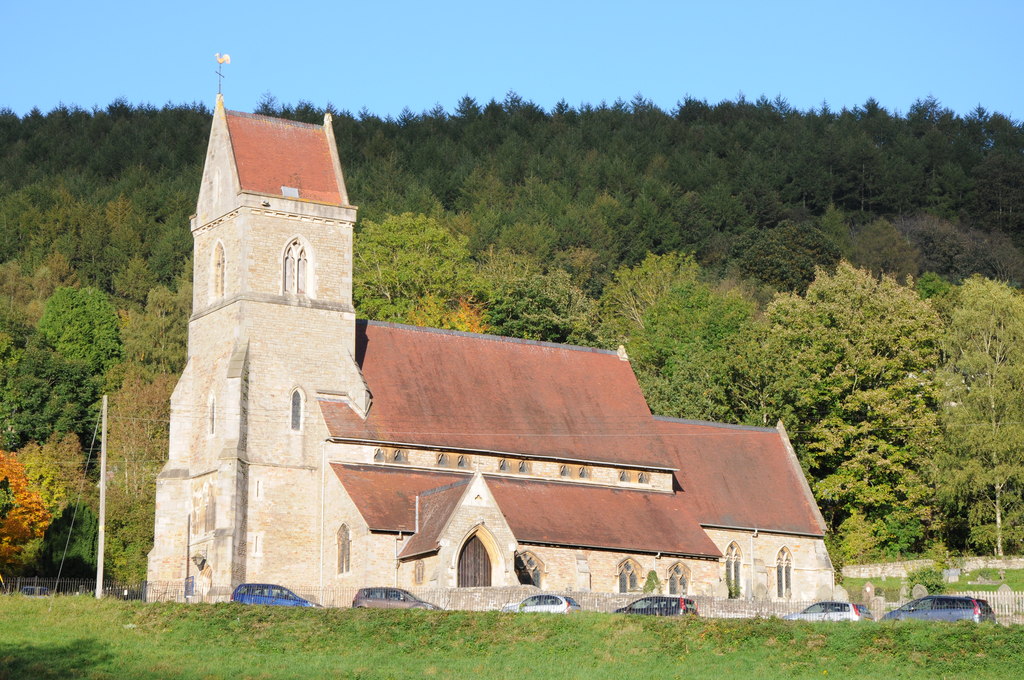
Holy Jesus Church, Lydbrook

Holy Jesus Church at Lydbrook is a Church of England parish church in the English county of Gloucestershire. == Structure == The greater part of the church...

The Pludds

The Pludds is a hamlet in the Forest of Dean, Gloucestershire, England (grid reference SO617161). Lydbrook and Joys Green are to the west, Ruardean is...

Brierley, Gloucestershire

Brierley is a village in the Forest of Dean, Gloucestershire, United Kingdom. It has one petrol station and a shop, both of which are both operated by...

Lydbrook

Lydbrook is a civil parish in the Forest of Dean, a local government district in the English county of Gloucestershire and is located in the Wye Valley...

Joys Green, Gloucestershire

Joy's Green is a village in the Forest of Dean in West Gloucestershire, England. The village is in the civil parish of the neighbouring village of Lydbrook...

Sarah Siddons' House

Sarah Siddons' House, also called the Old House, is a cottage in the village of Lydbrook, Gloucestershire, England. A Grade II* listed building, the cottage...

Drybrook Road railway station

Drybrook Road is a closed station on the Cinderford to Coleford direct railway line in the Forest of Dean in Gloucestershire, near the village of Drybrook...

Nearby Amenities

Located within 500m of 51.832182,-2.5630603
Bus Stop
Mireystock
Naptan AtcoCode: 1600GL3297
Naptan Bearing: S
Naptan CommonName: Mireystock
Naptan NaptanCode: gloagmjt
Naptan Street: B4234
Naptan Verified: no
Source: naptan_import
Lat/Long: 51.8294581/-2.5634664
Bus Stop
Mireystock
Naptan AtcoCode: 1600GL3298
Naptan Bearing: N
Naptan CommonName: Mireystock
Naptan NaptanCode: gloagmjp
Naptan Street: B4234
Naptan Verified: no
Source: naptan_import
Lat/Long: 51.8291258/-2.5633897
Bus Stop
Mireystock
Naptan AtcoCode: 1600GLA36653
Naptan Bearing: W
Naptan CommonName: Mireystock
Naptan NaptanCode: glogmgtp
Naptan Street: A4136
Naptan Verified: no
Source: naptan_import
Lat/Long: 51.8288047/-2.5628488
Bus Stop
Mireystock
Naptan AtcoCode: 1600GLA36654
Naptan Bearing: E
Naptan CommonName: Mireystock
Naptan NaptanCode: glogmgtw
Naptan Street: A4136
Naptan Verified: no
Source: naptan_import
Lat/Long: 51.8289217/-2.5628067
Power: pole
Lat/Long: 51.8318481/-2.5612972
Power: pole
Lat/Long: 51.8335945/-2.569301
Power: pole
Lat/Long: 51.8321127/-2.562621
Power: pole
Lat/Long: 51.8328227/-2.5660667
Power: pole
Lat/Long: 51.8317524/-2.5611445
Power: pole
Lat/Long: 51.8326778/-2.5614661
Power: pole
Lat/Long: 51.8325914/-2.5650768
Power: pole
Lat/Long: 51.8319646/-2.5611452
Power: pole
Lat/Long: 51.8315794/-2.5599742
Power: pole
Lat/Long: 51.8323841/-2.5639715
Power: pole
Lat/Long: 51.8353319/-2.5630334
Power: pole
Lat/Long: 51.8330953/-2.5671907
Power: pole
Lat/Long: 51.8345809/-2.5624109
Power: pole
Lat/Long: 51.8319306/-2.5613919
Power: pole
Lat/Long: 51.8318629/-2.5611158
Power: pole
Lat/Long: 51.8306849/-2.5575212
Power: pole
Lat/Long: 51.831164/-2.5579557
Power: pole
Lat/Long: 51.8314113/-2.5591633
Power: pole
Lat/Long: 51.8308557/-2.556109
Power: pole
Lat/Long: 51.8310993/-2.5573374
Power: pole
Lat/Long: 51.8312228/-2.5586088
Power: pole
Lat/Long: 51.8314074/-2.5594375
Power: pole
Lat/Long: 51.8315807/-2.5602765
Power: pole
Lat/Long: 51.8311979/-2.5578068
Power: pole
Lat/Long: 51.8314035/-2.5588448
Power: pole
Lat/Long: 51.8314746/-2.559181
Power: pole
Lat/Long: 51.8316777/-2.5601855
Power: pole
Lat/Long: 51.832114/-2.5622849
Power: pole
Lat/Long: 51.8322947/-2.563214
Power: pole
Lat/Long: 51.8324752/-2.5641391
Power: pole
Lat/Long: 51.8326509/-2.5650681
Power: pole
Lat/Long: 51.833139/-2.5671226
Power: pole
Lat/Long: 51.8335856/-2.5690091
Power: pole
Lat/Long: 51.8337016/-2.569453
Mirystock Bridge
Place: locality
Lat/Long: 51.8281688/-2.5603383
Little God Meadow
Place: locality
Lat/Long: 51.8295405/-2.5592572
Barnedge Hill
Place: locality
Lat/Long: 51.8314042/-2.5625711
Power: pole
Lat/Long: 51.8328997/-2.566135
The data included in this document is from www.openstreetmap.org. The data is made available under ODbL.

Have you been to Barnedge Hill?

Leave your review of Barnedge Hill below (or comments, questions and feedback).