Bass Rock

Hill, Mountain in East Lothian

Scotland

Bass Rock

Bass Rock, Lighthouse Lighthouse and ruins on Bass Rock with some of the 150,000 Gannets that inhabit the rock. A few people can be seen ascending the rock just above and left of the lighthouse.
Bass Rock, Lighthouse Credit: Adam Ward

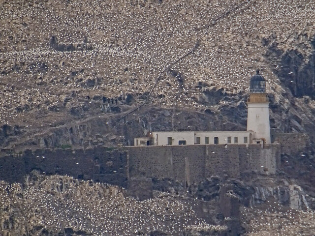
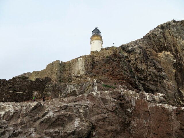
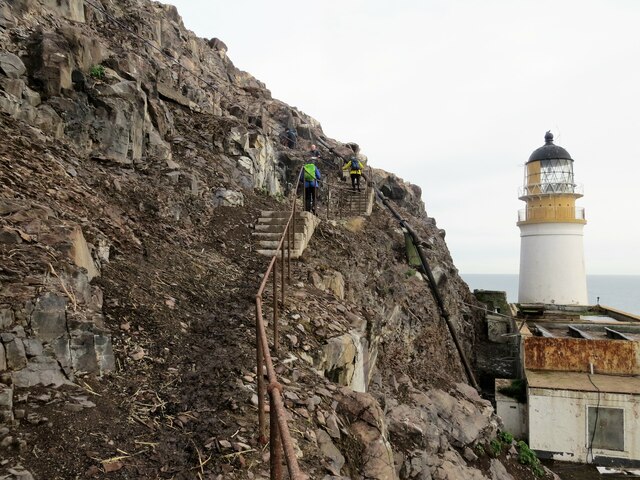
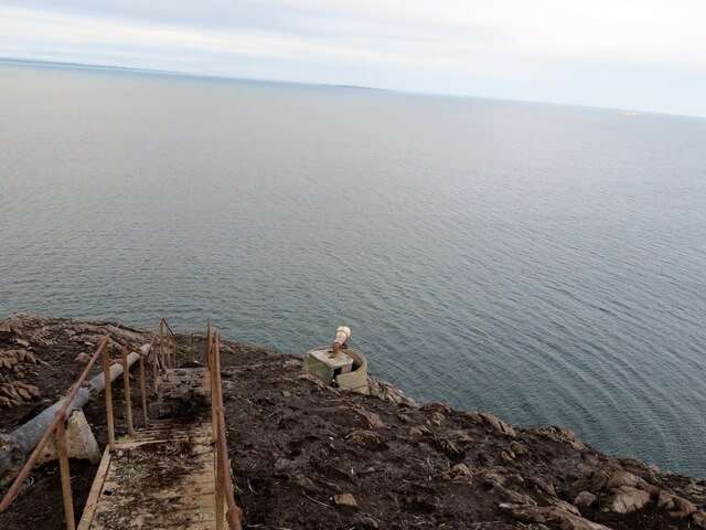
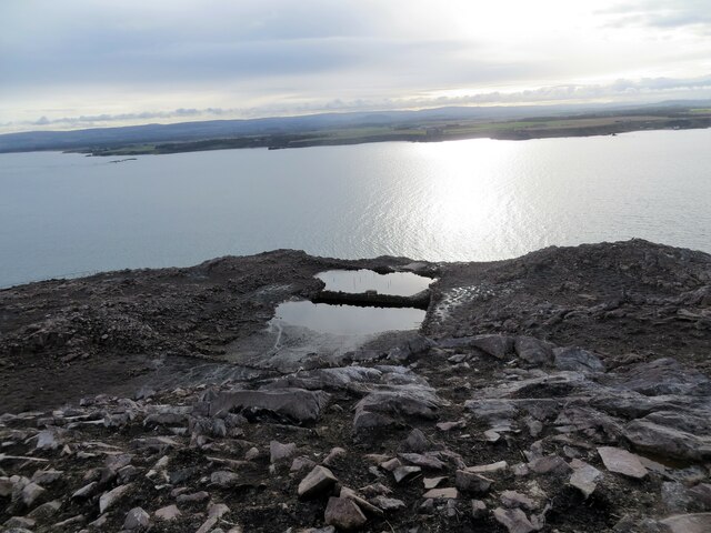
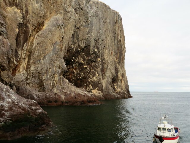
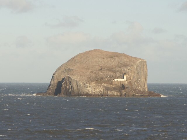
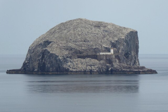
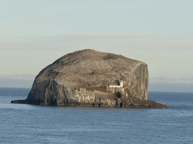
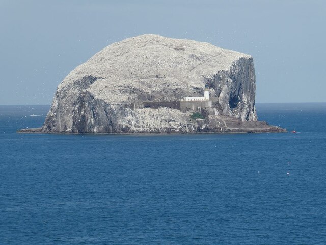
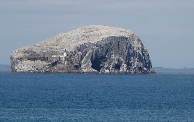
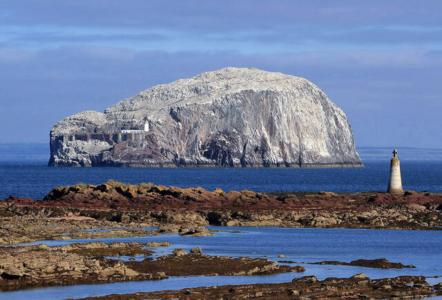
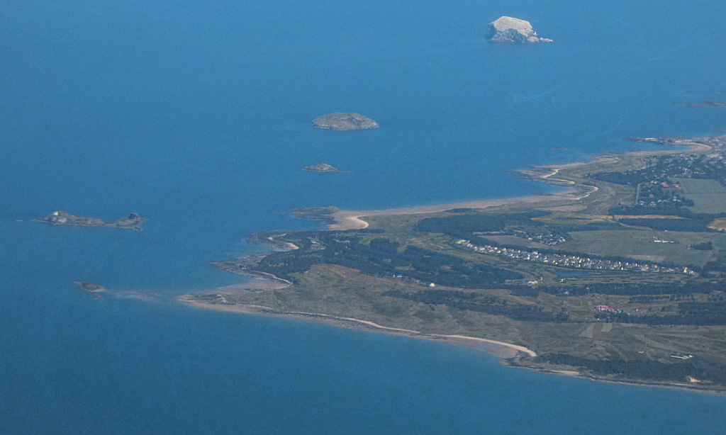
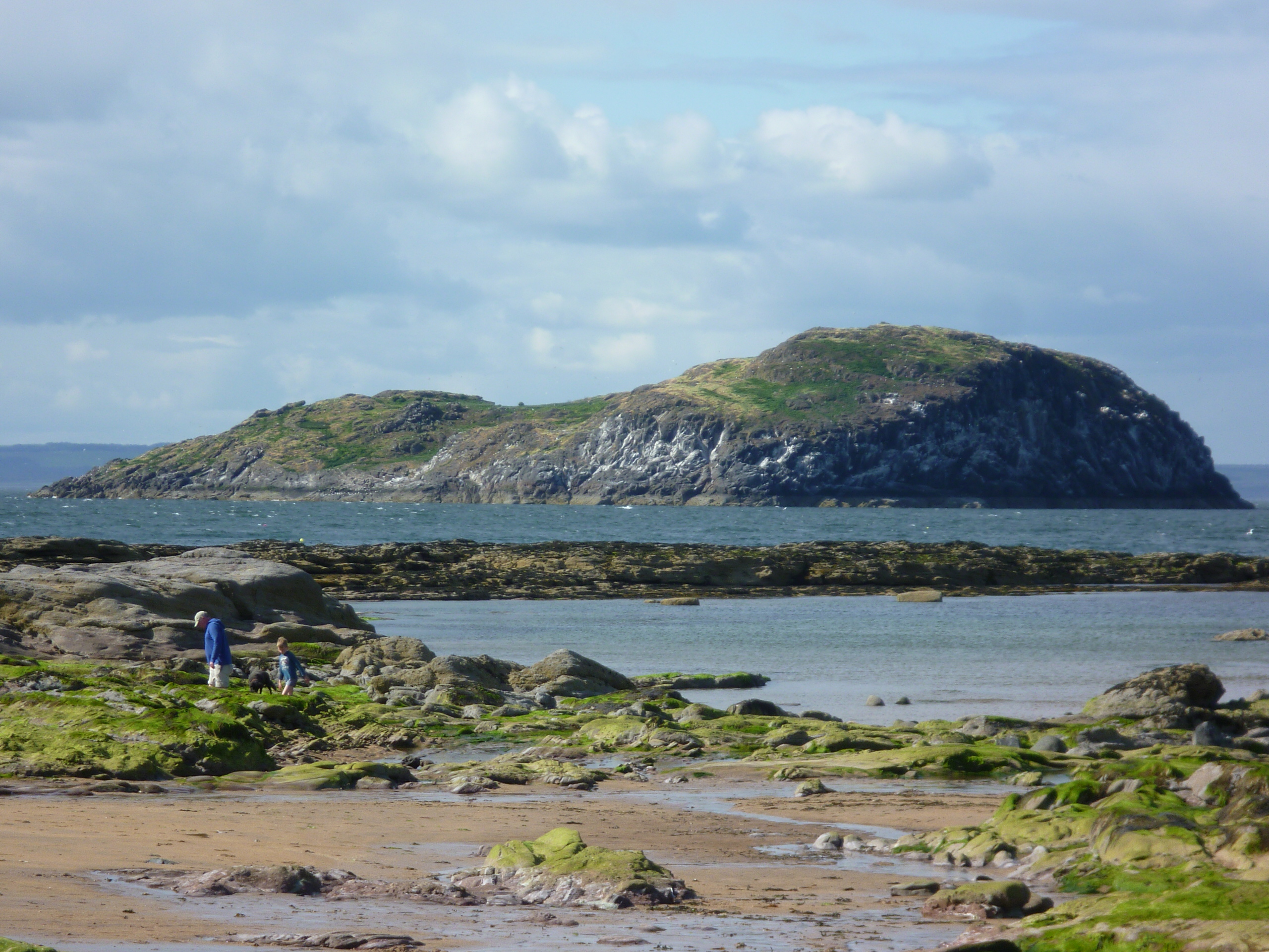
Bass Rock is a small island located in the Firth of Forth, approximately 2 kilometers off the coast of East Lothian, Scotland. The island is formed from volcanic rock, and its distinctive appearance and shape have earned it the nickname "The Bass." It rises steeply from the sea, reaching a height of 107 meters, making it an imposing landmark.

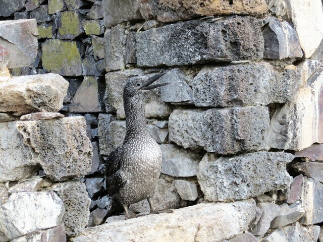
One of the most prominent features of Bass Rock is its unique white color, which is due to the large population of nesting seabirds that inhabit the island. Over 150,000 gannets, the largest colony in the world, make Bass Rock their home during the breeding season. The white coloration of their feathers, combined with the sheer number of birds, creates a stunning visual spectacle.

In addition to gannets, Bass Rock also hosts other seabird species, including puffins, guillemots, razorbills, and shags. The island's remote location and lack of predators make it an ideal nesting site for these birds.

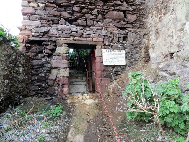
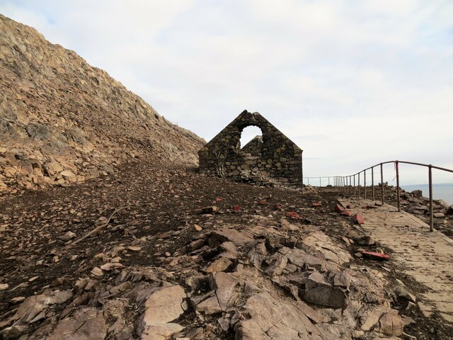
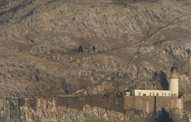
The island has a long and rich history, dating back to at least the 7th century, when it was used by Christian missionaries as a hermitage. Over the centuries, Bass Rock has served various purposes, including a fortification during the Napoleonic Wars and a prison for religious dissenters in the 17th century.

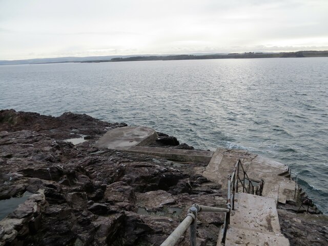
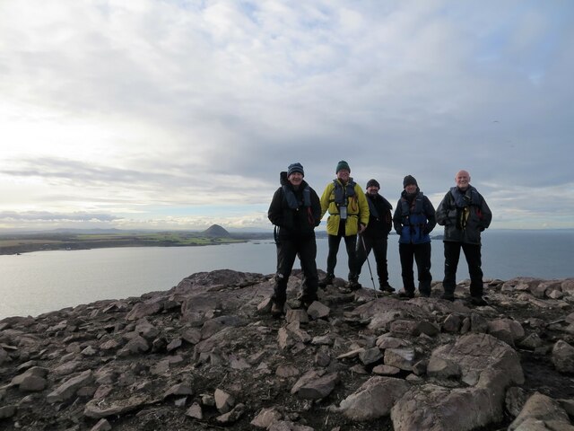
Today, Bass Rock is a popular tourist destination, attracting visitors who are interested in observing the diverse birdlife and learning about the island's history. Boat trips are available from North Berwick, allowing visitors to get up close and witness the incredible wildlife spectacle that is Bass Rock.

If you have any feedback on the listing, please let us know in the comments section below.

Bass Rock Images

Images are sourced within 2km of 56.078158/-2.6401258 or Grid Reference NT6087. Thanks to Geograph Open Source API. All images are credited.

Bass Rock, Lighthouse Lighthouse and ruins on Bass Rock with some of the 150,000 Gannets that inhabit the rock. A few people can be seen ascending the rock just above and left of the lighthouse.
Bass Rock, Lighthouse
Lighthouse and ruins on Bass Rock with some of the 150,000 Gannets that inhabit the rock. A few people can be seen ascending the rock just above and left of the lighthouse.
Bass Rock Lighthouse and fortifications Lighthouse erected in 1901 by commissioners of Northern Lighthouses
Bass Rock Lighthouse and fortifications
Lighthouse erected in 1901 by commissioners of Northern Lighthouses
Helipad on Bass Rock Between the East and the West landings
Helipad on Bass Rock
Between the East and the West landings
Entrance passage to the fortifications and lighthouse on Bass Rock Boatman opened the gate for us as it is always locked
Entrance passage to the fortifications and lighthouse on Bass Rock
Boatman opened the gate for us as it is always locked
Bass Rock lighthouse and stairs to the foghorn
Guga, a young gannet, on the window sill on St Baldred's Chapel Most of the gannets had left the Bass Rock for warmer climes, only a few still remain
Guga, a young gannet, on the window sill on St Baldred's Chapel
Most of the gannets had left the Bass Rock for warmer climes, only a few still remain
Foghorn, Bass Rock The foghorn is no longer in use. Overlooking the Firth of Forth
Foghorn, Bass Rock
The foghorn is no longer in use. Overlooking the Firth of Forth
Gardens and well below the summit of Bass Rock It was the water supply and gardens when it was used as a penal colony
Gardens and well below the summit of Bass Rock
It was the water supply and gardens when it was used as a penal colony
Happy group of walkers on Bass Rock summit North Berwick Law in the distance
Happy group of walkers on Bass Rock summit
North Berwick Law in the distance
Remains of St Baldred's Chapel, Bass Rock
Cliffs tower over the East Landing on Bass Rock Our boat, The Braveheart, in the foreground
Cliffs tower over the East Landing on Bass Rock
Our boat, The Braveheart, in the foreground
Bass Rock View from above Canty Bay when the gannets are away.
Bass Rock
View from above Canty Bay when the gannets are away.
Bass Rock Viewed from Drift above Canty Bay.
Bass Rock
Viewed from Drift above Canty Bay.
Bass Rock After the gannets had departed.
Bass Rock
After the gannets had departed.
St Baldred's Chapel and lighthouse, Bass Rock Winter view, the gannets are somewhere warmer off Africa.
St Baldred's Chapel and lighthouse, Bass Rock
Winter view, the gannets are somewhere warmer off Africa.
Bass Rock Covered in bird lime.  Seen from the headland on which the Drift cafe stands.
Bass Rock
Covered in bird lime. Seen from the headland on which the Drift cafe stands.
Bass Rock Covered in guano from the many gannets which have made the rock their home. The lighthouse is clearly visible with the East Landing to its right. The coast of Fife beyond.
Bass Rock
Covered in guano from the many gannets which have made the rock their home. The lighthouse is clearly visible with the East Landing to its right. The coast of Fife beyond.
The Bass Rock from the shoreline at Seacliff This telephoto shot also includes the shipping beacon called St Baldred’s Cross on Great Car.
The Bass Rock from the shoreline at Seacliff
This telephoto shot also includes the shipping beacon called St Baldred’s Cross on Great Car.
Show me another place!

Bass Rock is located at Grid Ref: NT6087 (Lat: 56.078158, Lng: -2.6401258)

Unitary Authority: East Lothian

Police Authority: The Lothians and Scottish Borders

What 3 Words

///emphasis.irrigated.shave. Near North Berwick, East Lothian

Related Wikis

Bass Rock

The Bass Rock, or simply the Bass ( ), (Scottish Gaelic: Creag nam Bathais or Scottish Gaelic: Am Bas) is an island in the outer part of the Firth of Forth...

Bass Rock Lighthouse

The Bass Rock Lighthouse on Bass Rock is a 20-metre (66 ft) lighthouse, built in 1902 by David Stevenson, who demolished the 13th-century keep, or governor...

Canty Bay

Canty Bay is a small inlet and coastal hamlet on the northern coast of East Lothian, Scotland. It is 2 miles (3.2 km) east of North Berwick and is opposite...
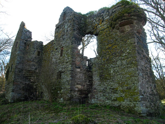
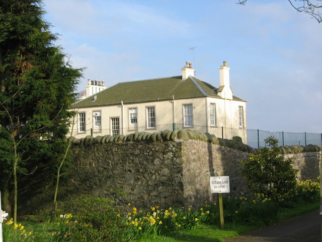
Auldhame Castle

Auldhame Castle is a ruined L-plan tower house standing on a ridge above Seacliff beach, about 3 miles east of North Berwick in East Lothian, and less...

Seacliff

Seacliff comprises a beach, an estate and a harbour. It lies 4 miles (6 kilometres) east of North Berwick, East Lothian, Scotland. == History == The beach...

Auldhame & Scoughall

Auldhame and Scoughall are hamlets in East Lothian, Scotland. They are close to the town of North Berwick and the village of Whitekirk, and are approximately...

North Berwick Castle

North Berwick Castle was a castle on motte, originating in the 13th-century, east of North Berwick, East Lothian, Scotland, just south of the Firth of...

Craigleith

Craigleith (Scottish Gaelic: Creag Lìte) is a small island in the Firth of Forth off North Berwick in East Lothian, Scotland. Its name comes from the Scottish...

Nearby Amenities

Located within 500m of 56.078158,-2.6401258
Created By: almien_coastlines
Lat/Long: 56.076636/-2.640275
Well
Natural: spring
Lat/Long: 56.0774693/-2.6398869
West Cove
Natural: bay
Source: OS_OpenData_StreetView
Lat/Long: 56.0777688/-2.6430344
Historic: yes
Man Made: lighthouse
Seamark Light 1 Character: Fl
Seamark Light 1 Colour: white
Seamark Light 1 Group: 3
Seamark Light 1 Height: 46
Seamark Light 1 Period: 20
Seamark Light 1 Range: 10
Seamark Light 1 Sector End: 107
Seamark Light 1 Sector Start: 241
Seamark Light 1 Sequence: 0.5+(2),0.5+(2),0.5+(14.5)
Seamark Light Reference: A 2864
Seamark Name: Bass Rock
Seamark Type: light_minor
Source: US NGA Pub. 114. 2011-05-26.
Start Date: 1902
Wikidata: Q15196984
Wikipedia: en:Bass Rock Lighthouse
Lat/Long: 56.0766/-2.6409359
Bass Rock
Ele: 107
Natural: peak
Lat/Long: 56.078307/-2.6403616
The Pulpit
Place: locality
Source: OS_OpenData_StreetView
Lat/Long: 56.0789294/-2.6385356
The data included in this document is from www.openstreetmap.org. The data is made available under ODbL.

Have you been to Bass Rock?

Leave your review of Bass Rock below (or comments, questions and feedback).