Mid Hill

Hill, Mountain in Aberdeenshire

Scotland

Mid Hill

Peter Hill Not named after the former chairman of Hereford United!   View from Sandy Hill, northwards.
Peter Hill Credit: Richard Webb

Mid Hill is a prominent hill located in Aberdeenshire, Scotland. It is part of the Grampian Mountains range and stands at an elevation of approximately 1,284 meters (4,213 feet). The hill is situated about 10 kilometers southeast of the town of Braemar and is easily accessible to hikers and mountaineers.

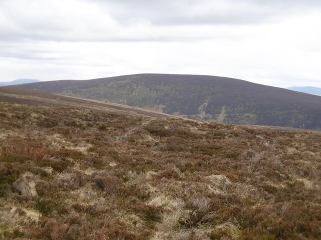
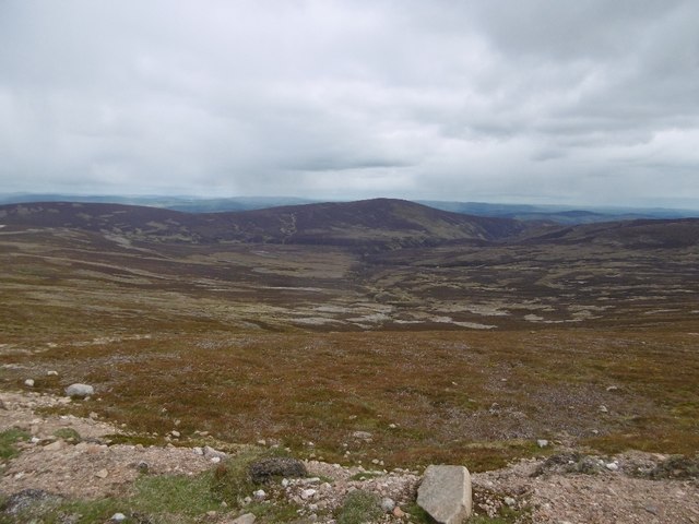
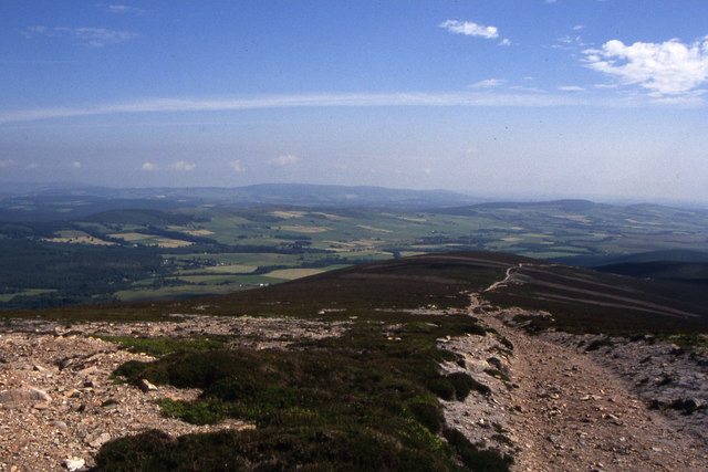
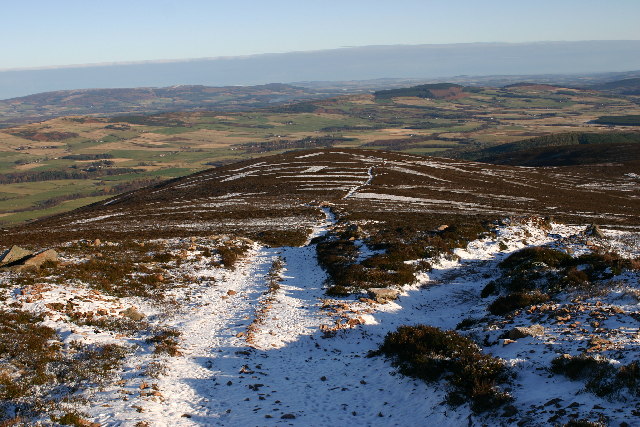
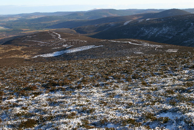
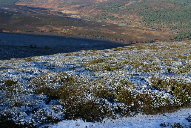
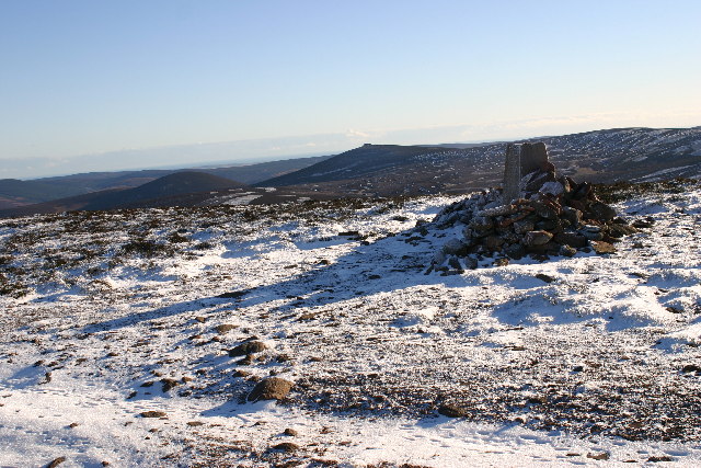
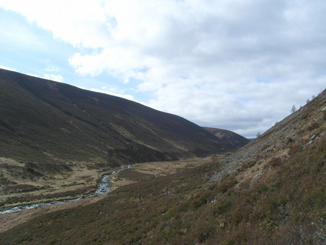
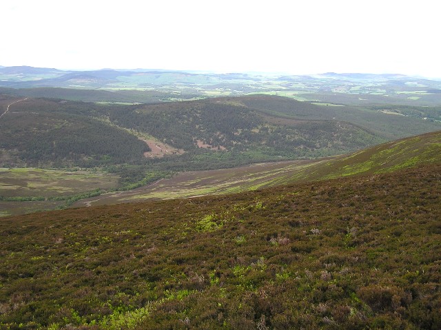
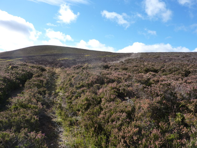
Mid Hill is known for its rugged and picturesque terrain, characterized by steep slopes and rocky outcrops. It offers stunning panoramic views of the surrounding countryside, including the Cairngorms National Park and the Cairngorm Mountains to the west. On clear days, it is even possible to see as far as the North Sea coastline.

The hill is a popular destination for outdoor enthusiasts, particularly those interested in hillwalking, climbing, and nature photography. There are several established routes to reach the summit, with varying levels of difficulty and length. The ascent can be challenging, especially in adverse weather conditions, but the rewarding views make it all worthwhile.

Mid Hill is also home to a diverse range of flora and fauna. The lower slopes are covered with heather and grasses, while the higher regions are characterized by rocky terrain and patches of alpine vegetation. It is not uncommon to spot wildlife such as red deer, mountain hares, and various bird species while exploring the hill.

Overall, Mid Hill in Aberdeenshire offers outdoor enthusiasts a chance to experience the breathtaking beauty of the Scottish Highlands and enjoy a challenging adventure in a pristine natural setting.

If you have any feedback on the listing, please let us know in the comments section below.

Mid Hill Images

Images are sourced within 2km of 56.985622/-2.7044947 or Grid Reference NO5788. Thanks to Geograph Open Source API. All images are credited.

Peter Hill Not named after the former chairman of Hereford United!   View from Sandy Hill, northwards.
Peter Hill
Not named after the former chairman of Hereford United! View from Sandy Hill, northwards.
Leggie Burn Catchment of Water of Aven and a view of Peter Hill from the slopes of Mount Battock.
Leggie Burn
Catchment of Water of Aven and a view of Peter Hill from the slopes of Mount Battock.
Trig point on Peter Hill
The path northeast from Peter Hill
Moorland track on Peter Hill Looking NE from position
Moorland track on Peter Hill
Looking NE from position
On Peter Hill Looking E towards Luther Moss
On Peter Hill
Looking E towards Luther Moss
Peter Hill trig Looking SW
Peter Hill trig
Looking SW
Moorland on Peter Hill Looking NW from position
Moorland on Peter Hill
Looking NW from position
Peter Hill trig Looking ESE
Peter Hill trig
Looking ESE
Bog Pool These small peaty pools are typical of the blanket bogs that cover these rolling hills
Bog Pool
These small peaty pools are typical of the blanket bogs that cover these rolling hills
Water of Aven Looking South-West across the Water of Aven from the southern slope of Creaganducy.
Water of Aven
Looking South-West across the Water of Aven from the southern slope of Creaganducy.
North-West from Peter Hill A view across the heather and Blaeberry of Peter Hill's north-west slopes towards the Forest of Birse and Carnferg (<a href="https://www.geograph.org.uk/gridref/NO5293">NO5293</a>)
North-West from Peter Hill
A view across the heather and Blaeberry of Peter Hill's north-west slopes towards the Forest of Birse and Carnferg (NO5293)
North from Peter Hill A view across the heather and Blaeberry of Peter Hill's north-west slopes towards Glenferrick Pinewood (<a href="https://www.geograph.org.uk/gridref/NO5791">NO5791</a>).
North from Peter Hill
A view across the heather and Blaeberry of Peter Hill's north-west slopes towards Glenferrick Pinewood (NO5791).
Landslip on new landrover track by the Water of Aven The fence line follows the track all the way to Cock Hill
Landslip on new landrover track by the Water of Aven
The fence line follows the track all the way to Cock Hill
A track heading up through deep heather, south of the River Feugh
On moorland south of the River Feugh, looking across the Glaspits Burn The hill in the background is Baudnacauner
On moorland south of the River Feugh, looking across the Glaspits Burn
The hill in the background is Baudnacauner
Peter Hill Taken from Tom's Cairn above Finzean at late evening.
Peter Hill
Taken from Tom's Cairn above Finzean at late evening.
Wolf Burn Moorland adjacent to the Wolf Burn, a tributary of the Water of Aven, with Peter Hill forming the background to the image.
Wolf Burn
Moorland adjacent to the Wolf Burn, a tributary of the Water of Aven, with Peter Hill forming the background to the image.
Show me another place!

Mid Hill is located at Grid Ref: NO5788 (Lat: 56.985622, Lng: -2.7044947)

Unitary Authority: Aberdeenshire

Police Authority: North East

What 3 Words

///clubbing.goad.router. Near Aboyne, Aberdeenshire

Nearby Locations

Peter Hill Mid Hill

Related Wikis

Forest of Birse

The Forest of Birse is a remote upland area in the upper catchment of the Water of Feugh, which forms the south-western portion of the Parish of Birse...

Mount Battock

Mount Battock (778 m) is a mountain in the Mounth on the eastern edge of the Scottish Highlands, on the border between Aberdeenshire and Angus. A rounded...

Clachnaben

Clachnaben (archaically "Cloch-na'bain"; Scottish Gaelic: "Clach na Beinne") is a 589-metre hill in Glen Dye, Aberdeenshire, Scotland. It is a distinctive...

Easter Clune Castle

Easter Clune Castle is a ruined 16th-century tower house, about 6 miles (9.7 km) south-west of Banchory, Aberdeenshire, Scotland, and south of the Water...

Have you been to Mid Hill?

Leave your review of Mid Hill below (or comments, questions and feedback).