Cock Hill

Hill, Mountain in Kincardineshire

Scotland

Cock Hill

Cumulus clouds over Aberdeenshire uplands
Cumulus clouds over Aberdeenshire uplands Credit: Bill Harrison

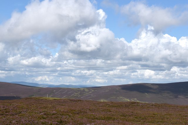
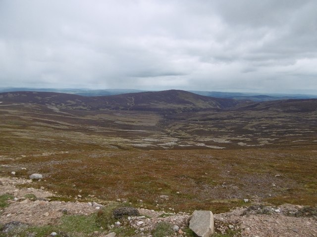
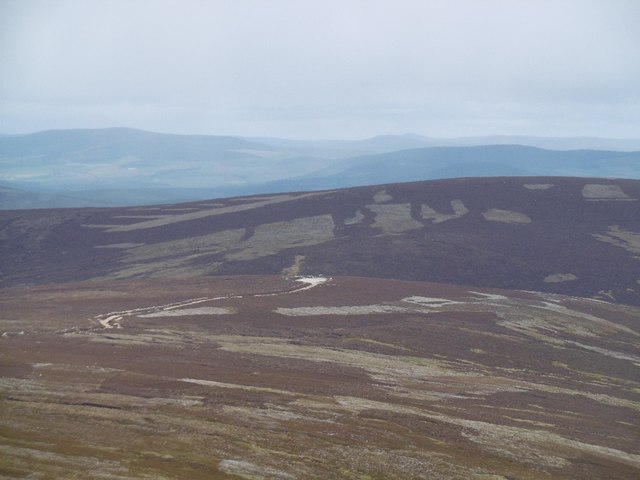
Cock Hill is a prominent hill located in Kincardineshire, Scotland. It rises to an elevation of 336 meters (1,102 feet) above sea level, making it a notable landmark in the region. Situated near the village of Fettercairn, Cock Hill offers commanding views of the surrounding countryside, including the picturesque Mearns Valley and the Grampian Mountains.

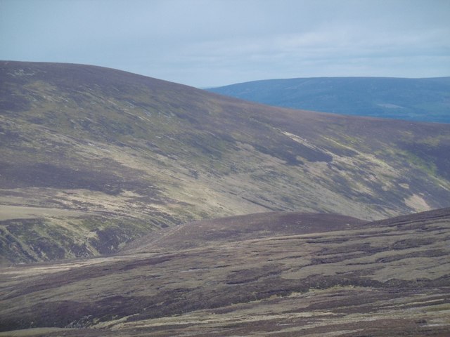
The hill is named after its distinctive shape, which resembles the head and neck of a rooster, with a broad rounded summit. It is composed of granite and is part of the Grampian Mountains range, known for its rugged beauty and diverse wildlife.

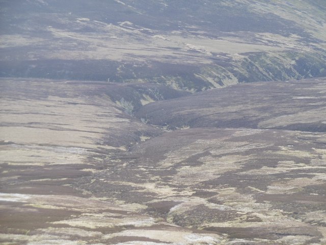
Cock Hill is a popular destination for outdoor enthusiasts, hikers, and nature lovers. Several well-maintained trails lead to the summit, providing a variety of options for different skill levels. As one ascends, they are treated to stunning vistas of the surrounding landscapes, with rolling hills, lush green meadows, and the sparkling waters of the River North Esk.

The hill is also rich in historical significance. It is believed that ancient settlements and burial grounds can be found in the vicinity, highlighting the hill's importance throughout the ages. Today, visitors can explore the area's heritage and learn about the local history through guided tours and informative displays.

Overall, Cock Hill in Kincardineshire is a captivating destination that offers both natural beauty and cultural heritage. Its commanding position, breathtaking views, and diverse landscapes make it a must-visit for anyone exploring the region.

If you have any feedback on the listing, please let us know in the comments section below.

Cock Hill Images

Images are sourced within 2km of 56.968769/-2.7325653 or Grid Reference NO5586. Thanks to Geograph Open Source API. All images are credited.

Cumulus clouds over Aberdeenshire uplands
Clouds over heather moorland A glorious view on a summer day but probably very bleak in other weather...
Clouds over heather moorland
A glorious view on a summer day but probably very bleak in other weather...
Shooting hut south of The Leggie The hut might be associated with grouse shooting although the moors were completely deserted on a perfect summer day just two days after the "glorious 12th".    Alan O'Dowd photographed the same hut some 11 years earlier in very different weather: <a title="https://www.geograph.org.uk/photo/3355832" href="https://www.geograph.org.uk/photo/3355832">Link</a> .
Shooting hut south of The Leggie
The hut might be associated with grouse shooting although the moors were completely deserted on a perfect summer day just two days after the "glorious 12th". Alan O'Dowd photographed the same hut some 11 years earlier in very different weather: Link .
Estate track to the west of Hill of Badymicks
Track across the moors
Moorland vista to the east of Mount Battock Estate paths snake across the moor, which make hiking so much easier...
Moorland vista to the east of Mount Battock
Estate paths snake across the moor, which make hiking so much easier...
First glimpse of Clachnaben,,, ,,,some 6 km to the east.   As seen from the lower slope of Mount Battock.
First glimpse of Clachnaben,,,
,,,some 6 km to the east. As seen from the lower slope of Mount Battock.
Path beside the ruined fence The patches of very dark moorland in the distance are under clouds.
Path beside the ruined fence
The patches of very dark moorland in the distance are under clouds.
Granite outcrop on the slope of Mount Battock In the distance is Peter Hill and even farther back the valley of the River Dee.
Granite outcrop on the slope of Mount Battock
In the distance is Peter Hill and even farther back the valley of the River Dee.
Bulldozed road under Mount Battock The road runs high on the hill, along its northeastern flank.
Bulldozed road under Mount Battock
The road runs high on the hill, along its northeastern flank.
Moorland, Mount Battock Remains of a previous road on the hill seen from the current road.
Moorland, Mount Battock
Remains of a previous road on the hill seen from the current road.
Road on Mount Battock A road runs much of the length of the ridge between Clachnaben and Mount Battock, turning down to Glen Dye at Hill of Edendocher.
Road on Mount Battock
A road runs much of the length of the ridge between Clachnaben and Mount Battock, turning down to Glen Dye at Hill of Edendocher.
Moorland, Water of Aven View towards Peter Hill from Mount Battock.
Moorland, Water of Aven
View towards Peter Hill from Mount Battock.
Road on Mount Battock Traversing the northeast side of the hill just below the summit.
Road on Mount Battock
Traversing the northeast side of the hill just below the summit.
Leggie Burn Catchment of Water of Aven and a view of Peter Hill from the slopes of Mount Battock.
Leggie Burn
Catchment of Water of Aven and a view of Peter Hill from the slopes of Mount Battock.
Leggie Burn Draining the slopes of Mount Battock into the Water of Aven.
Leggie Burn
Draining the slopes of Mount Battock into the Water of Aven.
Cock Hill Looking along to the road end where there was a parked Land Rover.
Cock Hill
Looking along to the road end where there was a parked Land Rover.
Outwash from the roads Gravel washed off the bulldozed road across the north east side of Mount Battock.
Outwash from the roads
Gravel washed off the bulldozed road across the north east side of Mount Battock.
Show me another place!

Cock Hill is located at Grid Ref: NO5586 (Lat: 56.968769, Lng: -2.7325653)

Unitary Authority: Aberdeenshire

Police Authority: North East

What 3 Words

///hence.shelf.cuddled. Near Aboyne, Aberdeenshire

Nearby Locations

Cock Hill

Related Wikis

Mount Battock

Mount Battock (778 m) is a mountain in the Mounth on the eastern edge of the Scottish Highlands, on the border between Aberdeenshire and Angus. A rounded...

Forest of Birse

The Forest of Birse is a remote upland area in the upper catchment of the Water of Feugh, which forms the south-western portion of the Parish of Birse...
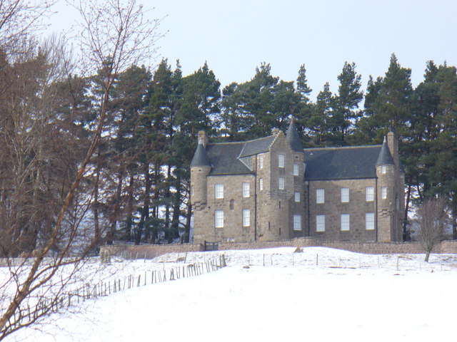
Birse Castle

Birse Castle is located in the Forest of Birse, Aberdeenshire, Scotland. Originally a square tower house, it was rebuilt in the first decade of the 20th...

Clachnaben

Clachnaben (archaically "Cloch-na'bain"; Scottish Gaelic: "Clach na Beinne") is a 589-metre hill in Glen Dye, Aberdeenshire, Scotland. It is a distinctive...

Have you been to Cock Hill?

Leave your review of Cock Hill below (or comments, questions and feedback).