Barbon

Settlement in Westmorland South Lakeland

England

Barbon

Road junction in Barbondale The signpost points left to Barbon and Sedbergh; right to Dent and Hawes; and behind the camera to Casterton and Kirkby Lonsdale. There's also a cycle route sign for the Lakes and Dales Loop.
Road junction in Barbondale Credit: Stephen Craven

Barbon is a small village located in the county of Cumbria, England. It lies in the historic county of Westmorland, which was absorbed into Cumbria in 1974. Situated in the picturesque Lune Valley, Barbon is nestled between the larger towns of Kirkby Lonsdale and Sedbergh.

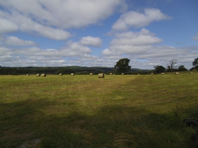
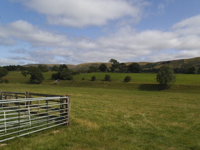
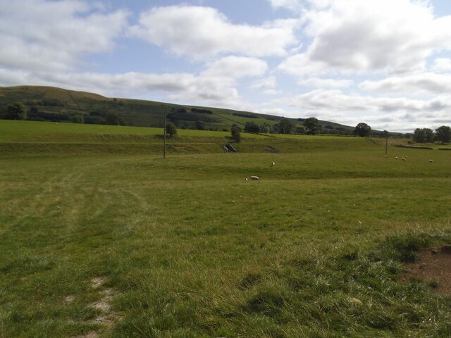
With a population of around 200 residents, Barbon exudes a charming rural character. The village is known for its stunning countryside views, with rolling hills and meandering rivers providing a scenic backdrop. The nearby Barbon Beck, a small tributary of the River Lune, adds to the village's natural beauty.

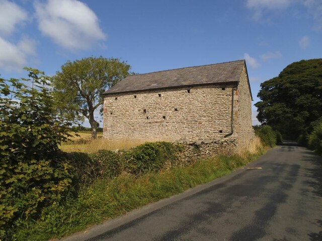
Historically, Barbon was an agricultural community, and remnants of its farming past can still be seen today. Traditional stone buildings, including a number of historic farmhouses, dot the landscape, lending a sense of authenticity and history to the area.

Despite its small size, Barbon offers a range of amenities to both residents and visitors. The village features a pub, The Barbon Inn, which serves as a social hub for locals and a welcoming stop for tourists exploring the area. Additionally, Barbon boasts a village hall, which hosts various community events and gatherings throughout the year.

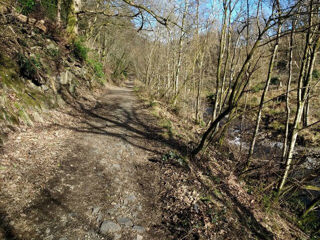
For outdoor enthusiasts, Barbon provides an ideal starting point for exploring the surrounding countryside. The village is surrounded by numerous footpaths and walking trails, offering opportunities to immerse oneself in nature and enjoy the tranquility of the area.

Overall, Barbon is a picturesque and peaceful village, offering a slice of rural life in the heart of the stunning Westmorland countryside.

If you have any feedback on the listing, please let us know in the comments section below.

Barbon Images

Images are sourced within 2km of 54.236565/-2.57139 or Grid Reference SD6282. Thanks to Geograph Open Source API. All images are credited.

Road junction in Barbondale The signpost points left to Barbon and Sedbergh; right to Dent and Hawes; and behind the camera to Casterton and Kirkby Lonsdale. There's also a cycle route sign for the Lakes and Dales Loop.
Road junction in Barbondale
The signpost points left to Barbon and Sedbergh; right to Dent and Hawes; and behind the camera to Casterton and Kirkby Lonsdale. There's also a cycle route sign for the Lakes and Dales Loop.
Barbon St Bartholomew - lychgate The lychgate bears the dates 1872 and 1915. See also <a href="https://www.geograph.org.uk/photo/3503493">SD6382 : Lychgate, St Bartholomew's, Barbon</a>.
Barbon St Bartholomew - lychgate
The lychgate bears the dates 1872 and 1915. See also SD6382 : Lychgate, St Bartholomew's, Barbon.
Barbon St Bartholomew Unusually the tower, which contains six bells, is at the east rather than west end.
Barbon St Bartholomew
Unusually the tower, which contains six bells, is at the east rather than west end.
Barbon St Bartholomew - interior There's a good if brief description on the Church Heritage Record <span class="nowrap"><a title="https://facultyonline.churchofengland.org/CHR/ChurchDetails.aspx?id=2057#Home" rel="nofollow ugc noopener" href="https://facultyonline.churchofengland.org/CHR/ChurchDetails.aspx?id=2057#Home">Link</a><img style="margin-left:2px;" alt="External link" title="External link - shift click to open in new window" src="https://s1.geograph.org.uk/img/external.png" width="10" height="10"/></span> as well as the Historic England listing.
Barbon St Bartholomew - interior
There's a good if brief description on the Church Heritage Record LinkExternal link as well as the Historic England listing.
Barbon St Bartholomew - war memorial Even a small village like this lost seven men in the Great War.
Barbon St Bartholomew - war memorial
Even a small village like this lost seven men in the Great War.
Barbon St Bartholomew - Lord and Lady Shuttleworth's memorial Wooden panelling beneath the west window forms tribute to Ughtred James, 1st Baron Shuttleworth (1844-1939) and his wife Blanche (1851-1924) of Barbon Manor. I presume Lawrence and Edward named on the church's war memorial <a href="https://www.geograph.org.uk/photo/6981118">SD6382 : Barbon St Bartholomew - war memorial</a> were their sons.
Barbon St Bartholomew - Lord and Lady Shuttleworth's memorial
Wooden panelling beneath the west window forms tribute to Ughtred James, 1st Baron Shuttleworth (1844-1939) and his wife Blanche (1851-1924) of Barbon Manor. I presume Lawrence and Edward named on the church's war memorial SD6382 : Barbon St Bartholomew - war memorial were their sons.
Barbon St Bartholomew - west window "This window is  dedicated to Louisa wife of Sir Woodbine Parish KCH by her daughter Blanche M Kay Shuttleworth". The Shuttleworths were Lords of the Manor, and Blanche is in her turn commemorated in the panelling below the window <a href="https://www.geograph.org.uk/photo/6981128">SD6382 : Barbon St Bartholomew - Lord and Lady Shuttleworth's memorial</a>. The central motif is the Good Shepherd, a popular one of the late 19th and early 20th centuries.
Barbon St Bartholomew - west window
"This window is dedicated to Louisa wife of Sir Woodbine Parish KCH by her daughter Blanche M Kay Shuttleworth". The Shuttleworths were Lords of the Manor, and Blanche is in her turn commemorated in the panelling below the window SD6382 : Barbon St Bartholomew - Lord and Lady Shuttleworth's memorial. The central motif is the Good Shepherd, a popular one of the late 19th and early 20th centuries.
Barbon St Bartholomew - small stained glass window "In memory of James Harrison St Stephen's Day 1900". James had been vicar of the parish since 1872.
Barbon St Bartholomew - small stained glass window
"In memory of James Harrison St Stephen's Day 1900". James had been vicar of the parish since 1872.
Barbon St Bartholomew - sundial In the church grounds.
Barbon St Bartholomew - sundial
In the church grounds.
Hayfield in Barbondale A Roman road ran a little to the left of the large tree in the distance, and an early medieval settlement was just the other side of the road behind the camera <a href="https://www.geograph.org.uk/photo/2158331">SD6281 : Ancient settlement near Town End, Barbon</a>. What crop did ancient Romans and early English people grow on this  field?
Hayfield in Barbondale
A Roman road ran a little to the left of the large tree in the distance, and an early medieval settlement was just the other side of the road behind the camera SD6281 : Ancient settlement near Town End, Barbon. What crop did ancient Romans and early English people grow on this field?
Roadside laithe between Barbon and Casterton Kept in better condition than most, it even has a proper rainwater drainage system.
Roadside laithe between Barbon and Casterton
Kept in better condition than most, it even has a proper rainwater drainage system.
Disused railway embankment between Barbon and Casterton (1) The railway was the LMS route one between the 'Little North Western' line at Clapham and their main line to Scotland at Lowgill, via Ingleton. It last saw regular trains in 1954 and the track was lifted in 1967.
Disused railway embankment between Barbon and Casterton (1)
The railway was the LMS route one between the 'Little North Western' line at Clapham and their main line to Scotland at Lowgill, via Ingleton. It last saw regular trains in 1954 and the track was lifted in 1967.
Disused railway embankment between Barbon and Casterton (2) The railway was the LMS route one between the 'Little North Western' line at Clapham and their main line to Scotland at Lowgill, via Ingleton. It last saw regular trains in 1954 and the track was lifted in 1967. Note the underpass for farm traffic.
Disused railway embankment between Barbon and Casterton (2)
The railway was the LMS route one between the 'Little North Western' line at Clapham and their main line to Scotland at Lowgill, via Ingleton. It last saw regular trains in 1954 and the track was lifted in 1967. Note the underpass for farm traffic.
Woodland track in Barbondale
Barbon Manor One-time home of the historian Roger Fulford,  and featured in the annual Barbon hill-climb challenge.
Barbon Manor
One-time home of the historian Roger Fulford, and featured in the annual Barbon hill-climb challenge.
Barbon road sign Traditional metal posts - spot of rust. Hawes is a long way off. Barbon Manor in the distance.
Barbon road sign
Traditional metal posts - spot of rust. Hawes is a long way off. Barbon Manor in the distance.
Path to Blindbeck Bridge Lovely path climbs gently up the dale from Barbon.
Path to Blindbeck Bridge
Lovely path climbs gently up the dale from Barbon.
The road from Barbon Manor The private access road from Barbon Manor to Barbon village near Pencil Brow; the Lune Valley is in the background.  The road is also a public bridleway.
The road from Barbon Manor
The private access road from Barbon Manor to Barbon village near Pencil Brow; the Lune Valley is in the background. The road is also a public bridleway.
Show me another place!

Barbon is located at Grid Ref: SD6282 (Lat: 54.236565, Lng: -2.57139)

Administrative County: Cumbria

District: South Lakeland

Police Authority: Cumbria

What 3 Words

///scraper.interval.cherubs. Near Kirkby Lonsdale, Cumbria

Related Wikis

Barbon railway station

Barbon railway station was located in Westmorland (now part of Cumbria), England, serving the town and locale of Barbon on the Ingleton Branch Line....

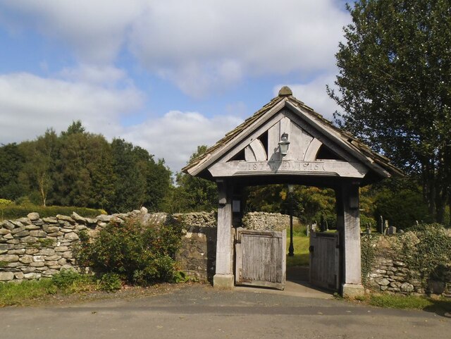
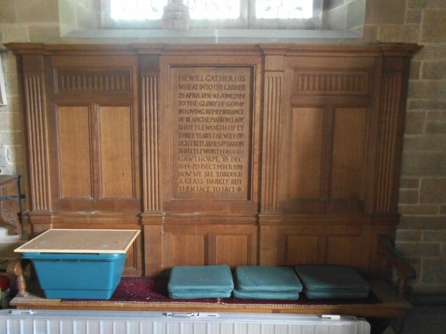
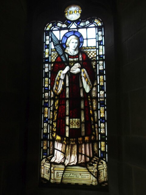
St Bartholomew's Church, Barbon

St Bartholomew's Church is in the village of Barbon, Cumbria, England. It is an active Anglican parish church in the deanery of Kendal, the archdeaconry...

Barbon Beck

Barbon Beck is a small river in Barbondale, Cumbria. It is a tributary of the River Lune. Rising at Weather Ling Hill, where it is known as Barkin Beck...

Barbon

Barbon is a village and civil parish in Westmorland and Furness, England. According to the 2001 census it had a population of 263, reducing to 236 at...

St Peter's Church, Mansergh

St Peter's Church is in the village of Mansergh, Cumbria, England. It is an active Anglican parish church in the deanery of Kendal, the archdeaconry of...

Mansergh, Cumbria

Mansergh is a village and civil parish in the South Lakeland district of the English county of Cumbria. It includes the village of Mansergh and the hamlet...

Underley Hall

Underley Hall is a large country house near Kirkby Lonsdale in Cumbria. It was designed in a Jacobean Revival style by the architect George Webster for...

Casterton School

Casterton School was an independent boarding and day school for girls aged 3 to 18 years in the village of Casterton in rural Cumbria. In its final years...

Nearby Amenities

Located within 500m of 54.236565,-2.57139
Barbon
Abandoned Railway: station
Railway: site
Source: NPE
Wikidata: Q4859706
Lat/Long: 54.2363138/-2.5693652
Barbon
Created By: Potlatch 0.10f
Is In: South Lakeland, Cumbria, England, UK
Place: village
Source: npe
Lat/Long: 54.2369391/-2.5708652
Town End
Created By: Merkaartor 0.13
Is In: Barbon, South Lakeland, Cumbria, England, UK
Place: hamlet
Source: npe
Lat/Long: 54.233891/-2.5720204
Created By: Merkaartor 0.13
Lat/Long: 54.2408569/-2.5726344
Bus Stop
Cross
Naptan AtcoCode: 090079050989
Naptan Bearing: E
Naptan BusStopType: CUS
Naptan CommonName: Cross
Naptan Indicator: opp
Naptan Landmark: War Memorial
Naptan NaptanCode: cumdgpdj
Naptan Street: No name
Naptan Verified: yes
Public Transport: platform
Source: naptan_import
Lat/Long: 54.2368434/-2.5713243
Historic: memorial
Lat/Long: 54.2367122/-2.5711822
Bench
Lat/Long: 54.2368607/-2.5715575
Telephone
Defibrillator
Booth: KX100
Covered: booth
Defibrillator Location: inside phone box near war memorial in Barbon
Emergency: defibrillator
Man Made: telephone_box
Note: no phone present Aug 2018
Lat/Long: 54.2368994/-2.5717312
Barrier: stile
Material: stone
Stile: squeezer
Lat/Long: 54.2345667/-2.5681725
Barrier: cattle_grid
Lat/Long: 54.2368595/-2.5674015
Give Way
Direction: backward
Lat/Long: 54.2373858/-2.5735659
Give Way
Direction: forward
Lat/Long: 54.2371318/-2.5734827
Give Way
Direction: forward
Lat/Long: 54.2372122/-2.5728835
Give Way
Direction: backward
Lat/Long: 54.237202/-2.5725132
Give Way
Direction: backward
Lat/Long: 54.2367706/-2.5712118
Give Way
Direction: forward
Lat/Long: 54.2367018/-2.5710162
Give Way
Direction: forward
Lat/Long: 54.2366059/-2.5713346
Give Way
Direction: backward
Lat/Long: 54.2346654/-2.5722835
Give Way
Direction: forward
Lat/Long: 54.2339935/-2.5738251
Give Way
Direction: backward
Lat/Long: 54.2332486/-2.5762047
Give Way
Direction: backward
Lat/Long: 54.2349645/-2.5660352
Power: pole
Lat/Long: 54.239393/-2.5751929
Give Way
Direction: backward
Lat/Long: 54.2364395/-2.5696187
The Churchmouse
Addr City: Barbon
Addr Postcode: LA6 2LL
Fhrs Id: 328924
Shop: convenience
Website: https://www.churchmousecheeses.com/
Lat/Long: 54.2356348/-2.571707
Post Box
Collection Times: Mo-Fr 16:30; Sa 11:30
Drive Through: no
Post Box Type: lamp
Ref: LA6 119
Royal Cypher: EIIR
Royal Cypher Wikidata: Q33102113
Lat/Long: 54.2356689/-2.5717705
Post Office
Barbon Post Office
Addr City: Barbon
Addr Housename: Barbon Village Hall
Addr Postcode: LA6 2LL
Opening Hours: Mo 14:00-16:00
Ref Pol Id: 122745
Lat/Long: 54.2352966/-2.5722314
Hiking: yes
Information: guidepost
Source: GPS survey
Tourism: information
Lat/Long: 54.2379611/-2.5662115
Hiking: yes
Information: guidepost
Source: GPS survey
Tourism: information
Lat/Long: 54.2387088/-2.5728178
Noexit: yes
Lat/Long: 54.2349928/-2.5724999
Barrier: stile
Material: stone
Source: survey;gps
Stile: squeezer
Lat/Long: 54.2382816/-2.573361
Barrier: stile
Material: stone
Source: survey;gps
Stile: squeezer
Lat/Long: 54.2362377/-2.5680549
Barrier: kissing_gate
Material: wood
Source: survey;gps
Lat/Long: 54.2335098/-2.5698862
Barrier: stile
Material: stone
Source: survey;gps
Stile: stepover
Lat/Long: 54.2336221/-2.572553
Barrier: stile
Material: stone
Source: survey;gps
Stile: stepover
Lat/Long: 54.2345435/-2.5721095
Bicycle Parking
Bicycle Parking: wall_loops
Capacity: 10
Covered: no
Lat/Long: 54.2356765/-2.5716987
Power: pole
Lat/Long: 54.2342886/-2.565029
Power: pole
Lat/Long: 54.2345312/-2.5664877
Power: pole
Lat/Long: 54.2347588/-2.5678878
Power: pole
Lat/Long: 54.2349775/-2.5693389
Power: pole
Lat/Long: 54.2353807/-2.5727145
Power: pole
Lat/Long: 54.2352989/-2.5738855
Power: pole
Lat/Long: 54.2344746/-2.5748987
Power: pole
Lat/Long: 54.2341131/-2.574359
Power: pole
Lat/Long: 54.2345431/-2.5756904
Power: pole
Lat/Long: 54.2355831/-2.5763956
Power: pole
Lat/Long: 54.236699/-2.5767291
Power: pole
Lat/Long: 54.2377984/-2.5771186
Power: pole
Lat/Long: 54.2396551/-2.5763039
Power: pole
Lat/Long: 54.2390913/-2.5738906
Power: pole
Lat/Long: 54.2325195/-2.5703852
Power: pole
Lat/Long: 54.2334584/-2.5693465
Power: pole
Lat/Long: 54.2329525/-2.5748452
The data included in this document is from www.openstreetmap.org. The data is made available under ODbL.

Have you been to Barbon?

Leave your review of Barbon below (or comments, questions and feedback).