Ingestre

Settlement in Staffordshire Stafford

England

Ingestre

Ingestre Hall Chetwynd's Jacobean masterpiece is owned by Sandwell Borough Council, who use it as a residential arts centre. <span class="nowrap"><a title="http://pages.britishlibrary.net/tixandrews/ingestre/inghall.html" rel="nofollow ugc noopener" href="http://pages.britishlibrary.net/tixandrews/ingestre/inghall.html">Link</a><img style="margin-left:2px;" alt="External link" title="External link - shift click to open in new window" src="https://s1.geograph.org.uk/img/external.png" width="10" height="10"/></span>
Ingestre Hall Credit: Adrian Bailey

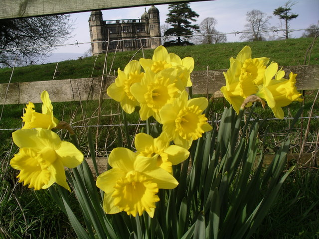
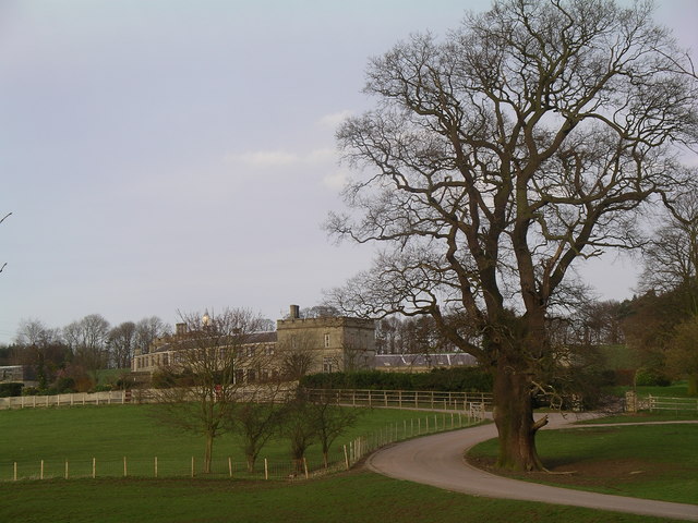
Ingestre is a small village located in the county of Staffordshire, England. Situated approximately five miles to the west of the town of Stafford, it lies on the edge of the picturesque Cannock Chase Area of Outstanding Natural Beauty.

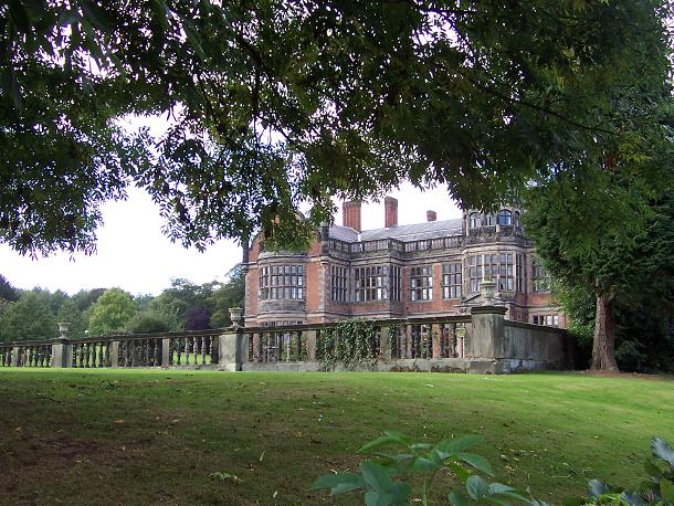
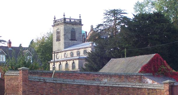
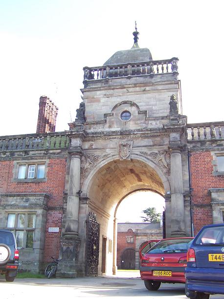
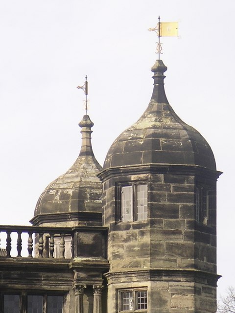
The village is known for its rich history, with records dating back to the Domesday Book of 1086. Ingestre Hall, a Grade II* listed Jacobean mansion, stands proudly at the heart of the village. Built in the early 17th century, it boasts stunning architecture and beautiful gardens, making it a popular attraction for visitors. The Hall is also renowned for its connection with the arts, as it houses an arts center that offers various courses and workshops throughout the year.

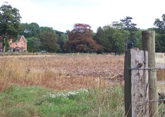
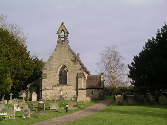
Despite its small size, Ingestre has a vibrant community and a strong sense of identity. The village is home to a number of traditional cottages, which add to its charm and character. Additionally, a local pub provides a hub for social gatherings and a place for residents and visitors to enjoy traditional British cuisine.

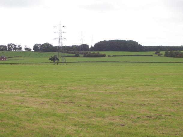
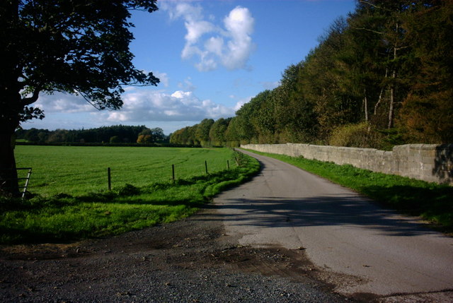
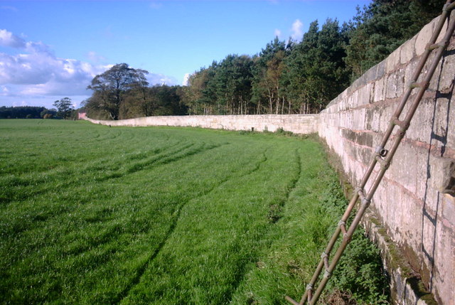
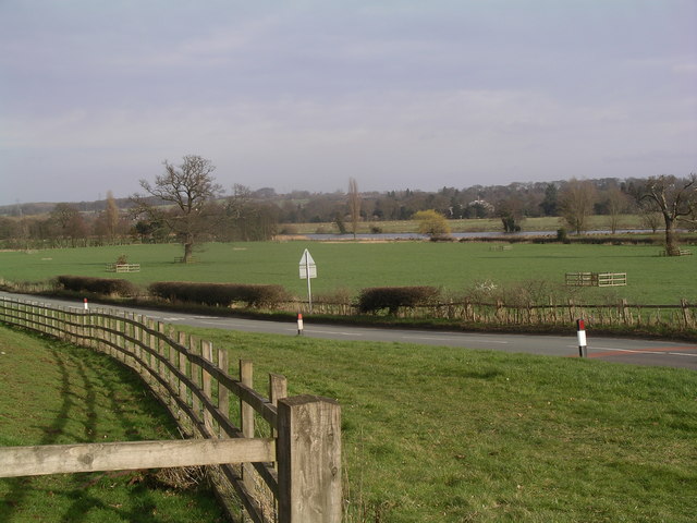
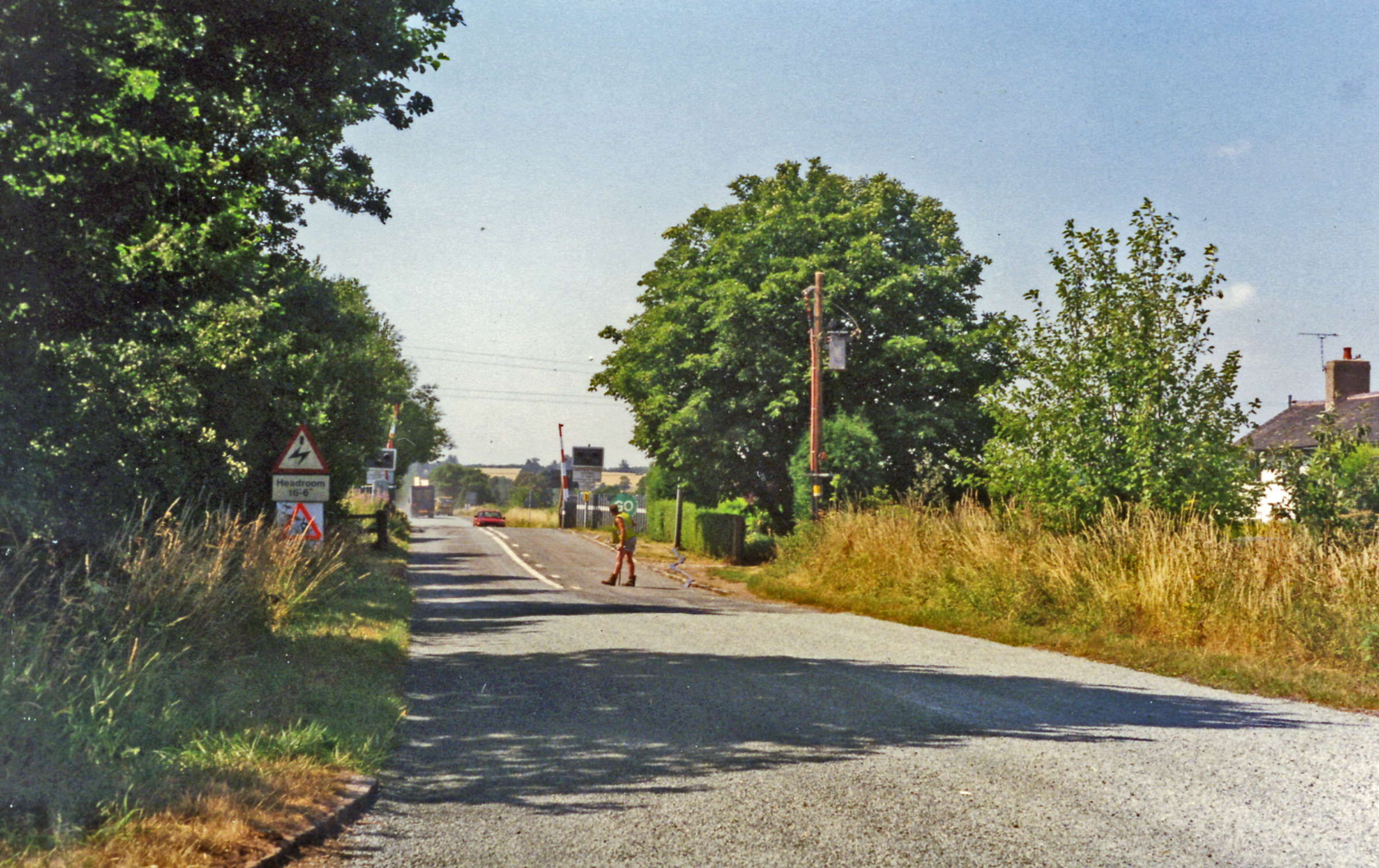
The surrounding countryside offers ample opportunities for outdoor activities, such as hiking, cycling, and horse riding. The nearby Cannock Chase provides a haven for nature enthusiasts, with its diverse wildlife and scenic landscapes.

Overall, Ingestre is a picturesque village that combines history, natural beauty, and a strong community spirit, making it a delightful place to visit or call home.

If you have any feedback on the listing, please let us know in the comments section below.

Ingestre Images

Images are sourced within 2km of 52.820124/-2.033088 or Grid Reference SJ9724. Thanks to Geograph Open Source API. All images are credited.

Ingestre Hall Chetwynd's Jacobean masterpiece is owned by Sandwell Borough Council, who use it as a residential arts centre. <span class="nowrap"><a title="http://pages.britishlibrary.net/tixandrews/ingestre/inghall.html" rel="nofollow ugc noopener" href="http://pages.britishlibrary.net/tixandrews/ingestre/inghall.html">Link</a><img style="margin-left:2px;" alt="External link" title="External link - shift click to open in new window" src="https://s1.geograph.org.uk/img/external.png" width="10" height="10"/></span>
Ingestre Hall
Chetwynd's Jacobean masterpiece is owned by Sandwell Borough Council, who use it as a residential arts centre. LinkExternal link
Fields at Tixall Farm The distant wood is Bricklawn Covert. The GR given is for the near pylon.
Fields at Tixall Farm
The distant wood is Bricklawn Covert. The GR given is for the near pylon.
Little Ingestre Viewed from the village lane. Does anyone know how "Ingestre" is pronounced?
Little Ingestre
Viewed from the village lane. Does anyone know how "Ingestre" is pronounced?
St Mary the Virgin, Ingestre Built 1676. <span class="nowrap"><a title="http://pages.britishlibrary.net/tixandrews/ingestre/ingchrch.html" rel="nofollow ugc noopener" href="http://pages.britishlibrary.net/tixandrews/ingestre/ingchrch.html">Link</a><img style="margin-left:2px;" alt="External link" title="External link - shift click to open in new window" src="https://s1.geograph.org.uk/img/external.png" width="10" height="10"/></span>
St Mary the Virgin, Ingestre
Built 1676. LinkExternal link
Ingestre This odd little place viewed from the stables.
Ingestre
This odd little place viewed from the stables.
Ingestre Stables <span class="nowrap"><a title="http://www.ingestre.com/" rel="nofollow ugc noopener" href="http://www.ingestre.com/">Link</a><img style="margin-left:2px;" alt="External link" title="External link - shift click to open in new window" src="https://s1.geograph.org.uk/img/external.png" width="10" height="10"/></span>
Ingestre is quite a surprise. The village is at the end of a no-through road, so you'll only arrive here by choice or by accident. Your reward is not only a magnificent hall and church, but these amazing stables, which look to me more like an Oxford college. Hmm...
Ingestre Stables
LinkExternal link Ingestre is quite a surprise. The village is at the end of a no-through road, so you'll only arrive here by choice or by accident. Your reward is not only a magnificent hall and church, but these amazing stables, which look to me more like an Oxford college. Hmm...
Farm Track and Bridleway This track leads to the A518, it is a continuation of a bridleway from Tixall near Stafford. The woodland on the right is called Pool covert.
Farm Track and Bridleway
This track leads to the A518, it is a continuation of a bridleway from Tixall near Stafford. The woodland on the right is called Pool covert.
Bridleway in a Field This bridleway runs alongside a tall stone-walled wooded area (Lamberts Coppice) on the right and a very large open field on the left. I guess that at one time there used to be deer kept behind the wall looking at the names on the map.
Bridleway in a Field
This bridleway runs alongside a tall stone-walled wooded area (Lamberts Coppice) on the right and a very large open field on the left. I guess that at one time there used to be deer kept behind the wall looking at the names on the map.
Green Road and the Village Green, Weston This is Green Road with Ferrers Road on the right and the Village Green beyond in the village of Weston near Stafford. The white building in the background is The Woolpack, another photo is submitted.
Green Road and the Village Green, Weston
This is Green Road with Ferrers Road on the right and the Village Green beyond in the village of Weston near Stafford. The white building in the background is The Woolpack, another photo is submitted.
John The Baptist Parish Church John the Baptist Parish Church in Tixall.
John The Baptist Parish Church
John the Baptist Parish Church in Tixall.
Tixall Gatehouse Whilst taking this photograph I heard the laughter of children playing in the glorious spring like sunshine. The children were on the roof of the Gatehouse.
Tixall Gatehouse
Whilst taking this photograph I heard the laughter of children playing in the glorious spring like sunshine. The children were on the roof of the Gatehouse.
Tixall Gatehouse from the lane
A side view of the Gatehouse A view further down the lane.
A side view of the Gatehouse
A view further down the lane.
An usual view of Tixall Gatehouse The grass was full of beautiful daffodils alongside the lane running past Tixall Gatehouse.
An usual view of Tixall Gatehouse
The grass was full of beautiful daffodils alongside the lane running past Tixall Gatehouse.
Two towers at Tixall A close up of the two towers at the Gatehouse.
Two towers at Tixall
A close up of the two towers at the Gatehouse.
John The Baptist Parish Church A landscape view of the church and churchyard.
John The Baptist Parish Church
A landscape view of the church and churchyard.
The lane adjacent to Tixall Gatehouse A view towards the canal.
The lane adjacent to Tixall Gatehouse
A view towards the canal.
Tixall Mews These are the mews houses at the back of Tixall Gatehouse.
Tixall Mews
These are the mews houses at the back of Tixall Gatehouse.
Show me another place!

Ingestre is located at Grid Ref: SJ9724 (Lat: 52.820124, Lng: -2.033088)

Administrative County: Staffordshire

District: Stafford

Police Authority: Staffordshire

What 3 Words

///situation.chum.bigger. Near Great Haywood, Staffordshire

Related Wikis

Ingestre

Ingestre is a village and civil parish in the Stafford district, in the county of Staffordshire, England. The population of the civil parish taken at the...

Ingestre Hall

Ingestre Hall is a Grade II* 17th-century Jacobean mansion situated at Ingestre, near Stafford, Staffordshire, England. Formerly the seat of the Earls...

Hixon railway station

Hixon railway station is a disused railway station in Staffordshire, England. The railway line between Stone and Colwich was opened by the North Staffordshire...

Hixon rail crash

On 6 January 1968, a low-loader transporter carrying a 120-ton electrical transformer was struck by a British Rail express train on a recently installed...
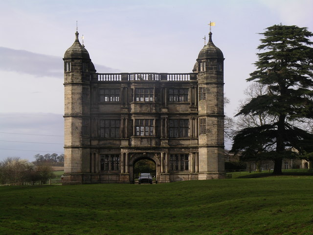
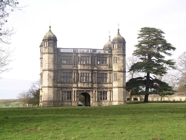
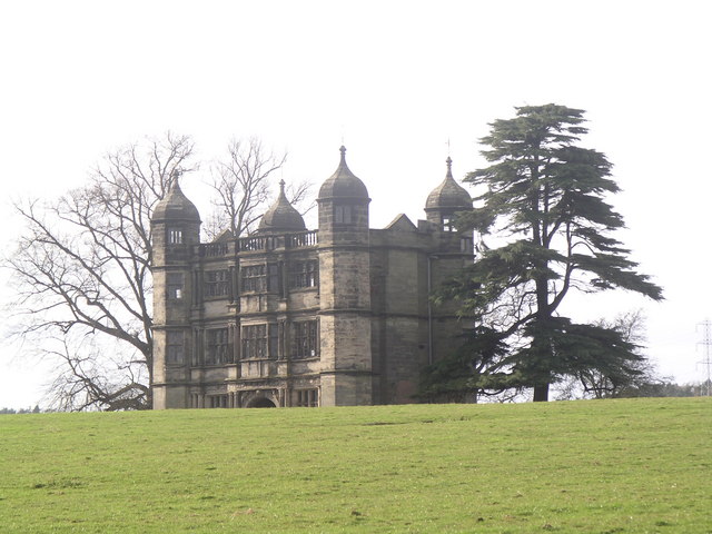
Tixall Gatehouse

Tixall Gatehouse is a 16th-century gatehouse situated at Tixall, near Stafford, Staffordshire and is all that remains of Tixall Hall which was demolished...

Tixall

Tixall is a small village and civil parish in the Stafford district, in the English county of Staffordshire lying on the western side of the Trent valley...

Ingestre railway station

Ingestre and Weston railway station was a former British railway station to serve the village of Ingestre in Staffordshire.It was opened by the Stafford...

Way for the Millennium

The Way for the Millennium is a 41-mile-long (66 km) east–west route across Staffordshire, deliberately designed for easy walking, using towpaths, old...

Nearby Amenities

Located within 500m of 52.820124,-2.033088
Bus Stop
Home Farm
Bus: yes
Naptan AtcoCode: 3800C705300
Naptan Bearing: NW
Naptan CommonName: Home Farm
Naptan Indicator: Adj
Naptan Landmark: Home Farm
Naptan Street: Main Rd
Naptan Verified: no
Public Transport: platform
Source: naptan_import
Lat/Long: 52.8201848/-2.030732
Bus Stop
Home Farm
Bus: yes
Naptan AtcoCode: 3800C705301
Naptan Bearing: SE
Naptan BusStopType: CUS
Naptan CommonName: Home Farm
Naptan Indicator: Opp
Naptan Landmark: Home Farm
Naptan Street: Main Rd
Naptan Verified: no
Public Transport: platform
Source: naptan_import
Lat/Long: 52.8201669/-2.0304798
Telephone
Booth: K6
Covered: booth
Listed Status: Grade II
Operator: BT
Phone: +44 1889 270633
Lat/Long: 52.8178842/-2.0273485
Post Box
Post Box Mounting: brick_pillar
Post Box Type: wall
Ref: ST18 182
Lat/Long: 52.81814/-2.026613
Ingestre
Place: hamlet
Source: NLS - OS 1:25k 1st Series 1937-61
Lat/Long: 52.8195712/-2.0286247
Defibrillator
Emergency: defibrillator
Indoor: yes
Lat/Long: 52.8196125/-2.0340414
The data included in this document is from www.openstreetmap.org. The data is made available under ODbL.

Have you been to Ingestre?

Leave your review of Ingestre below (or comments, questions and feedback).