Brown Howe
Hill, Mountain in Westmorland Eden
England
Brown Howe

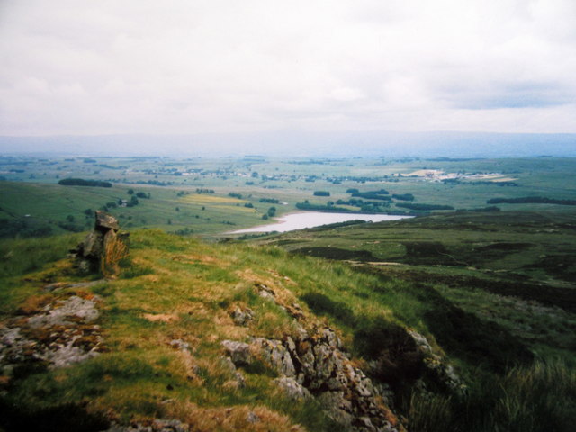
Brown Howe is a prominent hill located in the historic county of Westmorland, England. It is part of the stunning Lake District National Park, renowned for its picturesque landscapes and rich natural beauty. Rising to an elevation of 427 meters (1,401 feet), Brown Howe offers breathtaking panoramic views of the surrounding countryside, making it a popular destination for hikers and nature enthusiasts.
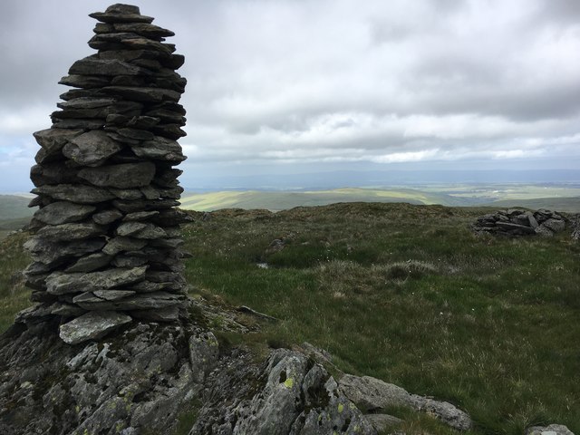
Situated in close proximity to the charming village of Coniston, Brown Howe is easily accessible and attracts visitors from all over the world. The hill is characterized by its distinctive conical shape, covered in a lush carpet of green vegetation and dotted with scattered rocks and boulders. The terrain of Brown Howe is relatively gentle, making it suitable for walkers of all abilities.
The summit of Brown Howe provides an unrivaled vantage point to admire the splendor of the Lake District. On a clear day, visitors can enjoy sweeping vistas of the shimmering Coniston Water, the towering peaks of the Old Man of Coniston and Wetherlam, and the rolling hills that define the region. The hill is also home to a variety of flora and fauna, including heather, bilberry bushes, and bird species such as skylarks and meadow pipits.
For those wishing to explore further, Brown Howe serves as a gateway to an extensive network of walking routes and trails. From here, one can embark on longer hikes to nearby fells and mountains, such as Dow Crag and Coniston Old Man. Whether seeking solitude in nature or seeking an adventure, Brown Howe offers a truly captivating experience in the heart of the Lake District.
If you have any feedback on the listing, please let us know in the comments section below.
Brown Howe Images
Images are sourced within 2km of 54.469165/-2.7432132 or Grid Reference NY5108. Thanks to Geograph Open Source API. All images are credited.


Brown Howe is located at Grid Ref: NY5108 (Lat: 54.469165, Lng: -2.7432132)
Administrative County: Cumbria
District: Eden
Police Authority: Cumbria
What 3 Words
///indoors.grunt.kitchen. Near Shap, Cumbria
Nearby Locations
Related Wikis

Grey Crag
Grey Crag is a fell in the English Lake District. It stands to the east of Longsleddale in the Far Eastern Fells. == Topography == North of Sadgill, the...

Wasdale Horseshoe
The Wasdale Horseshoe is a group of hills on the eastern fringe of the English Lake District, to the west of the A6, south of Shap, Cumbria. They surround...

Howes (fell)
Howes is a subsidiary summit of Branstree in the English Lake District, south east of Selside Pike in Cumbria. It is the subject of a chapter of Wainwright...

Crookdale Horseshoe
The Crookdale Horseshoe is a group of hills on the eastern edge of the English Lake District, in Cumbria, west of the A6 road. They are the subject of...

Tarn Crag (Far Eastern Fells)
Tarn Crag is a fell in the English Lake District. It stands to the east of Longsleddale in the Far Eastern Fells. == Topography == North of Sadgill, the...

Seat Robert
Seat Robert is a hill in the east of the English Lake District, south west of Shap, Cumbria. It is the subject of a chapter of Wainwright's book The Outlying...
Sleddale Hall
Sleddale Hall is a farmhouse on the north side of the Wet Sleddale valley near Shap in Cumbria, England. It featured as "Crow Crag", Uncle Monty's Lake...

Mosedale Beck (Swindale)
Mosedale Beck is a stream in Cumbria, England, which runs between Tarn Crag and Branstree, flowing north to join Swindale Beck at Swindale Head; Swindale...
Nearby Amenities
Located within 500m of 54.469165,-2.7432132Have you been to Brown Howe?
Leave your review of Brown Howe below (or comments, questions and feedback).