Ben Knowle Hill

Hill, Mountain in Somerset Mendip

England

Ben Knowle Hill

Field near Henton Looking up the slopes of Yarley Hill from the B3139 east of Henton.
Field near Henton Credit: Derek Harper

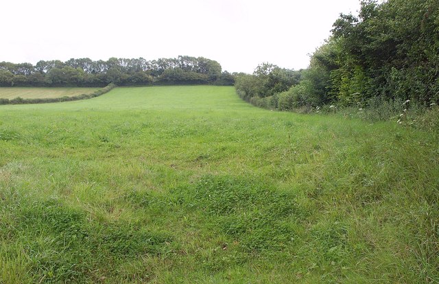
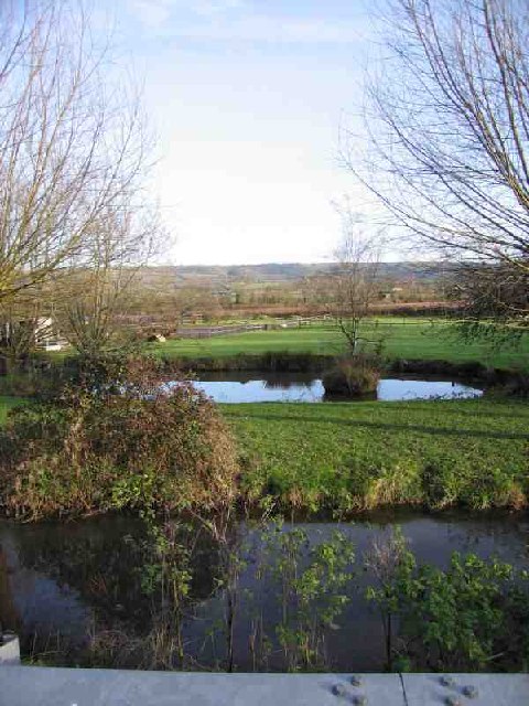
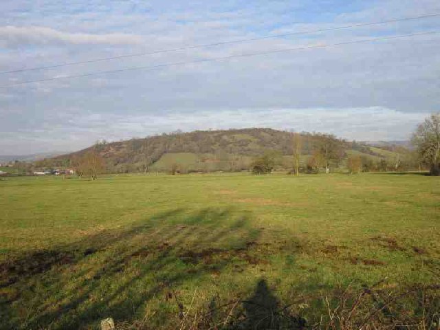
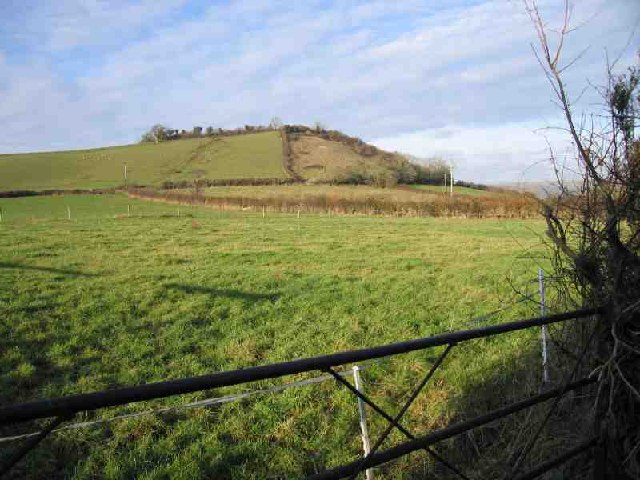
Ben Knowle Hill, located in Somerset, is a prominent hill that forms part of the Mendip Hills range in southwestern England. With an elevation of approximately 280 meters (919 feet), it offers breathtaking panoramic views of the surrounding countryside and is a popular destination for hikers and nature enthusiasts.

The hill is characterized by its gentle slopes, covered in lush green vegetation, including grasses, shrubs, and scattered trees. It is also home to a variety of wildlife, such as rabbits, foxes, and various bird species, making it an ideal spot for birdwatching and wildlife photography.

At the summit of Ben Knowle Hill, there is a trig point, a concrete pillar used in mapping and surveying, which provides a convenient landmark for visitors. From this vantage point, visitors can enjoy uninterrupted vistas of the Somerset Levels, the Bristol Channel, and even the distant hills of Exmoor.

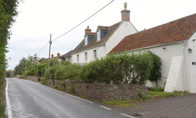
The hill is easily accessible by foot, with several trails leading up to the summit. The most popular route starts from the nearby village of Cheddar, renowned for its famous cheese. Along the way, hikers can admire the picturesque countryside, with its rolling hills, charming farms, and quaint cottages.

Overall, Ben Knowle Hill is a scenic and tranquil destination, offering a chance to escape the hustle and bustle of everyday life and immerse oneself in the beauty of nature. Whether it's a leisurely stroll or a more challenging hike, this hill provides an enjoyable experience for all.

If you have any feedback on the listing, please let us know in the comments section below.

Ben Knowle Hill Images

Images are sourced within 2km of 51.2011/-2.6938634 or Grid Reference ST5144. Thanks to Geograph Open Source API. All images are credited.

Field near Henton Looking up the slopes of Yarley Hill from the B3139 east of Henton.
Field near Henton
Looking up the slopes of Yarley Hill from the B3139 east of Henton.
Ripple Farm A farmhouse on the B3139 at the east end of Henton.
Ripple Farm
A farmhouse on the B3139 at the east end of Henton.
B3139 towards Henton
Henton House, Wells Road, Henton
Wookey (Somerset) St Matthew's church Not to be confused with Wookey Hole which has its own church.
Wookey (Somerset) St Matthew's church
Not to be confused with Wookey Hole which has its own church.
Castle Hill, Fenny Castle
Mill Pond Run-Off The Mill Pond Run-Off at Burcott Mill. From here the stream follows the road and contours (canal-like) to the west. It appears in geographs at <a href="https://www.geograph.org.uk/gridref/ST4845">ST4845</a> and <a href="https://www.geograph.org.uk/gridref/ST5045">ST5045</a>
Mill Pond Run-Off
The Mill Pond Run-Off at Burcott Mill. From here the stream follows the road and contours (canal-like) to the west. It appears in geographs at ST4845 and ST5045
Stream and Pond Near foreground shows the stream that follows the road from Burcott Mill <a href="https://www.geograph.org.uk/gridref/ST5245">ST5245</a> to Bleadney <a href="https://www.geograph.org.uk/gridref/ST4845">ST4845</a> where it drops down on to the levels and joins the river Axe. Beyond that is a duck pond. In the distance are the Mendip Hills where Ebbor Gorge <a href="https://www.geograph.org.uk/gridref/ST5248">ST5248</a> can be seen.
Stream and Pond
Near foreground shows the stream that follows the road from Burcott Mill ST5245 to Bleadney ST4845 where it drops down on to the levels and joins the river Axe. Beyond that is a duck pond. In the distance are the Mendip Hills where Ebbor Gorge ST5248 can be seen.
Wells, St Cuthbert Out: Burcott Mill A 19th century watermill powered by a leat from the river Axe. Restored to working order in 1990 and now open to the public and offering accommodation. The internal waterwheel, cast by ironfounders Bodley Brothers, of Exeter, dates from 1864. See <span class="nowrap"><a title="http://www.burcottmill.com/pages/firstpage.htm" rel="nofollow ugc noopener" href="http://www.burcottmill.com/pages/firstpage.htm">Link</a><img style="margin-left:2px;" alt="External link" title="External link - shift click to open in new window" src="https://s1.geograph.org.uk/img/external.png" width="10" height="10"/></span> for details of opening times. By the B3139 Wells – Burnham-on-Sea road
Wells, St Cuthbert Out: Burcott Mill
A 19th century watermill powered by a leat from the river Axe. Restored to working order in 1990 and now open to the public and offering accommodation. The internal waterwheel, cast by ironfounders Bodley Brothers, of Exeter, dates from 1864. See LinkExternal link for details of opening times. By the B3139 Wells – Burnham-on-Sea road
Bristol Water Works It certainly does! I don't know much about water but I guess being on the top of a hill this is not a spring. Probably a convenient holding tank for the villages nearby.
Bristol Water Works
It certainly does! I don't know much about water but I guess being on the top of a hill this is not a spring. Probably a convenient holding tank for the villages nearby.
Ben Knowle Hill It's a Hill. One of many that sticks out from the Somerset Levels. This one in particular is part or a chain that runs West from Wells. Others are isolated; I'll be bagging those soon.
Ben Knowle Hill
It's a Hill. One of many that sticks out from the Somerset Levels. This one in particular is part or a chain that runs West from Wells. Others are isolated; I'll be bagging those soon.
Stream near Melsbury Yet another stream helping to manage the water on the Levels. Despite clearly flowing, the smoothness of the surface gave an excellent reflection.
Stream near Melsbury
Yet another stream helping to manage the water on the Levels. Despite clearly flowing, the smoothness of the surface gave an excellent reflection.
Coxley Vineyard The Somerset Levels are clearly well suited for grapes, not that I like English wine that much. The Mendips can be seen in the background, in particular the Mendip Mast at <a href="https://www.geograph.org.uk/gridref/ST5648">ST5648</a>.
Coxley Vineyard
The Somerset Levels are clearly well suited for grapes, not that I like English wine that much. The Mendips can be seen in the background, in particular the Mendip Mast at ST5648.
Hay Hill Hay Hill is one of the chain to the West of Wells. The side is steeper than it looks.
Hay Hill
Hay Hill is one of the chain to the West of Wells. The side is steeper than it looks.
Wookey - Long Ford This is the only ford in know of that goes along the road, not just across it. In fact this ford does not even cross the road; it comes in from the left in the foreground and 100yds later goes back out to the left. This is normal, it is not flooded! Since posting this I have been told this is known as Longwater; another ford nearby is Shortwater. Also since posting, I have learnt of another long ford, also in Somerset and not far away at Rickford <a href="https://www.geograph.org.uk/gridref/ST4859">ST4859</a>.
Wookey - Long Ford
This is the only ford in know of that goes along the road, not just across it. In fact this ford does not even cross the road; it comes in from the left in the foreground and 100yds later goes back out to the left. This is normal, it is not flooded! Since posting this I have been told this is known as Longwater; another ford nearby is Shortwater. Also since posting, I have learnt of another long ford, also in Somerset and not far away at Rickford ST4859.
Old Railway The track of an old railway running NW out of Wells can be seen. The line was a victim of Beeching. The shed in the foreground (built over the line) is used by one of the Carnival Clubs for building their elaborate floats.
Old Railway
The track of an old railway running NW out of Wells can be seen. The line was a victim of Beeching. The shed in the foreground (built over the line) is used by one of the Carnival Clubs for building their elaborate floats.
Greenfields Parish of Wookey Cemetery on Doctor's Hill
Greenfields Parish of Wookey
Cemetery on Doctor's Hill
Coxley, Christ Church
Show me another place!

Ben Knowle Hill is located at Grid Ref: ST5144 (Lat: 51.2011, Lng: -2.6938634)

Administrative County: Somerset

District: Mendip

Police Authority: Avon and Somerset

What 3 Words

///taxpayers.factored.calls. Near Wells, Somerset

Nearby Locations

Hay Moor Ben Knowle Hill

Related Wikis

Ben Knowle

Ben Knowle (grid reference ST513450) is a 1.5 hectare geological Site of Special Scientific Interest in Somerset, notified in 1984. Ben Knowle is a natural...

Wookey

Wookey is a village and civil parish 2 miles (3.2 km) west of Wells, on the River Axe in Somerset, England. The parish includes the village of Henton and...

Fenny Castle

Fenny Castle is the remains of a motte and bailey castle in the parish of Wookey, Somerset, England. It is a Scheduled Ancient Monument, but not accessible...

Christ Church, Coxley

Christ Church is a Church of England church in Coxley, Somerset, England. It was built in 1839–40 to the designs of Richard Carver and is a Grade II listed...

Wookey railway station

Wookey railway station was a station on the Bristol and Exeter Railway's Cheddar Valley line in Somerset, England. The site is a 0.04 hectare geological...

Polsham railway station

Polsham was a railway station on the Somerset and Dorset Railway in the village of Polsham, Somerset in England. Opening in December 1861 on the Somerset...

St Cuthberts Mill

St Cuthberts Mill is a British paper manufacturing company in Wells, Somerset, that specialises in mould made artists papers. The range includes traditional...

St Cuthbert Out

St Cuthbert Out, sometimes Wells St Cuthbert Out, is a civil parish in the Mendip district of Somerset, England. It entirely surrounds (but does not include...

Nearby Amenities

Located within 500m of 51.2011,-2.6938634
Ben Knowle Hill
Ele: 99
Natural: peak
Note: 325 Feet on NPE Map is 99m
Source: New Popular Edition
Lat/Long: 51.2009376/-2.6940785
The data included in this document is from www.openstreetmap.org. The data is made available under ODbL.

Have you been to Ben Knowle Hill?

Leave your review of Ben Knowle Hill below (or comments, questions and feedback).