Woodhouse Hill

Hill, Mountain in Westmorland South Lakeland

England

Woodhouse Hill

The west end of Hincaster Tunnel Opened on the 18th June 1819, the 378 yard tunnel was built to facilitate access to Kendal by the Lancaster Canal.
The tunnel had fallen into disuse by the mid 1940s and it was officially closed in 1955.
There is an Ordnance Survey 1GL bolt benchmark on the pilaster to the right of the tunnel entrance (detail photograph <a href="https://www.geograph.org.uk/photo/7364790">SD5085 : Benchmark, Hincaster Tunnel</a>).
The west end of Hincaster Tunnel Credit: Adrian Taylor

Woodhouse Hill is a prominent hill located in Westmorland, a historic county in the northwest region of England. With an elevation of approximately 400 meters (1,312 feet), it is classified as a hill rather than a mountain. The hill is positioned in the Lake District National Park, a renowned area known for its breathtaking landscapes and natural beauty.

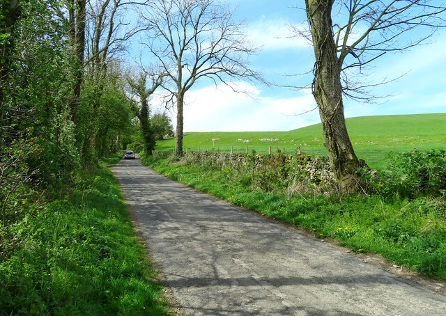
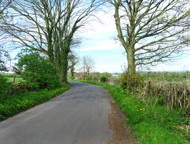
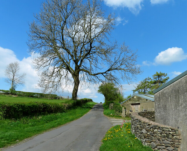
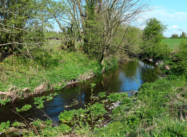
Woodhouse Hill is situated amidst picturesque surroundings, surrounded by lush greenery, rolling hills, and charming countryside. It offers stunning panoramic views of the surrounding area, including the nearby Lake Windermere, England's largest natural lake. The hill is a popular destination for hikers, nature enthusiasts, and photographers, who flock to the area to admire its scenic vistas and capture its beauty.

The slopes of Woodhouse Hill are covered in a variety of vegetation, including heather, grasses, and scattered trees. The hill is also home to a diverse range of wildlife, such as birds, rabbits, and occasional deer, providing ample opportunities for wildlife spotting.

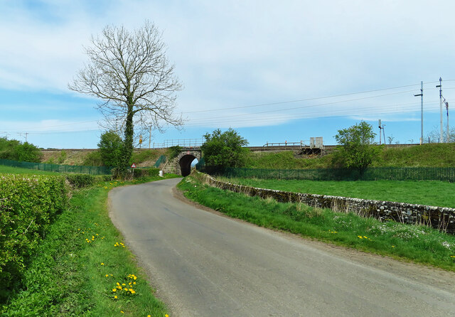
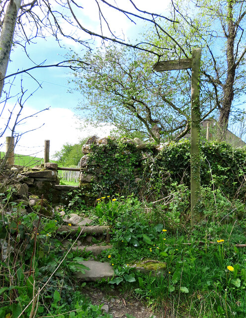
Visitors can access Woodhouse Hill via well-maintained footpaths that wind their way up the hillside. The climb to the summit is moderate, making it accessible to most walkers. At the top, a trig point marks the highest point, offering a sense of achievement for those who conquer the ascent.

Woodhouse Hill is not only a natural landmark but also a cultural one. It has inspired artists, writers, and poets throughout history, who have captured its beauty in various forms of art and literature. Overall, Woodhouse Hill is a captivating destination that showcases the stunning natural landscapes that the Lake District is renowned for.

If you have any feedback on the listing, please let us know in the comments section below.

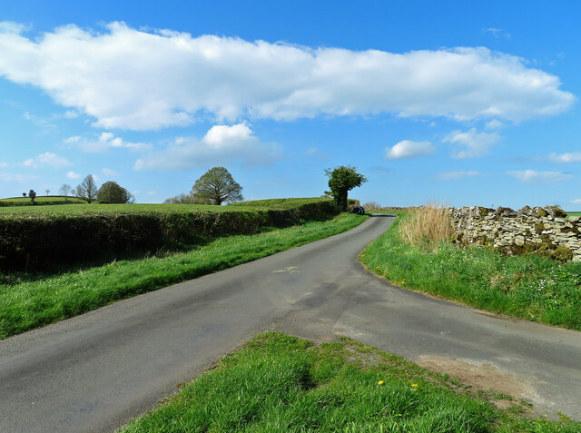
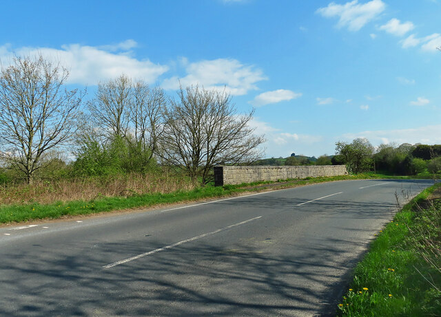
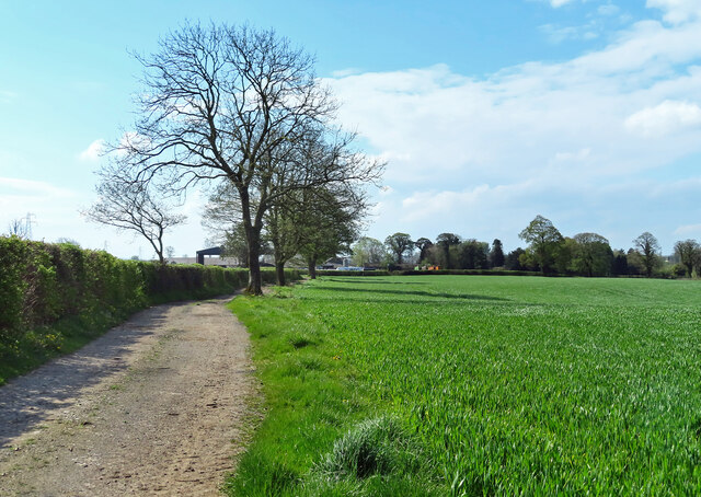
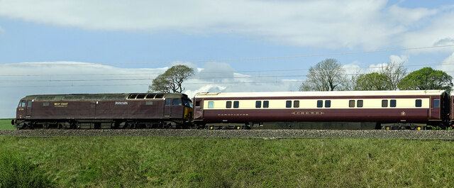
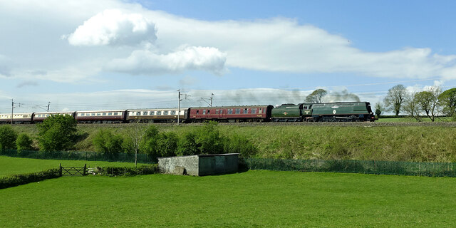
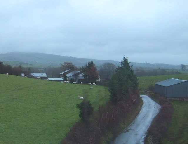
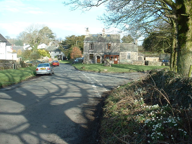
Woodhouse Hill Images

Images are sourced within 2km of 54.246841/-2.7466834 or Grid Reference SD5183. Thanks to Geograph Open Source API. All images are credited.

The west end of Hincaster Tunnel Opened on the 18th June 1819, the 378 yard tunnel was built to facilitate access to Kendal by the Lancaster Canal.
The tunnel had fallen into disuse by the mid 1940s and it was officially closed in 1955.
There is an Ordnance Survey 1GL bolt benchmark on the pilaster to the right of the tunnel entrance (detail photograph <a href="https://www.geograph.org.uk/photo/7364790">SD5085 : Benchmark, Hincaster Tunnel</a>).
The west end of Hincaster Tunnel
Opened on the 18th June 1819, the 378 yard tunnel was built to facilitate access to Kendal by the Lancaster Canal. The tunnel had fallen into disuse by the mid 1940s and it was officially closed in 1955. There is an Ordnance Survey 1GL bolt benchmark on the pilaster to the right of the tunnel entrance (detail photograph SD5085 : Benchmark, Hincaster Tunnel).
On Viver Lane Viewed where the lane passes below the West Coast main railway line on a fine April afternoon.
On Viver Lane
Viewed where the lane passes below the West Coast main railway line on a fine April afternoon.
Heading for Hincaster Viewed from the bridge that crosses a disused railway line on a bright April afternoon.
Heading for Hincaster
Viewed from the bridge that crosses a disused railway line on a bright April afternoon.
This way to Kendal The bridge crosses a disused railway line.
This way to Kendal
The bridge crosses a disused railway line.
Junction near Hincaster Turn left here for Hincaster or right for Woodhouse and Milnthorpe.
Junction near Hincaster
Turn left here for Hincaster or right for Woodhouse and Milnthorpe.
Towards Leasgill This road leads to Leasgill and then connects with the A6.
Towards Leasgill
This road leads to Leasgill and then connects with the A6.
Footpath near Hincaster The roadside start of this path, one of many in the area.
Footpath near Hincaster
The roadside start of this path, one of many in the area.
This way to Hincaster A quiet country road leading to Hincaster village. Roadside dandelions add a splash of spring colour to the scene.
This way to Hincaster
A quiet country road leading to Hincaster village. Roadside dandelions add a splash of spring colour to the scene.
Deepthwaite view Viewed at the farm while climbing up from Stainton Beck on a bright April morning.
Deepthwaite view
Viewed at the farm while climbing up from Stainton Beck on a bright April morning.
Stainton Beck Viewed on the corner of the square on a bright April morning.
Stainton Beck
Viewed on the corner of the square on a bright April morning.
This way to Rowell This minor road leads to Rowell Farm and then continues to the A6 at Milnthorpe.
This way to Rowell
This minor road leads to Rowell Farm and then continues to the A6 at Milnthorpe.
Rowell Bridge Rowell Bridge takes the B6385 over Stainton Beck.
Rowell Bridge
Rowell Bridge takes the B6385 over Stainton Beck.
Milton Moor Located on the B6385 to the north-east of Milnthorpe.
Milton Moor
Located on the B6385 to the north-east of Milnthorpe.
Milton Moor view A busy farm on a busy road viewed from a nearby footpath.
Milton Moor view
A busy farm on a busy road viewed from a nearby footpath.
Towards Kidside There's public access by foot along the track to Kidside Farm.
Towards Kidside
There's public access by foot along the track to Kidside Farm.
Alnwick Castle goes north Locomotive 57316 “Alnwick Castle” acted as the support engine for the Great Britain XIV Railtour in April 2022. The class 57 diesel engines were remanufactured from redundant class 47s around 1998.
Alnwick Castle goes north
Locomotive 57316 “Alnwick Castle” acted as the support engine for the Great Britain XIV Railtour in April 2022. The class 57 diesel engines were remanufactured from redundant class 47s around 1998.
Tangmere hauls the GB XIV Railtour Locomotive 34067 “Tangmere” is a Battle of Britain class engine named after RAF Tangmere. Rail enthusiasts nicknamed the class “Spam Cans” because of its unusual shape. Viewed heading north on the main West Coast line for the Great Britain XIV Railtour in April 2022. The whole train was gleaming in the spring sunshine.
Tangmere hauls the GB XIV Railtour
Locomotive 34067 “Tangmere” is a Battle of Britain class engine named after RAF Tangmere. Rail enthusiasts nicknamed the class “Spam Cans” because of its unusual shape. Viewed heading north on the main West Coast line for the Great Britain XIV Railtour in April 2022. The whole train was gleaming in the spring sunshine.
Crooklands Hotel Located on the A65 between Kendal and Kirkby Lonsdale, the Crooklands originally was built as a farmhouse in the mid 1700's.
Over the intervening years, it has developed into an hotel, restaurant and inn.
Crooklands Hotel
Located on the A65 between Kendal and Kirkby Lonsdale, the Crooklands originally was built as a farmhouse in the mid 1700's. Over the intervening years, it has developed into an hotel, restaurant and inn.
Show me another place!

Woodhouse Hill is located at Grid Ref: SD5183 (Lat: 54.246841, Lng: -2.7466834)

Administrative County: Cumbria

District: South Lakeland

Police Authority: Cumbria

What 3 Words

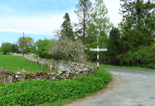
///salary.iceberg.risky. Near Milnthorpe, Cumbria

Related Wikis

Deepthwaite

Deepthwaite is a hamlet in Cumbria, England. == References ==

Westmorland County Agricultural Society

The Westmorland County Agricultural Society (WCAS, established 1799) is a registered charity which supports agriculture and related activities in and around...

Hincaster

Hincaster is a small hamlet and civil parish in the South Lakeland district of Cumbria, England, located between Kendal and Milnthorpe. In the 2001 census...
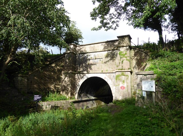
Hincaster Tunnel

The Hincaster Tunnel is a canal tunnel on the Lancaster Canal at Hincaster, a hamlet in Cumbria, England. == History == Work to extend the Lancaster Canal...

Nearby Amenities

Located within 500m of 54.246841,-2.7466834
Bus Stop
Greenside (Harry Brow)
Bus: yes
Local Ref: BY
Naptan AtcoCode: 090079311552
Naptan Bearing: W
Naptan BusStopType: CUS
Naptan CommonName: Greenside opp guide post (W bound)
Naptan Indicator: by
Naptan Landmark: Village Guide Post opposite Harry Brow Road
Naptan NaptanCode: cumdjdpd
Naptan Street: No name
Naptan Verified: no
Public Transport: platform
Source: naptan_import
Lat/Long: 54.2480073/-2.7534377
Bus Stop
Greenside (Harry Brow)
Bus: yes
Naptan AtcoCode: 090079313308
Naptan Bearing: E
Naptan BusStopType: CUS
Naptan CommonName: Greenside (E bound)
Naptan Indicator: opp
Naptan Landmark: Village Guide Post
Naptan NaptanCode: cumdjdpg
Naptan Street: No name
Naptan Verified: no
Public Transport: platform
Source: naptan_import
Lat/Long: 54.2480269/-2.753308
Noexit: yes
Lat/Long: 54.2453868/-2.7510417
Post Box
Collection Times: Mo-Fr 16:15; Sa 11:00
Drive Through: no
Post Box Type: lamp
Ref: LA7 235
Lat/Long: 54.2437217/-2.7414409
Give Way
Direction: forward
Lat/Long: 54.2470022/-2.7509984
Give Way
Direction: backward
Lat/Long: 54.2470849/-2.7510356
Post Box
Collection Times: Mo-Fr 16:15; Sa 11:00
Drive Through: no
Post Box Type: wall
Ref: LA7 238
Lat/Long: 54.2470313/-2.7511342
Give Way
Direction: backward
Lat/Long: 54.244385/-2.7486439
Give Way
Direction: forward
Lat/Long: 54.2450385/-2.7521983
Power: pole
Lat/Long: 54.2490452/-2.74037
Power: pole
Lat/Long: 54.2480438/-2.7406919
Power: pole
Lat/Long: 54.2464907/-2.7412283
Power: pole
Lat/Long: 54.2458043/-2.741459
Power: pole
Lat/Long: 54.2450771/-2.7416843
Power: pole
Lat/Long: 54.2443279/-2.7419365
Power: pole
Lat/Long: 54.2443217/-2.7418426
Power: pole
Lat/Long: 54.2450551/-2.7416012
Power: pole
Lat/Long: 54.2457651/-2.7413571
Power: pole
Lat/Long: 54.2464531/-2.7411157
Power: pole
Lat/Long: 54.2470393/-2.7409387
Power: pole
Lat/Long: 54.2480438/-2.74059
Power: pole
Lat/Long: 54.2490217/-2.7402815
Greenside (Harry Brow)
Bus: yes
Public Transport: stop_position
Lat/Long: 54.2480304/-2.7534285
Greenside (Harry Brow)
Bus: yes
Public Transport: stop_position
Lat/Long: 54.2480074/-2.753326
Woodhouse Hill
Natural: peak
Lat/Long: 54.2460997/-2.7483954
Give Way
Direction: forward
Lat/Long: 54.2480797/-2.7536481
Direction: 250
Generator Method: photovoltaic
Generator Output Electricity: yes
Generator Solar Modules: 8
Generator Source: solar
Generator Type: solar_photovoltaic_panel
Location: roof
Power: generator
Lat/Long: 54.248464/-2.753528
Direction: 70
Generator Method: photovoltaic
Generator Output Electricity: yes
Generator Solar Modules: 6
Generator Source: solar
Generator Type: solar_photovoltaic_panel
Location: roof
Power: generator
Lat/Long: 54.2484712/-2.7534894
Direction: 210
Generator Method: photovoltaic
Generator Output Electricity: yes
Generator Solar Modules: 13
Generator Source: solar
Generator Type: solar_photovoltaic_panel
Location: roof
Power: generator
Lat/Long: 54.2481726/-2.7530633
Barrier: cattle_grid
Lat/Long: 54.2440229/-2.7523518
Power: pole
Lat/Long: 54.244488/-2.7481835
Power: pole
Lat/Long: 54.2448804/-2.7489803
Power: pole
Lat/Long: 54.2451029/-2.7494438
Power: pole
Lat/Long: 54.2451762/-2.7500477
Power: pole
Lat/Long: 54.2452259/-2.7505464
Power: pole
Lat/Long: 54.2454866/-2.7511001
Power: pole
Lat/Long: 54.2457106/-2.751674
Power: pole
Lat/Long: 54.2461308/-2.7513733
Power: pole
Lat/Long: 54.246871/-2.7506918
Power: pole
Lat/Long: 54.2475729/-2.7500653
Power: pole
Lat/Long: 54.2482317/-2.749494
Power: pole
Lat/Long: 54.2491716/-2.7486019
Power: pole
Lat/Long: 54.2499051/-2.7478903
Power: pole
Lat/Long: 54.2503501/-2.7508195
Power: pole
Lat/Long: 54.2501232/-2.7493311
Power: pole
Lat/Long: 54.2496855/-2.7464144
Power: pole
Lat/Long: 54.2497587/-2.7456001
Power: pole
Lat/Long: 54.2492712/-2.744029
Power: pole
Lat/Long: 54.2487544/-2.7424128
Power: pole
Lat/Long: 54.2436003/-2.7422199
Power: pole
Lat/Long: 54.2435837/-2.7421176
Power: pole
Lat/Long: 54.2441395/-2.7430718
Power: pole
Lat/Long: 54.2441234/-2.7421923
Power: pole
Lat/Long: 54.2441117/-2.7415834
Power: pole
Lat/Long: 54.2440956/-2.7408567
Defibrillator
Defibrillator Location: Mounted in a stone wall at the edge of the car park
Emergency: defibrillator
Indoor: no
Lat/Long: 54.248603/-2.7496127
Barrier: entrance
Lat/Long: 54.2476692/-2.7504654
Man Made: street_cabinet
Lat/Long: 54.2485952/-2.7495896
Man Made: street_cabinet
Lat/Long: 54.2485885/-2.7495608
Historic: boundary_stone
Lat/Long: 54.2470458/-2.751121
Grit Bin
Lat/Long: 54.2470087/-2.750919
Noexit: yes
Lat/Long: 54.2444385/-2.7517649
The data included in this document is from www.openstreetmap.org. The data is made available under ODbL.

Have you been to Woodhouse Hill?

Leave your review of Woodhouse Hill below (or comments, questions and feedback).