Deepthwaite

Settlement in Westmorland South Lakeland

England

Deepthwaite

Farleton Fell View of Farleton Fell as seen from the M6.
Farleton Fell Credit: Stuart Wilding

Deepthwaite is a charming village located in the historic county of Westmorland in the northwestern region of England. Situated amidst the picturesque scenery of the Lake District National Park, this idyllic countryside settlement offers a tranquil retreat for both locals and visitors alike.

The village of Deepthwaite is characterized by its traditional architecture, with many of its buildings dating back several centuries. The houses are predominantly constructed with local stone, giving the village a rustic and timeless feel. The narrow lanes and cobbled streets further add to the charm and appeal of this quaint settlement.

Surrounded by lush green fields and rolling hills, Deepthwaite is a haven for nature enthusiasts. The village is situated near several stunning lakes, including Lake Windermere and Ullswater, offering ample opportunities for outdoor activities such as boating, fishing, and hiking.

Despite its small size, Deepthwaite boasts a close-knit community. The village features a local pub, The Deepthwaite Arms, which serves as a popular meeting place for residents and visitors alike. Additionally, the village hall hosts various events throughout the year, including traditional fairs and cultural festivals.

Deepthwaite is conveniently located near the market town of Kendal, which provides access to a range of amenities such as shops, restaurants, and entertainment venues. The village also benefits from good transport links, with regular bus services connecting it to nearby towns and cities.

Overall, Deepthwaite offers a peaceful and scenic retreat, making it a sought-after destination for those seeking a break from the hustle and bustle of modern life.

If you have any feedback on the listing, please let us know in the comments section below.
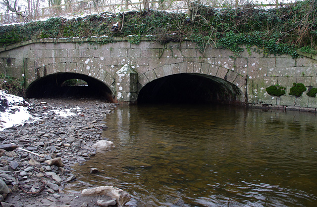
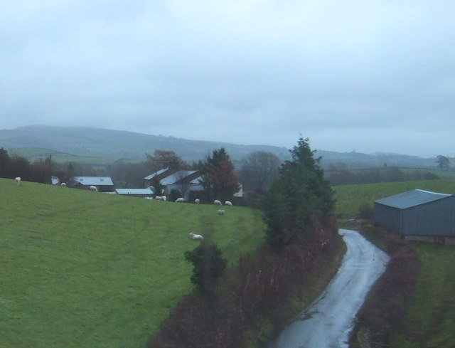
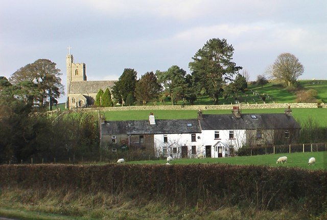
Deepthwaite Images

Images are sourced within 2km of 54.243132/-2.738837 or Grid Reference SD5183. Thanks to Geograph Open Source API. All images are credited.

Farleton Fell View of Farleton Fell as seen from the M6.
Farleton Fell
View of Farleton Fell as seen from the M6.
Heversham Head Plantation
Minor road towards Greenside Heading south east beside Heversham Head Plantation.
Minor road towards Greenside
Heading south east beside Heversham Head Plantation.
Minor road towards Greenside Heading south east.
Minor road towards Greenside
Heading south east.
Mabbin Hall
Mabbin Hall
Rough grazing and stone wall Near Greenside.
Rough grazing and stone wall
Near Greenside.
Downhill towards Greenside Heading east.
Downhill towards Greenside
Heading east.
Grazing, Greenside
Grazing, Greenside
Minor road, Greenside Looking south east.
Minor road, Greenside
Looking south east.
Grazing near Greenside Farm
Greenside Farm
Greenside Farm
House in Hincaster
House in Hincaster
Reflections
Reflections
Fields in winter View from the old towpath on the Lancaster Canal.
Fields in winter
View from the old towpath on the Lancaster Canal.
Preston Patrick in winter View across fields to School Houses and St. Patrick's Church.
Preston Patrick in winter
View across fields to School Houses and St. Patrick's Church.
Crooklands Aqueduct, Lancaster Canal Bridge 165, over Peasey Beck.
Crooklands Aqueduct, Lancaster Canal
Bridge 165, over Peasey Beck.
Hedge with tree Taken from a lay-by on the A590, an ash I think.  Just beyond Well Heads Lane runs across the picture.
Hedge with tree
Taken from a lay-by on the A590, an ash I think. Just beyond Well Heads Lane runs across the picture.
New roundabout on the A6070 Built to serve a new industrial unit off to the right.

The picture was taken from the offices seen here: <a href="https://www.geograph.org.uk/photo/4264610">SD5382 : Units at the Moss End Business Village</a>
New roundabout on the A6070
Built to serve a new industrial unit off to the right. The picture was taken from the offices seen here: SD5382 : Units at the Moss End Business Village
Show me another place!

Deepthwaite is located at Grid Ref: SD5183 (Lat: 54.243132, Lng: -2.738837)

Administrative County: Cumbria

District: South Lakeland

Police Authority: Cumbria

What 3 Words

///accent.jetliner.tumblers. Near Milnthorpe, Cumbria

Related Wikis

Deepthwaite

Deepthwaite is a hamlet in Cumbria, England. == References ==

Westmorland County Agricultural Society

The Westmorland County Agricultural Society (WCAS, established 1799) is a registered charity which supports agriculture and related activities in and around...

Crooklands

Crooklands is a village in South Lakeland, Cumbria, England, 4.5 miles (7.2 km) south of Kendal on the A65 road. Historically part of Westmorland, the...

Milnthorpe railway station

Milnthorpe railway station served the village of Milnthorpe, in the historical county of Westmorland, England, from 1846 to 1968 on the Lancaster and Carlisle...

Nearby Amenities

Located within 500m of 54.243132,-2.738837
Power: tower
Lat/Long: 54.2446089/-2.7319338
Power: tower
Lat/Long: 54.2415999/-2.7331315
Post Box
Collection Times: Mo-Fr 16:15; Sa 11:00
Drive Through: no
Post Box Type: lamp
Ref: LA7 235
Lat/Long: 54.2437217/-2.7414409
Power: pole
Lat/Long: 54.2464907/-2.7412283
Power: pole
Lat/Long: 54.2458043/-2.741459
Power: pole
Lat/Long: 54.2450771/-2.7416843
Power: pole
Lat/Long: 54.2443279/-2.7419365
Power: pole
Lat/Long: 54.2426478/-2.7425909
Power: pole
Lat/Long: 54.241792/-2.7429289
Power: pole
Lat/Long: 54.2408108/-2.7433124
Power: pole
Lat/Long: 54.2399377/-2.7436504
Power: pole
Lat/Long: 54.2399299/-2.7435565
Power: pole
Lat/Long: 54.2407763/-2.7432105
Power: pole
Lat/Long: 54.2417685/-2.7428108
Power: pole
Lat/Long: 54.2426227/-2.7424756
Power: pole
Lat/Long: 54.2443217/-2.7418426
Power: pole
Lat/Long: 54.2450551/-2.7416012
Power: pole
Lat/Long: 54.2457651/-2.7413571
Power: pole
Lat/Long: 54.2464531/-2.7411157
Power: pole
Lat/Long: 54.2470393/-2.7409387
Give Way
Direction: forward
Lat/Long: 54.2423427/-2.7330572
Give Way
Direction: backward
Lat/Long: 54.2422906/-2.7329616
Parking
Parking: surface
Lat/Long: 54.2418215/-2.7322503
Entrance: yes
Lat/Long: 54.2418626/-2.7321418
Give Way
Direction: forward
Lat/Long: 54.239997/-2.7384274
Give Way
Direction: backward
Lat/Long: 54.2398326/-2.7385962
Power: pole
Lat/Long: 54.2436003/-2.7422199
Power: pole
Lat/Long: 54.2435837/-2.7421176
Power: pole
Lat/Long: 54.2441395/-2.7430718
Power: pole
Lat/Long: 54.2441234/-2.7421923
Power: pole
Lat/Long: 54.2441117/-2.7415834
Power: pole
Lat/Long: 54.2440956/-2.7408567
Power: pole
Lat/Long: 54.244078/-2.7400599
Power: pole
Lat/Long: 54.2424659/-2.7314777
The data included in this document is from www.openstreetmap.org. The data is made available under ODbL.

Have you been to Deepthwaite?

Leave your review of Deepthwaite below (or comments, questions and feedback).