Perch Hill

Hill, Mountain in Somerset Mendip

England

Perch Hill

Broad Road near Rodney Stoke A view down Broad Road at the top of the descent into Rodney Stoke.
The view west goes over the Somerset Levels to the Bristol Channel.
Broad Road near Rodney Stoke Credit: Kevin Pearson

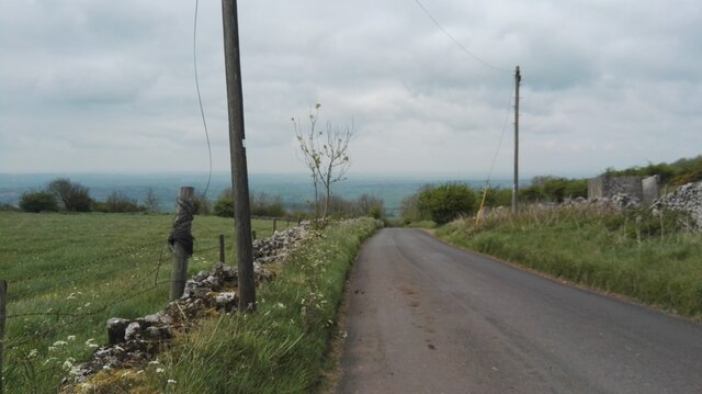
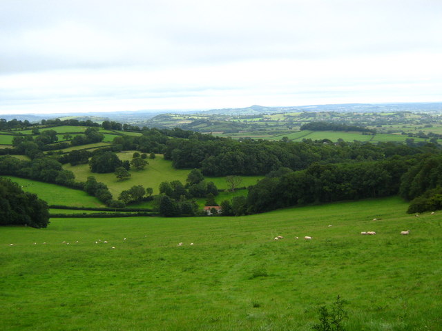
Perch Hill, located in Somerset, England, is a prominent hill that stands at an elevation of approximately 180 meters (590 feet) above sea level. It is situated within the Mendip Hills, a range of limestone hills renowned for their natural beauty and diverse wildlife. Perch Hill itself is one of the highest peaks within this range, offering breathtaking panoramic views of the surrounding countryside.

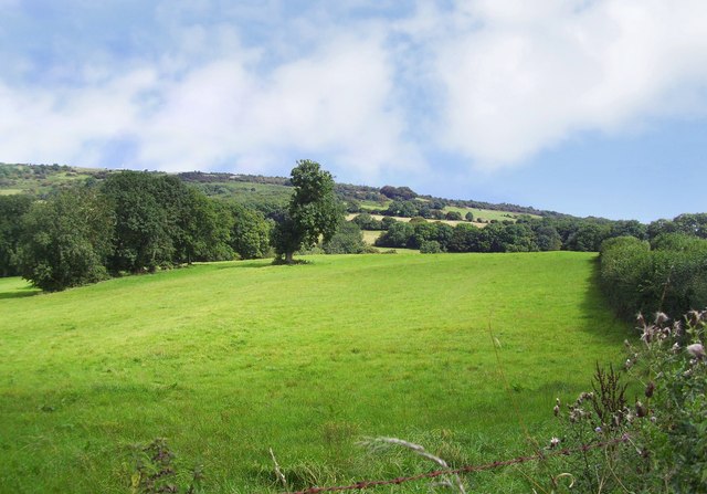
The hill is characterized by its gentle slopes and grassy terrain, making it a popular destination for hikers, nature enthusiasts, and photographers. Its strategic location provides visitors with a unique vantage point to admire the picturesque landscapes of Somerset, including rolling green fields, dense forests, and charming villages.

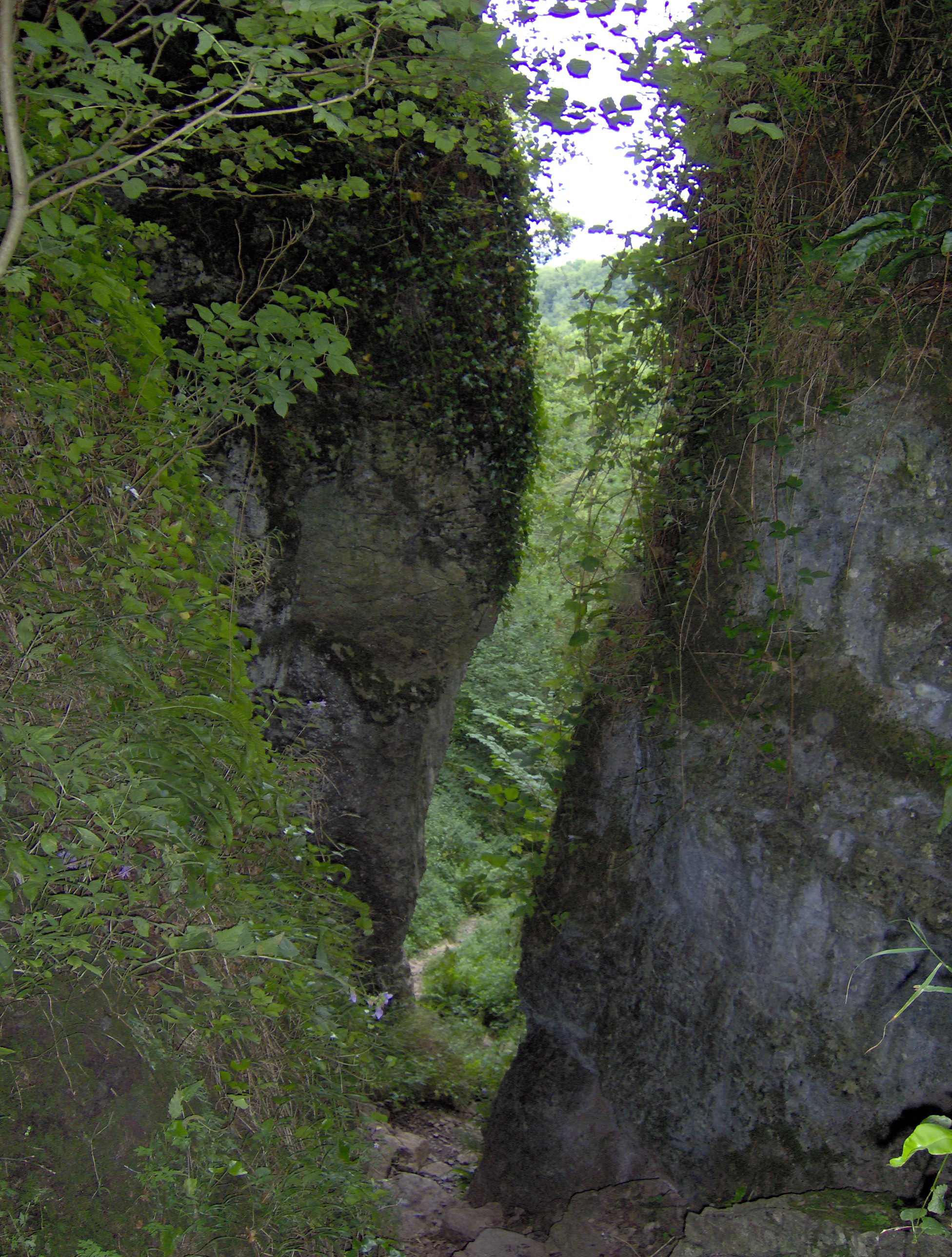
Perch Hill is also home to a variety of plant and animal species, adding to its ecological significance. The hill's rich biodiversity includes various wildflowers, such as orchids and bluebells, as well as numerous bird species, including skylarks and kestrels. It is not uncommon to spot rabbits, foxes, and even deer roaming freely in the area.

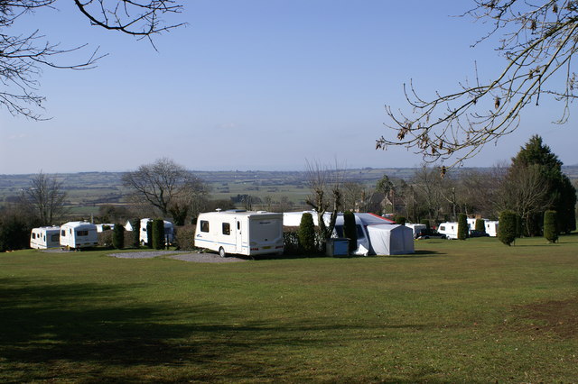
Due to its accessibility and natural beauty, Perch Hill attracts a considerable number of visitors throughout the year. The hill offers several well-maintained walking trails, allowing visitors to explore its surroundings at their own pace. Additionally, there are designated picnic areas and benches strategically placed for those who wish to relax and soak in the tranquil atmosphere.

Overall, Perch Hill, Somerset, is a captivating natural landmark that showcases the breathtaking beauty of the Mendip Hills. Its stunning views, diverse wildlife, and serene ambiance make it a must-visit destination for nature lovers and outdoor enthusiasts alike.

If you have any feedback on the listing, please let us know in the comments section below.

Perch Hill Images

Images are sourced within 2km of 51.23532/-2.7109649 or Grid Reference ST5048. Thanks to Geograph Open Source API. All images are credited.

Broad Road near Rodney Stoke A view down Broad Road at the top of the descent into Rodney Stoke.
The view west goes over the Somerset Levels to the Bristol Channel.
Broad Road near Rodney Stoke
A view down Broad Road at the top of the descent into Rodney Stoke. The view west goes over the Somerset Levels to the Bristol Channel.
River Axe The river, fringed by himalayan balsam, cuts across the northeast edge of the square. Not very big, but then there is a Lower River Axe running a mile to the south, the two having separated at Wookey. The lane is heading from Knowle Bridge to Bleadney.
River Axe
The river, fringed by himalayan balsam, cuts across the northeast edge of the square. Not very big, but then there is a Lower River Axe running a mile to the south, the two having separated at Wookey. The lane is heading from Knowle Bridge to Bleadney.
Knowle Moor Drove A lane over the levels, here passing willow trees as it veers away from the River Axe (behind the camera).
Knowle Moor Drove
A lane over the levels, here passing willow trees as it veers away from the River Axe (behind the camera).
Knowle Moor Drove Looking in the other direction from the spot where <a href="https://www.geograph.org.uk/photo/2587937">ST4947 : Knowle Moor Drove</a> was taken. The River Axe runs along the left side of the road.
Knowle Moor Drove
Looking in the other direction from the spot where ST4947 : Knowle Moor Drove was taken. The River Axe runs along the left side of the road.
Westbury-Sub Mendip Church Saint Lawrence, with parts dating back to the 12th century.
Westbury-Sub Mendip Church
Saint Lawrence, with parts dating back to the 12th century.
Mendip Edge Scenery On the south west slope of the Mendip Hills near Rodney Stoke.
Mendip Edge Scenery
On the south west slope of the Mendip Hills near Rodney Stoke.
Chalcroft Hill Bridge over drainage ditch/stream with Chalcroft Hill (all in square) in background.
Chalcroft Hill
Bridge over drainage ditch/stream with Chalcroft Hill (all in square) in background.
Caravan Park On Westclose Hill
Caravan Park
On Westclose Hill
Meadows on Westbury Moor Taken from the footpath over Lodge Hill, which can be seen snaking back towards the left of the picture.
Meadows on Westbury Moor
Taken from the footpath over Lodge Hill, which can be seen snaking back towards the left of the picture.
Looking South from Lodge Hill
St Lawrence's church, Westbury Originally C12; a little Norman work remains, but the tower was rebuilt in 1887, possibly reusing the former pinnacles <span class="nowrap"><a title="http://webapp1.somerset.gov.uk/her/details.asp?prn=22003" rel="nofollow ugc noopener" href="http://webapp1.somerset.gov.uk/her/details.asp?prn=22003">Link</a><img style="margin-left:2px;" alt="External link" title="External link - shift click to open in new window" src="https://s1.geograph.org.uk/img/external.png" width="10" height="10"/></span> .
St Lawrence's church, Westbury
Originally C12; a little Norman work remains, but the tower was rebuilt in 1887, possibly reusing the former pinnacles LinkExternal link .
Churchyard, Westbury-Sub-Mendip The churchyard on the north side of <a href="https://www.geograph.org.uk/photo/1878790">ST4948 : St Lawrence's church, Westbury</a>. In the background are barns at Court House Farm.
Churchyard, Westbury-Sub-Mendip
The churchyard on the north side of ST4948 : St Lawrence's church, Westbury. In the background are barns at Court House Farm.
St Lawrence's church, Westbury A view of <a href="https://www.geograph.org.uk/photo/1878790">ST4948 : St Lawrence's church, Westbury</a> from the south, showing the two-storey porch with its pierced parapet and empty niche. In a few minutes the sun would have illuminated more of the stonework, but breakfast called.
St Lawrence's church, Westbury
A view of ST4948 : St Lawrence's church, Westbury from the south, showing the two-storey porch with its pierced parapet and empty niche. In a few minutes the sun would have illuminated more of the stonework, but breakfast called.
Hollow Farm The lane is The Hollow, running from the centre of Westbury-Sub-Mendip to meet the A371 turnpike. Hollow Farm lies below Broadway Hill on the right.
Hollow Farm
The lane is The Hollow, running from the centre of Westbury-Sub-Mendip to meet the A371 turnpike. Hollow Farm lies below Broadway Hill on the right.
Towards Stoneleigh from The Hollow Looking across a couple of fields down the hill to the houses at Stoneleigh, which are along the A371 Stoke Road. The partly wooded Lodge Hill rises in the background.
Towards Stoneleigh from The Hollow
Looking across a couple of fields down the hill to the houses at Stoneleigh, which are along the A371 Stoke Road. The partly wooded Lodge Hill rises in the background.
Footpath up Broadway Hill The sign indicates the start of footpath WS 13/59 from The Hollow, but according to the maps it should leave the lane 100 metres further east. Two more footpaths cross the field.
Footpath up Broadway Hill
The sign indicates the start of footpath WS 13/59 from The Hollow, but according to the maps it should leave the lane 100 metres further east. Two more footpaths cross the field.
Show me another place!

Perch Hill is located at Grid Ref: ST5048 (Lat: 51.23532, Lng: -2.7109649)

Administrative County: Somerset

District: Mendip

Police Authority: Avon and Somerset

What 3 Words

///sensitive.shared.clotting. Near Draycott, Somerset

Related Wikis

Westbury-sub-Mendip

Westbury-sub-Mendip is a village and civil parish in Somerset, England. The village is on the southern slopes of the Mendip Hills, 4 miles (6.4 km) from...

Church of St Lawrence, Westbury-sub-Mendip

The Church of St Lawrence in Westbury-sub-Mendip, Somerset, England was built in the 12th century. It is a Grade II* listed building. == History == The...

Lodge Hill railway station

Lodge Hill railway station was a station on the Bristol and Exeter Railway's Cheddar Valley line in Somerset, England from 1870 until 1963. The station...

St Paul's Church, Easton

St Paul's Church is a Church of England church in Easton, Somerset, England. The church, which was designed by Richard Carver and built in 1843, has been...

Brimble Pit and Cross Swallet Basins

Brimble Pit and Cross Swallet Basins (grid reference ST512505) is a 154.3 hectare (381.3 acre) geological Site of Special Scientific Interest between Wookey...

Ebbor Gorge

Ebbor Gorge is a limestone gorge in Somerset, England, designated and notified in 1952 as a 63.5-hectare (157-acre) biological Site of Special Scientific...

Rodney Stoke

Rodney Stoke is a small village and civil parish, located at grid reference ST486501, 5 miles north-west of Wells, in the English county of Somerset. The...

Rodney Stoke SSSI

Rodney Stoke (grid reference ST492507) is a 69.6 hectare (172.0 acre) biological Site of Special Scientific Interest, just north of the village of Rodney...

Nearby Amenities

Located within 500m of 51.23532,-2.7109649
Power: pole
Lat/Long: 51.2317873/-2.7135344
Power: pole
Lat/Long: 51.2309979/-2.7105786
Power: pole
Lat/Long: 51.2311339/-2.7110721
Power: pole
Lat/Long: 51.231396/-2.7121289
Power: pole
Lat/Long: 51.2322895/-2.7152403
Historic: memorial
Lat/Long: 51.2362505/-2.7168758
Holly brook
Place: hamlet
Lat/Long: 51.2332287/-2.7088223
Public Bookcase
Westbury Book Exchange
Booth: K6
Colour: red
Disused Amenity: telephone
Man Made: telephone_box
Note: this was one of the earliest of book exchanges in converted phone boxes in 2009
Public Bookcase Type: phone_box
Lat/Long: 51.2370303/-2.7151054
The data included in this document is from www.openstreetmap.org. The data is made available under ODbL.

Have you been to Perch Hill?

Leave your review of Perch Hill below (or comments, questions and feedback).