Wearyall Hill

Hill, Mountain in Somerset Mendip

England

Wearyall Hill

Barrier on NCN3 at Back River Drove Barrier on the exit of the NCN3 path onto Back River Drove near Sharpham.
Spacing of the path either side of the barrier is approximately 1m.
The slope going up to the bridge behind the barrier is quite steep.
The path from here to Middle Drove is a gravel path, which is uneven and rutted in places and will be muddy in wet weather.
Barrier on NCN3 at Back River Drove Credit: Kevin Pearson

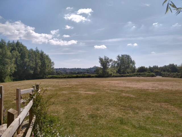
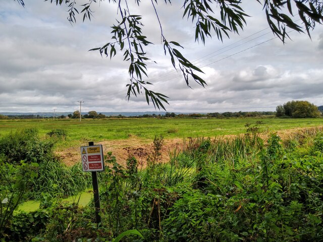
Wearyall Hill is a prominent landmark located in Somerset, England. It is situated near the town of Glastonbury and is part of the larger Glastonbury Tor complex. Although it is referred to as a hill, it is more accurately described as a small rise or mound, measuring only 18 meters in height.

The hill derives its name from a legendary event that is said to have taken place here. According to local folklore, Joseph of Arimathea, a biblical figure, arrived in Glastonbury with the Holy Grail and thrust his staff into the ground on Wearyall Hill. From this staff, a thorn tree is said to have grown, which became an iconic symbol of Glastonbury.

Today, Wearyall Hill is home to a solitary thorn tree, known as the Glastonbury Thorn. This tree is believed to be a descendant of the original tree planted by Joseph of Arimathea and is regarded with great reverence by locals and pilgrims alike. It is particularly famous for its unique blooming pattern, with its white flowers appearing during the winter months.

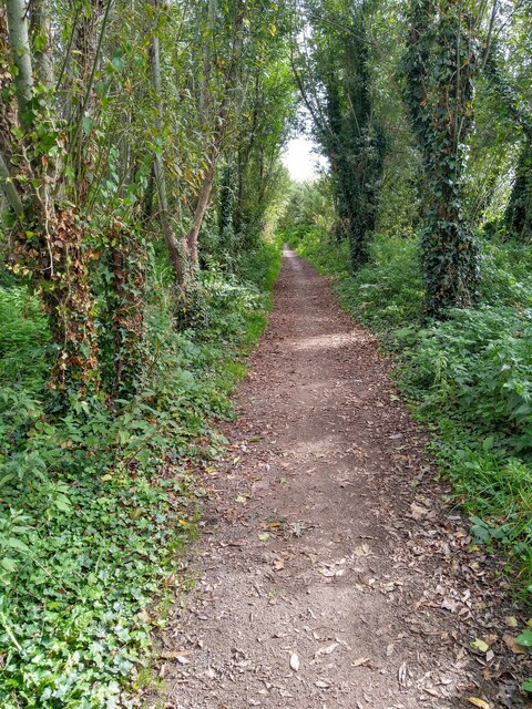
The hill offers visitors panoramic views of the surrounding countryside, including the nearby Glastonbury Tor, the Somerset Levels, and the Mendip Hills. It is a popular spot for nature walks, picnics, and photography, attracting both locals and tourists throughout the year.

Wearyall Hill holds a significant place in the cultural and historical heritage of Glastonbury. Its association with Joseph of Arimathea and the Glastonbury Thorn makes it an important pilgrimage site for those seeking spiritual connections and mystical experiences. Whether for its natural beauty, historical significance, or spiritual allure, Wearyall Hill continues to captivate and inspire all who visit.

If you have any feedback on the listing, please let us know in the comments section below.

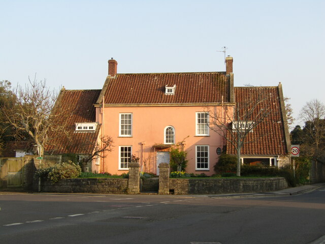
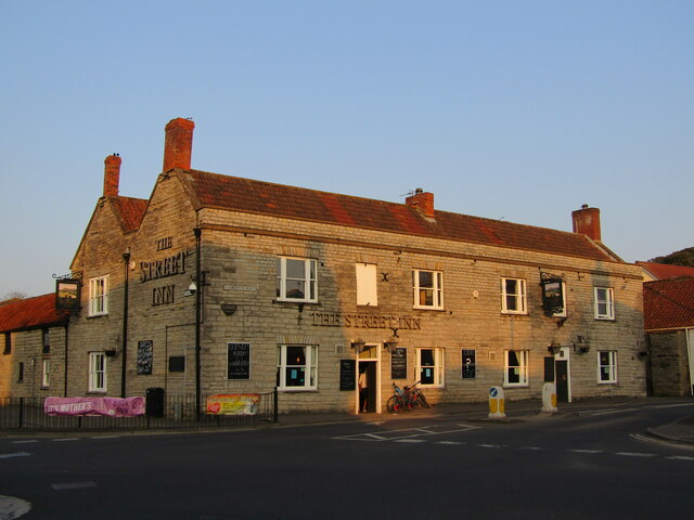
Wearyall Hill Images

Images are sourced within 2km of 51.140327/-2.7271289 or Grid Reference ST4938. Thanks to Geograph Open Source API. All images are credited.

Barrier on NCN3 at Back River Drove Barrier on the exit of the NCN3 path onto Back River Drove near Sharpham.
Spacing of the path either side of the barrier is approximately 1m.
The slope going up to the bridge behind the barrier is quite steep.
The path from here to Middle Drove is a gravel path, which is uneven and rutted in places and will be muddy in wet weather.
Barrier on NCN3 at Back River Drove
Barrier on the exit of the NCN3 path onto Back River Drove near Sharpham. Spacing of the path either side of the barrier is approximately 1m. The slope going up to the bridge behind the barrier is quite steep. The path from here to Middle Drove is a gravel path, which is uneven and rutted in places and will be muddy in wet weather.
View from Amy's Picnic Area on NCN3 near Glastonbury Looking east towards Glastonbury Tor from Amy's Picnic Area on the NCN3 path near Glastonbury.
Amy's Picnic Area was built in memory of a local teenager who tragically died of an asthma attack - for information please see <span class="nowrap"><a title="https://amy-thomas.muchloved.com/Lifestories/39617904" rel="nofollow ugc noopener" href="https://amy-thomas.muchloved.com/Lifestories/39617904">Link</a><img style="margin-left:2px;" alt="External link" title="External link - shift click to open in new window" src="https://s1.geograph.org.uk/img/external.png" width="10" height="10"/></span>
View from Amy's Picnic Area on NCN3 near Glastonbury
Looking east towards Glastonbury Tor from Amy's Picnic Area on the NCN3 path near Glastonbury. Amy's Picnic Area was built in memory of a local teenager who tragically died of an asthma attack - for information please see LinkExternal link
NCN3 path exit onto Middle Drove near Glastonbury The gateway at the exit onto of the NCN3 off road path onto Middle Drove near Glastonbury.  
The space through the gateway is over 1m wide and 2m high, so there is no problem with accessibility, although there is a small lip at the bottom of the gate.
The path up to here is a gravel path which can be muddy and rutted in places in wet weather.
NCN3 path exit onto Middle Drove near Glastonbury
The gateway at the exit onto of the NCN3 off road path onto Middle Drove near Glastonbury. The space through the gateway is over 1m wide and 2m high, so there is no problem with accessibility, although there is a small lip at the bottom of the gate. The path up to here is a gravel path which can be muddy and rutted in places in wet weather.
Lower New Close from NCN3 A view over the Somerset Levels at Lower New Close, taken looking north from the NCN3 path between Back Water Drove and Middle Drove.
Lower New Close from NCN3
A view over the Somerset Levels at Lower New Close, taken looking north from the NCN3 path between Back Water Drove and Middle Drove.
NCN3 path near Glastonbury Looking east along the NCN3 path between Backwater Drove and Middle Drove.
The path here is a gravel path, which can be muddy and rutted in wet weather.
NCN3 path near Glastonbury
Looking east along the NCN3 path between Backwater Drove and Middle Drove. The path here is a gravel path, which can be muddy and rutted in wet weather.
Buildings on Leigh Road, Street It was the colonnade to the left that interested me in this view (taken from a bus that was stopped in the town centre) but I haven't managed to find out anything about it.  The building to the right is the library <a href="https://www.geograph.org.uk/photo/4989955">ST4836 : Library - Leigh Road</a>.
Buildings on Leigh Road, Street
It was the colonnade to the left that interested me in this view (taken from a bus that was stopped in the town centre) but I haven't managed to find out anything about it. The building to the right is the library ST4836 : Library - Leigh Road.
Street - The Bear Inn Historic hostelry facing Clark's shoe factory. Originally a beer & cider house, it later became a temperance hotel in 1894 and was unlicensed until 1976. The Bear is now in the Marston's portfolio.
Street - The Bear Inn
Historic hostelry facing Clark's shoe factory. Originally a beer & cider house, it later became a temperance hotel in 1894 and was unlicensed until 1976. The Bear is now in the Marston's portfolio.
Street - The Bear Inn This old pub carries the date 1894 when it became a Temperance Hotel under the auspices of the Quaker family Clark, owners of the local shoe factory.
It was "dry" till 1976 and is now an inn managed by Marston's Brewery.
Street - The Bear Inn
This old pub carries the date 1894 when it became a Temperance Hotel under the auspices of the Quaker family Clark, owners of the local shoe factory. It was "dry" till 1976 and is now an inn managed by Marston's Brewery.
Street - Crispin Hall Distinctive late 19th century building (b.1885), named after the patron saint of shoemakers - Clark's shoe factory is nearby.
Originally a public hall and library, today the hall contains a cafe and community services.
Street - Crispin Hall
Distinctive late 19th century building (b.1885), named after the patron saint of shoemakers - Clark's shoe factory is nearby. Originally a public hall and library, today the hall contains a cafe and community services.
Street - Town Clock Sited outside Crispin Hall - note the dinosaur finial - ichthyosaur fossils have been found in local quarries (blue lias stone).
Street - Town Clock
Sited outside Crispin Hall - note the dinosaur finial - ichthyosaur fossils have been found in local quarries (blue lias stone).
Street - The Lantokay Large pub on Street's High Street. It is in the Wetherspoon's chain and named after a historic appellation for the town.
Street - The Lantokay
Large pub on Street's High Street. It is in the Wetherspoon's chain and named after a historic appellation for the town.
Street - "The Pink House" Historic house in the Clark's factory town of Street.
Street - "The Pink House"
Historic house in the Clark's factory town of Street.
Street - Twin Town Mural Showing the parish churches of Street, Notre Dame de Gravenchon and Isny im Allgaeu. Shame that graffiti has been daubed.
Street - Twin Town Mural
Showing the parish churches of Street, Notre Dame de Gravenchon and Isny im Allgaeu. Shame that graffiti has been daubed.
Street - Shepherd Mural Artwork depicting an earlier age in the old market town.
Street - Shepherd Mural
Artwork depicting an earlier age in the old market town.
Street - Shoemaker Mural Artwork depicting industry in this market town - the shoe factory (started 1825) of Clark's shoes is in Street.
Street - Shoemaker Mural
Artwork depicting industry in this market town - the shoe factory (started 1825) of Clark's shoes is in Street.
Street - Shoe Industry Mural The town of Street is where C&J Clark founded their famous shoe-making company in 1825.
Street - Shoe Industry Mural
The town of Street is where C&J Clark founded their famous shoe-making company in 1825.
Street - Mural Mural of a female guitarist, in a small park opposite Crispin Hall.
Street - Mural
Mural of a female guitarist, in a small park opposite Crispin Hall.
Street - The Street Inn Large pub at a main road junction, facing the north end of Street's High Street.
Street - The Street Inn
Large pub at a main road junction, facing the north end of Street's High Street.
Show me another place!

Wearyall Hill is located at Grid Ref: ST4938 (Lat: 51.140327, Lng: -2.7271289)

Administrative County: Somerset

District: Mendip

Police Authority: Avon and Somerset

What 3 Words

///aimlessly.songbook.secure. Near Glastonbury, Somerset

Related Wikis

Tor Leisure Ground, Glastonbury

Tor Leisure Ground, previously known as Morlands Athletic Ground until 1986, is a former first-class cricket ground located in Glastonbury, Somerset....

Northover, Somerset

Northover is a former village, now a suburb of Glastonbury in Mendip, Somerset, England.It should not be confused with Northover, Ilchester, a former parish...

Glastonbury Cricket Club

Glastonbury Cricket Club is an English amateur cricket club based in Glastonbury, Somerset. The club's first team plays in the West of England Premier...

Hospital of St Mary Magdalene, Glastonbury

The Hospital of St Mary Magdalene is a former Catholic religious complex in Glastonbury, Somerset, England. It built around 1310 by the Benedictine monks...

Nearby Amenities

Located within 500m of 51.140327,-2.7271289
Mini Roundabout
Direction: clockwise
Lat/Long: 51.1408117/-2.7238098
Barrier: bollard
Bicycle: yes
Foot: yes
Lat/Long: 51.141288/-2.7315419
Barrier: bollard
Bicycle: yes
Foot: yes
Lat/Long: 51.1420941/-2.7317383
Barrier: kissing_gate
Lat/Long: 51.1419541/-2.7224721
Bench
Backrest: yes
Lat/Long: 51.141055/-2.7236418
Bench
Backrest: yes
Lat/Long: 51.1403415/-2.7275149
Bench
Backrest: yes
Lat/Long: 51.1403802/-2.7272198
Bench
Backrest: yes
Lat/Long: 51.1405889/-2.7263266
Bench
Backrest: yes
Lat/Long: 51.1409103/-2.7252028
Barrier: kissing_gate
Lat/Long: 51.1396313/-2.7297331
Bench
Backrest: yes
Lat/Long: 51.1411829/-2.724366
Premier Inn
Brand: Premier Inn
Brand Wikidata: Q2108626
Brand Wikipedia: en:Premier Inn
Contact Website: https://www.premierinn.com/gb/en/hotels/england/somerset/glastonbury/glastonbury.html
Internet Access: wlan
Internet Access Fee: customers
Internet Access Operator: Virgin Media
Internet Access Ssid: Premier Inn Free Wi-Fi
Tourism: hotel
Lat/Long: 51.1403047/-2.7341668
Pub
Brewers Fayre
Brand: Brewers Fayre
Brand Wikidata: Q4962678
Brand Wikipedia: en:Brewers Fayre
Cuisine: british
Lat/Long: 51.1405327/-2.7337712
Turning Circle
Lat/Long: 51.1432137/-2.7286065
Crossing
Button Operated: yes
Crossing: traffic_signals
Kerb: lowered
Tactile Paving: no
Traffic Signals Sound: yes
Traffic Signals Vibration: no
Lat/Long: 51.1407014/-2.7331829
Crossing
Button Operated: yes
Crossing: traffic_signals
Kerb: lowered
Tactile Paving: no
Traffic Signals Sound: yes
Traffic Signals Vibration: no
Lat/Long: 51.1407977/-2.7331156
Traffic Signals
Traffic Signals: signal
Traffic Signals Direction: forward
Lat/Long: 51.1405222/-2.7333471
Traffic Signals
Traffic Signals: signal
Traffic Signals Direction: forward
Lat/Long: 51.1406501/-2.7327932
Traffic Signals
Traffic Signals: signal
Traffic Signals Direction: forward
Lat/Long: 51.1408301/-2.7331513
Noexit: yes
Lat/Long: 51.1408607/-2.7341079
Poles: bipole
Power: pole
Source: bing
Transformer: distribution
Lat/Long: 51.1383414/-2.7284597
Power: pole
Source: bing
Lat/Long: 51.1380183/-2.7281781
Power: pole
Source: bing
Lat/Long: 51.1375993/-2.7278025
Power: pole
Source: bing
Lat/Long: 51.1368579/-2.7278388
Power: pole
Source: bing
Lat/Long: 51.1361763/-2.727883
Crossing
Crossing: uncontrolled
Crossing Ref: zebra
Lat/Long: 51.1431628/-2.7287386
Crossing
Crossing: uncontrolled
Crossing Ref: zebra
Lat/Long: 51.1431438/-2.7292996
Crossing
Crossing: uncontrolled
Crossing Ref: zebra
Lat/Long: 51.1432444/-2.729178
Crossing
Crossing: uncontrolled
Lat/Long: 51.143638/-2.7319382
Fast Food
Subway
Addr City: Glastonbury
Addr Postcode: BA6 9XE
Addr Street: Wirral Park Road
Brand: Subway
Brand Wikidata: Q244457
Cuisine: sandwich
Drive Through: no
Fhrs Id: 1076618
Takeaway: yes
Lat/Long: 51.1428791/-2.7290881
Fast Food
Domino's
Addr City: Glastonbury
Addr Postcode: BA6 9XE
Addr Street: Wirral Park Road
Brand: Domino's
Brand Wikidata: Q839466
Cuisine: pizza
Drive Through: no
Fhrs Id: 175032
Takeaway: yes
Lat/Long: 51.14288/-2.7289688
Traffic Calming: island
Lat/Long: 51.141068/-2.7319203
Crossing
Crossing: traffic_signals
Lat/Long: 51.1405425/-2.7333031
Crossing
Crossing: traffic_signals
Lat/Long: 51.1404862/-2.7331376
Post Box
Brand: Royal Mail
Brand Wikidata: Q638098
Collection Times: Mo-Fr 09:00; Sa 07:00
Mapillary: 1269632300591201
Operator: Royal Mail
Operator Wikidata: Q638098
Post Box Mounting: pier
Post Box Type: lamp
Ref: BA6 22D
Royal Cypher: EIIR
Survey Date: 2023-07-06
Lat/Long: 51.1429853/-2.7268383
Generator Method: photovoltaic
Generator Output Electricity: yes
Generator Source: solar
Generator Type: solar_photovoltaic_panel
Location: roof
Power: generator
Lat/Long: 51.1422928/-2.7207631
Generator Method: photovoltaic
Generator Output Electricity: yes
Generator Source: solar
Generator Type: solar_photovoltaic_panel
Location: roof
Power: generator
Lat/Long: 51.1421666/-2.7212995
Generator Method: photovoltaic
Generator Output Electricity: yes
Generator Source: solar
Generator Type: solar_photovoltaic_panel
Location: roof
Power: generator
Lat/Long: 51.1386848/-2.7303936
Generator Method: photovoltaic
Generator Output Electricity: yes
Generator Source: solar
Generator Type: solar_photovoltaic_panel
Location: roof
Power: generator
Lat/Long: 51.1391913/-2.728752
Generator Method: photovoltaic
Generator Output Electricity: yes
Generator Source: solar
Generator Type: solar_photovoltaic_panel
Location: roof
Power: generator
Lat/Long: 51.1392957/-2.7281123
Generator Method: photovoltaic
Generator Output Electricity: yes
Generator Source: solar
Generator Type: solar_photovoltaic_panel
Location: roof
Power: generator
Lat/Long: 51.1387319/-2.7292711
Generator Method: photovoltaic
Generator Output Electricity: yes
Generator Source: solar
Generator Type: solar_photovoltaic_panel
Location: roof
Power: generator
Lat/Long: 51.1385577/-2.7283672
Generator Method: photovoltaic
Generator Output Electricity: yes
Generator Source: solar
Generator Type: solar_photovoltaic_panel
Location: roof
Power: generator
Lat/Long: 51.1388766/-2.7283323
Generator Method: photovoltaic
Generator Output Electricity: yes
Generator Source: solar
Generator Type: solar_photovoltaic_panel
Location: roof
Power: generator
Lat/Long: 51.1388682/-2.7281714
Generator Method: photovoltaic
Generator Output Electricity: yes
Generator Source: solar
Generator Type: solar_photovoltaic_panel
Location: roof
Power: generator
Lat/Long: 51.1388968/-2.7279863
Generator Method: photovoltaic
Generator Output Electricity: yes
Generator Source: solar
Generator Type: solar_photovoltaic_panel
Location: roof
Power: generator
Lat/Long: 51.1389372/-2.7278093
Generator Method: photovoltaic
Generator Output Electricity: yes
Generator Source: solar
Generator Type: solar_photovoltaic_panel
Location: roof
Power: generator
Lat/Long: 51.1391375/-2.7266854
Generator Method: photovoltaic
Generator Output Electricity: yes
Generator Source: solar
Generator Type: solar_photovoltaic_panel
Location: roof
Power: generator
Lat/Long: 51.1390617/-2.7270126
Generator Method: photovoltaic
Generator Output Electricity: yes
Generator Source: solar
Generator Type: solar_photovoltaic_panel
Location: roof
Power: generator
Lat/Long: 51.1392485/-2.7261892
Generator Method: photovoltaic
Generator Output Electricity: yes
Generator Source: solar
Generator Type: solar_photovoltaic_panel
Location: roof
Power: generator
Lat/Long: 51.1403929/-2.7240837
Generator Method: photovoltaic
Generator Output Electricity: yes
Generator Source: solar
Generator Type: solar_photovoltaic_panel
Location: roof
Power: generator
Lat/Long: 51.1408641/-2.7227587
Generator Method: photovoltaic
Generator Output Electricity: yes
Generator Source: solar
Generator Type: solar_photovoltaic_panel
Location: roof
Power: generator
Lat/Long: 51.1409129/-2.7225843
Generator Method: photovoltaic
Generator Output Electricity: yes
Generator Source: solar
Generator Type: solar_photovoltaic_panel
Location: roof
Power: generator
Lat/Long: 51.1411249/-2.7219379
Generator Method: photovoltaic
Generator Output Electricity: yes
Generator Source: solar
Generator Type: solar_photovoltaic_panel
Location: roof
Power: generator
Lat/Long: 51.141268/-2.7216053
Generator Method: photovoltaic
Generator Output Electricity: yes
Generator Source: solar
Generator Type: solar_photovoltaic_panel
Location: roof
Power: generator
Lat/Long: 51.1414211/-2.7210876
Generator Method: photovoltaic
Generator Output Electricity: yes
Generator Source: solar
Generator Type: solar_photovoltaic_panel
Location: roof
Power: generator
Lat/Long: 51.1426327/-2.7266479
Generator Method: photovoltaic
Generator Output Electricity: yes
Generator Source: solar
Generator Type: solar_photovoltaic_panel
Location: roof
Power: generator
Lat/Long: 51.1416853/-2.7305532
Booth: K6
Covered: booth
Disused Amenity: telephone
Man Made: telephone_box
Lat/Long: 51.1409722/-2.723403
The data included in this document is from www.openstreetmap.org. The data is made available under ODbL.

Have you been to Wearyall Hill?

Leave your review of Wearyall Hill below (or comments, questions and feedback).