West Chinnock Hill

Hill, Mountain in Somerset South Somerset

England

West Chinnock Hill

Merriott All Saints Church
Merriott Credit: Liz Martin

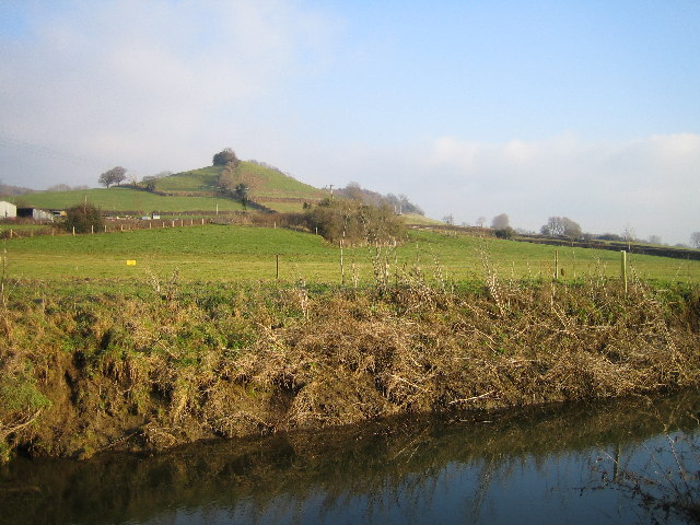
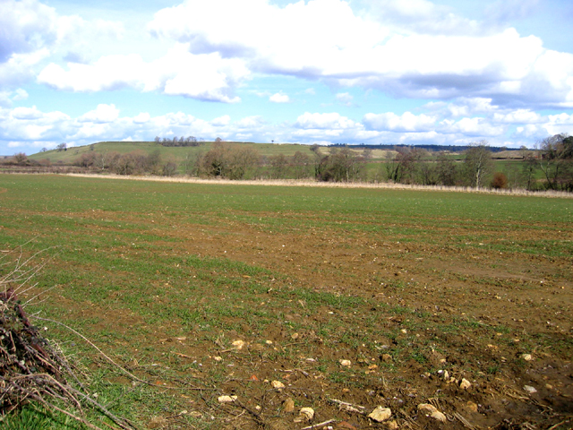
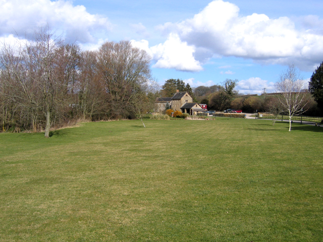
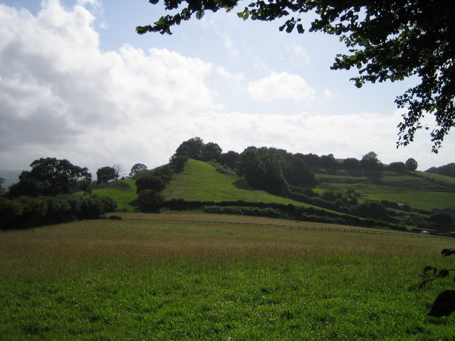
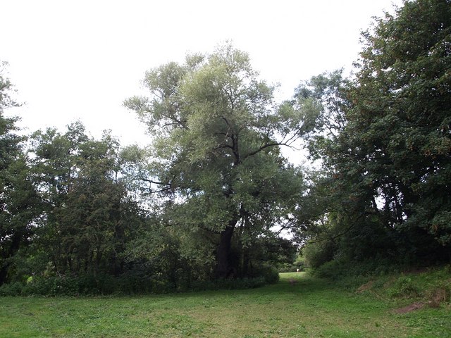
West Chinnock Hill is a prominent natural feature located in Somerset, England. It is classified as a hill and is situated near the villages of West Chinnock and Middle Chinnock. Rising to an elevation of approximately 200 meters (656 feet), it offers stunning panoramic views of the surrounding countryside.

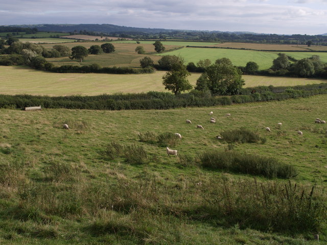
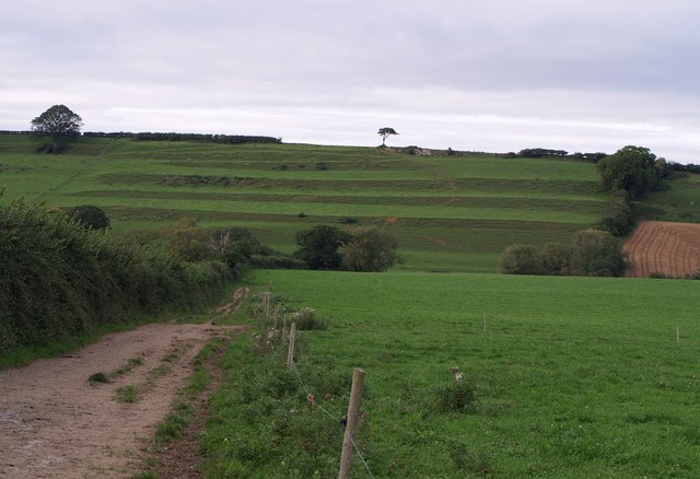
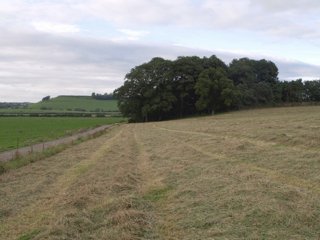
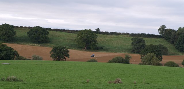
The hill is characterized by its gentle slopes and rolling landscape, making it a popular destination for hikers, nature enthusiasts, and those seeking outdoor recreational activities. Its location within the beautiful Somerset countryside provides visitors with a tranquil and picturesque setting.

West Chinnock Hill is known for its diverse flora and fauna, with a variety of plant and animal species thriving in its ecosystem. The hill is covered in lush greenery, including grasses, wildflowers, and shrubs, creating a vibrant and colorful landscape.

In addition to its natural beauty, West Chinnock Hill is also of historical significance. It has been inhabited by humans for centuries, and traces of ancient settlements have been discovered in the area. The hill has witnessed the passage of time, with evidence of human activity dating back to prehistoric times.

For those interested in exploring West Chinnock Hill, there are several walking trails and footpaths that wind their way through its slopes, offering visitors the opportunity to immerse themselves in its natural splendor. Whether it is for a leisurely stroll or a more challenging hike, West Chinnock Hill provides a captivating and enriching experience for all who visit.

If you have any feedback on the listing, please let us know in the comments section below.

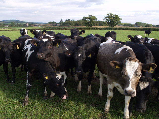
West Chinnock Hill Images

Images are sourced within 2km of 50.911878/-2.7676995 or Grid Reference ST4612. Thanks to Geograph Open Source API. All images are credited.

Merriott All Saints Church
Merriott
All Saints Church
Balham Hill Balham Hill across the river Parrett at Byme Bridge.
Balham Hill
Balham Hill across the river Parrett at Byme Bridge.
St. Margaret, Middle Chinnock
Post Office, Merriott, Somerset located at 1 Knapp, the crossroads which links Broadway (left) and Lower Street in the south of the village and square.
Post Office, Merriott, Somerset
located at 1 Knapp, the crossroads which links Broadway (left) and Lower Street in the south of the village and square.
View down the Parrett valley, Merriott, Somerset – looking NNE from the Marriott-Haselbury road.
View down the Parrett valley, Merriott, Somerset
– looking NNE from the Marriott-Haselbury road.
Haselbury Mill, Haselbury Plucknett, Somerset – view N of a 17th century mill beside the River Parrett, now a restaurant and registered for marriages.
Haselbury Mill, Haselbury Plucknett, Somerset
– view N of a 17th century mill beside the River Parrett, now a restaurant and registered for marriages.
Looking towards Balham Hill
St Mary's Church - West Chinnock
West Chinnock
West Chinnock
Brympton Hill Brympton Hill as seen from Smoky Hole Lane.
Brympton Hill
Brympton Hill as seen from Smoky Hole Lane.
View from Barrows Hill At the foot of the hill beyond the grazing sheep, the A30 runs between the hedges. It is about to cross Broad River, whose course is marked by the winding line of bushes and trees beyond. Seen from the lane which runs along the edge of Barrows Hill from a junction with the A30 to Middle Chinnock.
View from Barrows Hill
At the foot of the hill beyond the grazing sheep, the A30 runs between the hedges. It is about to cross Broad River, whose course is marked by the winding line of bushes and trees beyond. Seen from the lane which runs along the edge of Barrows Hill from a junction with the A30 to Middle Chinnock.
Strip Lynchets Strip Lynchets on the steep south-facing oolite slope of West Chinnock Hill. Seen from footpath Y11/8, here followed by both the Monarch's Way and the Liberty Trail.
Strip Lynchets
Strip Lynchets on the steep south-facing oolite slope of West Chinnock Hill. Seen from footpath Y11/8, here followed by both the Monarch's Way and the Liberty Trail.
Rushy Wood A fairly recent farm road crosses the foot of the slope to the edge of the wood, beyond which West Chinnock Hill can be seen. Taken from footpath Y11/6, here followed by Monarch's Way.
Rushy Wood
A fairly recent farm road crosses the foot of the slope to the edge of the wood, beyond which West Chinnock Hill can be seen. Taken from footpath Y11/6, here followed by Monarch's Way.
Field and trees by River Parrett Footpath Y11/1 passes through the gap at the end of the hedge. The Parrett is a few yards to the left, and Easthams Bridge, where it is crossed by the A30, some 20 metres behind the camera. That's a very small pony in the next field.
Field and trees by River Parrett
Footpath Y11/1 passes through the gap at the end of the hedge. The Parrett is a few yards to the left, and Easthams Bridge, where it is crossed by the A30, some 20 metres behind the camera. That's a very small pony in the next field.
Churns at Rushy Wood Farm The farm has expanded its buildings considerably in recent years, and seems to have gone in for some art as well; this interesting sculpture in the middle of a pond is beside footpath Y11/6, which has been slightly diverted to avoid the buildings.
Churns at Rushy Wood Farm
The farm has expanded its buildings considerably in recent years, and seems to have gone in for some art as well; this interesting sculpture in the middle of a pond is beside footpath Y11/6, which has been slightly diverted to avoid the buildings.
Tea at Rushy Wood Farm Part of the herd at the farm tucking in. The large barn is recent. Seen from  footpath Y11/6.
Tea at Rushy Wood Farm
Part of the herd at the farm tucking in. The large barn is recent. Seen from footpath Y11/6.
Farmland near West Chinnock A tractor works on a field on the slopes of West Chinnock Hill, just east of the lynchets seen in <a href="https://www.geograph.org.uk/photo/541853">ST4612 : Strip Lynchets</a>; doubtless they would have continued across this slope, but have been removed. Out of sight in the dip, following the line of trees, is Broad River. Seen from footpath Y11/8, here followed by both the Monarch's Way and the Liberty Trail.
Farmland near West Chinnock
A tractor works on a field on the slopes of West Chinnock Hill, just east of the lynchets seen in ST4612 : Strip Lynchets; doubtless they would have continued across this slope, but have been removed. Out of sight in the dip, following the line of trees, is Broad River. Seen from footpath Y11/8, here followed by both the Monarch's Way and the Liberty Trail.
Excitable bullocks The Liberty Trail crosses the field which contains these frisky bullocks. I am taking the photo from the other side of an electric fence. The hedge in the background hides the A30, and in the distance is Haselbury Plucknett.
Excitable bullocks
The Liberty Trail crosses the field which contains these frisky bullocks. I am taking the photo from the other side of an electric fence. The hedge in the background hides the A30, and in the distance is Haselbury Plucknett.
Show me another place!

West Chinnock Hill is located at Grid Ref: ST4612 (Lat: 50.911878, Lng: -2.7676995)

Administrative County: Somerset

District: South Somerset

Police Authority: Avon and Somerset

What 3 Words

///pegged.speeded.artist. Near Merriott, Somerset

Related Wikis

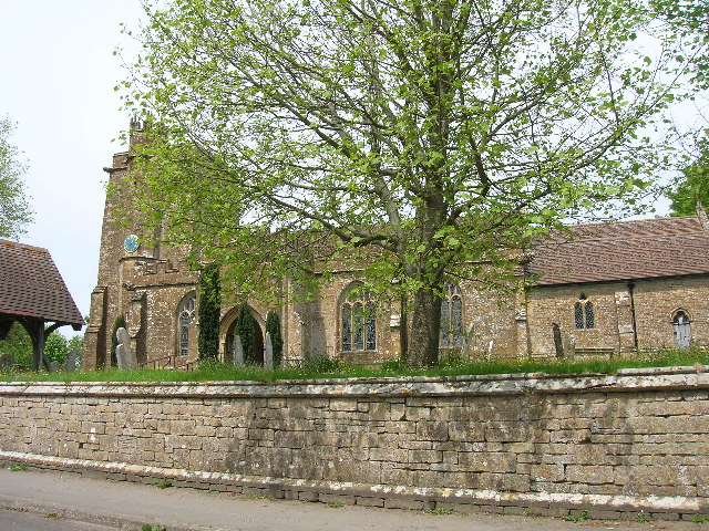
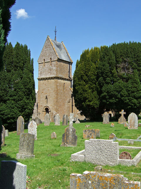
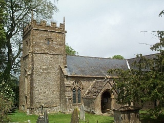
Church of the Blessed Virgin Mary, West Chinnock

The Church of the Blessed Virgin Mary is a Church of England church in West Chinnock, Somerset, England. It has 13th-century origins but was largely rebuilt...
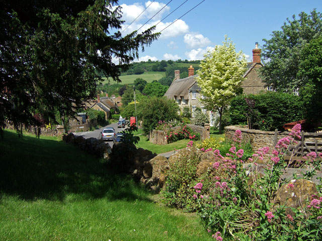
West Chinnock

West Chinnock is a village and former civil parish, now in the parish of West and Middle Chinnock, in the Somerset district, in the ceremonial county of...

Church of St Margaret, Middle Chinnock

The Anglican Church of St Margaret in Middle Chinnock, Somerset, England was built in the 12th century. It is a Grade II* listed building. == History... ==

Middle Chinnock

Middle Chinnock is a village in the civil parish of West and Middle Chinnock, in Somerset, England, 3 miles (4.8 km) north east of Crewkerne. It lies 0...
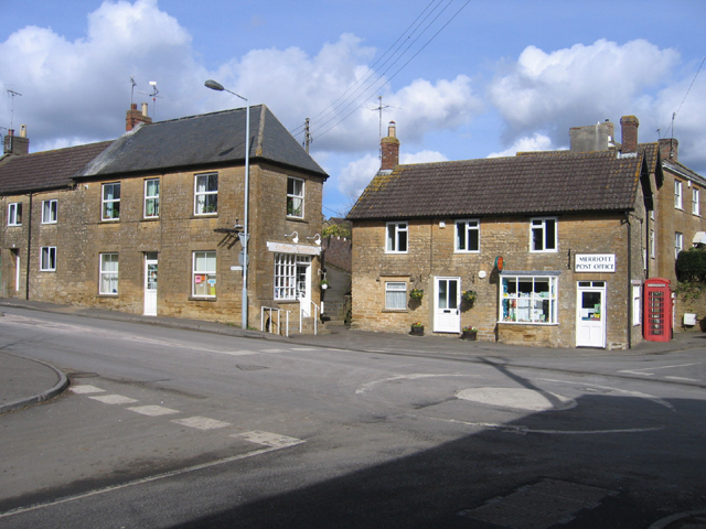
Merriott

Merriott is a village and civil parish in Somerset, England, near the town of Crewkerne and 7 miles (11.3 km) west of Yeovil in the South Somerset district...

Haselbury Bridge

Haselbury Bridge (sometimes called Haselbury Old Bridge) is a stone built bridge dating from the 14th century in Haselbury Plucknett in the English county...

Church of All Saints, Merriott

The Anglican Church of All Saints in Merriott, Somerset, England was built in the 13th century. It is a Grade II* listed building. == History == The church...

Church of St Michael and All Angels, Haselbury Plucknett

The Anglican Church of St Michael and All Angels in Haselbury Plucknett, Somerset, England was built in the 14th century. It is a Grade II* listed building...

Have you been to West Chinnock Hill?

Leave your review of West Chinnock Hill below (or comments, questions and feedback).