Cransmill Hill

Hill, Mountain in Aberdeenshire

Scotland

Cransmill Hill

Wormy Hillock A mound by the henge of the same name covered by heather it has the apperarnce of having been at least enhanced in the past.Legend has it as the grave of a "Wurm" or wingless dragon.
Wormy Hillock Credit: Andrew Wood

Cransmill Hill is a prominent hill located in Aberdeenshire, Scotland. The hill is part of the Grampian Mountains, which stretch across the northeastern part of the country. Cransmill Hill is known for its picturesque landscape and stunning views, making it a popular destination for hikers and nature enthusiasts.

Standing at an elevation of approximately 500 meters (1,640 feet), Cransmill Hill offers panoramic vistas of the surrounding countryside. The hill is characterized by its gentle slopes and grassy terrain, making it relatively accessible for hikers of varying skill levels. The summit provides breathtaking views of the nearby mountains and valleys, including the sweeping landscapes of Aberdeenshire.

The surrounding area of Cransmill Hill is rich in biodiversity, with a variety of flora and fauna. The hill is covered in heather and grasses, creating a vibrant and colorful landscape during the summer months. Wildlife such as red deer, mountain hares, and various bird species can also be spotted in the area.

Access to Cransmill Hill is relatively straightforward, with several well-marked trails leading to the summit. The hill is located near the village of Lumphanan, and parking facilities are available for visitors. Hiking to the top of Cransmill Hill offers a rewarding experience, allowing visitors to immerse themselves in the natural beauty of Aberdeenshire and enjoy the peace and tranquility of the Scottish countryside.

If you have any feedback on the listing, please let us know in the comments section below.

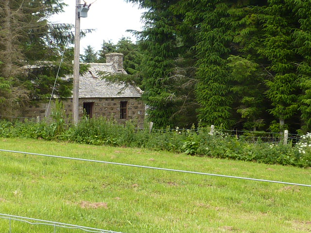
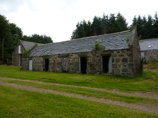
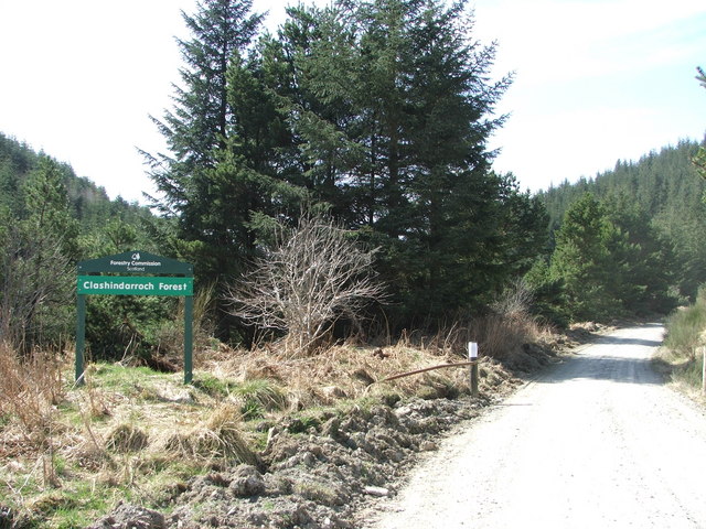
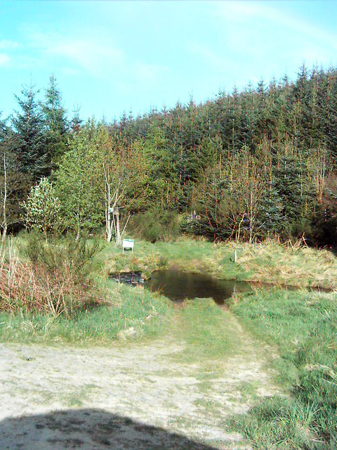
Cransmill Hill Images

Images are sourced within 2km of 57.371202/-2.8976854 or Grid Reference NJ4631. Thanks to Geograph Open Source API. All images are credited.

Wormy Hillock A mound by the henge of the same name covered by heather it has the apperarnce of having been at least enhanced in the past.Legend has it as the grave of a "Wurm" or wingless dragon.
Wormy Hillock
A mound by the henge of the same name covered by heather it has the apperarnce of having been at least enhanced in the past.Legend has it as the grave of a "Wurm" or wingless dragon.
Wormy Hillock Henge A henge in the Clashindarroch Forest.The henge itself is 13.5m in diameter, with the oval inside the ditch approximately 6m in diameter.
Wormy Hillock Henge
A henge in the Clashindarroch Forest.The henge itself is 13.5m in diameter, with the oval inside the ditch approximately 6m in diameter.
Howe by Finglenny The Howe of Slug by Finglenny in the Clashendarroch. Through it flows the Ealaiche Burn on its way to the Kirkney Water.
Howe by Finglenny
The Howe of Slug by Finglenny in the Clashendarroch. Through it flows the Ealaiche Burn on its way to the Kirkney Water.
View towards Old Merdrum from Tap o' Noth Some of the fields in this photograph have now become forested especially to the south west of Old Merdrum.
View towards Old Merdrum from Tap o' Noth
Some of the fields in this photograph have now become forested especially to the south west of Old Merdrum.
Old Merdrum farmhouse From a path which now by-passes the farm. The house and other buildings are now being renovated.
Old Merdrum farmhouse
From a path which now by-passes the farm. The house and other buildings are now being renovated.
Old Merdrum farm buildings Under renovation
Old Merdrum farm buildings
Under renovation
Old Merdrum - unused farm buildings
The top of the Hill of Oldmerdrum The hilltop is hidden in forestry
The top of the Hill of Oldmerdrum
The hilltop is hidden in forestry
Pile of large rocks near top of Hill of Merdrum They look as though they have been there for a long time
Pile of large rocks near top of Hill of Merdrum
They look as though they have been there for a long time
South-west slopes of Hill of Merdrum This area is within a deer fence, and is recently planted with young rowan and birch, presumably intended to give some cover to deer. There is another area near this also planted so. Amidst the huge area of the Clashindarroch Forest, I wonder if it shows the long-term increasing commercial value of deer against that of forestry.
South-west slopes of Hill of Merdrum
This area is within a deer fence, and is recently planted with young rowan and birch, presumably intended to give some cover to deer. There is another area near this also planted so. Amidst the huge area of the Clashindarroch Forest, I wonder if it shows the long-term increasing commercial value of deer against that of forestry.
Small pile of rocks near top of Hill of Merdrum
Clashindarroch Forest Forestry access road to Clashindarroch Forest, home of stage 2 of the Granite City Rally this year (2006), a round of the Scottish Rally Championship.
Clashindarroch Forest
Forestry access road to Clashindarroch Forest, home of stage 2 of the Granite City Rally this year (2006), a round of the Scottish Rally Championship.
Ford A Ford just past Mytice.
Ford
A Ford just past Mytice.
Rally car in Clashindarroch Forest A rally car competing on the Speyside Stages rally in Clashindarroch Forest. Visible is the bridge over the stream and the track leads off to Finglenny Farm. There is no apparent evidence of the historic 'henge'
Rally car in Clashindarroch Forest
A rally car competing on the Speyside Stages rally in Clashindarroch Forest. Visible is the bridge over the stream and the track leads off to Finglenny Farm. There is no apparent evidence of the historic 'henge'
Road to Finglenny Taken from moving car
Road to Finglenny
Taken from moving car
Buildings at Finglenny The buildings at Finglenny, with a house on the left & old farm buildings on the left. The track continues through the forest and eventually meets the Rhynie to Dufftown road in the Cabrach area.
Buildings at Finglenny
The buildings at Finglenny, with a house on the left & old farm buildings on the left. The track continues through the forest and eventually meets the Rhynie to Dufftown road in the Cabrach area.
Meanders on the Ealaiche Burn
Successional forestry plantation Three generations in one shot.
Successional forestry plantation
Three generations in one shot.
Show me another place!

Cransmill Hill is located at Grid Ref: NJ4631 (Lat: 57.371202, Lng: -2.8976854)

Unitary Authority: Aberdeenshire

Police Authority: North East

What 3 Words

///slipping.refills.bulldozer. Near Huntly, Aberdeenshire

Nearby Locations

Cransmill Hill Quarry Hill

Related Wikis

Wormy Hillock Henge

Wormy Hillock Henge, also known as The Dragon's Grave, is a small henge in Aberdeenshire, Scotland. It is a Scheduled Ancient Monument located in the Clashindarroch...

Tap o' Noth

The Tap o' Noth is a hill and the name of a Pictish hill fort on its summit,8 miles south of Huntly in Aberdeenshire, Scotland at grid reference NJ485293...

Lesmoir Castle

Lesmoir Castle was a 16th-century castle, about 2.0 miles (3.2 km) west of Rhynie, Aberdeenshire, Scotland, south-west of Tap o' Noth, at Mains of Lesmoir...

Rhynie chert

The Rhynie chert is a Lower Devonian sedimentary deposit exhibiting extraordinary fossil detail or completeness (a Lagerstätte). It is exposed near the...

Have you been to Cransmill Hill?

Leave your review of Cransmill Hill below (or comments, questions and feedback).