Arthur's Pike

Hill, Mountain in Westmorland Eden

England

Arthur's Pike

Old Boundary Marker on The Dodd Parish Boundary Marker on The Dodd, 1820 metres north of Loadpot Hill. On the boundary of Barton and Askham parishes.

Milestone Society National ID: WE_BART12pb
Old Boundary Marker on The Dodd Credit: Colin Smith

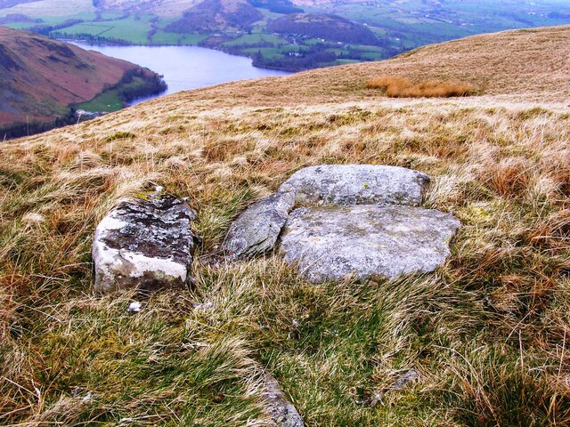
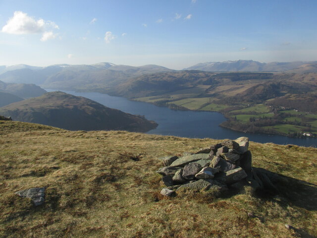
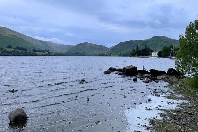
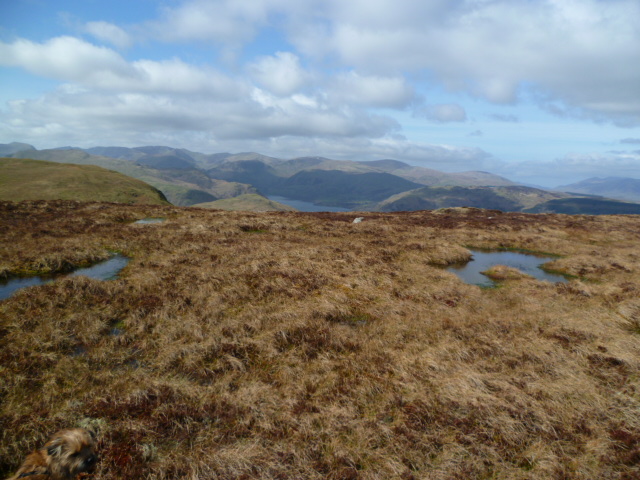
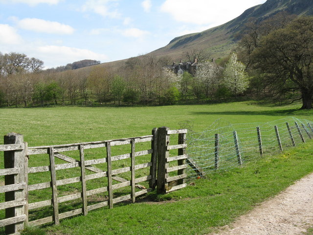
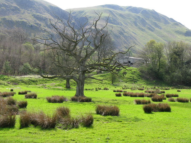
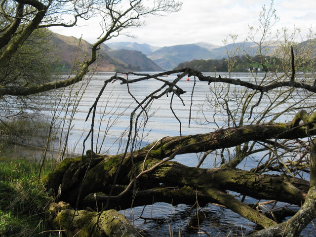
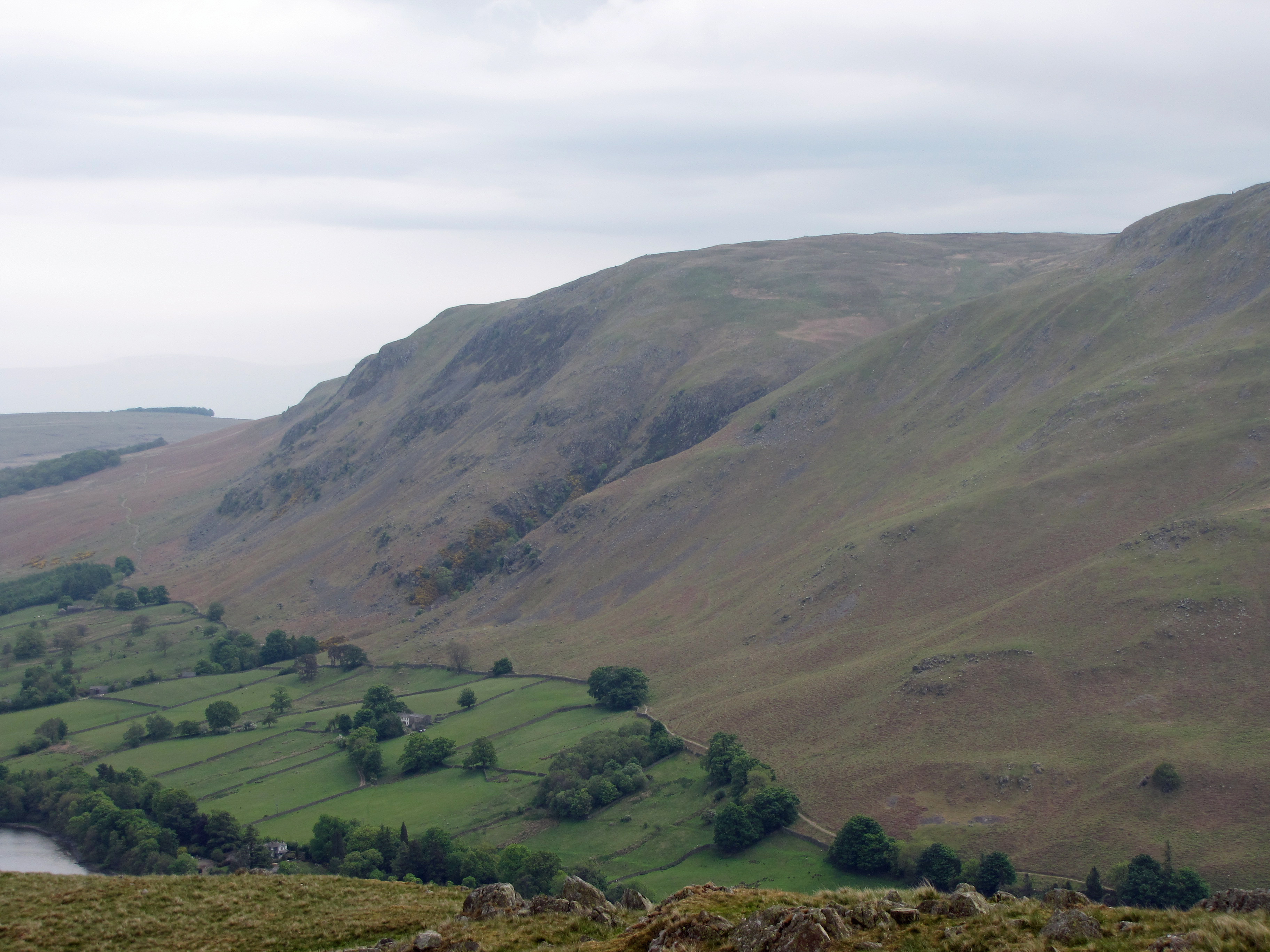
Arthur's Pike is a prominent hill located in the county of Westmorland, in the northwestern region of England. Situated within the Lake District National Park, it forms part of a larger range known as the Eastern Fells. Standing at an elevation of 533 meters (1,749 feet), Arthur's Pike offers breathtaking panoramic views of the surrounding countryside and the nearby Ullswater Lake.

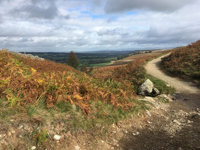
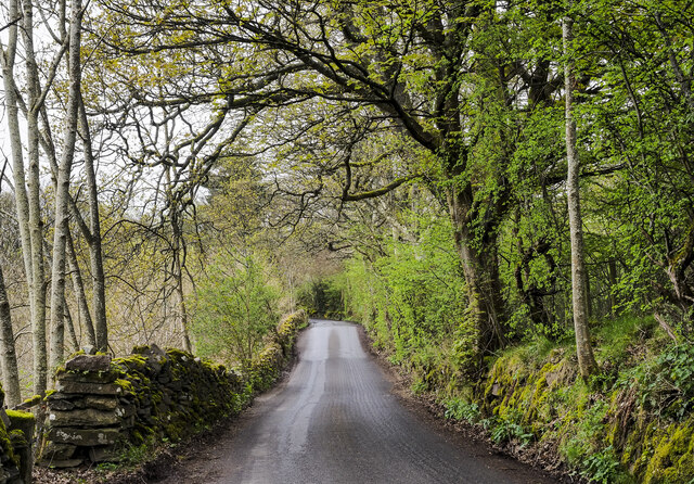
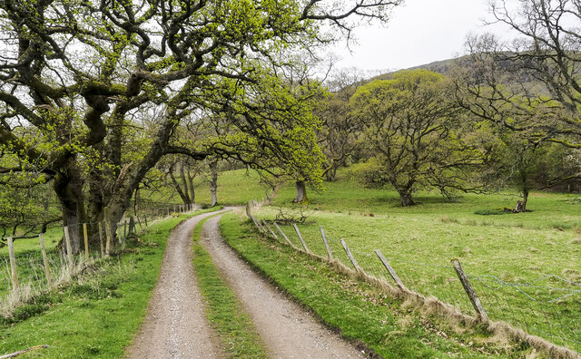
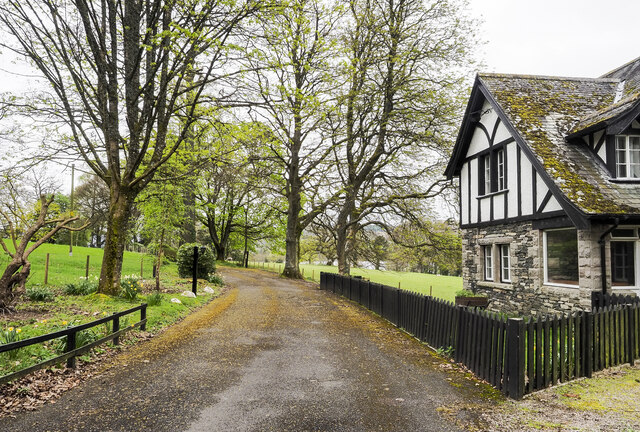
The hill is named after the legendary King Arthur, with local folklore suggesting that he once used its summit as a vantage point during battles. The name "Pike" refers to its pointed shape. Arthur's Pike is easily accessible, with well-maintained footpaths leading to the summit from the nearby village of Pooley Bridge.

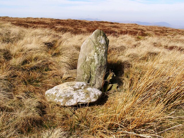
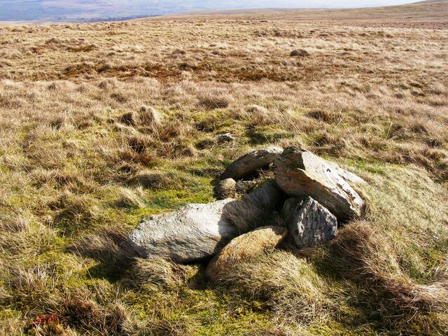
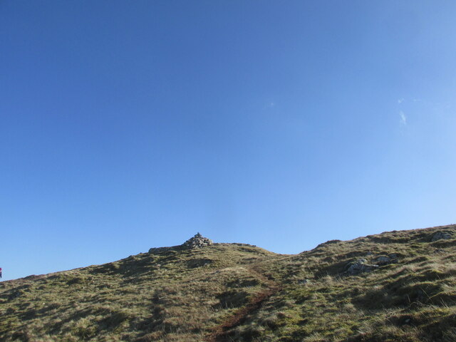
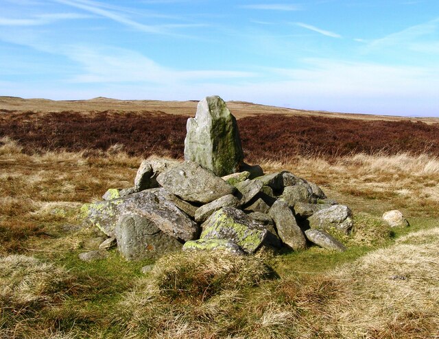
The summit of Arthur's Pike is marked by a cairn, a man-made pile of stones, which adds to the hill's charm and offers a picturesque spot for visitors to rest and take in the scenery. On clear days, it is possible to see the majestic Helvellyn range to the west and the Pennines to the east.

Nature enthusiasts are drawn to Arthur's Pike for its diverse flora and fauna. The hill is home to a variety of bird species, including curlews, skylarks, and red grouse, making it a popular spot for birdwatching. Wildflowers, such as heather and bilberry, adorn the slopes during the summer months, adding vibrant colors to the landscape.

Overall, Arthur's Pike is a captivating hill in Westmorland, offering visitors the opportunity to immerse themselves in the natural beauty of the Lake District while enjoying panoramic views and exploring its rich history.

If you have any feedback on the listing, please let us know in the comments section below.

Arthur's Pike Images

Images are sourced within 2km of 54.578068/-2.8358686 or Grid Reference NY4620. Thanks to Geograph Open Source API. All images are credited.

Old Boundary Marker on The Dodd Parish Boundary Marker on The Dodd, 1820 metres north of Loadpot Hill. On the boundary of Barton and Askham parishes.

Milestone Society National ID: WE_BART12pb
Old Boundary Marker on The Dodd
Parish Boundary Marker on The Dodd, 1820 metres north of Loadpot Hill. On the boundary of Barton and Askham parishes. Milestone Society National ID: WE_BART12pb
Old Boundary Marker on Lord's Seat Parish Boundary Marker on Lord's Seat, 1270 metres north of Loadpot Hill. On the boundary of Barton and Askham parishes.

Milestone Society National ID: WE_BART13pb
Old Boundary Marker on Lord's Seat
Parish Boundary Marker on Lord's Seat, 1270 metres north of Loadpot Hill. On the boundary of Barton and Askham parishes. Milestone Society National ID: WE_BART13pb
Old Boundary Marker on Brock Crag Parish Boundary Marker on Brock Crag, 910 metres northwest of Loadpot Hill. On the boundary of Martindale and Barton parishes.

Milestone Society National ID: WE_MART02pb
Old Boundary Marker on Brock Crag
Parish Boundary Marker on Brock Crag, 910 metres northwest of Loadpot Hill. On the boundary of Martindale and Barton parishes. Milestone Society National ID: WE_MART02pb
Path crossing Aik Beck
Small cairn on the summit of Arthur's Pike
Summit cairn on Bonscale Pike Good views over Ullswater.
Summit cairn on Bonscale Pike
Good views over Ullswater.
Oldchurch bay on Ullswater
Shepherds shelter by Ullswater
Minor road on eastern side of Ullswater The road heading north close to the farm at Bonscale, below the hill, Bonscale Pike.
Minor road on eastern side of Ullswater
The road heading north close to the farm at Bonscale, below the hill, Bonscale Pike.
Access road for Sharrow Cottages The road leaves the minor public road on the east side of Ullswater south of Sharrow Bay. It's also the route of a public footpath.
Access road for Sharrow Cottages
The road leaves the minor public road on the east side of Ullswater south of Sharrow Bay. It's also the route of a public footpath.
Access road for Sharrow Bay Hotel The Sharrow Bay Hotel closed in March 2020 blaming the Covid-19 pandemic for its inability to continue trading. On the day the image was recorded the access road remained barred and notices were in place forbidding entry to the site.
Access road for Sharrow Bay Hotel
The Sharrow Bay Hotel closed in March 2020 blaming the Covid-19 pandemic for its inability to continue trading. On the day the image was recorded the access road remained barred and notices were in place forbidding entry to the site.
Old Boundary Marker at Wartches Parish Boundary Marker at Wartches, 2820 metres southwest of Ketley Gate. On the boundary of Barton and Askham parishes. See also <a title="https://www.geograph.org.uk/photo/1563511" href="https://www.geograph.org.uk/photo/1563511">Link</a> and <a title="https://www.geograph.org.uk/photo/3275338" href="https://www.geograph.org.uk/photo/3275338">Link</a>.

Milestone Society National ID: WE_BART08pb
Old Boundary Marker at Wartches
Parish Boundary Marker at Wartches, 2820 metres southwest of Ketley Gate. On the boundary of Barton and Askham parishes. See also Link and Link. Milestone Society National ID: WE_BART08pb
Old Boundary Marker on Brown Rigg Parish Boundary Marker on Brown Rigg, 1970 metres southwest of Ketley Gate. On the boundary of Barton and Askham parishes. See also <a title="https://www.geograph.org.uk/photo/2852174" href="https://www.geograph.org.uk/photo/2852174">Link</a>.

Milestone Society National ID: WE_BART11pb
Old Boundary Marker on Brown Rigg
Parish Boundary Marker on Brown Rigg, 1970 metres southwest of Ketley Gate. On the boundary of Barton and Askham parishes. See also Link. Milestone Society National ID: WE_BART11pb
Old Boundary Marker near Swarthbeck Cottage Township Boundary Marker surrounded by a drystone wall on the west side of the road at Swarthbeck Cottage. On the boundary of Martindale and Barton townships in Barton parish. Martindale became a separate parish in 1866. Grade II Listed details <span class="nowrap"><a title="https://historicengland.org.uk/listing/the-list/list-entry/1145264" rel="nofollow ugc noopener" href="https://historicengland.org.uk/listing/the-list/list-entry/1145264">Link</a><img style="margin-left:2px;" alt="External link" title="External link - shift click to open in new window" src="https://s1.geograph.org.uk/img/external.png" width="10" height="10"/></span>. See also <span class="nowrap"><a title="http://www.geog.port.ac.uk/webmap/thelakes/photos/blo79.jpg" rel="nofollow ugc noopener" href="http://www.geog.port.ac.uk/webmap/thelakes/photos/blo79.jpg">Link</a><img style="margin-left:2px;" alt="External link" title="External link - shift click to open in new window" src="https://s1.geograph.org.uk/img/external.png" width="10" height="10"/></span>.

Milestone Society National ID: WE_MARBAR01pb
Old Boundary Marker near Swarthbeck Cottage
Township Boundary Marker surrounded by a drystone wall on the west side of the road at Swarthbeck Cottage. On the boundary of Martindale and Barton townships in Barton parish. Martindale became a separate parish in 1866. Grade II Listed details LinkExternal link. See also LinkExternal link. Milestone Society National ID: WE_MARBAR01pb
Leaving Arthur's Pike On the ridge heading for Bonscale Pike. Ullswater in shot.
Leaving Arthur's Pike
On the ridge heading for Bonscale Pike. Ullswater in shot.
Sharrow Bay Cottages By the side of Ullswater on the road to Martindale, under Barton Fell
Sharrow Bay Cottages
By the side of Ullswater on the road to Martindale, under Barton Fell
Farmland near Sharrow Bay Looking south towards Swarthbeck and the fells of Martindale Common.
Farmland near Sharrow Bay
Looking south towards Swarthbeck and the fells of Martindale Common.
Ullswater, from Sharrow Bay
Show me another place!

Arthur's Pike is located at Grid Ref: NY4620 (Lat: 54.578068, Lng: -2.8358686)

Administrative County: Cumbria

District: Eden

Police Authority: Cumbria

What 3 Words

///worldwide.sedative.crumples. Near Penrith, Cumbria

Nearby Locations

Arthur's Pike

Related Wikis

Arthur's Pike

Arthur's Pike is a fell in the English Lake District, near Ullswater. It is a subsidiary top on the ridge falling north from Loadpot Hill in the Far Eastern...

Bonscale Pike

Bonscale Pike is a fell in the English Lake District, standing above Howtown on Ullswater. It is the northern end of a spur running north north west from...

Sharrow Bay Country House

Sharrow Bay Country House was a hotel and restaurant located on the eastern shore of Ullswater near Pooley Bridge, Cumbria, England. The hotel is associated...

Howtown

Howtown is a hamlet in Cumbria, England, situated at a small harbour on the east shore of Ullswater in the Lake District. It lies within the civil parish...

Howtown Hotel

Howtown Hotel is a hotel in Howtown, Cumbria, England, located near the southern shore of the Ullswater lake. Although it won the César Award for Best...

Watermillock

Watermillock is a village and former civil parish, now in the parish of Matterdale, in the Westmorland and Furness district, in the ceremonial county of...

Ullswater

Ullswater is a glacial lake in Cumbria, England and part of the Lake District National Park. It is the second largest lake in the region by both area and...

Loadpot Hill

Loadpot Hill is a fell in the English Lake District, between Haweswater and Ullswater. == Topography == Although of moderate height, Loadpot Hill and its...

Nearby Amenities

Located within 500m of 54.578068,-2.8358686
Arthur's Pike
Ele: 532
Natural: peak
Wikidata: Q4797719
Wikipedia: en:Arthur's Pike
Lat/Long: 54.5784047/-2.835844
The data included in this document is from www.openstreetmap.org. The data is made available under ODbL.

Have you been to Arthur's Pike?

Leave your review of Arthur's Pike below (or comments, questions and feedback).