Frosty Hill
Hill, Mountain in Aberdeenshire
Scotland
Frosty Hill

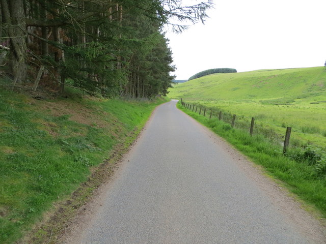
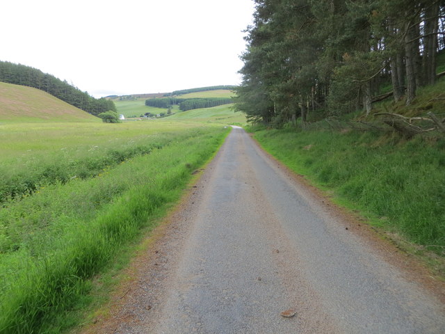
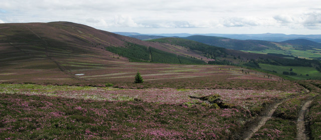
Frosty Hill is a prominent hill located in Aberdeenshire, Scotland. Rising to an impressive height of 1,500 feet (457 meters), it is considered one of the notable peaks in the region. The hill is nestled in a picturesque landscape, surrounded by lush greenery and offering breathtaking views of the surrounding countryside.
The name "Frosty Hill" is derived from the winter season when the summit is often covered in a glistening layer of frost, creating a magical and ethereal atmosphere. This natural phenomenon adds to the charm and allure of the hill, attracting outdoor enthusiasts and nature lovers throughout the year.
The hill is a popular destination for hikers and climbers, offering a range of routes suitable for all skill levels. The ascent to the summit is relatively moderate, with well-maintained paths and trails guiding visitors through the rugged terrain. Once at the top, hikers are rewarded with panoramic vistas of the rolling hills, winding rivers, and distant mountains.
Wildlife thrives in the area surrounding Frosty Hill, with various species of birds, mammals, and flora calling it home. The hill provides a habitat for rare and protected species, adding to its ecological significance.
Frosty Hill is not only a natural wonder but also a site of historical importance. The area is steeped in folklore and tales of ancient settlements, and archaeological remains have been discovered in the vicinity, further enhancing its cultural significance.
With its stunning natural beauty, recreational opportunities, and historical significance, Frosty Hill attracts a diverse range of visitors and remains a cherished landmark in Aberdeenshire.
If you have any feedback on the listing, please let us know in the comments section below.
Frosty Hill Images
Images are sourced within 2km of 57.185203/-2.8938469 or Grid Reference NJ4610. Thanks to Geograph Open Source API. All images are credited.


Frosty Hill is located at Grid Ref: NJ4610 (Lat: 57.185203, Lng: -2.8938469)
Unitary Authority: Aberdeenshire
Police Authority: North East
What 3 Words
///moth.attending.mourner. Near Alford, Aberdeenshire
Nearby Locations
Related Wikis

Towie Castle
Towie Castle was a 17th-century tower house, about 3.5 miles (5.6 km) southwest of Kildrummy in Aberdeenshire, Scotland, on the right bank of the Don....

Towie, Aberdeenshire
Towie is a small hamlet and civil parish in Aberdeenshire, Scotland, close to Alford and Lumsden, on the River Don.One of the most notable features of...
Migvie Castle
Migvie Castle was a 13th-century castle to the west of Migvie, Aberdeenshire, Scotland. Its remains were listed as a scheduled monument in 2007. ��2�...
Glenkindie Castle
Glenkindie Castle was a 16th-century castle, about 3 miles (4.8 km) south-west of Kildrummy, Aberdeenshire, Scotland, at Glenkindie, north of the River...
Kildrummy Castle
Kildrummy Castle is a ruined castle near Kildrummy, in Aberdeenshire, Scotland. Though ruined, it is one of the most extensive castles dating from the...
Scottish Sculpture Open
The Scottish Sculpture Open exhibition, sometimes known as the Kildrummy Open, was organised by the Scottish Sculpture Workshop from 1981 to 1997. The...
Cushnie Castle
Cushnie Castle was a 16th-century tower house, about 6 miles (9.7 km) south west of Alford, Aberdeenshire, Scotland, near Cushnie Burn, in the Glen of...

Tarland
Tarland (Gaelic: Turlann) is a village in Aberdeenshire, Scotland and is located 5 miles (8 km) northwest of Aboyne, and 30 miles (50 km) west of Aberdeen...
Have you been to Frosty Hill?
Leave your review of Frosty Hill below (or comments, questions and feedback).