Hartsgarth Fell

Hill, Mountain in Roxburghshire

Scotland

Hartsgarth Fell

Trig point, Roan Fell At the southern (not highest) end of the hills large rounded summit area.
Trig point, Roan Fell Credit: Callum Black

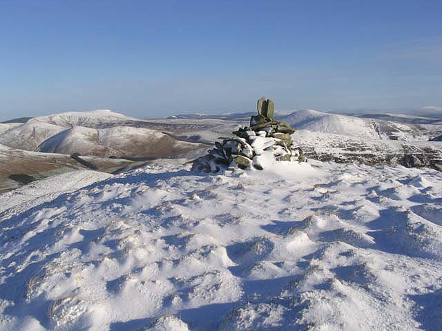
Hartsgarth Fell is a prominent hill located in Roxburghshire, a historic county in the southern region of Scotland. Rising to an elevation of approximately 1,200 feet, it is considered a significant landmark in the area. The fell is situated in the sprawling Scottish Borders region, known for its picturesque landscapes and rich history.

Covered in lush green vegetation, Hartsgarth Fell is characterized by its gently sloping sides and rounded summit. It offers breathtaking panoramic views of the surrounding countryside, including the rolling hills, valleys, and distant mountains. The hill is a popular destination for hikers, nature enthusiasts, and photographers, who are drawn to its natural beauty and tranquility.

The fell is home to a diverse range of flora and fauna, with heather, grasses, and various wildflowers dotting the landscape. It provides habitat for several bird species, including buzzards, kestrels, and peregrine falcons, making it a haven for birdwatchers. Additionally, the hill is occasionally visited by deer and other small mammals.

Access to Hartsgarth Fell is primarily through well-marked trails and footpaths, ensuring visitors can explore the area safely. The hill is located in close proximity to the village of Hawick, which offers amenities such as accommodation, dining, and parking facilities. Whether one is seeking a peaceful hike or simply wishes to immerse themselves in the stunning Scottish countryside, Hartsgarth Fell is a captivating destination that showcases the natural beauty of Roxburghshire.

If you have any feedback on the listing, please let us know in the comments section below.

Hartsgarth Fell Images

Images are sourced within 2km of 55.236689/-2.8640514 or Grid Reference NY4593. Thanks to Geograph Open Source API. All images are credited.

Trig point, Roan Fell At the southern (not highest) end of the hills large rounded summit area.
Trig point, Roan Fell
At the southern (not highest) end of the hills large rounded summit area.
Rough path, Millstone Edge A rough path cuts the corner towards Millstone Edge. The Landrover track is visible in the distance.
Rough path, Millstone Edge
A rough path cuts the corner towards Millstone Edge. The Landrover track is visible in the distance.
"Construction site" Keep out sign on the summit of Roan Fell. Work appears to be underway to stabilise the peat bogs.
"Construction site"
Keep out sign on the summit of Roan Fell. Work appears to be underway to stabilise the peat bogs.
Flooded track Flooded track, presumably as a result of the nearby attempts to stabilise and repair the peat bog.
Flooded track
Flooded track, presumably as a result of the nearby attempts to stabilise and repair the peat bog.
Roan Fell Climbed from road to north passed the pack of hounds at Twislehope and good track to Hartsgarth Fell but then it is a damp trudge to the summit.
Name: Roan Fell
Hill number: 1918
Height: 568m / 1864ft
Area: 28B: The River Tweed to the English Border
Class: Ma,5D
Grid ref: NY 45173 93110
Summit feature: cairn by fence
Drop: 256m
Col: 312m  NY437978
Roan Fell
Climbed from road to north passed the pack of hounds at Twislehope and good track to Hartsgarth Fell but then it is a damp trudge to the summit. Name: Roan Fell Hill number: 1918 Height: 568m / 1864ft Area: 28B: The River Tweed to the English Border Class: Ma,5D Grid ref: NY 45173 93110 Summit feature: cairn by fence Drop: 256m Col: 312m NY437978
Slope north of Haregrain Rig A view north-west from an estate road on Haregrain Rig has the deeply shadowed valley of Caulker Grain at the left side of the image with Ewe Hill rising above it to the right.
Slope north of Haregrain Rig
A view north-west from an estate road on Haregrain Rig has the deeply shadowed valley of Caulker Grain at the left side of the image with Ewe Hill rising above it to the right.
Fence extending north from Roan Fell Roan Fell is a moorland hill and a Marilyn. The distant hills are Cauldcleuch Head and Greatmoor Hill.
Fence extending north from Roan Fell
Roan Fell is a moorland hill and a Marilyn. The distant hills are Cauldcleuch Head and Greatmoor Hill.
Heather moorland with trig point of Roan Fell Although this triangulation column is known to the OS as Roan Fell it's some distance from the summit of that hill; there's even intervening higher ground at Millstone Edge between the two locations. The view beyond the pillar is generally to the north-west.
Heather moorland with trig point of Roan Fell
Although this triangulation column is known to the OS as Roan Fell it's some distance from the summit of that hill; there's even intervening higher ground at Millstone Edge between the two locations. The view beyond the pillar is generally to the north-west.
Summit of Roan Fell Sandstone hill with big bogs and many midges...
Summit of Roan Fell
Sandstone hill with big bogs and many midges...
Approaching the summit of Din Fell Fine January conditions on this high moorland hill.
Approaching the summit of Din Fell
Fine January conditions on this high moorland hill.
Winter Landscape Moorland at Haregrain Rig with Din Fell and Greatmoor Hill in the background.
Winter Landscape
Moorland at Haregrain Rig with Din Fell and Greatmoor Hill in the background.
A fence on Hartsgarth Fell Fine January weather on this high moorland hill.
A fence on Hartsgarth Fell
Fine January weather on this high moorland hill.
Grain Head On high moorland in lovely winter conditions looking over Grain Head towards Wetherhorn Hill and Cockplay Hill.
Grain Head
On high moorland in lovely winter conditions looking over Grain Head towards Wetherhorn Hill and Cockplay Hill.
The summit of Wetherhorn Hill A cairn marks the summit at 522m. Greatmoor Hill is on the far left and Din Fell is to the right of the cairn.
The summit of Wetherhorn Hill
A cairn marks the summit at 522m. Greatmoor Hill is on the far left and Din Fell is to the right of the cairn.
Caulker Grain Viewed from Cockplay Hill with Caulker Grain in shadow between Ewe Hill and Carlintooth Rig. The track from Twislehope to Hartsgarth Fell can be seen winding up to the right below Ewe Hill.
Caulker Grain
Viewed from Cockplay Hill with Caulker Grain in shadow between Ewe Hill and Carlintooth Rig. The track from Twislehope to Hartsgarth Fell can be seen winding up to the right below Ewe Hill.
Cockplay Hill Some stones mark the high point of the northwest ridge of Cockplay Hill. Din Fell is in the background centre right.
Cockplay Hill
Some stones mark the high point of the northwest ridge of Cockplay Hill. Din Fell is in the background centre right.
The grip of winter Icicles by the track on the way to Hartsgarth Fell.
The grip of winter
Icicles by the track on the way to Hartsgarth Fell.
The trig point at Millstone Edge At 560m with a flush bracket number S7990. The true summit of Millstone Edge is 450m to the northeast of the trig point at 561m.
The trig point at Millstone Edge
At 560m with a flush bracket number S7990. The true summit of Millstone Edge is 450m to the northeast of the trig point at 561m.
Show me another place!

Hartsgarth Fell is located at Grid Ref: NY4593 (Lat: 55.236689, Lng: -2.8640514)

Unitary Authority: The Scottish Borders

Police Authority: The Lothians and Scottish Borders

What 3 Words

///mincing.equipping.energy. Near Teviothead, Scottish Borders

Nearby Locations

Roan Fell Hartsgarth Fell

Related Wikis

Dinley

Dinley is a hamlet in the Scottish Borders through which Hermitage Water flows. == Etymology == The first element, din, seems to be the Cumbric word for...

Hermitage Castle

Hermitage Castle is a semi-ruined castle in the border region of Scotland. It is under the care of Historic Scotland. The castle has a reputation, both...

Hermitage, Scottish Borders

Hermitage is a village near Newcastleton, on the B6399, in the Scottish Borders area of Scotland. == See also == List of places in the Scottish Borders...

Hermitage Water

The Hermitage Water is a river in Liddesdale, in the Scottish Borders area of Scotland. Among its many feeder burns are Braidley Burn, Dinley Burn, Gorrenberry...

Nearby Amenities

Located within 500m of 55.236689,-2.8640514
Turning Circle
Lat/Long: 55.2360488/-2.8682855
Hartsgarth Fell
Ele: 551
Natural: peak
Lat/Long: 55.2364965/-2.8641857
The data included in this document is from www.openstreetmap.org. The data is made available under ODbL.

Have you been to Hartsgarth Fell?

Leave your review of Hartsgarth Fell below (or comments, questions and feedback).