Ibsley

Settlement in Hampshire New Forest

England

Ibsley

Ibsley Bridge, 1926, view North By comparing with a 2010 photo <a href="https://www.geograph.org.uk/photo/1803581">SU1409 : Ibsley Bridge</a> this is the West end of the bridge, looking upstream.
Ibsley Bridge, 1926, view North Credit: John A Hawgood

Ibsley is a small village located in the New Forest district of Hampshire, England. Situated near the Avon Valley, it lies approximately 10 miles west of the town of Ringwood and 20 miles east of the city of Bournemouth. The village is surrounded by picturesque countryside, with the New Forest National Park to the east and the River Avon to the west.

Historically, Ibsley has been inhabited since ancient times, with evidence of Iron Age settlements found in the area. The village is mentioned in the Domesday Book of 1086, indicating its long-standing presence. Today, Ibsley remains a quiet and charming rural community.

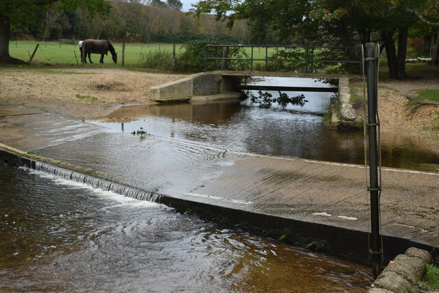
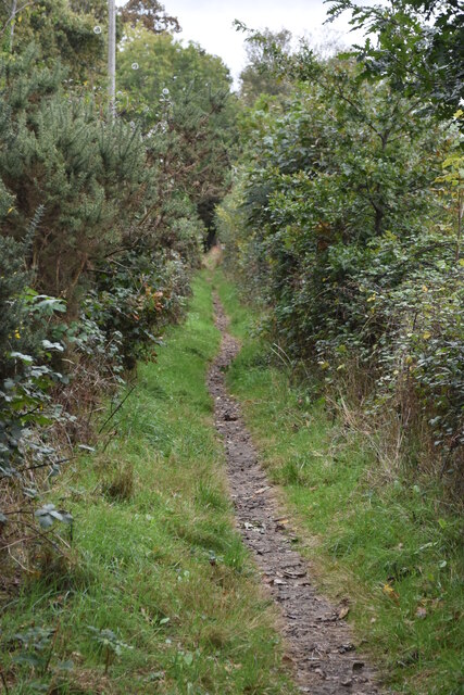
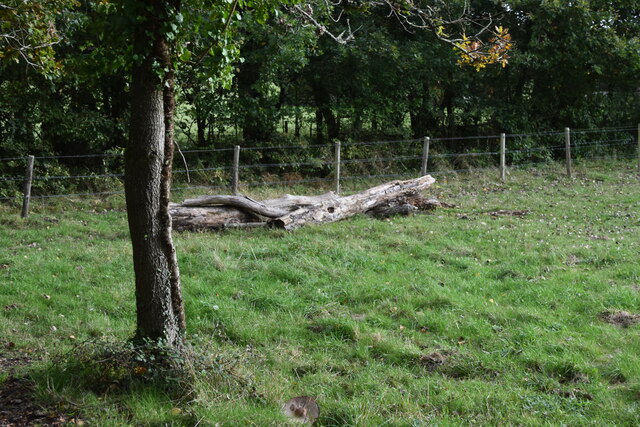
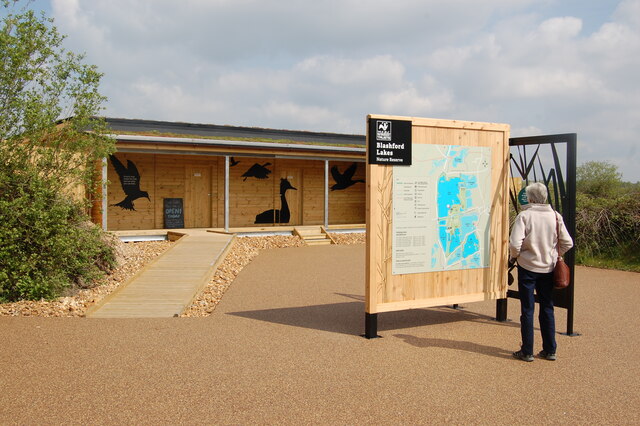
One of the notable features of Ibsley is its proximity to various natural attractions. Just south of the village lies Ibsley Common, a designated Site of Special Scientific Interest (SSSI) due to its heathland habitat and diverse wildlife, including rare species such as the sand lizard and the Dartford warbler. The nearby Blashford Lakes Nature Reserve offers additional opportunities for nature enthusiasts, with several lakes, meadows, and woodland areas.

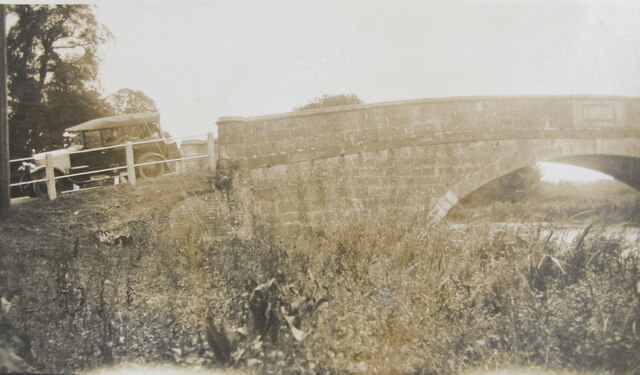
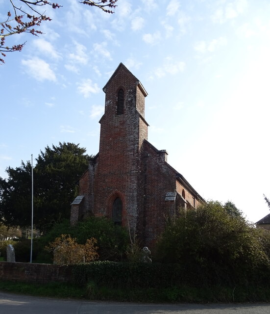
Although Ibsley may be small in size, it boasts a rich cultural heritage. The village is home to the historic Ibsley Bridge, a Grade II listed structure dating back to the 18th century. There is also a quaint village church, St. Martin's, which dates back to the 13th century and features beautiful stained glass windows.

Overall, Ibsley offers a peaceful and idyllic setting, perfect for those seeking a tranquil retreat in the heart of the Hampshire countryside.

If you have any feedback on the listing, please let us know in the comments section below.

Ibsley Images

Images are sourced within 2km of 50.884102/-1.786591 or Grid Reference SU1509. Thanks to Geograph Open Source API. All images are credited.

Ibsley Bridge, 1926, view North By comparing with a 2010 photo <a href="https://www.geograph.org.uk/photo/1803581">SU1409 : Ibsley Bridge</a> this is the West end of the bridge, looking upstream.
Ibsley Bridge, 1926, view North
By comparing with a 2010 photo SU1409 : Ibsley Bridge this is the West end of the bridge, looking upstream.
Car on Ibsley Bridge, 1926, view South The car was parked on the bridge at the Western end.
Car on Ibsley Bridge, 1926, view South
The car was parked on the bridge at the Western end.
Picnic by Ibsley Bridge, 1926 A group of students packing up after lunch. In 1926 a car could just stop and park on the grass verge within yards of the bridge, this is the view from the bridge looking West.
Picnic by Ibsley Bridge, 1926
A group of students packing up after lunch. In 1926 a car could just stop and park on the grass verge within yards of the bridge, this is the view from the bridge looking West.
Ford near Moyles Court
Minor road at Rockford
Dinghy sailing on Blashford Lake
Path beside Blashford Lake Despite being almost at the water’s edge, there are few clear views of the lake due to the overhanging vegetation.
Path beside Blashford Lake
Despite being almost at the water’s edge, there are few clear views of the lake due to the overhanging vegetation.
Lakeside path This path is beside the lake north of Blashford Lake, which is not named on the OS map.
Lakeside path
This path is beside the lake north of Blashford Lake, which is not named on the OS map.
Fallen tree trunk in corner of field at Rockford
Little hut near Ellingham Lake Blashford lakes Nature Reserve
Little hut near Ellingham Lake
Blashford lakes Nature Reserve
New hide at Blashford Lakes
Karma Cottage
Karma Cottage
Bus stop on Salisbury Road (A338)
Quarry entrance off Salisbury Road (A338)
Salisbury Road (A338)
Former St Martin's Church
Salisbury Road (A338)
Show me another place!

Ibsley is located at Grid Ref: SU1509 (Lat: 50.884102, Lng: -1.786591)

Administrative County: Hampshire

District: New Forest

Police Authority: Hampshire

What 3 Words

///classmate.makeovers.tonsils. Near Ringwood, Hampshire

Related Wikis

Ibsley

Ibsley is a village and former civil parish, now in the parish of Ellingham, Harbridge and Ibsley, in the New Forest district, in Hampshire, England. It...

Avon Valley (Bickton to Christchurch)

Avon Valley (Bickton to Christchurch) is a 1,403.8-hectare (3,469-acre) biological Site of Special Scientific Interest which stretches from Christchurch...

RAF Ibsley

Royal Air Force Ibsley or more simply RAF Ibsley is a former Royal Air Force station in Hampshire, England. The airfield is near the village of Ibsley...

Ibsley Circuit

Ibsley Circuit was a car racing circuit situated at RAF Ibsley, on the Fordingbridge to Ringwood Road in Hampshire, United Kingdom. Autosport states that...

Ringwood and Fordingbridge Rural District

Ringwood and Fordingbridge was a rural district in Hampshire from 1932 to 1974.It was formed by the merger of part of the disbanded Christchurch Rural...

Mockbeggar, Hampshire

Mockbeggar is a hamlet in the New Forest National Park of Hampshire, England. Its nearest town is Ringwood, which lies approximately 3 miles (5.6 km) south...

Harbridge

Harbridge is a small village and former civil parish, now in the parish of Ellingham, Harbridge and Ibsley, in the New Forest district, in the county of...

South Gorley

South Gorley is a hamlet in the New Forest National Park of Hampshire, England. It is in the civil parish of Ellingham, Harbridge and Ibsley. Its nearest...

Nearby Amenities

Located within 500m of 50.884102,-1.786591
Ibsley
Is In: Hampshire, England, UK
Place: village
Wikidata: Q5984889
Lat/Long: 50.8837514/-1.7880622
Bus Stop
Ibsley Church
Bench: no
Bin: no
Bus: yes
Lit: no
Naptan AtcoCode: 1900HA081023
Naptan Bearing: NE
Naptan CommonName: Ibsley Church
Naptan Crossing: Mockbeggar Lane
Naptan Landmark: St Martins Gallery
Naptan NaptanCode: hamadgdj
Naptan Street: A338 Salisbury Road
Naptan Verified: no
Public Transport: platform
Shelter: no
Source: naptan_import
Tactile Paving: no
Lat/Long: 50.8832286/-1.7902784
Bus Stop
Ibsley Church
Bench: yes
Bin: no
Bus: yes
Lit: no
Naptan AtcoCode: 1900HA081024
Naptan Bearing: SW
Naptan CommonName: Ibsley Church
Naptan Crossing: Mockbeggar Lane
Naptan Landmark: St Martins Gallery
Naptan NaptanCode: hamadgdw
Naptan Street: A338 Salisbury Road
Naptan Verified: no
Public Transport: platform
Shelter: yes
Source: naptan_import
Tactile Paving: no
Lat/Long: 50.8833538/-1.789894
Bus Stop
Ibsley Bridge
Bench: no
Bin: no
Bus: yes
Lit: no
Naptan AtcoCode: 1900HAA13564
Naptan Bearing: N
Naptan CommonName: Ibsley Bridge
Naptan Landmark: Opp Cottages
Naptan NaptanCode: hamadgpt
Naptan Street: A338 Salisbury Road
Naptan Verified: no
Public Transport: platform
Shelter: no
Source: naptan_import
Tactile Paving: no
Lat/Long: 50.8861417/-1.7879824
Ibsley Bridge
Naptan AtcoCode: 1900HAA13565
Naptan Bearing: S
Naptan BusStopType: CUS
Naptan CommonName: Ibsley Bridge
Naptan NaptanCode: hamadgta
Naptan Street: A338 Salisbury Road
Naptan Verified: no
Source: naptan_import
Lat/Long: 50.8861199/-1.7878771
Post Box
Brand: Post Office
Brand Wikidata: Q1783168
Collection Times: Mo-Fr 09:00; Sa 09:00
Operator: Post Office
Operator Wikidata: Q1783168
Post Box Type: wall
Postal Code: BH24
Ref: BH24 10
Royal Cypher: GVIR
Royal Cypher Wikidata: Q33102169
Lat/Long: 50.8846204/-1.788509
Bus Stop
Ibsley Bridge
Bench: no
Bin: no
Bus: yes
Lit: no
Public Transport: platform
Shelter: no
Tactile Paving: no
Lat/Long: 50.8863872/-1.7877513
Crossing
Crossing: unmarked
Crossing Island: no
Crossing Markings: no
Tactile Paving: no
Lat/Long: 50.8833148/-1.7900053
The data included in this document is from www.openstreetmap.org. The data is made available under ODbL.

Have you been to Ibsley?

Leave your review of Ibsley below (or comments, questions and feedback).