Hill of Menduff

Hill, Mountain in Banffshire

Scotland

Hill of Menduff

An Ominous Sight As we set off to retrace a favourite walk, we were confronted by what turned out to be the first of many obstructions in the shape of trees blown down across the track by Storm Arwen last November. I expect that Forest and Land Scotland will eventually get round to clearing little-used tracks like this one, but there must be many much more inconvenient blockages to deal with in the meantime.
An Ominous Sight Credit: Anne Burgess

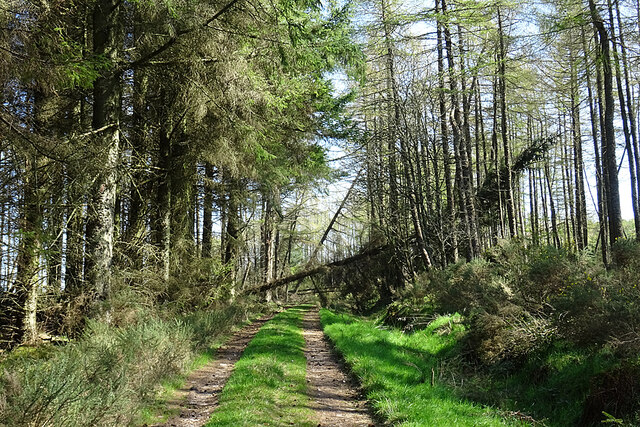
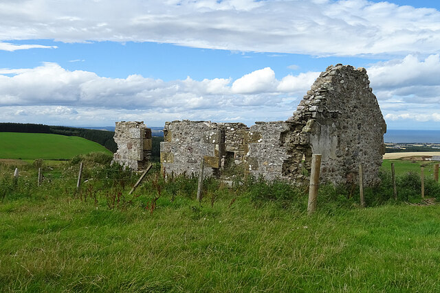
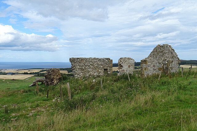
Hill of Menduff is a prominent geographical feature located in Banffshire, Scotland. Rising to an elevation of 265 meters (869 feet), it is classified as a hill rather than a mountain. Situated near the village of Cuminestown, Hill of Menduff is a popular destination for hikers, nature enthusiasts, and outdoor adventurers.

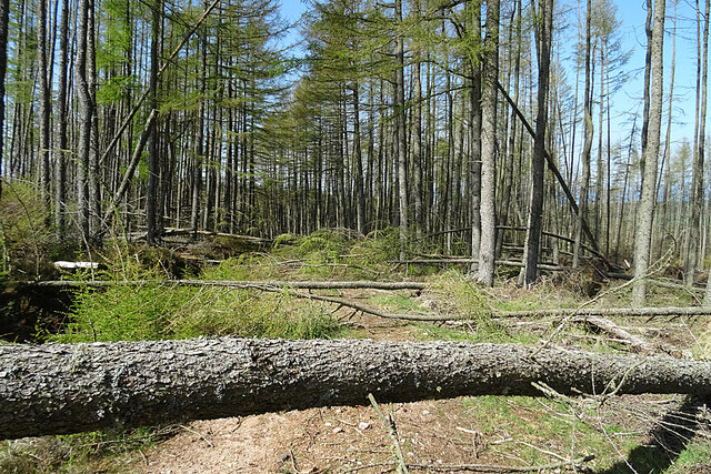
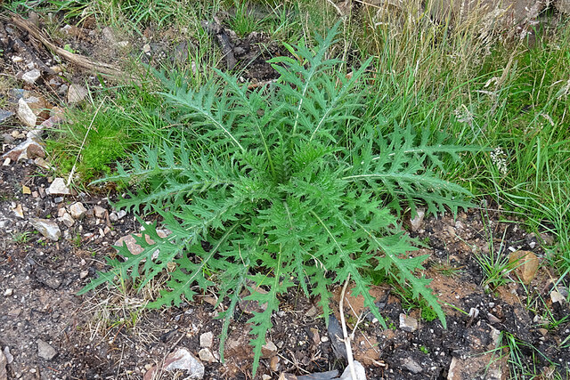
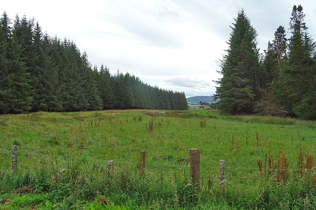
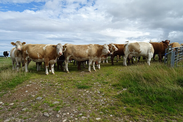
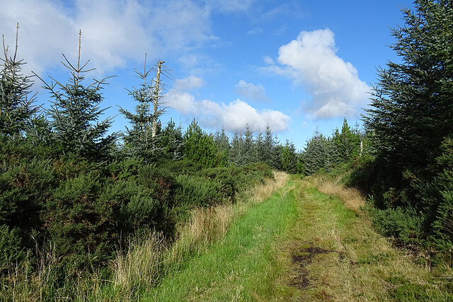
The hill offers breathtaking panoramic views of the surrounding countryside, with its slopes covered in lush green vegetation and dotted with a variety of plant and animal species. Heather, gorse, and wildflowers adorn the landscape, providing a colorful and picturesque setting. The diverse ecosystem supports a range of wildlife, including birds, rabbits, and deer, which can often be spotted during a visit.

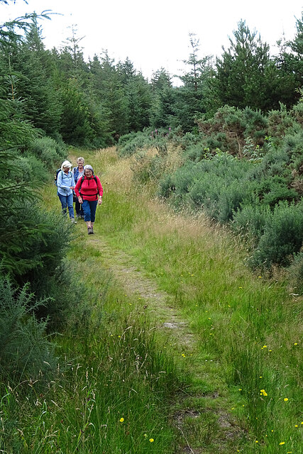
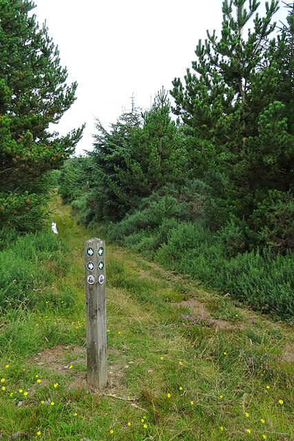
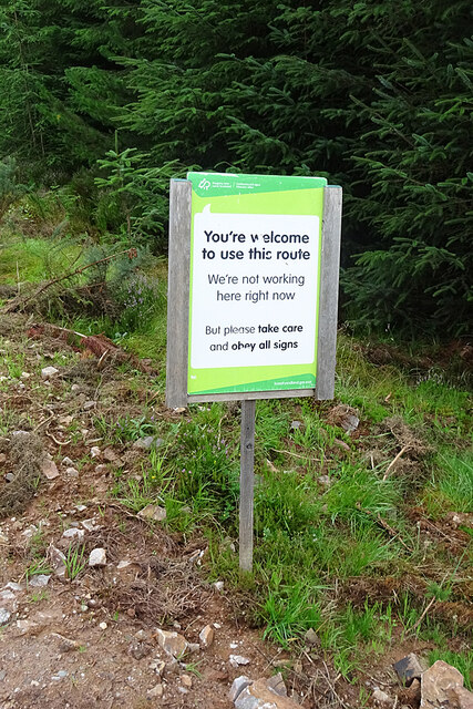
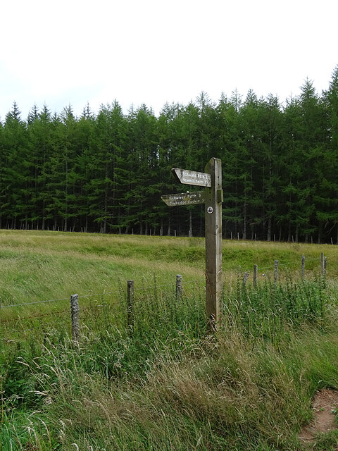
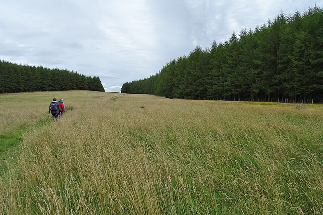
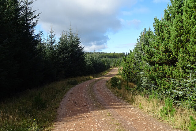
Hill of Menduff is accessible via a network of footpaths, making it an ideal destination for walkers of all abilities. The paths are well-maintained, ensuring a pleasant and safe experience for visitors. The summit of the hill provides a rewarding vantage point, showcasing the natural beauty of the area and offering a sense of tranquility and serenity.

In addition to its natural attractions, Hill of Menduff is also steeped in history. The area is known to have been inhabited since ancient times, with archaeological remains suggesting human activity in the area dating back thousands of years. Exploring the hill allows visitors to connect with the past and gain insights into the lives of those who once called this area home.

Overall, Hill of Menduff is a captivating destination that combines natural beauty, outdoor recreation, and historical significance, making it a must-visit location for those exploring Banffshire and the surrounding areas.

If you have any feedback on the listing, please let us know in the comments section below.

Hill of Menduff Images

Images are sourced within 2km of 57.624549/-2.9480964 or Grid Reference NJ4359. Thanks to Geograph Open Source API. All images are credited.

An Ominous Sight As we set off to retrace a favourite walk, we were confronted by what turned out to be the first of many obstructions in the shape of trees blown down across the track by Storm Arwen last November. I expect that Forest and Land Scotland will eventually get round to clearing little-used tracks like this one, but there must be many much more inconvenient blockages to deal with in the meantime.
An Ominous Sight
As we set off to retrace a favourite walk, we were confronted by what turned out to be the first of many obstructions in the shape of trees blown down across the track by Storm Arwen last November. I expect that Forest and Land Scotland will eventually get round to clearing little-used tracks like this one, but there must be many much more inconvenient blockages to deal with in the meantime.
An Obstacle Course If we thought this was a significant obstacle, it was nothing to some of the ones we encountered further on where trees have been blown down across the track by Storm Arwen last November. I expect that Forest and Land Scotland will eventually get round to clearing little-used tracks like this one, but there must be many much more inconvenient blockages to deal with in the meantime.
An Obstacle Course
If we thought this was a significant obstacle, it was nothing to some of the ones we encountered further on where trees have been blown down across the track by Storm Arwen last November. I expect that Forest and Land Scotland will eventually get round to clearing little-used tracks like this one, but there must be many much more inconvenient blockages to deal with in the meantime.
Fishwives' Path The waymarked route of the Fishwives' Path deviates from the route used by the fishwives who used to carry fish from Buckie to sell in Keith. Instead of going straight past Drodland it diverts to the west, passing the former smithy at Fernking and the following this path, which was originally the only access to the smithy. Since we last walked it (see <a title="http://www.geograph.org.uk/geotrips/1702)" href="http://www.geograph.org.uk/geotrips/1702)">Link</a> it has been diverted again, now using a forest road instead of the continuation of this path.
Fishwives' Path
The waymarked route of the Fishwives' Path deviates from the route used by the fishwives who used to carry fish from Buckie to sell in Keith. Instead of going straight past Drodland it diverts to the west, passing the former smithy at Fernking and the following this path, which was originally the only access to the smithy. Since we last walked it (see Link it has been diverted again, now using a forest road instead of the continuation of this path.
Not the Fishwives' Path The last time we walked the Fishwives' Path, the waymarkers directed us along this path. They now direct us along the forestry road to the right. It may be that this path is blocked further up by fallen trees. We did not go to investigate.
Not the Fishwives' Path
The last time we walked the Fishwives' Path, the waymarkers directed us along this path. They now direct us along the forestry road to the right. It may be that this path is blocked further up by fallen trees. We did not go to investigate.
A Welcoming Sign This is the helpful sign that greeted us as we joined the forestry road that is now part of the Fishwives' Path.
A Welcoming Sign
This is the helpful sign that greeted us as we joined the forestry road that is now part of the Fishwives' Path.
Log Piles Stacks of tree trunks beside the forestry road await transport to a sawmill.
Log Piles
Stacks of tree trunks beside the forestry road await transport to a sawmill.
Clear Felled Forest There's nothing quite so untidy as the devastation left when the forest harvesters move out, but it won't be long before regeneration hides the worst of it. The distant hill is Knock Hill.
Clear Felled Forest
There's nothing quite so untidy as the devastation left when the forest harvesters move out, but it won't be long before regeneration hides the worst of it. The distant hill is Knock Hill.
Forest Operations A tree harvesting machine is parked beyond the stacks of logs awaiting removal to be processed.
Forest Operations
A tree harvesting machine is parked beyond the stacks of logs awaiting removal to be processed.
Marsh Thistle (Cirsium palustre) A fine unblemished specimen of the species, which will flower next summer.
Marsh Thistle (Cirsium palustre)
A fine unblemished specimen of the species, which will flower next summer.
Waymarker At this point the Fishwives' Path rejoins the route originally used by the fishwives on their way to and from Keith.
Waymarker
At this point the Fishwives' Path rejoins the route originally used by the fishwives on their way to and from Keith.
Fishwives' Path The Buckie fishwives walked straight down here on their way to and from Keith, but the waymarked route is diverted wet on forest roads and tracks.
Fishwives' Path
The Buckie fishwives walked straight down here on their way to and from Keith, but the waymarked route is diverted wet on forest roads and tracks.
Addie Hill The Fishwives' Path follows the gap in the forest to the summit of Addie Hill. I looked in vain, again, for the remains of the King's Cairn to the right of the path.
Addie Hill
The Fishwives' Path follows the gap in the forest to the summit of Addie Hill. I looked in vain, again, for the remains of the King's Cairn to the right of the path.
Inkerman This is the identical view to <a href="https://www.geograph.org.uk/photo/6634980">NJ4459 : Inkerman</a>. In the two intervening years the tree and both chimneys have gone.
Inkerman
This is the identical view to NJ4459 : Inkerman. In the two intervening years the tree and both chimneys have gone.
Inkerman Another view of the ruined 'Crimean Croft'. Compare with <a href="https://www.geograph.org.uk/photo/6634980">NJ4459 : Inkerman</a>. The tree that grew by the east gable appears to be lying, uprooted, by the west gable.
Inkerman
Another view of the ruined 'Crimean Croft'. Compare with NJ4459 : Inkerman. The tree that grew by the east gable appears to be lying, uprooted, by the west gable.
Inquisitive Cattle The cattle all came over to take a look at us as we passed by. I suppose a party of walkers is something different to investigate. Fortunately there is an electric fence between them and us. Cows are bigger than I am, and they can run faster, and they can be quite aggressive if they think their calves are being threatened, so I always prefer to avoid entering a field where there are cattle, even though the Land Reform (Scotland) Act 2003 specifically entitles me to do so provided that I do no damage and do not endanger myself or anyone else.
Inquisitive Cattle
The cattle all came over to take a look at us as we passed by. I suppose a party of walkers is something different to investigate. Fortunately there is an electric fence between them and us. Cows are bigger than I am, and they can run faster, and they can be quite aggressive if they think their calves are being threatened, so I always prefer to avoid entering a field where there are cattle, even though the Land Reform (Scotland) Act 2003 specifically entitles me to do so provided that I do no damage and do not endanger myself or anyone else.
Road junction near Hillpark
Woodland Track The Fishwives' Path diversion here follows the original track to and from the smiddy at Fernking.
Woodland Track
The Fishwives' Path diversion here follows the original track to and from the smiddy at Fernking.
Forest Road Looking east on one of the forest roads in Aultmore Forest.
Forest Road
Looking east on one of the forest roads in Aultmore Forest.
Show me another place!

Hill of Menduff is located at Grid Ref: NJ4359 (Lat: 57.624549, Lng: -2.9480964)

Unitary Authority: Moray

Police Authority: North East

What 3 Words

///amplifier.rollers.ensemble. Near Buckie, Moray

Related Wikis

Foudland Hills

The Foudland Hills is a mountain range in the northeast of Aberdeenshire, Scotland and northwest of Morayshire. The Foudland Hills are a prominent feature...

Craigmin Bridge

Craigmin Bridge is an eighteenth century bridge within the grounds of Letterfourie House, in Moray, Scotland. Spanning the Burn of Letterfourie, it once...

Enzie railway station

Enzie railway station was a station which served the hamlet of Enzie, in the Scottish county of Moray. It was served by trains on the Buckie and Portessie...

Letterfourie House

Letterfourie House is a Georgian house in Moray, built by Robert Adam and completed in 1773. Its main block has three main storeys, with a raised cellar...

Related Videos

Craigmin Bridge, Drybridge (4K)

Just outside Buckie in the small village of Drybridge, is a 18th century bridge, which is a hidden gem in Scotland. It was built ...

Craigmin Bridge | A hidden gem!

If you look upwards from the bottom of the sloping banks of the Letterfourie Burn, you might think that you can see a skeletal face ...

Have you been to Hill of Menduff?

Leave your review of Hill of Menduff below (or comments, questions and feedback).